Category:London NW5
Jump to navigation
Jump to search

Subcategories
This category has the following 18 subcategories, out of 18 total.
B
- Bartholomew Road, London (3 F)
- Bull and Gate, Kentish Town (5 F)
C
- Chetwynd Road, London (8 F)
- College Lane, Kentish Town (11 F)
D
E
- Elaine Grove (3 F)
G
- Gaisford Street (10 F)
J
K
L
- Lady Somerset Road (5 F)
- St Luke's Church, Kentish Town (24 F)
M
R
- Railey Mews, London (5 F)
T
- Torriano Avenue (12 F)
- Torriano Cottages (3 F)
Y
Media in category "London NW5"
The following 89 files are in this category, out of 89 total.
-

-
-
 Boscastle Road, NW5 (3) - geograph.org.uk - 1447180.jpg 640 × 480; 88 KB
-

-
 Bull and Last, Dartmouth Park, NW5 (3904412359).jpg 2,581 × 1,936; 2.14 MB
-
 Burghley Road, NW5 - geograph.org.uk - 1440261.jpg 640 × 480; 94 KB
-

-
 Cafe de la Paix, Fortess Road, NW5 - geograph.org.uk - 1440191.jpg 640 × 480; 109 KB
-

-
 Charlton King's Road, NW5 (2) - geograph.org.uk - 1412410.jpg 640 × 480; 81 KB
-
 Charlton King's Road, NW5 - geograph.org.uk - 1412386.jpg 640 × 480; 80 KB
-
 Chetwynd Road, NW5 - geograph.org.uk - 1446896.jpg 640 × 480; 83 KB
-
 Churchill Road, London NW5 - geograph.org.uk - 1638643.jpg 640 × 480; 64 KB
-
 College Yard, NW5 (2) - geograph.org.uk - 1533544.jpg 480 × 640; 147 KB
-
 College Yard, NW5 - geograph.org.uk - 1533540.jpg 640 × 480; 144 KB
-
 Countess Road, NW5 (2) - geograph.org.uk - 1417708.jpg 640 × 480; 107 KB
-
 Countess Road, NW5 - geograph.org.uk - 1417699.jpg 640 × 480; 93 KB
-
 Dartmouth Park, Chetwynd Road, NW5 - geograph.org.uk - 216835.jpg 640 × 480; 98 KB
-

-
 Dunollie Road, NW5 (2) - geograph.org.uk - 1417816.jpg 640 × 480; 91 KB
-
 Dunollie Road, NW5 - geograph.org.uk - 1417640.jpg 640 × 480; 92 KB
-

-

-
-

-

-

-

-
 Falkland Place, NW5 - geograph.org.uk - 1533416.jpg 640 × 480; 141 KB
-
 Falkland Road, NW5 - geograph.org.uk - 1417518.jpg 480 × 640; 65 KB
-
 Former Falkland Arms, Kentish Town - geograph.org.uk - 1021922.jpg 640 × 480; 106 KB
-
 Fortess Road, NW5 (2) - geograph.org.uk - 1440212.jpg 640 × 480; 98 KB
-
 Fortess Road, NW5 - geograph.org.uk - 1440206.jpg 640 × 480; 91 KB
-

-
 Grove Terrace, off Highgate Road, NW5 - geograph.org.uk - 1533782.jpg 640 × 480; 180 KB
-
 Highgate Road, NW5 - geograph.org.uk - 371121.jpg 640 × 480; 135 KB
-
 Holmes Road, London NW5 - geograph.org.uk - 1323465.jpg 640 × 480; 64 KB
-
 Houses in Leighton Grove, NW5 - geograph.org.uk - 1412476.jpg 640 × 480; 116 KB
-
 Kentish Town, Bartholomew Road, NW5 - geograph.org.uk - 65221.jpg 640 × 427; 151 KB
-
 Kentish Town, Lady Margaret Road, NW5 - geograph.org.uk - 212661.jpg 640 × 480; 125 KB
-
 Kentish Town, Leverton Street, NW5 - geograph.org.uk - 212644.jpg 640 × 480; 76 KB
-
 Kentish Town, The Peckwater Estate, NW5 - geograph.org.uk - 212629.jpg 480 × 640; 106 KB
-
 Lady Margaret Road, NW5 (2) - geograph.org.uk - 1417632.jpg 640 × 480; 111 KB
-
 Lady Margaret Road, NW5 - geograph.org.uk - 1417617.jpg 640 × 480; 107 KB
-
 Lady Margaret Road, NW5 - geograph.org.uk - 1440081.jpg 640 × 480; 88 KB
-
 Leighton Grove, NW5 - geograph.org.uk - 1412502.jpg 640 × 480; 82 KB
-
 Leighton Road, NW5 - geograph.org.uk - 1412402.jpg 640 × 480; 92 KB
-
 Leighton Road, NW5 - geograph.org.uk - 1531699.jpg 640 × 480; 98 KB
-
 Leverton Place, Kentish Town - geograph.org.uk - 1021902.jpg 640 × 480; 77 KB
-
 Leverton Place, NW5 - geograph.org.uk - 1533403.jpg 640 × 480; 122 KB
-
 Leverton Street, NW5 (2) - geograph.org.uk - 1417763.jpg 640 × 480; 84 KB
-
 Leverton Street, NW5 - geograph.org.uk - 1417758.jpg 640 × 480; 96 KB
-
 Leverton Street, NW5 - geograph.org.uk - 1533394.jpg 640 × 480; 97 KB
-
 Little Green Street Camden Town Sign.jpg 2,400 × 1,968; 1.14 MB
-
 Little Green Street, NW5 (2) - geograph.org.uk - 1533628.jpg 640 × 480; 159 KB
-
 Little Green Street, NW5 - geograph.org.uk - 1533624.jpg 640 × 480; 147 KB
-
 London Buses route C11 Brookfield Park NW5.jpg 1,600 × 1,200; 552 KB
-
 Lupton Street, NW5 - geograph.org.uk - 1440163.jpg 640 × 480; 96 KB
-

-
 Oak Village, NW5 - geograph.org.uk - 1534191.jpg 640 × 480; 70 KB
-
 Oakford Road, NW5 - geograph.org.uk - 1440254.jpg 640 × 480; 83 KB
-
 Old sign for Falkland Place, NW5 - geograph.org.uk - 1533430.jpg 501 × 376; 80 KB
-
 Ospringe Road, NW5 - geograph.org.uk - 1440092.jpg 640 × 480; 107 KB
-

-
 Quadrant Grove, NW5 - geograph.org.uk - 1039637.jpg 640 × 480; 80 KB
-
 Raveley Street, NW5 - geograph.org.uk - 1440159.jpg 640 × 480; 89 KB
-

-

-

-
 Spencer Rise, NW5 - geograph.org.uk - 1446884.jpg 640 × 480; 88 KB
-
 St Silas Church, St Silas Place, NW5 - geograph.org.uk - 296918.jpg 640 × 425; 80 KB
-
 St Silas Church, St Silas Place, NW5 - geograph.org.uk - 296920.jpg 640 × 425; 92 KB
-

-

-

-

-

-
 Terraced houses in Montpelier Grove, NW5 - geograph.org.uk - 1417539.jpg 640 × 480; 100 KB
-
 Terraced houses, Leighton Road, NW5 - geograph.org.uk - 1412392.jpg 480 × 640; 103 KB
-

-

-
-
 The Pineapple, Leverton Street, NW5 - geograph.org.uk - 1417714.jpg 640 × 480; 93 KB
-
 Torriano Cottages, NW5 - geograph.org.uk - 1412331.jpg 640 × 480; 111 KB
-

-
-
 Wesleyan Place, NW5 - geograph.org.uk - 1533771.jpg 640 × 480; 113 KB
-
 Woodsome Road, NW5 (2) - geograph.org.uk - 1447191.jpg 640 × 480; 76 KB
-
 Woodsome Road, NW5 - geograph.org.uk - 1447157.jpg 640 × 480; 98 KB
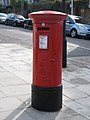
_postbox,_Boscastle_Road_-_Woodsome_Road,_NW5_-_geograph.org.uk_-_1447147.jpg)
_postbox,_Fortess_Road_-_Raveley_Street,_NW5_-_geograph.org.uk_-_1440188.jpg)
_-_geograph.org.uk_-_1447180.jpg)

.jpg)

_-_geograph.org.uk_-_1440196.jpg)


_-_geograph.org.uk_-_1412410.jpg)


_-_geograph.org.uk_-_1533544.jpg)

_-_geograph.org.uk_-_1417708.jpg)


_-_geograph.org.uk_-_1417816.jpg)

_Sorting_Office,_Leighton_Road,_NW5_-_geograph.org.uk_-_1531684.jpg)
_Sorting_Office,_Leighton_Road,_NW5_-_royal_cipher_-_geograph.org.uk_-_1531667.jpg)


_-_geograph.org.uk_-_1440212.jpg)


_-_geograph.org.uk_-_1417632.jpg)


_-_geograph.org.uk_-_1417763.jpg)


_-_geograph.org.uk_-_1533628.jpg)


_Sorting_Office,_Leighton_Road,_NW5_-_geograph.org.uk_-_1531679.jpg)


_-_geograph.org.uk_-_1451084.jpg)


_-_geograph.org.uk_-_1412469.jpg)
_-_geograph.org.uk_-_1412512.jpg)


_Falkland_Arms,_Falkland_Road,_NW5_-_geograph.org.uk_-_1417532.jpg)


_-_geograph.org.uk_-_1447191.jpg)
