Category:Lom Bílina
Jump to navigation
Jump to search
| Object location | | View all coordinates using: OpenStreetMap |
|---|
 | |||||
| Upload media | |||||
| Instance of |
| ||||
|---|---|---|---|---|---|
| Named after | |||||
| Location | Bílina, Teplice District, Ústí nad Labem Region, Czechia | ||||
 | |||||
Subcategories
This category has the following 2 subcategories, out of 2 total.
Media in category "Lom Bílina"
The following 44 files are in this category, out of 44 total.
-
 05 Bilina.jpg 3,504 × 2,482; 3.12 MB
-
 Důl Býlina, okres Most, Ústecký kraj.jpg 9,248 × 6,944; 17.26 MB
-
 Elektrárna Ledvice (ELED), 2020 (37).jpg 4,272 × 2,848; 3.99 MB
-
 Flug Dortmund–Timișoara 13 Statutární město Most.jpg 2,736 × 3,648; 5.68 MB
-
 Halda hnědého uhlí, Lom Bílina.jpg 4,608 × 2,592; 2.81 MB
-
 Hnědouhelná sloj.jpg 4,608 × 2,592; 2.72 MB
-
 Jáma s pasovkou - Lom Bílina.JPG 2,560 × 1,920; 839 KB
-
 Kolesové rypadlo - Lom Bílina 2.JPG 1,920 × 2,560; 895 KB
-
 Kolesové rypadlo - Lom Bílina 3.JPG 1,920 × 2,560; 888 KB
-
 Kolesové rypadlo - Lom Bílina 4.JPG 2,560 × 1,920; 961 KB
-
 Kolesové rypadlo - Lom Bílina 5.JPG 1,920 × 2,560; 957 KB
-
 Kolesové rypadlo - Lom Bílina 6.JPG 2,560 × 1,920; 996 KB
-
 Kolesové rypadlo - Lom Bílina.JPG 1,920 × 2,560; 836 KB
-
 Kolesové rypadlo s bagrem - Lom Bílina.JPG 2,560 × 1,920; 925 KB
-
 Kolesové rypadlo, Lom Bílina.jpg 4,608 × 3,072; 2.82 MB
-
 Kolesové rypadlo, zadní část - Lom Bílina 2.JPG 1,920 × 2,560; 813 KB
-
 Kolesové rypadlo, zadní část - Lom Bílina.JPG 2,560 × 1,920; 1.05 MB
-
 Kolesové rypadlo, část stroje - Lom Bílina 2.JPG 1,920 × 2,560; 891 KB
-
 Kolesové rypadlo, část stroje - Lom Bílina.JPG 1,920 × 2,560; 795 KB
-
 Koule z lomu Bílina A.jpg 5,664 × 4,248; 2.95 MB
-
 Koule z lomu Bílina B.jpg 5,664 × 4,248; 2.97 MB
-
 Koule z lomu Bílina C.jpg 5,664 × 4,248; 3.26 MB
-
 Koule z lomu Bílina D.jpg 5,664 × 4,248; 3.25 MB
-
 Ledvická elektrárna, doly Bílina a Krušné hory z Milešovky.JPG 3,888 × 2,592; 2.77 MB
-
 Lom bilina.JPG 2,816 × 2,112; 2.74 MB
-
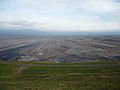
 Lom Bílina - panorama.jpg 6,858 × 1,996; 7.48 MB
-
 Lom Bílina, zavalené historické chodby.jpg 4,608 × 2,592; 2.68 MB
-
 Ministerska vyhlidka Lom Bilina Elektrarna Ledvice TP CZ pano 001.jpg 4,500 × 1,114; 2.21 MB
-

-
 Pasovka - Lom Bílina.JPG 2,560 × 1,920; 1.04 MB
-
 Pasovka a stroje, Důl Bílina.jpg 4,608 × 2,592; 2.55 MB
-
 Pasovka se zakladačem - Lom Bílina.JPG 1,920 × 2,560; 794 KB
-
 Pohled na jámu, hnědouhelný Lom Bílina.jpg 4,608 × 2,592; 8.22 MB
-
 Pohled z jámy - Lom Bílina.JPG 2,560 × 1,920; 1,009 KB
-

-
 Sd-bilina.9.08.JPG 2,816 × 2,112; 2.13 MB
-
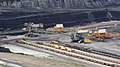
 Skrývkové rypadlo na dole Bílina.jpg 4,608 × 3,072; 2.87 MB
-
 Stará odhalená štola - Lom Bílina.JPG 1,920 × 2,560; 882 KB
-
 V jámě - Lom Bílina.JPG 1,920 × 2,560; 862 KB
-
 Velkostroj, Lom Bílina, hnědouhelný důl.jpg 4,608 × 2,592; 7.09 MB
-
 Velkostroje (rypadlo, zakladač) na Dole Bílina 2017.jpg 4,608 × 2,592; 2.64 MB
-
 Vodopád - Lom Bílina.JPG 1,920 × 2,560; 861 KB
-
 Vodopád 2 - Lom Bílina.JPG 1,920 × 2,560; 866 KB
-
 Zakladač s pásovým dopravníkem, Lom Bílina.jpg 4,608 × 2,592; 5.89 MB


,_2020_(37).jpg)


_na_Dole_B%C3%ADlina_2017.jpg)


_B%C5%AF%C5%BEek_1971,_Salicaceae._Fossil_leaf_from_the_early_Miocene_epoch,_Burdigalian_stage_20,44_-_15,97_million_years_ago,_by_Omar_Hoftun.JPG)