Category:Locator maps of municipalities of Luxembourg
Jump to navigation
Jump to search
Countries of Europe: Belgium · Bosnia and Herzegovina · Bulgaria · Czech Republic · Denmark · Estonia · Finland · Greece · Iceland · Italy · Latvia · Liechtenstein · Luxembourg · Norway · San Marino · Slovenia · Spain‡ · Sweden
Limited recognition: Kosovo
‡: partly located in Europe
Limited recognition: Kosovo
‡: partly located in Europe
Media in category "Locator maps of municipalities of Luxembourg"
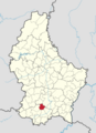
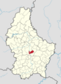
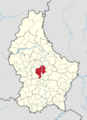
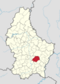
The following 102 files are in this category, out of 102 total.
-
 Bartreng commune map.png 746 × 1,032; 268 KB
-
 Bauschelt commune map.png 746 × 1,032; 268 KB
-
 Bech commune map.png 746 × 1,032; 268 KB
-
 Beefort commune map.png 746 × 1,032; 268 KB
-
 Beetebuerg commune map.png 746 × 1,032; 268 KB
-
 Bettenduerf commune map.png 746 × 1,032; 268 KB
-
 Betzder commune map.png 746 × 1,032; 268 KB
-
 Biekerech commune map.png 746 × 1,032; 268 KB
-
 Biissen commune map.png 746 × 1,032; 268 KB
-
 Biwer commune map.png 746 × 1,032; 268 KB
-
 Bous commune map.png 746 × 1,032; 268 KB
-
 Buerschent commune map.png 746 × 1,032; 268 KB
-
 Bäerdref commune map.png 746 × 1,032; 268 KB
-
 Colmer-Bierg commune map.png 746 × 1,032; 268 KB
-
 Conter commune map.png 746 × 1,032; 268 KB
-
 Diddeleng commune map.png 746 × 1,032; 268 KB
-
 Dikrech commune map.png 746 × 1,032; 268 KB
-
 Dippech commune map.png 746 × 1,032; 268 KB
-
 Duelem commune map.png 746 × 1,032; 268 KB
-
 Déifferdeng commune map.png 746 × 1,032; 268 KB
-
 Ell commune map.png 746 × 1,032; 268 KB
-
 Esch-Sauer commune map.png 746 × 1,032; 268 KB
-
 Esch-Uelzecht commune map.png 746 × 1,032; 268 KB
-
 Ettelbréck commune map.png 746 × 1,032; 268 KB
-
 Feelen commune map.png 746 × 1,032; 268 KB
-
 Fiels commune map.png 746 × 1,032; 268 KB
-
 Fluessweiler commune map.png 746 × 1,032; 268 KB
-
 Fréiseng commune map.png 746 × 1,032; 268 KB
-
 Fëschbech commune map.png 746 × 1,032; 268 KB
-
 Garnech commune map.png 746 × 1,032; 268 KB
-
 Groussbus commune map.png 746 × 1,032; 268 KB
-
 Gréiwemaacher commune map.png 746 × 1,032; 268 KB
-
 Géisdref commune map.png 746 × 1,032; 268 KB
-
 Habscht commune map.png 746 × 1,032; 268 KB
-
 Helperknapp commune map.png 746 × 1,032; 268 KB
-
 Hesper commune map.png 746 × 1,032; 268 KB
-
 Hiefenech commune map.png 746 × 1,032; 268 KB
-
 Iechternach commune map.png 746 × 1,032; 268 KB
-
 Ierpeldeng op der Sauer commune map.png 746 × 1,032; 268 KB
-
 Jonglënster commune map.png 746 × 1,032; 268 KB
-
 Keel commune map.png 746 × 1,032; 268 KB
-
 Kielen commune map.png 746 × 1,032; 268 KB
-
 Kiischpelt commune map.png 746 × 1,032; 268 KB
-
 Klierf commune map.png 746 × 1,032; 268 KB
-
 Konsdref commune map.png 746 × 1,032; 268 KB
-
 Koplescht commune map.png 746 × 1,032; 268 KB
-
 Käerch-commune-map.png 746 × 1,032; 269 KB
-
 Käerjeng commune map.png 746 × 1,032; 268 KB
-
 Leideleng commune map.png 746 × 1,032; 268 KB
-
 Lenneng commune map.png 746 × 1,032; 268 KB
-
 Luerenzweiler commune map.png 746 × 1,032; 268 KB
-
 Lëntgen commune map.png 746 × 1,032; 268 KB
-
 Lëtzebuerg commune map.png 746 × 1,032; 268 KB
-
 Mamer commune map.png 746 × 1,032; 268 KB
-
 Manternach commune map.png 746 × 1,032; 268 KB
-
 Miersch commune map.png 746 × 1,032; 268 KB
-
 Monnerech commune map.png 746 × 1,032; 268 KB
-
 Munneref commune map.png 746 × 1,032; 268 KB
-
 Mäertert commune map.png 746 × 1,032; 268 KB
-
 Mäerzeg commune map.png 746 × 1,032; 268 KB
-
 Nidderaanwen commune map.png 746 × 1,032; 268 KB
-
 Noumer commune map.png 746 × 1,032; 268 KB
-
 Parc Housen commune map.png 746 × 1,032; 268 KB
-
 Préizerdaul commune map.png 746 × 1,032; 268 KB
-
 Péiteng commune map.png 746 × 1,032; 268 KB
-
 Pëtschent commune map.png 746 × 1,032; 268 KB
-
 Rammerech commune map.png 746 × 1,032; 268 KB
-
 Reckeng op der Mess commune map.png 746 × 1,032; 268 KB
-
 Reisduerf commune map.png 746 × 1,032; 268 KB
-
 Rouspert-Mompech commune map.png 746 × 1,032; 268 KB
-
 Réiden op der Atert commune map.png 746 × 1,032; 268 KB
-
 Réimech commune map.png 746 × 1,032; 268 KB
-
 Réiser commune map.png 746 × 1,032; 268 KB
-
 Rëmeleng commune map.png 746 × 1,032; 268 KB
-
 Sandweiler commune map.png 746 × 1,032; 268 KB
-
 Schengen commune map.png 746 × 1,032; 268 KB
-
 Schieren commune map.png 746 × 1,032; 268 KB
-
 Schëffleng commune map.png 746 × 1,032; 268 KB
-
 Schëtter commune map.png 746 × 1,032; 268 KB
-
 Stadbriedemes commune map.png 746 × 1,032; 268 KB
-
 Stauséigemeng commune map.png 746 × 1,032; 268 KB
-
 Steesel commune map.png 746 × 1,032; 268 KB
-
 Stengefort commune map.png 746 × 1,032; 268 KB
-
 Stroossen commune map.png 746 × 1,032; 268 KB
-
 Suessem commune map.png 746 × 1,032; 268 KB
-
 Sëll commune map.png 746 × 1,032; 268 KB
-
 Tandel commune map.png 746 × 1,032; 268 KB
-
 Useldeng commune map.png 746 × 1,032; 268 KB
-
 Veianen commune map.png 746 × 1,032; 268 KB
-
 Viichten commune map.png 746 × 1,032; 268 KB
-
 Wal commune map.png 746 × 1,032; 268 KB
-
 Waldbriedemes commune map.png 746 × 1,032; 268 KB
-
 Waldbëlleg commune map.png 746 × 1,032; 268 KB
-
 Walfer commune map.png 746 × 1,032; 268 KB
-
 Wanseler commune map.png 746 × 1,032; 268 KB
-
 Weiler zum Tuer commune map.png 746 × 1,032; 268 KB
-
 Wolz commune map.png 746 × 1,032; 268 KB
-
 Wuermer commune map.png 746 × 1,032; 268 KB
-
 Wäiswampech commune map.png 746 × 1,032; 268 KB
-
 Wëntger commune map.png 746 × 1,032; 268 KB
-
 Ärenzdall commune map.png 746 × 1,032; 268 KB
-
 Ëlwen commune map.png 746 × 1,032; 268 KB


