Category:Locator maps of municipalities in the Landkreis Stendal
Jump to navigation
Jump to search
Districts of Saxony-Anhalt:
Urban districts (cities):
Subcategories
This category has only the following subcategory.
Media in category "Locator maps of municipalities in the Landkreis Stendal"
The following 27 files are in this category, out of 27 total.
-
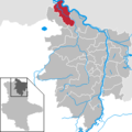 Aland in SDL.png 299 × 299; 5 KB
-
 Altmärkische Höhe in SDL.png 299 × 299; 5 KB
-
 Altmärkische Wische in SDL.png 299 × 299; 5 KB
-
 Arneburg in SDL.png 299 × 299; 5 KB
-
 Bismark (Altmark) in SDL.png 299 × 299; 5 KB
-
 Eichstedt (Altmark) in SDL.png 299 × 299; 5 KB
-
 Goldbeck in SDL.png 299 × 299; 5 KB
-
 Hassel in SDL.png 299 × 299; 5 KB
-
 Havelberg in SDL.png 299 × 299; 5 KB
-
 Hohenberg-Krusemark in SDL.png 299 × 299; 5 KB
-
 Iden in SDL.png 299 × 299; 5 KB
-
 Kamern in SDL.png 299 × 299; 5 KB
-
 Klietz in SDL.png 299 × 299; 5 KB
-
 Lkr Stendal Gliederung.svg 1,378 × 1,755; 960 KB
-
 Municipalities in SDL.png 299 × 299; 6 KB
-
 Osterburg (Altmark) in SDL.png 299 × 299; 5 KB
-
 Rochau in SDL.png 299 × 299; 5 KB
-
 Sandau (Elbe) in SDL.png 299 × 299; 5 KB
-
 Schollene in SDL.png 299 × 299; 5 KB
-
 Schönhausen (Elbe) in SDL.png 299 × 299; 5 KB
-
 Seehausen (Altmark) in SDL.png 299 × 299; 5 KB
-
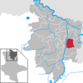
 Stendal in SDL.png 299 × 299; 5 KB
-
 Tangerhütte in SDL.png 299 × 299; 5 KB
-
 Tangermünde in SDL.png 299 × 299; 5 KB
-
 Werben (Elbe) in SDL.png 299 × 299; 5 KB
-
 Wust-Fischbeck in SDL.png 299 × 299; 5 KB
-
 Zehrental in SDL.png 299 × 299; 5 KB


_in_SDL.png)
_in_SDL.png)


_in_SDL.png)

_in_SDL.png)

_in_SDL.png)
_in_SDL.png)


_in_SDL.png)

