Category:Locator maps of municipalities in Landkreis Schweinfurt
Jump to navigation
Jump to search
Media in category "Locator maps of municipalities in Landkreis Schweinfurt"
The following 39 files are in this category, out of 39 total.
-
 Bergrheinfeld in SW.svg 569 × 630; 1.2 MB
-
 Bürgerwald in SW.svg 569 × 630; 1.2 MB
-
 Dingolshausen in SW.svg 569 × 630; 1.2 MB
-
 Dittelbrunn in SW.svg 569 × 630; 1.2 MB
-
 Donnersdorf in SW.svg 569 × 630; 1.2 MB
-
 Euerbach in SW.svg 569 × 630; 1.2 MB
-
 Frankenwinheim in SW.svg 569 × 630; 1.2 MB
-
 Geiersberg (Gemeindefreies Gebiet) in SW.svg 569 × 630; 1.2 MB
-
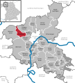
 Geldersheim in SW.svg 569 × 630; 1.2 MB
-
 Gerolzhofen in SW.svg 569 × 630; 1.2 MB
-
 Gochsheim in SW.svg 569 × 630; 1.2 MB
-
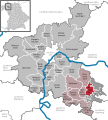
 Grafenrheinfeld in SW.svg 569 × 630; 1.2 MB
-
 Grettstadt in SW.svg 569 × 630; 1.2 MB
-
 Hundelshausen (Bayern) in SW.svg 569 × 630; 1.2 MB
-
 Kolitzheim in SW.svg 569 × 630; 1.2 MB
-
 Lülsfeld in SW.svg 569 × 630; 1.2 MB
-
 Michelau im Steigerwald in SW.svg 569 × 630; 1.2 MB
-
 Municipalities in SW.svg 569 × 630; 1.2 MB
-
 Niederwerrn in SW.svg 569 × 630; 1.2 MB
-
 Nonnenkloster (Unterfranken) in SW.svg 569 × 630; 1.2 MB
-
 Oberschwarzach in SW.svg 569 × 630; 1.2 MB
-
 Poppenhausen in SW.svg 569 × 630; 1.2 MB
-
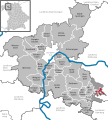
 Röthlein in SW.svg 569 × 630; 1.2 MB
-
 Schonungen in SW.svg 569 × 630; 1.2 MB
-
 Schwanfeld in SW.svg 569 × 630; 1.2 MB
-
 Schwebheim in SW.svg 569 × 630; 1.2 MB
-
 Sennfeld in SW.svg 569 × 630; 1.2 MB
-
 Stadtlauringen in SW.svg 569 × 630; 1.2 MB
-
 Stollbergerforst in SW.svg 569 × 630; 1.2 MB
-
 Sulzheim in SW.svg 569 × 630; 1.2 MB
-
 Verwaltungsgemeinschaft Gerolzhofen in SW.svg 569 × 630; 1.2 MB
-
 Verwaltungsgemeinschaft Schwanfeld in SW.svg 569 × 630; 1.2 MB
-
 Vollburg in SW.svg 569 × 630; 1.2 MB
-
 Waigolshausen in SW.svg 569 × 630; 1.2 MB
-
 Wasserlosen in SW.svg 569 × 630; 1.2 MB
-
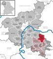
 Werneck in SW.svg 569 × 630; 1.2 MB
-
 Wipfeld in SW.svg 569 × 630; 1.2 MB
-
 Wustvieler Forst in SW.svg 569 × 630; 1.2 MB
-
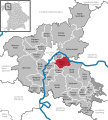
 Üchtelhausen in SW.svg 569 × 630; 1.2 MB


_in_SW.svg)


_in_SW.svg)


_in_SW.svg)


