Category:Locator maps of islands in Oceania
Jump to navigation
Jump to search
Subcategories
This category has the following 34 subcategories, out of 34 total.
Media in category "Locator maps of islands in Oceania"
The following 6 files are in this category, out of 6 total.
-
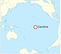 Caroline Island's location.JPG 720 × 641; 46 KB
-
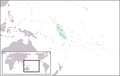
 LocationCarolineIslands.png 248 × 156; 3 KB
-
 LocationGilbertandEllice.png 250 × 158; 7 KB
-
 IOL - Namorik Atoll.JPG 335 × 480; 32 KB
-
 LocationSamoaIslands.PNG 250 × 158; 5 KB
-
 Tahiti.png 800 × 800; 213 KB


