Category:Locator maps of islands in North America
Jump to navigation
Jump to search
Subcategories
This category has the following 12 subcategories, out of 12 total.
Media in category "Locator maps of islands in North America"
The following 11 files are in this category, out of 11 total.
-
 Aleuten Lage.png 707 × 545; 631 KB
-
 Aleutian Islands.PNG 747 × 470; 310 KB
-
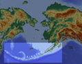
 Aleutian Islands xrmap.png 672 × 672; 77 KB
-
 Block Island Map of Rhode Island.png 238 × 310; 12 KB
-
 Diomede Islands.PNG 692 × 524; 14 KB
-
 Ellis-Island-map.svg 687 × 733; 331 KB
-
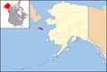
 Map of Alaska highlighting Prince of Wales Island.png 300 × 186; 8 KB
-
 LocationPribilofIslands.PNG 2,929 × 1,713; 167 KB
-
 LocationStLawrenceIslands.PNG 2,929 × 1,713; 165 KB
-
 St. Lawrence Island location.png 738 × 501; 50 KB
-
 Stmatthewisland.png 2,929 × 1,713; 51 KB


