Category:Locator maps of Washington (state)
Jump to navigation
Jump to search
States of the United States: Alabama · Alaska · Arizona · Arkansas · California · Colorado · Connecticut · Delaware · Florida · Georgia · Hawaii · Idaho · Illinois · Indiana · Iowa · Kansas · Kentucky · Louisiana · Maine · Maryland · Massachusetts · Michigan · Minnesota · Mississippi · Missouri · Montana · Nebraska · Nevada · New Hampshire · New Jersey · New Mexico · New York · North Carolina · North Dakota · Ohio · Oklahoma · Oregon · Pennsylvania · Rhode Island · South Carolina · South Dakota · Tennessee · Texas · Utah · Vermont · Virginia · Washington · West Virginia · Wisconsin · Wyoming – Washington, D.C.
insular area of the United States: American Samoa · Guam · Northern Mariana Islands · Puerto Rico · United States Virgin Islands – Baker Island · Howland Island · Jarvis Island · Johnston Atoll · Kingman Reef · Midway Atoll · Navassa Island · Palmyra Atoll · Wake Island
insular area of the United States: American Samoa · Guam · Northern Mariana Islands · Puerto Rico · United States Virgin Islands – Baker Island · Howland Island · Jarvis Island · Johnston Atoll · Kingman Reef · Midway Atoll · Navassa Island · Palmyra Atoll · Wake Island
Subcategories
This category has the following 5 subcategories, out of 5 total.
Media in category "Locator maps of Washington (state)"
The following 34 files are in this category, out of 34 total.
-
-
 A Map of Washington 2022.png 450 × 279; 58 KB
-
 ElkInfobox.png 590 × 586; 262 KB
-
 Lake Washington Ship Canal Fish Ladder pamphlet 04.jpg 1,641 × 1,639; 818 KB
-
 Lamoine map wiki.jpg 3,300 × 2,550; 392 KB
-
 Locmap-Haro-Boundary additional labels.png 384 × 309; 61 KB
-
 Locmap-Haro-Boundary without border.png 384 × 309; 73 KB
-
 Locmap-Haro-Boundary.png 384 × 309; 58 KB
-
 Locmap-hoodcanal-nopoints.png 834 × 1,086; 35 KB
-
 Locmap-hoodcanal-ss.png 802 × 1,043; 103 KB
-
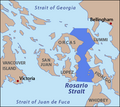
 Locmap-RosarioStrait with border.png 345 × 309; 53 KB
-
 Locmap-RosarioStrait without border.png 345 × 309; 49 KB
-
 Map of Washington highlighting Adams County.png 300 × 202; 10 KB
-
 Map of Washington highlighting Jefferson County.png 300 × 202; 9 KB
-
 Map of Washington highlighting Lincoln County.png 300 × 202; 10 KB
-
 Map-of-washington-state-showing-puget-sound-area.png 221 × 136; 3 KB
-
 MarbleInfobox.png 584 × 558; 258 KB
-
 Milan Infobox.png 582 × 554; 254 KB
-
 Mock Infobox.png 594 × 590; 270 KB
-
 Olympicpeninsula.PNG 221 × 136; 3 KB
-
 Orchard Prairie Infoxbox.png 590 × 554; 263 KB
-
 PickeringPassage-nowords.png 640 × 604; 124 KB
-
 RodnaInfobox.png 584 × 588; 266 KB
-
 SkagitBay-nowords.png 390 × 500; 71 KB
-
 St. Luke's infobox.png 548 × 520; 331 KB
-
 SuncrestInfobox.png 568 × 538; 246 KB
-
 USA Names Washington.png 5,895 × 4,049; 1.51 MB
-
 WAMap-doton-Kettle Falls.png 300 × 202; 10 KB
-
 Map of USA highlighting Washington.png 280 × 183; 35 KB
-
 Map of USA WA.svg 286 × 186; 167 KB
-
 Washington Locator Map with US.PNG 401 × 516; 83 KB
-
 Washington Locator Map.PNG 400 × 256; 11 KB
-
 Washington21234.png 375 × 232; 51 KB
-
 Wilkeson in Pierce County.png 960 × 435; 8 KB


