Category:Locator maps of Telangana
Jump to navigation
Jump to search
States of India: Andhra Pradesh · Arunachal Pradesh · Assam · Bihar · Chhattisgarh · Goa · Gujarat · Haryana · Himachal Pradesh · Jharkhand · Karnataka · Kerala · Madhya Pradesh · Maharashtra · Manipur · Meghalaya · Mizoram · Nagaland · Odisha · Punjab · Rajasthan · Sikkim · Tamil Nadu · Telangana · Tripura · Uttar Pradesh · Uttarakhand · West Bengal
Union territories: Andaman and Nicobar Islands · Chandigarh · Dadra and Nagar Haveli and Daman and Diu · Delhi · Jammu and Kashmir · Ladakh · Lakshadweep · Puducherry
Former states of India: Jammu and Kashmir ·
Former union territories: Dadra and Nagar Haveli district · Daman and Diu ·
Union territories: Andaman and Nicobar Islands · Chandigarh · Dadra and Nagar Haveli and Daman and Diu · Delhi · Jammu and Kashmir · Ladakh · Lakshadweep · Puducherry
Former states of India: Jammu and Kashmir ·
Former union territories: Dadra and Nagar Haveli district · Daman and Diu ·

Subcategories
This category has the following 2 subcategories, out of 2 total.
L
Media in category "Locator maps of Telangana"
The following 11 files are in this category, out of 11 total.
-
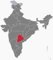 IN-TG.svg 512 × 583; 154 KB
-
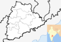
 IN-TS.svg 1,598 × 1,871; 240 KB
-
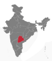
 India Telangana location map.svg 851 × 852; 367 KB
-
 India Telangana numbered district map 2022.svg 681 × 681; 233 KB
-
 Location map India Telangana (blank).svg 1,070 × 740; 424 KB
-
 Location map India Telangana he.png 643 × 600; 58 KB
-
 Location map India Telangana.png 1,018 × 708; 206 KB
-
 Location Map Telangana India.PNG 431 × 338; 32 KB
-
 Telangana in India.svg 1,500 × 1,615; 1.56 MB
-
 Telangana New.png 1,594 × 1,870; 203 KB
-
 Universities Map of Telangana State.png 1,184 × 1,064; 312 KB


.svg)