Category:Locator maps of Queensland
Jump to navigation
Jump to search
Media in category "Locator maps of Queensland"
The following 71 files are in this category, out of 71 total.
-
 AmityPoint locator map.png 563 × 476; 7 KB
-
 Aus QLD map.png 328 × 352; 25 KB
-
 Birdsville location map in Queensland.PNG 1,000 × 1,305; 92 KB
-
 Blank locator map queensland.PNG 1,000 × 1,305; 95 KB
-
 Boulia location map in Queensland.PNG 1,000 × 1,305; 94 KB
-
 Cairns location map in Queensland.PNG 1,000 × 1,305; 93 KB
-
 Cairns, Queensland.png 459 × 599; 118 KB
-
 Cameron County, Queensland.png 431 × 541; 6 KB
-
 Carruthers County, Queensland.png 431 × 541; 8 KB
-
 Charleville.PNG 1,000 × 1,305; 93 KB
-
 Charters towers location map in Queensland.PNG 1,000 × 1,305; 93 KB
-
 Charters Towers,Queensland carte.png 459 × 599; 116 KB
-
 Churchill-county-queensland.png 400 × 519; 58 KB
-
 Cloncurry, Queensland.png 459 × 599; 118 KB
-
 Cloncurry location map in Queensland.PNG 1,000 × 1,305; 93 KB
-
 Cooktown.png 459 × 599; 131 KB
-
 Cunnumulla location map in Queensland.PNG 1,000 × 1,305; 93 KB
-
 Dalby location map in Queensland.PNG 1,000 × 1,305; 93 KB
-
 DE Wikinews 2010 Queensland floods map.png 1,000 × 1,305; 164 KB
-
 Durham County, Queensland.png 431 × 541; 6 KB
-
 Emerald location map in Queensland.PNG 1,000 × 1,305; 93 KB
-
 Eyre County Queensland 4.png 414 × 552; 6 KB
-
 Gladstone location map in Queensland.PNG 1,000 × 1,305; 93 KB
-
 Goondiwindi location map in Queensland.PNG 1,000 × 1,305; 93 KB
-
 Gympie location map in Queensland.PNG 1,000 × 1,305; 92 KB
-
 Hervey Bay, Queensland.png 459 × 599; 119 KB
-
 Iffley County, Queensland.png 431 × 541; 6 KB
-
 Logan City Queensland.png 459 × 599; 120 KB
-
 Longreach location map in Queensland.PNG 1,000 × 1,305; 93 KB
-
 Mackay location map in Queensland.PNG 1,000 × 1,305; 93 KB
-
 Maroochy location.png 678 × 881; 36 KB
-
 Morstone County, Queensland.png 431 × 541; 6 KB
-
 Mt isa location map in Queensland.PNG 533 × 672; 25 KB
-
 Mt Isa, Queensland.png 459 × 599; 118 KB
-
 Muller County, Queensland.png 431 × 541; 6 KB
-
 Nash County, Queensland.png 431 × 541; 6 KB
-
 Noosa location map.png 678 × 881; 36 KB
-
 Normanton location map in Queensland.PNG 1,000 × 1,305; 93 KB
-
 Nyama County, Queensland.png 431 × 541; 6 KB
-
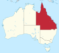
 QLD in Australia map.png 200 × 186; 11 KB
-
 QLDL-Gladstone.png 1,200 × 1,400; 155 KB
-
 QLDL-Longreach.png 1,200 × 1,400; 155 KB
-
 QLDL-Rockhampton.png 1,200 × 1,400; 155 KB
-
 Queensland carte.png 459 × 599; 118 KB
-
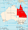
 Queensland in Australia.svg 2,055 × 1,846; 929 KB
-
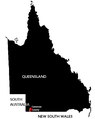
 Queensland location map.png 678 × 881; 5 KB
-
 Queensland Locator Map.svg 110 × 135; 26 KB
-
 Queensland locator-MJC.png 563 × 476; 12 KB
-
 Queensland locator-MJC.svg 200 × 186; 5 KB
-
 Queensland MapLocator.png 233 × 287; 3 KB
-
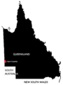
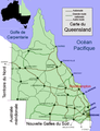
 QueenslandMap.png 2,190 × 1,577; 152 KB
-
 Rockhampton location map in Queensland.PNG 1,000 × 1,305; 94 KB
-
 Rockhampton, Queensland.png 459 × 599; 118 KB
-
 Rolleston location map in Queensland.PNG 1,000 × 1,305; 93 KB
-
 Roma location map in Queensland.PNG 1,000 × 1,305; 93 KB
-
 Rosebury County Queensland 4.png 414 × 552; 7 KB
-
 Rosebury County Queensland 6.png 414 × 552; 8 KB
-
 Sturt County Queensland 4.png 414 × 552; 6 KB
-
 Sunshine coast location.png 678 × 881; 37 KB
-
 Tanbar County Queensland 4.png 414 × 552; 5 KB
-
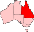
 Tigris-Australia location Queensland.svg 2,055 × 1,846; 159 KB
-
 Toowoomba LGA Qld.png 135 × 175; 14 KB
-
 Toowoomba location map in Queensland.PNG 1,000 × 1,305; 93 KB
-
 Toowoomba, Queensland.png 459 × 599; 117 KB
-
 Townsville location map in Queensland.PNG 1,000 × 1,305; 93 KB
-
 Townsville locator-MJC.png 563 × 476; 12 KB
-
 Townsville, Queensland carte.png 459 × 599; 118 KB
-
 Warrego Highway.png 459 × 599; 150 KB
-
 Wilson County, Queensland.png 431 × 541; 6 KB
-
 Windula County, Queensland.png 431 × 541; 6 KB
-
 Winton location map in Queensland.PNG 1,000 × 1,305; 93 KB


