Category:Locator maps of Prince Edward Island
Jump to navigation
Jump to search
Provinces and territories of Canada: Alberta · British Columbia · Manitoba · New Brunswick · Newfoundland and Labrador · Nova Scotia · Ontario · Prince Edward Island · Quebec · Saskatchewan · Northwest Territories · Nunavut · Yukon
Media in category "Locator maps of Prince Edward Island"
The following 37 files are in this category, out of 37 total.
-
 Alberton-Bloomfield electoral district map.svg 1,554 × 1,057; 668 KB
-
 Belfast-Murray River electoral district map.svg 1,554 × 1,057; 668 KB
-
 Borden-Kinkora electoral district map.svg 1,554 × 1,057; 668 KB
-
 Brackley-Hunter River electoral district map.svg 1,554 × 1,057; 668 KB
-
 Charlottetown-Belvedere electoral district map.svg 1,554 × 1,057; 668 KB
-
 Charlottetown-Brighton electoral district map.svg 1,554 × 1,057; 668 KB
-
 Charlottetown-Hillsborough Park electoral district map.svg 1,554 × 1,057; 668 KB
-
 Charlottetown-Victoria Park electoral district map.svg 1,554 × 1,057; 668 KB
-
 Charlottetown-West Royalty electoral district map.svg 1,554 × 1,057; 668 KB
-
 Charlottetown-Winsloe electoral district map.svg 1,554 × 1,057; 668 KB
-
 Cornwall-Meadowbank electoral district map.svg 1,554 × 1,057; 668 KB
-
 Evangeline-Miscouche electoral district map.svg 1,554 × 1,057; 668 KB
-
 Georgetown-Pownal electoral district map.svg 1,554 × 1,057; 668 KB
-
 Ile-du-Prince-Edouard.png 2,360 × 1,650; 980 KB
-

-
 Isola del Principe Edoardo.png 2,360 × 1,650; 994 KB
-
 Kensington-Malpeque electoral district map.svg 1,554 × 1,057; 668 KB
-
 Localisation IPE.svg 1,084 × 920; 97 KB
-
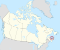
 Location of Prince Edward Island (highlighted) in Canada.png 4,517 × 3,833; 1.04 MB
-
 Mermaid-Stratford electoral district map.svg 1,554 × 1,057; 668 KB
-
 Montague-Kilmuir electoral district map.svg 1,554 × 1,057; 668 KB
-
 Morell-Donagh electoral district map.svg 1,554 × 1,057; 668 KB
-
 New Haven-Rocky Point electoral district map.svg 1,554 × 1,057; 668 KB
-
 O'Leary-Inverness electoral district map.svg 1,554 × 1,057; 668 KB
-
 PEI in Canada highlighted in red in Canada.png 1,207 × 1,024; 312 KB
-
 PEI-Canada-province.png 852 × 698; 163 KB
-
 Prince Edward Island in Canada (special marker) 2.svg 1,114 × 942; 279 KB
-
 Prinz-Edward-Insel.png 2,360 × 1,650; 986 KB
-
 Provmap-pe.png 250 × 210; 8 KB
-
 Rustico-Emerald electoral district map.svg 1,554 × 1,057; 668 KB
-
 Souris-Elmira electoral district map.svg 1,554 × 1,057; 668 KB
-
 Stanhope-Marshfield electoral district map.svg 1,554 × 1,057; 668 KB
-
 Stratford-Keppoch electoral district map.svg 1,554 × 1,057; 668 KB
-
 Summerside-South Drive electoral district map.svg 1,554 × 1,057; 668 KB
-
 Summerside-Wilmot electoral district map.svg 1,554 × 1,057; 668 KB
-
 Tignish-Palmer Road electoral district map.svg 1,554 × 1,057; 668 KB
-
 Tyne Valley-Sherbrooke electoral district map.svg 1,554 × 1,057; 668 KB


.jpg)


_in_Canada.png)


_2.svg)


