Category:Locator maps of Lower Silesian Voivodeship
Jump to navigation
Jump to search
Media in category "Locator maps of Lower Silesian Voivodeship"
The following 24 files are in this category, out of 24 total.
-
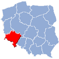
 Dolnoslaskie (EE,E NN,N).png 491 × 454; 348 KB
-
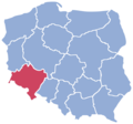
 Dolnoslaskie in Poland.svg 862 × 838; 719 KB
-
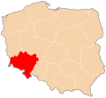
 Dolnoslaskie location map.PNG 2,000 × 1,863; 205 KB
-
 Dolnoslaskie.png 150 × 137; 28 KB
-
 Lesser Poland Voivodship2.png 580 × 425; 5 KB
-
 POL biedrzychowa gmina polkowice map.png 766 × 608; 96 KB
-
 POL dąbrowa gmina polkowice map.png 766 × 608; 96 KB
-
 POL guzice gmina polkowice map.png 766 × 608; 96 KB
-
 POL jędrzychów gmina polkowice map.png 766 × 608; 95 KB
-
 POL kaźmierzów gmina polkowice map.png 766 × 608; 96 KB
-
 POL komorniki gmina polkowice map.png 766 × 608; 96 KB
-
 POL moskorzyn gmina polkowice map.png 766 × 608; 96 KB
-
 POL nowa wieś lubińska gmina polkowice map.png 766 × 608; 96 KB
-
 POL pieszkowice gmina polkowice map.png 766 × 608; 96 KB
-
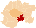
 POL polkowice gmina polkowice map.png 766 × 608; 96 KB
-
 POL sobin gmina polkowice map.png 766 × 608; 96 KB
-
 POL sucha górna gmina polkowice map.png 766 × 608; 96 KB
-
 POL tarnówek gmina polkowice map.png 766 × 608; 96 KB
-
 POL trzebcz gmina polkowice map.png 766 × 608; 96 KB
-
 POL żelazny most gmina polkowice map.png 766 × 608; 96 KB
-
 POL żuków gmina polkowice map.png 766 × 608; 96 KB
-
 Polska podział admin dolnoslaskie.svg 461 × 425; 214 KB
-
 Woj niederschles.png 233 × 233; 28 KB
-
 Wojewodztwo dolnoslaskie.png 580 × 425; 11 KB
.png)


