Category:Locator maps of County Antrim
Jump to navigation
Jump to search
Subcategories
This category has only the following subcategory.
B
Media in category "Locator maps of County Antrim"
The following 18 files are in this category, out of 18 total.
-
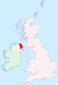 Antrim - British Isles.svg 1,250 × 1,835; 1,002 KB
-
 Antrim Brit Isles Sect 2.svg 915 × 841; 1,004 KB
-
 Antrim Brit Isles Sect 3.svg 939 × 677; 941 KB
-
 Antrim Brit Isles Sect 4.svg 627 × 643; 938 KB
-
 Antrim Brit Isles Sect 7.svg 583 × 711; 1,004 KB
-
 Antrim Ulster.png 200 × 249; 28 KB
-
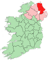
 AntrimAllIreland.PNG 500 × 586; 24 KB
-
 AntrimBrit2.PNG 608 × 604; 20 KB
-
 AntrimBrit3.PNG 698 × 491; 28 KB
-
 AntrimBrit4.PNG 468 × 487; 15 KB
-
 AntrimBrit4b.PNG 468 × 487; 15 KB
-
 AntrimShape.png 532 × 405; 11 KB
-
 CountyAntrim.png 443 × 535; 59 KB
-
 Ireland map County Antrim.png 188 × 128; 4 KB
-
 Larne Lough.PNG 415 × 541; 12 KB
-
 Location of County Antrim on island of Ireland.png 525 × 662; 115 KB
-
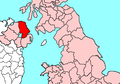
 NorthernIrelandAntrim.png 200 × 249; 30 KB
-
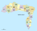 Rathlin Island townlands.svg 1,276 × 1,051; 214 KB


