Category:Location maps of districts in Beverstedt
Jump to navigation
Jump to search
Deutsch: Diese Kategorie umfasst Lagekarten aller Ortsteile der Gemeinde Beverstedt.
English: This category includes location maps of all districts of the Gemeinde Beverstedt.
Français : Cette catégorie comprend les cartes de localisation de tous les quartiers de la Gemeinde Beverstedt.
Media in category "Location maps of districts in Beverstedt"
The following 12 files are in this category, out of 12 total.
-
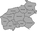 Ortschaften Beverstedt Blanko.svg 820 × 680; 19 KB
-
 Appeln in Beverstedt.svg 820 × 680; 19 KB
-
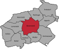 Beverstedt in Beverstedt.svg 820 × 680; 19 KB
-
 Bokel in Beverstedt.svg 820 × 680; 19 KB
-
 Frelsdorf in Beverstedt.svg 820 × 680; 19 KB
-
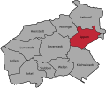
 Heerstedt in Beverstedt.svg 820 × 680; 19 KB
-
 Hollen in Beverstedt.svg 820 × 680; 19 KB
-
 Kirchwistedt in Beverstedt.svg 820 × 680; 19 KB
-
 Lunestedt in Beverstedt.svg 820 × 680; 19 KB
-
 Stubben in Beverstedt.svg 820 × 680; 19 KB
-
 Wellen in Beverstedt.svg 820 × 680; 19 KB
-
 Wollingst in Beverstedt.svg 820 × 680; 19 KB


