Category:Llangwyllog
Jump to navigation
Jump to search
village in Anglesey, Wales  | |||||
| Upload media | |||||
| Instance of | |||||
|---|---|---|---|---|---|
| Location | Anglesey, Irish Sea | ||||
 | |||||
Subcategories
This category has the following 3 subcategories, out of 3 total.
L
- Llangwyllog railway station (7 F)
- St Cwyllog's Church, Llangwyllog (15 F)
T
- St Caian's Church, Tregaian (2 F)
Media in category "Llangwyllog"
The following 48 files are in this category, out of 48 total.
-

-
 A mown hay field west of Afon Cefni - geograph.org.uk - 1396944.jpg 640 × 481; 55 KB
-
 Abandoned section of the B5111 - geograph.org.uk - 1400208.jpg 640 × 480; 69 KB
-
 Bridge over disused railway, Anglesey - geograph.org.uk - 59596.jpg 640 × 479; 99 KB
-
 Cattle Feeder - geograph.org.uk - 153183.jpg 640 × 480; 126 KB
-
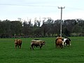 Cows Grazing - geograph.org.uk - 153190.jpg 640 × 480; 115 KB
-
 Farmland west of Glan Gors Farm - geograph.org.uk - 1400162.jpg 640 × 372; 43 KB
-
 Field alongside road - geograph.org.uk - 152507.jpg 640 × 480; 135 KB
-
 Fields near Ty Gwyn - geograph.org.uk - 152496.jpg 640 × 480; 110 KB
-
 Horse on rough grazing land - geograph.org.uk - 155797.jpg 640 × 480; 170 KB
-
 Modern sheepfold opposite Ty'n Rhos - geograph.org.uk - 1400097.jpg 640 × 480; 103 KB
-

-
 Overgrown railway track - geograph.org.uk - 1360981.jpg 640 × 480; 73 KB
-

-
 Signpost for cyclists - geograph.org.uk - 152616.jpg 480 × 640; 101 KB
-

-

-
 The railway bridge at Llangwyllog - geograph.org.uk - 1360943.jpg 640 × 480; 151 KB
-

-
 Wet marshland - geograph.org.uk - 152489.jpg 640 × 480; 142 KB
-

-
 Approaching a minor road junction - geograph.org.uk - 1189085.jpg 640 × 480; 136 KB
-
 Approaching Cerrig Turn crossroads - geograph.org.uk - 1188645.jpg 640 × 480; 71 KB
-

-

-

-

-
 Bryn Hyfryd Farmhouse - geograph.org.uk - 1400014.jpg 640 × 480; 70 KB
-
 Bryn-awel Farm - geograph.org.uk - 766853.jpg 640 × 250; 25 KB
-
 Cattle grid on farm road - geograph.org.uk - 152498.jpg 480 × 640; 95 KB
-
 Cors Erddreiniog SSSI from Capel Coch - geograph.org.uk - 422020.jpg 640 × 480; 111 KB
-
 Cow in field near Hendre farm - geograph.org.uk - 152731.jpg 640 × 480; 173 KB
-
 Currently Underwhelmed - geograph.org.uk - 232500.jpg 640 × 480; 100 KB
-
 Dutch barn at Ty'n Rhos. Llangwyllog - geograph.org.uk - 1400085.jpg 640 × 480; 74 KB
-
 Framed - geograph.org.uk - 232495.jpg 640 × 480; 105 KB
-
 Frogwy Bach Farm - geograph.org.uk - 152501.jpg 640 × 480; 147 KB
-
 Gafrogwy Bach Farm - geograph.org.uk - 1400075.jpg 640 × 481; 69 KB
-
 Garage at Llynfaes - geograph.org.uk - 152487.jpg 640 × 480; 97 KB
-

-
 Gilead Belan Chapel, Bodwrog - geograph.org.uk - 152509.jpg 640 × 480; 114 KB
-
 Refurbishment at Llidiart Twrcelyn - geograph.org.uk - 421968.jpg 640 × 480; 60 KB
-
 Road junction at Ty'n y Coed - geograph.org.uk - 152612.jpg 640 × 480; 101 KB
-
 Sharp bend - geograph.org.uk - 152508.jpg 640 × 480; 97 KB
-
 Sharp bend - geograph.org.uk - 152655.jpg 640 × 480; 165 KB
-

-
 Tre-Ysgawen - geograph.org.uk - 361482.jpg 640 × 480; 113 KB
-
 Tre-Ysgawen Hotel - geograph.org.uk - 247394.jpg 640 × 479; 74 KB
-
 Ty Gwyn derelict cottage - geograph.org.uk - 152497.jpg 640 × 480; 138 KB


.jpg)


