Category:Llanfairfechan
Jump to navigation
Jump to search
town and community in Conwy County Borough, Wales, UK .jpg) | |||||
| Upload media | |||||
| Instance of | |||||
|---|---|---|---|---|---|
| Location | Conwy County Borough, Wales | ||||
| official website | |||||
 | |||||
Subcategories
This category has the following 3 subcategories, out of 3 total.
Media in category "Llanfairfechan"
The following 200 files are in this category, out of 623 total.
(previous page) (next page)-
 "Rock and mound" - geograph.org.uk - 2431668.jpg 4,592 × 3,056; 5.63 MB
-
 1GL benchmark ^ bolt on Eglwys y Santes Fair, Llanfairfechan - geograph.org.uk - 2729279.jpg 3,000 × 4,000; 5.39 MB
-
 A bench near the war memorial, Llanfairfechan - geograph.org.uk - 6265954.jpg 1,600 × 1,200; 347 KB
-
 A black-white striped pole on Mill Road, Llanfairfechan - geograph.org.uk - 6298469.jpg 3,120 × 4,160; 4.85 MB
-

-
 A complex of sheepfolds - geograph.org.uk - 836760.jpg 640 × 480; 86 KB
-
 A ford - geograph.org.uk - 701374.jpg 640 × 480; 90 KB
-
 A green path above Llanfairfechan - geograph.org.uk - 6282458.jpg 4,608 × 3,456; 3.74 MB
-
 A large stench pipe on Glanmor Road, Llanfairfechan - geograph.org.uk - 6280184.jpg 1,536 × 2,048; 458 KB
-
 A plaque on the Wales Coast Path - geograph.org.uk - 4183219.jpg 1,600 × 1,516; 788 KB
-

-
 A Putative Slate Quarry on Yr Orsedd - geograph.org.uk - 232475.jpg 640 × 480; 118 KB
-
 A tiled porch floor on Station Road, Llanfairfechan - geograph.org.uk - 6271232.jpg 1,600 × 1,200; 421 KB
-
 A tiled shop doorway on Station Road, Llanfairfechan - geograph.org.uk - 6276524.jpg 4,160 × 3,120; 4.16 MB
-
 A tiled shop doorway on Station Road, Llanfairfechan - geograph.org.uk - 6277586.jpg 3,120 × 4,160; 4.14 MB
-
 A tiled shop doorway on Station Road, Llanfairfechan - geograph.org.uk - 6300143.jpg 4,160 × 3,120; 3.54 MB
-
 A tiled shop doorway on Village Road, Llanfairfechan - geograph.org.uk - 6301067.jpg 4,160 × 3,120; 3.45 MB
-

-
 A View Of Dinas - geograph.org.uk - 5242104.jpg 1,600 × 1,200; 500 KB
-
 A view towards Puffin Island - geograph.org.uk - 5119415.jpg 5,012 × 3,234; 3.36 MB
-
 A55 and buildings at Llanfairfechan - geograph.org.uk - 5103981.jpg 4,184 × 2,789; 3.49 MB
-
 A55 eastbound at Conway district boundary - geograph.org.uk - 6109197.jpg 1,024 × 769; 137 KB
-
 A55 eastbound near Bryn Y Neuadd Hospital - geograph.org.uk - 6109212.jpg 1,024 × 769; 129 KB
-
 A55 eastbound nearing Pen-y-Clip - geograph.org.uk - 6109229.jpg 1,024 × 769; 117 KB
-
 A55 lay-by heading west near Llanfairfechan - geograph.org.uk - 3041063.jpg 1,024 × 546; 111 KB
-

-
 A55, North Wales Expressway - geograph.org.uk - 3831796.jpg 1,200 × 798; 201 KB
-
 Aber Road by Hafod Fadog - geograph.org.uk - 5043970.jpg 1,500 × 997; 132 KB
-
 Aber Road out of Llanfairfechan - geograph.org.uk - 5043959.jpg 1,500 × 999; 132 KB
-

-
 Aber, UK - panoramio - IIya Kuzhekin (1).jpg 4,000 × 3,000; 3.48 MB
-
 Aber, UK - panoramio - IIya Kuzhekin.jpg 4,000 × 2,250; 2.22 MB
-
 Aber, UK - panoramio.jpg 4,000 × 3,000; 2.45 MB
-
 Above Blaen Llwyn - geograph.org.uk - 3266369.jpg 1,600 × 1,200; 620 KB
-
 Above Blaenau - geograph.org.uk - 6276079.jpg 1,600 × 1,200; 441 KB
-
 Above Ffridd Arw - geograph.org.uk - 3654525.jpg 1,600 × 1,200; 627 KB
-
 Above the pylons - geograph.org.uk - 1558854.jpg 424 × 640; 199 KB
-

-
 Afon Ddu flows across the beach to the sea - geograph.org.uk - 5043838.jpg 1,500 × 999; 216 KB
-
 Afon Ddu in Llanfairfechan - geograph.org.uk - 5043842.jpg 1,500 × 999; 213 KB
-
 Afon Llanfairfechan - geograph.org.uk - 1335123.jpg 640 × 480; 88 KB
-
 Afon Llanfairfechan - geograph.org.uk - 3876161.jpg 640 × 480; 75 KB
-
 Afon Maes-y-Bryn - geograph.org.uk - 3877264.jpg 640 × 480; 62 KB
-
 After sunset - geograph.org.uk - 1954264.jpg 1,600 × 1,200; 239 KB
-

-
 Allotments, Llanfairfechan - geograph.org.uk - 4524425.jpg 640 × 426; 83 KB
-
 Allotments, Llanfairfechan - geograph.org.uk - 4524427.jpg 640 × 426; 46 KB
-
 Along the North Wales coast - geograph.org.uk - 3716805.jpg 800 × 530; 334 KB
-
 Arfau Llanfair Arms, Llanfairfechan - geograph.org.uk - 4192871.jpg 1,600 × 1,064; 660 KB
-
 Arriva Train on its way to Holyhead - geograph.org.uk - 1340639.jpg 640 × 480; 70 KB
-
 At Llanfairfechan 2020 001.jpg 6,960 × 4,640; 22.97 MB
-
 At Llanfairfechan 2020 002.jpg 6,960 × 4,640; 27.73 MB
-
 At Llanfairfechan 2020 003.jpg 6,960 × 4,640; 27.63 MB
-
 At Llanfairfechan 2020 004.jpg 6,960 × 4,640; 20.94 MB
-
 At Llanfairfechan 2020 005.jpg 6,960 × 4,640; 36.93 MB
-
 At Llanfairfechan 2020 006.jpg 6,960 × 4,640; 27.66 MB
-
 At Llanfairfechan 2020 007.jpg 6,960 × 4,640; 24.16 MB
-
 At Llanfairfechan 2020 008.jpg 6,960 × 4,640; 20.3 MB
-
 At Llanfairfechan 2020 009.jpg 6,960 × 4,640; 20.78 MB
-
 At Llanfairfechan 2020 010.jpg 6,960 × 4,640; 20.09 MB
-
 At Llanfairfechan 2020 011.jpg 6,960 × 4,640; 27.23 MB
-
 At Llanfairfechan 2020 012.jpg 6,960 × 4,640; 32.82 MB
-
 At Llanfairfechan 2020 013.jpg 6,960 × 4,640; 23.94 MB
-
 At Llanfairfechan 2020 014.jpg 6,960 × 4,640; 30.07 MB
-
 Autumn colours as seen from coast path E of Llanfairfechan - geograph.org.uk - 5247290.jpg 5,184 × 2,920; 6.45 MB
-
 Back alley, Llanfairfechan - geograph.org.uk - 2863166.jpg 640 × 480; 55 KB
-

-
 Barrier and Junction on Penmaenmawr Road - geograph.org.uk - 5106794.jpg 4,184 × 2,789; 2.96 MB
-
 Beach at Glan y Môr Elias near Llanfairfechan - geograph.org.uk - 4538510.jpg 1,600 × 1,200; 487 KB
-
 Beach at Llanfairfechan - geograph.org.uk - 3484487.jpg 640 × 480; 84 KB
-
 Beach, Llanfairfechan - geograph.org.uk - 4524463.jpg 640 × 419; 68 KB
-
 Below Foel Ganol - geograph.org.uk - 1558845.jpg 640 × 427; 147 KB
-
 Below the pass - geograph.org.uk - 1558976.jpg 640 × 427; 177 KB
-
 Benarth House, Llanfairfechan - geograph.org.uk - 5469466.jpg 427 × 640; 95 KB
-
 Benchmark on Bont Newydd, Llanfairfechan - geograph.org.uk - 2161011.jpg 3,000 × 4,000; 5.45 MB
-
 Benchmark on Cae Ffynnon Road, Llanfairfechan - geograph.org.uk - 2089092.jpg 3,000 × 4,000; 4.97 MB
-
 Benchmark on Llannerch Road, Llanfairfechan - geograph.org.uk - 6086700.jpg 1,200 × 1,600; 609 KB
-

-
 Benchmark on the Station Road Railway Bridge, Llanfairfechan - geograph.org.uk - 2163641.jpg 3,000 × 4,000; 5.25 MB
-
 Bird hide at Glan y Mor Elias - geograph.org.uk - 1340667.jpg 640 × 480; 122 KB
-
 Bird Hide near Glan-y-môr Elias - geograph.org.uk - 4181950.jpg 1,600 × 1,064; 700 KB
-

-
 Boating pool in Llanfairfechan - geograph.org.uk - 5043854.jpg 1,500 × 999; 140 KB
-
 Boating pool, Llanfairfechan - geograph.org.uk - 1335127.jpg 640 × 480; 91 KB
-
 Boating Pool, Llanfairfechan - geograph.org.uk - 241999.jpg 640 × 480; 76 KB
-
 Boating Pool, Maes Chwarae Recreation Area - geograph.org.uk - 3859792.jpg 1,200 × 798; 237 KB
-
 Boulder field - geograph.org.uk - 2431022.jpg 4,592 × 3,056; 7.42 MB
-
 Bryn Coed Terrace, Llanfairfechan - geograph.org.uk - 4193063.jpg 1,600 × 1,064; 582 KB
-
 Bryn Road, Llanfairfechan - geograph.org.uk - 4193030.jpg 1,600 × 1,064; 505 KB
-
 Building on Mount Road below Blaen-llwyn - geograph.org.uk - 4194033.jpg 1,600 × 1,064; 1.04 MB
-
 Building on road junction - geograph.org.uk - 151500.jpg 640 × 480; 130 KB
-
 Buildings on Village Road, Llanfairfechan - geograph.org.uk - 4192864.jpg 1,600 × 1,064; 430 KB
-
 Bull bay farm glasfryn.jpg 600 × 450; 66 KB
-
 Burnt Mound, Bryniau Bugeilydd - geograph.org.uk - 5158591.jpg 1,600 × 1,200; 560 KB
-
 Bwlch Moelfre - geograph.org.uk - 232049.jpg 600 × 450; 162 KB
-

-
 Cafe and shop on the Promenade at Llanfairfechan - geograph.org.uk - 4538600.jpg 1,600 × 1,197; 280 KB
-
 Café on the Promenade, Llanfairfechan - geograph.org.uk - 4183020.jpg 1,600 × 1,064; 598 KB
-
 Cairn Below Drosgl - geograph.org.uk - 3654509.jpg 1,600 × 1,200; 614 KB
-
 Cairn Below Foel Lwyd - geograph.org.uk - 4502860.jpg 1,600 × 1,200; 766 KB
-
 Cairn, Cerrig Gwynion - geograph.org.uk - 3266420.jpg 1,600 × 1,200; 508 KB
-
 Cairn, Cors y Carneddau - geograph.org.uk - 3266402.jpg 1,600 × 1,200; 363 KB
-
 Camarnaint - geograph.org.uk - 420451.jpg 600 × 450; 69 KB
-
 Canada Geese at Glan y Mor Elias - geograph.org.uk - 1340604.jpg 640 × 480; 64 KB
-
 Canada Geese on the saltmarshes - geograph.org.uk - 1340594.jpg 640 × 480; 109 KB
-
 Capel Caersalem Chapel - geograph.org.uk - 4109686.jpg 640 × 480; 74 KB
-
 Capel yr Annibynwyr - geograph.org.uk - 4109678.jpg 640 × 480; 78 KB
-
 Caradog Place - geograph.org.uk - 4524442.jpg 640 × 426; 66 KB
-
 Castle Hotel, Llanfairfechan - geograph.org.uk - 4192804.jpg 1,600 × 1,064; 443 KB
-
 Central causeway at Glan y Môr Elias salt marshes - geograph.org.uk - 4538540.jpg 1,600 × 1,200; 386 KB
-
-
 Christian Fellowship Holidays-Meeting Room - geograph.org.uk - 4183080.jpg 1,600 × 1,446; 770 KB
-
 Church Institute, Llanfairfechan - geograph.org.uk - 6238158.jpg 1,600 × 1,200; 326 KB
-

-
 Coal hole cover on Station Road, Llanfairfechan - geograph.org.uk - 6283122.jpg 2,048 × 1,535; 790 KB
-
 Coastal path, Glan y Mor Elias - geograph.org.uk - 1340613.jpg 640 × 480; 65 KB
-

-
 Colourful houses on the Promenade - geograph.org.uk - 5043942.jpg 1,500 × 999; 163 KB
-
 Corlan, Garreg Fawr 1 - geograph.org.uk - 4157703.jpg 640 × 480; 90 KB
-
 Corlan, Garreg Fawr 2 - geograph.org.uk - 4157708.jpg 640 × 480; 100 KB
-
 Corlan, Garreg Fawr 3 - geograph.org.uk - 4157729.jpg 640 × 480; 81 KB
-
 Cornel y wal - geograph.org.uk - 412815.jpg 640 × 480; 95 KB
-
 Craiclwyd on Bryn Road, Llanfairfechan - geograph.org.uk - 4193039.jpg 1,600 × 1,064; 626 KB
-
 Craig y Dinas - geograph.org.uk - 220336.jpg 640 × 480; 40 KB
-

-
 Crossroads Above Ffridd Newydd - geograph.org.uk - 3654537.jpg 1,200 × 1,600; 440 KB
-
 Crossroads at Bwlch-y-Ddeufaen - geograph.org.uk - 2229151.jpg 3,888 × 2,592; 2.96 MB
-
 Crossroads near Drum - geograph.org.uk - 2229148.jpg 3,888 × 2,592; 2.12 MB
-
 Culvert under the railway line - geograph.org.uk - 6298161.jpg 1,024 × 768; 206 KB
-
 Curiosity on Park Road, Llanfairfechan - geograph.org.uk - 6239093.jpg 1,200 × 1,600; 548 KB
-
 Cycleway at Pen-y-Clip - geograph.org.uk - 5905573.jpg 3,264 × 1,836; 2.23 MB
-

-

-
 Dedication to a Hill Walker - geograph.org.uk - 232445.jpg 640 × 480; 97 KB
-
 Defibrillator on West Shore, Llanfairfechan - geograph.org.uk - 6299503.jpg 3,120 × 4,160; 2.87 MB
-
 Derelict Buildings, Penmaenmawr Quarry - geograph.org.uk - 5010968.jpg 1,600 × 1,200; 559 KB
-
 Derelict track side building - geograph.org.uk - 6297832.jpg 1,024 × 768; 187 KB
-
 Dinas summit cairn - geograph.org.uk - 3876287.jpg 640 × 480; 124 KB
-
 Dinas, Near Llanfairfechan - geograph.org.uk - 4502835.jpg 1,600 × 1,200; 545 KB
-
 Disused quarry - geograph.org.uk - 1558982.jpg 640 × 426; 221 KB
-
 Disused quarry - geograph.org.uk - 1558984.jpg 640 × 427; 214 KB
-
 Disused quarry - geograph.org.uk - 62464.jpg 640 × 480; 132 KB
-
 Eastbound along the A55 - geograph.org.uk - 2576172.jpg 1,490 × 1,066; 541 KB
-
 Eglwys y Santes Fair, Llanfairfechan - geograph.org.uk - 2729282.jpg 4,000 × 3,000; 2.31 MB
-
 Electricity pylons - geograph.org.uk - 2431001.jpg 4,402 × 2,929; 4.91 MB
-
 Electricity Pylons at Bwlch-y-Ddeufaen - geograph.org.uk - 1811502.jpg 2,592 × 1,944; 2.04 MB
-
 Elizabeth II pillar box on Station Road, Llanfairfechan - geograph.org.uk - 6263995.jpg 3,120 × 4,160; 4.57 MB
-
 Elizabeth II post box on Penmaenmawr Road Llanfairfechan - geograph.org.uk - 6272586.jpg 3,120 × 4,160; 3.59 MB
-
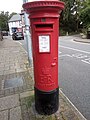
 Elizabeth II post box, Llanfairfechan - geograph.org.uk - 6237354.jpg 1,200 × 1,600; 428 KB
-
 Elizabeth II post box, Llanfairfechan - geograph.org.uk - 6263996.jpg 1,200 × 1,600; 320 KB
-
 Elyrch a'u cywion-Swans and cygnets at the Boating Pool - geograph.org.uk - 4538575.jpg 1,600 × 1,032; 356 KB
-
 Entrance to Hanson Penmaenmawr Quarry - geograph.org.uk - 4171082.jpg 1,600 × 1,064; 688 KB
-
 Erratic boulder - geograph.org.uk - 3877289.jpg 640 × 480; 67 KB
-
 Estate agency on Aber Road - geograph.org.uk - 5043946.jpg 1,500 × 968; 168 KB
-
 Farm Buildings above Llanfairfechan - geograph.org.uk - 151504.jpg 640 × 480; 124 KB
-
 Farmland near Madryn - geograph.org.uk - 4523990.jpg 640 × 426; 38 KB
-
 Fenceline on Drosgl. - geograph.org.uk - 6045992.jpg 1,024 × 683; 92 KB
-
 Ffens lechi - A slate fence - geograph.org.uk - 995381.jpg 640 × 466; 70 KB
-
 Finger Post at Bwlch-y-Ddeufaen - geograph.org.uk - 1811478.jpg 2,592 × 3,888; 3.52 MB
-
 Finger post at Llanfairfechan - geograph.org.uk - 4192805.jpg 1,064 × 1,600; 414 KB
-

-

-

-
 Flying Scotsman at Llanfairfechan - geograph.org.uk - 6317055.jpg 1,024 × 770; 186 KB
-

-
 Footbridge over the A55 North Wales Expressway - geograph.org.uk - 4183158.jpg 1,600 × 1,064; 543 KB
-
 Footbridge, A55 - geograph.org.uk - 4523985.jpg 640 × 426; 60 KB
-
 Footpath - geograph.org.uk - 416785.jpg 600 × 450; 90 KB
-
 Footpath above Llanfairfechan - geograph.org.uk - 1874817.jpg 640 × 480; 65 KB
-
 Footpath near Rhiwiau-isaf - geograph.org.uk - 4863505.jpg 640 × 480; 98 KB
-
 Footpath off Mount Road - geograph.org.uk - 4193433.jpg 1,600 × 1,064; 931 KB
-
 Footpath to Llys-y-gwynt - geograph.org.uk - 4862211.jpg 640 × 480; 84 KB
-
 Footpath up Drosgl - geograph.org.uk - 1874856.jpg 640 × 480; 78 KB
-
 Former drinking fountain, Llanfairfechan - geograph.org.uk - 2729285.jpg 3,000 × 4,000; 5.35 MB
-
 Former Shop Building on Station Road - geograph.org.uk - 5105807.jpg 4,184 × 2,789; 2.79 MB
-
 Former Surgery on Village Road, Llanfairfechan - geograph.org.uk - 4192812.jpg 1,600 × 1,064; 594 KB
-
 Four ponies on Drosgl's lower slopes - geograph.org.uk - 1958218.jpg 640 × 480; 87 KB
-
 Frost-shattered rock - geograph.org.uk - 3876220.jpg 640 × 480; 73 KB
-
 Garreg Fawr - geograph.org.uk - 4133216.jpg 640 × 480; 74 KB
-
 Garreg Fawr springs - geograph.org.uk - 4157779.jpg 640 × 480; 79 KB
-
 Gate Lodge to Plas Heulog - geograph.org.uk - 4132197.jpg 2,816 × 2,112; 1.07 MB
-
 Gatehouse, Plas Heulog - geograph.org.uk - 3266365.jpg 1,600 × 1,200; 597 KB
-
 Gerizim, Capel yr Annibynwyr, Llanfairfechan.jpg 3,872 × 2,592; 3.9 MB
-
 Glacial erratic boulder (1) - geograph.org.uk - 4135952.jpg 640 × 480; 74 KB
-
 Glacial erratic boulder (2) - geograph.org.uk - 4135966.jpg 640 × 480; 82 KB
-
 Glacial erratic boulder - geograph.org.uk - 4863110.jpg 640 × 480; 85 KB
-
 Glan y Mor Elias - geograph.org.uk - 3878304.jpg 1,600 × 1,200; 379 KB
-
 Glan y Môr Elias Local Nature Reserve - geograph.org.uk - 5119355.jpg 3,184 × 2,123; 2.24 MB
-
 Glan y Môr Elias Nature Reserve - geograph.org.uk - 5119363.jpg 4,184 × 2,789; 2.79 MB
-
 Glan y Môr Elias Nature Reserve - geograph.org.uk - 5119377.jpg 3,184 × 2,123; 2.21 MB
-
 Glan y Môr Elias Nature Reserve - geograph.org.uk - 5119389.jpg 3,184 × 2,123; 2.3 MB
-
 Glan-y-Mor Elias - geograph.org.uk - 4524415.jpg 640 × 426; 51 KB
-
 Golf course - geograph.org.uk - 4133202.jpg 640 × 480; 62 KB
-
 Gothic building in Caradog Place, Llanfairfechan - geograph.org.uk - 4538605.jpg 1,600 × 956; 224 KB
-
 GPO cable marker on Aber Road, Llanfairfechan - geograph.org.uk - 6277001.jpg 3,120 × 4,160; 5.53 MB
-
 GPO cable marker on Village Road, Llanfairfechan - geograph.org.uk - 6276994.jpg 3,120 × 4,160; 5.35 MB
-
 Grazing horses - geograph.org.uk - 6298170.jpg 1,024 × 768; 386 KB
-

-
 Groyne and pebbles - geograph.org.uk - 5043868.jpg 1,500 × 999; 243 KB
-
 Groyne on beach at Llanfairfechan - geograph.org.uk - 3484500.jpg 640 × 480; 61 KB


.jpg)


_-_geograph.org.uk_-_4135952.jpg)
_-_geograph.org.uk_-_4135966.jpg)


