Category:Littlethorpe, Leicestershire
Jump to navigation
Jump to search
English: Littlethorpe is a small village approximately 6 miles south of Leicester, separated from the village of Narborough by the Leicester to Birmingham railway line, and the River Soar.

village in Leicestershire, England, United Kingdom  | |||||
| Upload media | |||||
| Instance of | |||||
|---|---|---|---|---|---|
| Location | Narborough, Blaby, Leicestershire, East Midlands, England | ||||
 | |||||
Subcategories
This category has only the following subcategory.
Media in category "Littlethorpe, Leicestershire"
The following 16 files are in this category, out of 16 total.
-
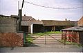 Farm Riddington.jpg 575 × 369; 53 KB
-
 Goats - geograph.org.uk - 509623.jpg 640 × 426; 107 KB
-
 Narborough Road towards Littlethorpe - geograph.org.uk - 509644.jpg 541 × 640; 114 KB
-
 Oak Road, Littlethorpe - geograph.org.uk - 236651.jpg 640 × 480; 74 KB
-
 Old Inn Littlethorpe 2.jpg 572 × 368; 49 KB
-
 Shop in Littlethorpe, Leicestershire - geograph.org.uk - 509641.jpg 640 × 411; 83 KB
-
 Station Road, Littlethorpe - geograph.org.uk - 509633.jpg 640 × 534; 106 KB
-

-
 The Plough, Littlethorpe - geograph.org.uk - 509632.jpg 503 × 640; 81 KB
-

-
 Through the rape field - geograph.org.uk - 164594.jpg 640 × 427; 145 KB
-
 Warwick Road near Littlethorpe - geograph.org.uk - 509612.jpg 640 × 457; 86 KB
-
 Welcome to Littlethorpe - geograph.org.uk - 509618.jpg 640 × 464; 96 KB
-
 Welcome to Littlethorpe - geograph.org.uk - 509642.jpg 640 × 483; 90 KB
-
 Lodge Farm, Littlethorpe - geograph.org.uk - 509637.jpg 640 × 396; 85 KB
-
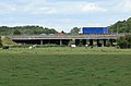 M1 Motorway near Littlethorpe - geograph.org.uk - 509621.jpg 640 × 419; 82 KB


