Category:Little Wolford
Jump to navigation
Jump to search
hamlet and civil parish in Warwickshire, UK  | |||||
| Upload media | |||||
| Instance of | |||||
|---|---|---|---|---|---|
| Location | Stratford-on-Avon, Warwickshire, West Midlands, England | ||||
 | |||||
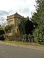
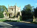
Little Wolford is a hamlet and civil parish in the Stratford-on-Avon District of Warwickshire, England. With the neighbouring parish of Great Wolford it is part of 'The Wolfords'. Little Wolford is significant for its Grade II* listed 15th- to 16th-century Little Wolford Manor House.
Media in category "Little Wolford"
The following 55 files are in this category, out of 55 total.
-
 Great and Little Wolford, Warwickshire 1903 map.jpg 743 × 743; 729 KB
-
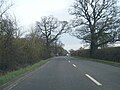
 A3400 drops down the hill - geograph.org.uk - 2004447.jpg 640 × 480; 105 KB
-
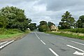
 A3400 junction near Little Wolford - geograph.org.uk - 2184139.jpg 640 × 480; 73 KB
-
 A3400 near Little Wolford Heath - geograph.org.uk - 4851851.jpg 640 × 481; 81 KB
-
 A3400 southbound at Weston Lodge - geograph.org.uk - 4851858.jpg 640 × 481; 73 KB
-
 A3400 southbound at Wolford Fields - geograph.org.uk - 4851834.jpg 640 × 481; 63 KB
-
 A3400 towards Stratford-upon-Avon - geograph.org.uk - 6237334.jpg 1,024 × 684; 360 KB
-
 A3400 towards Stratford-upon-Avon - geograph.org.uk - 6237357.jpg 1,024 × 684; 304 KB
-
 A3400 towards Stratford-upon-Avon - geograph.org.uk - 6237359.jpg 1,024 × 684; 385 KB
-

-
 Across the brook - geograph.org.uk - 1543749.jpg 640 × 480; 125 KB
-
 Approaching Broadmoor Lodge - geograph.org.uk - 3888750.jpg 2,000 × 1,144; 779 KB
-
 Approaching the turn for The Wolfords - geograph.org.uk - 3888729.jpg 2,000 × 1,184; 692 KB
-
 Approaching the turn for Todenham - geograph.org.uk - 3888783.jpg 2,000 × 1,226; 624 KB
-
 Bridge over the brook - geograph.org.uk - 1539706.jpg 640 × 480; 137 KB
-
 Broadmoor Farm, Little Wolford - geograph.org.uk - 1539347.jpg 640 × 480; 112 KB
-
 Broadmoor Lodge (geograph 5427193) (cropped).jpg 463 × 463; 98 KB
-
 Broadmoor Lodge (geograph 5427193).jpg 1,024 × 768; 258 KB
-
 Broadmoor Lodge - geograph.org.uk - 2728397.jpg 4,320 × 3,240; 5.04 MB
-
 Broadmoor Lodge - geograph.org.uk - 6266762.jpg 768 × 1,024; 276 KB
-
 Bucolic Warwickshire - geograph.org.uk - 1930313.jpg 4,000 × 3,000; 3.51 MB
-
 Cottage alongside the A3400 - geograph.org.uk - 1543862.jpg 640 × 480; 88 KB
-
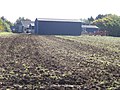
 Dutch barn at Manor Farm - geograph.org.uk - 1545030.jpg 640 × 480; 87 KB
-
 Fallen giant (2) - geograph.org.uk - 3000283.jpg 4,320 × 3,240; 4.8 MB
-
 Fallen tree at the brook - geograph.org.uk - 1543760.jpg 640 × 480; 146 KB
-
 Fallen tree by Nethercote Brook - geograph.org.uk - 2228883.jpg 640 × 423; 85 KB
-
 Farm track and footpath - geograph.org.uk - 271849.jpg 480 × 640; 133 KB
-
 Follow the field edge (1) - geograph.org.uk - 2998117.jpg 4,320 × 3,240; 4.8 MB
-
 Follow the field edge (2) - geograph.org.uk - 2998130.jpg 4,320 × 3,240; 4.72 MB
-
 Former lodge near Long Compton (geograph 2744930).jpg 640 × 469; 193 KB
-
 Green and pleasant - geograph.org.uk - 2998092.jpg 8,000 × 2,593; 4.01 MB
-
 Junction with the A3400 - geograph.org.uk - 2451174.jpg 640 × 480; 85 KB
-
 Little horses near Little Wolford - geograph.org.uk - 271848.jpg 640 × 480; 144 KB
-
 Little Wolford (geograph 6108376).jpg 1,600 × 1,200; 289 KB
-
 Little Wolford Heath - geograph.org.uk - 6166792.jpg 1,600 × 1,200; 612 KB
-
 Little Wolford village - geograph.org.uk - 1543842.jpg 640 × 480; 79 KB
-
 Little Wolford, Broadmoor Lodge - geograph.org.uk - 5568538.jpg 1,024 × 768; 134 KB
-
 Milepost, Little Wolford (geograph 5566232).jpg 3,456 × 4,608; 2.93 MB
-
 Molly's Lodge - geograph.org.uk - 271847.jpg 640 × 480; 131 KB
-
 Muddy stile - geograph.org.uk - 2998106.jpg 4,320 × 3,240; 5.2 MB
-
 Nethercote Brook - geograph.org.uk - 1539514.jpg 640 × 480; 149 KB
-
 No right of way - geograph.org.uk - 2993744.jpg 4,320 × 3,240; 5.07 MB
-
 Pumping house (1) - geograph.org.uk - 3000257.jpg 4,320 × 3,240; 5.13 MB
-
 Pumping house (2) - geograph.org.uk - 3000264.jpg 4,320 × 3,240; 4.78 MB
-
 Rectory Farm (1) - geograph.org.uk - 3000249.jpg 4,320 × 3,240; 4.76 MB
-
 Shetland ponies near Little Wolford - geograph.org.uk - 1539452.jpg 640 × 480; 91 KB
-
 The sign for Burmington - geograph.org.uk - 3888766.jpg 2,000 × 1,115; 835 KB
-
 Track into the woods - geograph.org.uk - 1731672.jpg 4,000 × 3,000; 3.38 MB
-
 Tree and stile - geograph.org.uk - 2998097.jpg 3,240 × 4,320; 4.83 MB
-
 Valley view - geograph.org.uk - 1543768.jpg 640 × 480; 65 KB
-
 Valley view - geograph.org.uk - 3000409.jpg 4,320 × 3,240; 4.8 MB
-
 Wolford Fields Cottages - geograph.org.uk - 2724916.jpg 4,320 × 3,240; 4.77 MB
-
 Wolford Fields Farm (1) - geograph.org.uk - 2724926.jpg 4,320 × 3,240; 5.09 MB
-
 Wolford Fields Farm (2) - geograph.org.uk - 2728363.jpg 4,320 × 3,240; 4.93 MB
-
 Wolford Fields Farm (3) - geograph.org.uk - 2728372.jpg 4,320 × 3,240; 4.81 MB


_(cropped).jpg)
.jpg)


_-_geograph.org.uk_-_3000283.jpg)


_-_geograph.org.uk_-_2998117.jpg)
_-_geograph.org.uk_-_2998130.jpg)
.jpg)


.jpg)


.jpg)


_-_geograph.org.uk_-_3000257.jpg)
_-_geograph.org.uk_-_3000264.jpg)
_-_geograph.org.uk_-_3000249.jpg)


_-_geograph.org.uk_-_2724926.jpg)
_-_geograph.org.uk_-_2728363.jpg)
_-_geograph.org.uk_-_2728372.jpg)