Category:Little Wittenham
Jump to navigation
Jump to search
village and civil parish in South Oxfordshire, England  | |||||
| Upload media | |||||
| Instance of | |||||
|---|---|---|---|---|---|
| Location | South Oxfordshire, Oxfordshire, South East England, England | ||||
| Located in or next to body of water | |||||
 | |||||
English: Little Wittenham is a village on the south bank of the River Thames, northeast of Didcot in South Oxfordshire. In 1974 it was transferred from Berkshire.
Subcategories
This category has the following 6 subcategories, out of 6 total.
Media in category "Little Wittenham"
The following 200 files are in this category, out of 297 total.
(previous page) (next page)-
 1 and 2, Main Street - geograph.org.uk - 3515993.jpg 3,648 × 2,736; 1.79 MB
-
 A wind in the willow - geograph.org.uk - 3176271.jpg 640 × 480; 126 KB
-
 A Wooden Cross - geograph.org.uk - 5087117.jpg 533 × 800; 144 KB
-
 Aerial view of Castle Hill, Wittenham Clumps - geograph.org.uk - 3431374.jpg 4,288 × 2,848; 4.01 MB
-
 Aerial view of Castle Hill, Wittenham Clumps - geograph.org.uk - 3431381.jpg 4,288 × 2,848; 4.02 MB
-
 Aerial view of Day's Lock and Weir - geograph.org.uk - 3417973.jpg 4,288 × 2,848; 4.82 MB
-
 Along by the Wall - geograph.org.uk - 5087919.jpg 1,024 × 683; 204 KB
-
 Altar at St Peter - geograph.org.uk - 5095099.jpg 533 × 800; 93 KB
-
 Altar ^ Back Panel - geograph.org.uk - 5095111.jpg 1,024 × 683; 156 KB
-
 Approaching Little Wittenham - geograph.org.uk - 6298700.jpg 1,024 × 770; 175 KB
-
 Approaching the weir at Day's Lock - geograph.org.uk - 6248975.jpg 4,608 × 3,456; 4.88 MB
-
 Arable farmland southwest of the Sinodun Hills - geograph.org.uk - 3516009.jpg 3,648 × 2,736; 2.16 MB
-
 Arable farmland southwest of the Sinodun Hills - geograph.org.uk - 3516026.jpg 3,648 × 2,736; 2.55 MB
-
 Art on the Lectern - geograph.org.uk - 5096387.jpg 1,024 × 683; 111 KB
-
 Baby detail - geograph.org.uk - 5098091.jpg 1,024 × 683; 87 KB
-
 Back of the Pulpit - geograph.org.uk - 5096456.jpg 1,024 × 683; 118 KB
-
 Baglady leaves Day's Lock - geograph.org.uk - 2487554.jpg 1,024 × 680; 194 KB
-
 Bench and view plinth on Round Hill - geograph.org.uk - 1242231.jpg 640 × 427; 97 KB
-

-
 Between the Pews - geograph.org.uk - 5098093.jpg 1,024 × 683; 125 KB
-
 Boat near the lock - geograph.org.uk - 1312831.jpg 640 × 426; 82 KB
-
 Boating down the river - geograph.org.uk - 1312844.jpg 640 × 426; 87 KB
-
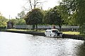
 Boating on the Thames - geograph.org.uk - 2364606.jpg 1,500 × 1,000; 234 KB
-
 Brass on the Tomb - geograph.org.uk - 5096362.jpg 1,024 × 683; 136 KB
-
 Brass on the Vault - geograph.org.uk - 5096650.jpg 1,024 × 683; 115 KB
-
 Brightwell Barrow from Castle Hill - geograph.org.uk - 3081820.jpg 3,588 × 2,100; 826 KB
-
 Candle Holder by the Tomb - geograph.org.uk - 5096368.jpg 533 × 800; 62 KB
-
 Candle Holders - geograph.org.uk - 5098097.jpg 533 × 800; 71 KB
-
 Carter Memorial - geograph.org.uk - 5097739.jpg 1,024 × 683; 80 KB
-
 Carved on the gate - geograph.org.uk - 1302833.jpg 640 × 426; 64 KB
-
 Cast Marker - geograph.org.uk - 5087924.jpg 533 × 800; 129 KB
-
 Castle Hill - geograph.org.uk - 2630342.jpg 1,024 × 683; 138 KB
-
 Castle Hill - geograph.org.uk - 2630397.jpg 1,024 × 683; 159 KB
-
 Castle Hill - geograph.org.uk - 5409289.jpg 1,024 × 768; 143 KB
-
 Castle Hill - geograph.org.uk - 5410779.jpg 1,024 × 683; 95 KB
-
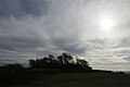
 Castle Hill in February - geograph.org.uk - 5410891.jpg 1,024 × 683; 72 KB
-
 Castle Hill Silhouette - geograph.org.uk - 5410785.jpg 1,024 × 683; 53 KB
-
 Castle Hill, Wittenham Clumps - geograph.org.uk - 2448839.jpg 1,000 × 666; 192 KB
-
 Chancel Arch - geograph.org.uk - 5094835.jpg 533 × 800; 94 KB
-
 Chancel in St Peter - geograph.org.uk - 5095092.jpg 533 × 800; 98 KB
-
 Chancel Window - geograph.org.uk - 5095106.jpg 533 × 800; 109 KB
-
 Christmas Cottage - geograph.org.uk - 2581611.jpg 1,024 × 683; 203 KB
-
 Close up of the Brass - geograph.org.uk - 5096655.jpg 1,024 × 683; 159 KB
-
 Corner of the boundary - geograph.org.uk - 1301927.jpg 400 × 600; 52 KB
-
 Corner of the Churchyard - geograph.org.uk - 5094739.jpg 1,024 × 683; 237 KB
-

-
 Cows and Clumps - geograph.org.uk - 2292918.jpg 1,024 × 765; 198 KB
-
 Cozens Memorial - geograph.org.uk - 5096640.jpg 1,024 × 683; 57 KB
-
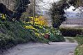
 Crocus ^ snowdrops - geograph.org.uk - 5409569.jpg 1,024 × 683; 172 KB
-
 Curve in the Ditch - geograph.org.uk - 5410774.jpg 1,024 × 683; 154 KB
-
 Cut between the graves - geograph.org.uk - 5098113.jpg 1,024 × 683; 161 KB
-
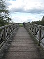
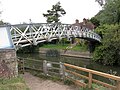
 Little Wittenham Bridge - geograph.org.uk - 1248238.jpg 640 × 401; 83 KB
-
 Day's Lock - geograph.org.uk - 2630394.jpg 1,024 × 683; 107 KB
-
 Day's Lock from Little Wittenham Bridge - geograph.org.uk - 3515666.jpg 3,648 × 2,736; 1.83 MB
-
 Days Lock - geograph.org.uk - 5410823.jpg 1,024 × 683; 133 KB
-
 Days lock down the hill - geograph.org.uk - 2629886.jpg 533 × 800; 113 KB
-
 Descent from Wittenham Clumps - geograph.org.uk - 5496959.jpg 3,000 × 4,000; 4.37 MB
-
 Didcot Power Station - geograph.org.uk - 5410829.jpg 1,024 × 683; 54 KB
-
 Didcot Power Station viewed from the east - geograph.org.uk - 2525672.jpg 1,024 × 680; 164 KB
-
 Different Types - geograph.org.uk - 5088076.jpg 1,024 × 683; 214 KB
-
 Direction finder at Wittenham Clumps - geograph.org.uk - 2480952.jpg 4,000 × 3,000; 4.34 MB
-
 Display board by the sign - geograph.org.uk - 1302849.jpg 640 × 426; 70 KB
-
 Ditch around Castle Hill - geograph.org.uk - 5410787.jpg 1,024 × 683; 103 KB
-
 Door View - geograph.org.uk - 5098106.jpg 1,024 × 683; 117 KB
-
 Dorchester on Thames - geograph.org.uk - 5410826.jpg 1,024 × 683; 95 KB
-
 Dunch Children - geograph.org.uk - 5097901.jpg 1,024 × 683; 131 KB
-
 Entrance to Earth Trust Centre - geograph.org.uk - 2755765.jpg 1,024 × 683; 198 KB
-
 Farm Buildings, Little Wittenham - geograph.org.uk - 2292906.jpg 1,024 × 730; 163 KB
-
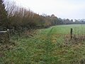
 Farmland, Little Wittenham - geograph.org.uk - 5934480.jpg 1,024 × 768; 274 KB
-
 Feel The View - geograph.org.uk - 3074742.jpg 3,968 × 2,232; 1.66 MB
-
 Fence around the Grave - geograph.org.uk - 5087007.jpg 1,024 × 683; 233 KB
-
 Field Gates and Wittenham Clumps - geograph.org.uk - 2771754.jpg 1,600 × 1,094; 366 KB
-
 Following me around - geograph.org.uk - 2630339.jpg 1,024 × 683; 156 KB
-
 Font ^ Cover - geograph.org.uk - 5094834.jpg 533 × 800; 78 KB
-
-
 Footbridge over the weir at Wittenham - geograph.org.uk - 2526868.jpg 1,024 × 680; 226 KB
-
 Footpath heading to Sires Hill - geograph.org.uk - 2769691.jpg 640 × 480; 88 KB
-
 Foundation Stone - geograph.org.uk - 5094740.jpg 1,024 × 683; 241 KB
-
 From Castle Hill to Brightwell Barrow - geograph.org.uk - 2502451.jpg 3,968 × 2,232; 1.82 MB
-
 From the Pulpit - geograph.org.uk - 5096459.jpg 1,024 × 683; 109 KB
-
 Gate on the Thames Path - geograph.org.uk - 2364580.jpg 1,500 × 1,000; 303 KB
-
 Gate on the Thames Path - geograph.org.uk - 2364583.jpg 1,500 × 1,000; 262 KB
-
 Gate on the Thames Path at Days Lock - geograph.org.uk - 2364643.jpg 1,500 × 1,000; 187 KB
-
 Gate to The Clumps - geograph.org.uk - 2292915.jpg 1,024 × 776; 174 KB
-
 Gates to the Trust - geograph.org.uk - 1302027.jpg 640 × 426; 64 KB
-
 Gateway on Sires Hill - geograph.org.uk - 2746282.jpg 1,024 × 683; 254 KB
-
 Gone fishing... - geograph.org.uk - 2487534.jpg 1,024 × 680; 213 KB
-
 Grassland, Little Wittenham - geograph.org.uk - 1566190.jpg 640 × 480; 131 KB
-
 Grave beside the Step - geograph.org.uk - 5096642.jpg 1,024 × 683; 133 KB
-
 Graves on the North Side - geograph.org.uk - 5088384.jpg 533 × 800; 128 KB
-
 Grey day on the clumps - geograph.org.uk - 2629884.jpg 1,024 × 683; 145 KB
-
 Harvesting near Little Wittenham - geograph.org.uk - 5497029.jpg 3,837 × 2,878; 4.96 MB
-
 Harvesting near Little Wittenham - geograph.org.uk - 5497032.jpg 3,951 × 2,963; 3.68 MB
-
 Harvesting near Little Wittenham - geograph.org.uk - 5497043.jpg 4,000 × 3,000; 4.56 MB
-
 Hedgerow by the Thames - geograph.org.uk - 2364623.jpg 1,500 × 1,000; 268 KB
-
 Henrietta Hilliard Memorial - geograph.org.uk - 5096464.jpg 1,024 × 683; 85 KB
-
 Here it is - geograph.org.uk - 1301963.jpg 640 × 426; 119 KB
-
 Heron at Little Wittenham - geograph.org.uk - 5496965.jpg 3,603 × 2,702; 4.07 MB
-
 Hill Farm - geograph.org.uk - 2630504.jpg 1,024 × 683; 89 KB
-
 Hill Farm - geograph.org.uk - 5410887.jpg 1,024 × 683; 130 KB
-
 Hilliard memorial - geograph.org.uk - 5096350.jpg 1,024 × 683; 119 KB
-
 House in the Garden - geograph.org.uk - 5094736.jpg 1,024 × 683; 169 KB
-
 In the pillbox - geograph.org.uk - 1311377.jpg 640 × 426; 46 KB
-
 Inside the Wood - geograph.org.uk - 5409797.jpg 1,024 × 683; 278 KB
-
 Into the village - geograph.org.uk - 1302014.jpg 640 × 426; 96 KB
-
 Junction of footpaths at field edge - geograph.org.uk - 2581251.jpg 1,024 × 683; 210 KB
-
 Layered hedge at Project Timescape - geograph.org.uk - 1243198.jpg 640 × 427; 107 KB
-
 Lectern in St Peter - geograph.org.uk - 5095115.jpg 533 × 800; 63 KB
-
 Left Hand Plaque - geograph.org.uk - 5097898.jpg 533 × 800; 77 KB
-
 Dirt on the floor - geograph.org.uk - 1301988.jpg 640 × 426; 54 KB
-
 Project Timescape - geograph.org.uk - 1243207.jpg 640 × 427; 56 KB
-
 Little Wittenham - geograph.org.uk - 1301934.jpg 640 × 426; 48 KB
-
 Little Wittenham - geograph.org.uk - 3483116.jpg 2,453 × 3,692; 3.99 MB
-
 Little Wittenham Bridge - geograph.org.uk - 2527155.jpg 1,024 × 680; 256 KB
-
 Little Wittenham Bridge - geograph.org.uk - 4690314.jpg 2,592 × 1,944; 1.64 MB
-
 Little Wittenham Bridge over the River Thames - geograph.org.uk - 5496960.jpg 4,000 × 3,000; 4.06 MB
-
 Little Wittenham Church - geograph.org.uk - 5087004.jpg 1,024 × 683; 185 KB
-
 Little Wittenham church - geograph.org.uk - 5497025.jpg 4,000 × 3,000; 4.94 MB
-
 Little Wittenham Manor - geograph.org.uk - 2630331.jpg 1,024 × 683; 201 KB
-
 Little Wittenham Manor - geograph.org.uk - 2630508.jpg 1,024 × 755; 194 KB
-
 Little Wittenham Manor - geograph.org.uk - 5410827.jpg 1,024 × 683; 142 KB
-
 Little Wittenham Manor - geograph.org.uk - 946991.jpg 640 × 480; 77 KB
-
 Lock keeper's house - geograph.org.uk - 3434655.jpg 800 × 520; 124 KB
-

-
 Ditch by the pillbox - geograph.org.uk - 1300173.jpg 400 × 600; 109 KB
-
 Looking Along the Ditch - geograph.org.uk - 5409813.jpg 1,024 × 683; 170 KB
-
 Looking over a field towards Didcot - geograph.org.uk - 2364613.jpg 1,500 × 1,000; 155 KB
-
 Looking towards Brightwell Barrow from Castle Hill - geograph.org.uk - 2481022.jpg 4,000 × 3,000; 4.04 MB
-
 Loophole on the corner - geograph.org.uk - 1302864.jpg 640 × 426; 67 KB
-
 Mary Dunch (Close up) - geograph.org.uk - 5097752.jpg 1,024 × 683; 121 KB
-
 Mary Dunch - geograph.org.uk - 5097749.jpg 1,024 × 683; 148 KB
-
 Memorial at the Back - geograph.org.uk - 5096639.jpg 533 × 800; 83 KB
-
 Memorials on the North Wall - geograph.org.uk - 5096657.jpg 533 × 800; 81 KB
-
 Millennium Window - geograph.org.uk - 5095122.jpg 1,024 × 683; 77 KB
-
 Misty Morn - geograph.org.uk - 543437.jpg 640 × 443; 49 KB
-
 More near the Door - geograph.org.uk - 5098100.jpg 533 × 800; 74 KB
-
 Moss on the Top - geograph.org.uk - 5087918.jpg 1,024 × 683; 149 KB
-
 Muddy approach to footbridge on the Thames Path - geograph.org.uk - 4323467.jpg 1,024 × 683; 278 KB
-
 Next one is over there - geograph.org.uk - 1300498.jpg 640 × 426; 35 KB
-

-
 North Moreton farmland - geograph.org.uk - 2214219.jpg 2,560 × 1,920; 829 KB
-
 Northmoor Trust Offices - geograph.org.uk - 1243211.jpg 640 × 427; 74 KB
-
 Old Gosling in backwater - geograph.org.uk - 543590.jpg 640 × 479; 63 KB
-
 On Castle Hill - geograph.org.uk - 2481018.jpg 4,000 × 3,000; 3.98 MB
-
 On the slopes of Round Hill - geograph.org.uk - 947050.jpg 640 × 480; 87 KB
-
 Only One Left - geograph.org.uk - 4215671.jpg 3,220 × 2,332; 2.16 MB
-
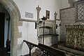
 Organ at St Peter - geograph.org.uk - 5096452.jpg 1,024 × 683; 111 KB
-
 Out of the Chancel - geograph.org.uk - 5096454.jpg 1,024 × 683; 117 KB
-
 Out the loophole - geograph.org.uk - 1311385.jpg 640 × 426; 56 KB
-
 Overgrown Churchyard - geograph.org.uk - 5098110.jpg 1,024 × 683; 243 KB
-
 Oxfordshire Panoramic - geograph.org.uk - 5409285.jpg 997 × 292; 198 KB
-
 Painting in the nave - geograph.org.uk - 5096471.jpg 533 × 800; 81 KB
-
 Parish Church of St Peter - geograph.org.uk - 5087916.jpg 1,024 × 683; 146 KB
-
 Pasture land west of Wittenham Clumps - geograph.org.uk - 3514708.jpg 3,390 × 2,534; 1.5 MB
-
 Path to Round Hill - geograph.org.uk - 2629880.jpg 1,024 × 683; 163 KB
-
 Phone box on the junction - geograph.org.uk - 1304616.jpg 400 × 600; 69 KB
-
 Pillbox by the Thames - geograph.org.uk - 2364558.jpg 1,000 × 1,500; 194 KB
-
 Pillbox in the buttercups - geograph.org.uk - 1311400.jpg 640 × 426; 88 KB
-
 Pillbox near Dorchester on Thames - geograph.org.uk - 2526851.jpg 1,024 × 680; 179 KB
-
 Plaque on the Stone - geograph.org.uk - 5409486.jpg 1,024 × 768; 254 KB
-
 Porch on St Peter - geograph.org.uk - 5094741.jpg 533 × 800; 123 KB
-
 Pulpit in St Peter - geograph.org.uk - 5094837.jpg 533 × 800; 90 KB
-
-
 Relief map of the Sinodun Hills - geograph.org.uk - 1242240.jpg 640 × 427; 71 KB
-
 Remains of benchmark on the Lock Keepers House - geograph.org.uk - 2578111.jpg 683 × 1,024; 187 KB
-
 Right Hand Plaque - geograph.org.uk - 5097899.jpg 533 × 800; 80 KB
-
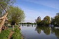
 River scene at Little Wittenham - geograph.org.uk - 2481066.jpg 4,000 × 3,000; 4.38 MB
-
 River Thame - geograph.org.uk - 124698.jpg 640 × 480; 120 KB
-
 River Thames above the weir at Day's Lock - geograph.org.uk - 2150384.jpg 1,280 × 960; 235 KB
-
 River Thames at Little Wittenham - geograph.org.uk - 2487526.jpg 1,024 × 680; 243 KB
-
 River Thames at Little Wittenham - geograph.org.uk - 5496964.jpg 3,965 × 2,230; 4.25 MB
-
 River Thames at Wittenham - geograph.org.uk - 2526870.jpg 1,024 × 680; 148 KB
-
 River Thames below the weir at Day's Lock - geograph.org.uk - 2150391.jpg 1,280 × 960; 424 KB
-
 Road junction on Sires Hill - geograph.org.uk - 2576575.jpg 1,024 × 683; 237 KB
-
 Road Junction to Didcot and Wallingford - geograph.org.uk - 1240684.jpg 640 × 427; 101 KB
-
 Road to Long Wittenham - geograph.org.uk - 1304602.jpg 400 × 600; 55 KB
-
 Road to St Peters - geograph.org.uk - 1304588.jpg 640 × 426; 83 KB
-
 Road to the Clumps - geograph.org.uk - 1304596.jpg 400 × 600; 52 KB
-
 Round Hill from Castle Hill - geograph.org.uk - 1242159.jpg 640 × 427; 75 KB
-
 Round Hill to Castle Hill - geograph.org.uk - 2630493.jpg 1,024 × 683; 138 KB
-
 Rubbish out the back - geograph.org.uk - 1311391.jpg 400 × 600; 74 KB
-
 Rustic seat on Castle Hill - geograph.org.uk - 1242130.jpg 640 × 443; 134 KB
-
 Scruffy View Point - geograph.org.uk - 5409283.jpg 1,024 × 768; 243 KB
-
 Second Marker - geograph.org.uk - 5087927.jpg 533 × 800; 124 KB
-
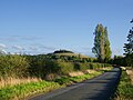
 Sharp bend to Little Wittenham - geograph.org.uk - 1243225.jpg 640 × 427; 105 KB
-
 Sheen Memorial - geograph.org.uk - 5097735.jpg 1,024 × 683; 97 KB
-
 Sheep on Wittenham Clumps hillslope - geograph.org.uk - 2739767.jpg 1,024 × 683; 156 KB
-
 Side by Side - geograph.org.uk - 5087922.jpg 1,024 × 683; 224 KB
-
 Side of the Chancel - geograph.org.uk - 5095306.jpg 1,024 × 683; 113 KB
-
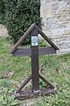
 Sign by the stile - geograph.org.uk - 1298867.jpg 640 × 426; 63 KB
-
 Signpost to the Sinodun Hills - geograph.org.uk - 1242235.jpg 427 × 640; 86 KB
-

-
 Sir William - geograph.org.uk - 5097745.jpg 1,024 × 683; 115 KB
-
 Skull ^ Cross Bones - geograph.org.uk - 5088081.jpg 1,024 × 683; 225 KB
-
 Slope on Round Hill - geograph.org.uk - 2630489.jpg 1,024 × 683; 133 KB
-
 Snowdrops on Castle Hill - geograph.org.uk - 5409573.jpg 1,024 × 683; 127 KB
-
 South Side of the Chancel - geograph.org.uk - 5096383.jpg 1,024 × 683; 111 KB
-
 South Side of the Church - geograph.org.uk - 5088084.jpg 533 × 800; 109 KB
-
 St Peter in the Trees - geograph.org.uk - 5094743.jpg 1,024 × 683; 236 KB
-
 St Peter's Font - geograph.org.uk - 5094829.jpg 533 × 800; 73 KB


_-_geograph.org.uk_-_5097752.jpg)


