Category:Little Marlow
Jump to navigation
Jump to search
Deutsch: Little Marlow ist ein Dorf in Buckinghamshire in England. Es liegt am Fluss Themse, etwa eine Meile nordöstlich von Great Marlow und ca. 50 km westlich von London. Little Marlow hat 130 Einwohner (2001) und gehört zum Distrikt Wycombe.
Français : Little Marlow est un village et paroisse civile du Buckinghamshire, Angleterre. Le village est situé sur la rive nord de la Tamise à moins de 2 km de Marlow. La population est de 130 habitants.
Nederlands: Little Marlow is een plaats in het bestuurlijke gebied Wycombe, in het Engelse graafschap Buckinghamshire. De plaats telt 130 inwoners.
village in Buckinghamshire, England, UK  | |||||
| Upload media | |||||
| Instance of | |||||
|---|---|---|---|---|---|
| Location | Buckinghamshire, South East England, England | ||||
| Said to be the same as | Little Marlow (Wikimedia duplicated page, civil parish) | ||||
 | |||||
Subcategories
This category has the following 5 subcategories, out of 5 total.
Media in category "Little Marlow"
The following 200 files are in this category, out of 252 total.
(previous page) (next page)-
 The northern end of Little Marlow - geograph.org.uk - 96432.jpg 640 × 480; 86 KB
-
 A boat on the River Thames - geograph.org.uk - 3863048.jpg 1,500 × 999; 167 KB
-
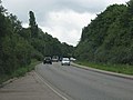
 A busy M40 towards Oxford - geograph.org.uk - 2869154.jpg 640 × 480; 73 KB
-
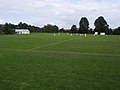 A late summer game - geograph.org.uk - 965797.jpg 640 × 480; 52 KB
-
 A404 - A4155 junction - geograph.org.uk - 3690416.jpg 640 × 430; 51 KB
-
 A404 approaching Handy Cross - geograph.org.uk - 3690425.jpg 640 × 430; 42 KB
-
 A404 bridge over Winchbottom Lane - geograph.org.uk - 3834767.jpg 640 × 428; 113 KB
-
 A404 Northbound - geograph.org.uk - 4515029.jpg 640 × 427; 250 KB
-
 A404 Northbound - geograph.org.uk - 4515049.jpg 640 × 427; 249 KB
-
 A404 Northbound, Marlow - geograph.org.uk - 5608299.jpg 640 × 428; 101 KB
-
-
-
 A404 towards High Wycombe - geograph.org.uk - 5608284.jpg 640 × 428; 103 KB
-
 A404, Handy Cross Junction - geograph.org.uk - 4515053.jpg 640 × 427; 254 KB
-
 A404, Handy Cross Roundabout - geograph.org.uk - 3690426.jpg 640 × 430; 51 KB
-
 A404, Marlow - geograph.org.uk - 4515015.jpg 640 × 480; 255 KB
-
 A404, northbound - geograph.org.uk - 3690420.jpg 640 × 430; 52 KB
-
 A404, northbound - geograph.org.uk - 3690421.jpg 640 × 390; 44 KB
-
 A404, northbound - geograph.org.uk - 3690422.jpg 640 × 430; 55 KB
-
 A4155 eastbound - geograph.org.uk - 3885315.jpg 640 × 480; 76 KB
-
 A4155 eastbound - geograph.org.uk - 3885332.jpg 640 × 521; 70 KB
-
 A4155 eastbound - geograph.org.uk - 3885349.jpg 640 × 480; 47 KB
-

-
 A4155 Marlow Road - geograph.org.uk - 6178143.jpg 1,024 × 684; 329 KB
-
 A4155 Marlow Road, Well End - geograph.org.uk - 6178104.jpg 1,024 × 684; 356 KB
-
 A4155 Marlow Road, Well End - geograph.org.uk - 6178138.jpg 1,024 × 684; 327 KB
-
 A4155 overbridges, A404 - geograph.org.uk - 3690417.jpg 640 × 430; 53 KB
-
 A4155 to Little Marlow - geograph.org.uk - 2470902.jpg 640 × 480; 61 KB
-
 Above Little Marlow - geograph.org.uk - 2024977.jpg 640 × 427; 227 KB
-

-
 Approaching the Handy Cross Roundabout - geograph.org.uk - 3719489.jpg 3,440 × 2,053; 1.45 MB
-
 Approaching The Kings Head, Little Marlow-geograph-3885327.jpg 640 × 406; 41 KB
-
 Arable field near Marlow - geograph.org.uk - 1812721.jpg 1,500 × 1,000; 246 KB
-
 At the end of the road - geograph.org.uk - 5273011.jpg 1,600 × 1,200; 1,004 KB
-
 Barn, Little Marlow-10267688674.jpg 3,815 × 2,870; 3.28 MB
-
 Barns at Handy Cross Farm - geograph.org.uk - 5280052.jpg 4,269 × 2,880; 1.61 MB
-
 Beech Wood near Little Marlow - geograph.org.uk - 117555.jpg 480 × 640; 187 KB
-
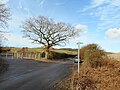
 Bent Signpost, Winchbottom Lane - geograph.org.uk - 5273098.jpg 4,000 × 3,000; 1.7 MB
-
 Birds on Spade Oak Lake - geograph.org.uk - 5291536.jpg 800 × 506; 107 KB
-
 Bloom Wood - geograph.org.uk - 99272.jpg 480 × 640; 242 KB
-
 Bloom Wood, bright winter morning - geograph.org.uk - 117520.jpg 480 × 640; 330 KB
-
 Bloom Wood, Little Marlow - geograph.org.uk - 117560.jpg 640 × 480; 318 KB
-
 Blossom in a tree near Marlow Garden Centre - geograph.org.uk - 1812723.jpg 1,500 × 1,000; 159 KB
-

-
 Boathouses near Winter Hill - geograph.org.uk - 948258.jpg 640 × 427; 180 KB
-
 Boats on the Thames - geograph.org.uk - 3883888.jpg 640 × 480; 65 KB
-
 Bourne End marina - geograph.org.uk - 5311205.jpg 5,202 × 3,465; 3.66 MB
-

-
 Bridleway to Sheepridge Lane - geograph.org.uk - 1306227.jpg 640 × 480; 70 KB
-
 Car park at Marlow Garden Centre - geograph.org.uk - 2413874.jpg 640 × 436; 236 KB
-
 Catkins by the Path - geograph.org.uk - 5289884.jpg 1,600 × 1,200; 936 KB
-
 Chapman Lane - geograph.org.uk - 3846743.jpg 640 × 480; 137 KB
-
 Chapman Lane Reservoir - geograph.org.uk - 6211987.jpg 4,974 × 3,236; 5.31 MB
-
 Chiltern Way - geograph.org.uk - 1476105.jpg 640 × 480; 145 KB
-
 Chiltern Way in beeches of Bloom Wood - geograph.org.uk - 719474.jpg 480 × 640; 279 KB
-
 Church Road at the junction of Marlow Road - geograph.org.uk - 4566990.jpg 2,560 × 1,920; 2.01 MB
-
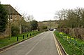
 Church Road, Little Marlow - geograph.org.uk - 5291529.jpg 1,600 × 1,012; 471 KB
-
 Coldmoorholme Lane at the junction of Marlow Road - geograph.org.uk - 5648244.jpg 2,304 × 1,728; 859 KB
-
 Colmoorholme Lane to the River Thames - geograph.org.uk - 3863035.jpg 1,500 × 970; 170 KB
-
 Countryside, Little Marlow - geograph.org.uk - 902540.jpg 640 × 480; 199 KB
-
 Countryside, Little Marlow - geograph.org.uk - 902545.jpg 640 × 480; 145 KB
-
 Countryside, Little Marlow - geograph.org.uk - 902552.jpg 640 × 480; 166 KB
-
 Countryside, Little Marlow - geograph.org.uk - 902556.jpg 640 × 480; 110 KB
-
 Daws Hill Lane Bridge, M40 - geograph.org.uk - 2693303.jpg 640 × 430; 42 KB
-
 Dead Wood by the Brook - geograph.org.uk - 5291681.jpg 1,024 × 768; 339 KB
-
 Donkey Lane, Bourne End - geograph.org.uk - 5311215.jpg 5,202 × 3,465; 3.13 MB
-
 Dusk over the A404 - geograph.org.uk - 4879228.jpg 2,048 × 1,536; 799 KB
-
 Entrance to Little Marlow - geograph.org.uk - 3885309.jpg 640 × 400; 30 KB
-
 Farm shop at Little Marlow-geograph-1799762-by-David-Hawgood.jpg 2,549 × 1,907; 2.07 MB
-
 Farm track, Little Marlow - geograph.org.uk - 902511.jpg 640 × 480; 117 KB
-
 Farmland near Little Marlow - geograph.org.uk - 89677.jpg 597 × 367; 33 KB
-
 Farmland north of Little Marlow - geograph.org.uk - 5272564.jpg 1,600 × 1,200; 554 KB
-
 Farmland, Little Marlow - geograph.org.uk - 1835562.jpg 640 × 480; 148 KB
-
 Farmland, Little Marlow - geograph.org.uk - 902420.jpg 640 × 480; 108 KB
-
 Farmland, Little Marlow - geograph.org.uk - 902426.jpg 640 × 480; 116 KB
-
 Farmland, Little Marlow - geograph.org.uk - 902436.jpg 640 × 480; 132 KB
-
 Farmland, Little Marlow - geograph.org.uk - 902444.jpg 640 × 480; 126 KB
-
 Farmland, Little Marlow - geograph.org.uk - 902481.jpg 640 × 480; 124 KB
-
 Farmland, Little Marlow - geograph.org.uk - 902521.jpg 640 × 480; 142 KB
-
 Farmland, Little Marlow - geograph.org.uk - 902529.jpg 640 × 480; 152 KB
-
 Farmland, Little Marlow - geograph.org.uk - 902570.jpg 640 × 480; 202 KB
-
 Flood in The Avenue - geograph.org.uk - 3846758.jpg 640 × 464; 80 KB
-
 Floods in The Avenue - geograph.org.uk - 3846755.jpg 640 × 480; 121 KB
-

-
 Footpath by Spade Oak lake - geograph.org.uk - 3084790.jpg 3,648 × 2,736; 4.1 MB
-
 Footpath crosses Winchbottom Lane - geograph.org.uk - 5272579.jpg 1,600 × 1,200; 602 KB
-
 Footpath crossing quarry road - geograph.org.uk - 5291557.jpg 1,600 × 1,200; 596 KB
-
 Footpath in Bloom Wood - geograph.org.uk - 2024968.jpg 640 × 427; 284 KB
-
 Footpath to Little Marlow - geograph.org.uk - 965789.jpg 640 × 480; 90 KB
-
 Footpath to Monkton Lane - geograph.org.uk - 3834762.jpg 640 × 480; 100 KB
-
 Former gravel pit, Little Marlow - geograph.org.uk - 97240.jpg 640 × 480; 88 KB
-
 Former gravel pit, Little Marlow - geograph.org.uk - 97244.jpg 640 × 480; 83 KB
-
 Frederica at rest - geograph.org.uk - 3415344.jpg 640 × 480; 108 KB
-
 Grassland, Little Marlow - geograph.org.uk - 902461.jpg 640 × 480; 116 KB
-
 Grassland, Little Marlow - geograph.org.uk - 902466.jpg 640 × 480; 158 KB
-
 Grassland, Little Marlow - geograph.org.uk - 902472.jpg 640 × 480; 149 KB
-
 Grassland, Little Marlow - geograph.org.uk - 902491.jpg 640 × 480; 120 KB
-
 Grassland, Little Marlow - geograph.org.uk - 902574.jpg 640 × 480; 151 KB
-
 Heath End Road Bridge, M40 - geograph.org.uk - 5653971.jpg 640 × 381; 50 KB
-
 Heath End Road, High Wycombe - geograph.org.uk - 4376509.jpg 2,560 × 1,920; 1.98 MB
-
 Horse jump in Horton Wood - geograph.org.uk - 1766588.jpg 2,272 × 1,704; 3.12 MB
-
 Horton Wood - geograph.org.uk - 3834755.jpg 640 × 480; 183 KB
-
 Jolly boating weather - geograph.org.uk - 851065.jpg 640 × 533; 129 KB
-
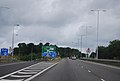
 Junction 4 exit to the A404 on the M40 - geograph.org.uk - 2524109.jpg 1,594 × 1,147; 176 KB
-
 Kissing gate from Marlow Rugby Club on towpath - geograph.org.uk - 3084710.jpg 3,648 × 2,736; 3.35 MB
-
 Kissing gate on Thames towpath - geograph.org.uk - 3084711.jpg 3,648 × 2,736; 3.49 MB
-
 Kissing gate on the Thames Path - geograph.org.uk - 3863045.jpg 1,500 × 999; 161 KB
-
 Large tree on Marlow Road, Well End - geograph.org.uk - 5648247.jpg 2,304 × 1,728; 1.54 MB
-
 Layby on Northbound A404 - geograph.org.uk - 4515042.jpg 640 × 427; 220 KB
-
 Layby on the A404 - geograph.org.uk - 3719484.jpg 4,561 × 2,036; 2.04 MB
-
 Leaning Trees in Horton Wood - geograph.org.uk - 5274157.jpg 1,600 × 1,200; 1.14 MB
-
 Level crossing for footpath - geograph.org.uk - 719694.jpg 480 × 640; 124 KB
-
 Level crossing near Spade Oak farm - geograph.org.uk - 5311194.jpg 5,202 × 3,465; 3.73 MB
-
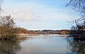
 Little Marlow Lakes - geograph.org.uk - 2257253.jpg 2,560 × 1,920; 1.2 MB
-
 Little Marlow Road crossing the A404 - geograph.org.uk - 4515021.jpg 640 × 480; 265 KB
-
 Looking out of Bloom Wood at sunset - geograph.org.uk - 99287.jpg 640 × 480; 77 KB
-
 Lower Grounds Wood from the air - geograph.org.uk - 2356284.jpg 640 × 480; 182 KB
-
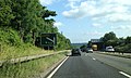
 M40 at High Wycombe - geograph.org.uk - 3184756.jpg 2,999 × 1,974; 3.56 MB
-
 M40 at High Wycombe - geograph.org.uk - 3186850.jpg 2,959 × 1,946; 3.36 MB
-
 M40 at High Wycombe - geograph.org.uk - 3186873.jpg 2,970 × 1,936; 3.75 MB
-
 M40 at Junction 4 - geograph.org.uk - 2869158.jpg 640 × 480; 41 KB
-
 M40 by Myee's Plantation - geograph.org.uk - 2831399.jpg 640 × 481; 59 KB
-
 M40 motorway - Daws Hill Lane bridge - geograph.org.uk - 2358242.jpg 640 × 480; 73 KB
-
 M40 motorway - junction 4 bridges - geograph.org.uk - 2358300.jpg 640 × 480; 72 KB
-
 M40 Motorway approaching junction 4 - geograph.org.uk - 2358256.jpg 640 × 480; 66 KB
-

-

-
 M40 near Deangarden Wood - geograph.org.uk - 2358207.jpg 640 × 480; 63 KB
-
 M40 near High Wycombe - geograph.org.uk - 2869153.jpg 640 × 480; 62 KB
-
 M40 north exit, A404 - geograph.org.uk - 3690423.jpg 640 × 430; 46 KB
-
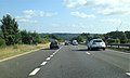
 M40 northbound - geograph.org.uk - 2869150.jpg 640 × 480; 48 KB
-
 M40 south of High Wycombe - geograph.org.uk - 2831400.jpg 640 × 481; 40 KB
-
 M40 southbound - geograph.org.uk - 2693309.jpg 640 × 430; 43 KB
-
 M40 towards Oxford - geograph.org.uk - 5946981.jpg 1,024 × 684; 192 KB
-
 M40 towards Oxford - geograph.org.uk - 5946988.jpg 1,024 × 684; 217 KB
-
 M40, approaching Junction 4 - geograph.org.uk - 2450646.jpg 640 × 367; 37 KB
-
 M40, bridges, Junction 4 - geograph.org.uk - 2450661.jpg 640 × 423; 36 KB
-
 M40, Daws Hill Lane Overbridge - geograph.org.uk - 2450640.jpg 640 × 339; 36 KB
-
 M40, southbound - geograph.org.uk - 5653983.jpg 640 × 371; 43 KB
-
 Marlow Road at Well End - geograph.org.uk - 3867650.jpg 1,500 × 999; 222 KB
-
 Marlow Road east of Marlow - geograph.org.uk - 4566969.jpg 2,560 × 1,920; 1.98 MB
-
 Marlow Road east of Marlow - geograph.org.uk - 4566971.jpg 2,560 × 1,920; 2.51 MB
-
 Marlow Road east of Marlow - geograph.org.uk - 5648250.jpg 2,234 × 1,630; 885 KB
-
 Marlow Road, Little Marlow - geograph.org.uk - 4566993.jpg 2,560 × 1,920; 2.12 MB
-
 Marlow Road, Well End - geograph.org.uk - 4568316.jpg 2,560 × 1,920; 1.99 MB
-
 Missed the sell by date - geograph.org.uk - 5289668.jpg 3,228 × 2,254; 1.66 MB
-
 Moored at Bourne End - geograph.org.uk - 3415365.jpg 586 × 419; 85 KB
-
 New fence and hedge enclose footpath - geograph.org.uk - 719491.jpg 480 × 640; 209 KB
-
 New Sports Centre at High Wycombe - geograph.org.uk - 4464436.jpg 4,608 × 2,014; 4.39 MB
-
 No Through Road - geograph.org.uk - 5273035.jpg 1,600 × 1,200; 1.08 MB
-
 North of Winchbottom Farm - geograph.org.uk - 5273429.jpg 4,000 × 3,000; 2.29 MB
-
 Northbound A404 - geograph.org.uk - 4515036.jpg 640 × 427; 273 KB
-
 Northbound A404 near Marlow - geograph.org.uk - 4515025.jpg 640 × 427; 225 KB
-
 Northbound M40 - geograph.org.uk - 3597091.jpg 640 × 480; 245 KB
-
 Northbound M40, Bridges at Junction 4 - geograph.org.uk - 3597121.jpg 640 × 480; 267 KB
-

-
 Opposite the Thames Path near Bourne End - geograph.org.uk - 5310160.jpg 5,202 × 3,465; 4.75 MB
-
 Orange Way after Wiltshire (411) - geograph.org.uk - 3618417.jpg 800 × 600; 107 KB
-
 Orange Way after Wiltshire (412) - geograph.org.uk - 3618422.jpg 800 × 600; 74 KB
-
 Orange Way after Wiltshire (413) - geograph.org.uk - 3618428.jpg 800 × 600; 113 KB
-
 Orange Way after Wiltshire (414) - geograph.org.uk - 3618430.jpg 800 × 600; 139 KB
-
 Orange Way after Wiltshire (415) - geograph.org.uk - 3618438.jpg 800 × 600; 132 KB
-
 Orange Way after Wiltshire (416) - geograph.org.uk - 3618444.jpg 800 × 600; 101 KB
-
 Paddocks, Little Marlow - geograph.org.uk - 729374.jpg 640 × 480; 119 KB
-
 Parking area on Marlow Road, Little Marlow - geograph.org.uk - 4566994.jpg 2,560 × 1,920; 1.98 MB
-
 Pasture by the A404 - geograph.org.uk - 948752.jpg 640 × 479; 172 KB
-
 Pasture, Little Marlow - geograph.org.uk - 2230104.jpg 640 × 480; 120 KB
-
 Phone box in Little Marlow - geograph.org.uk - 1419839.jpg 640 × 480; 75 KB
-
 Private Fishing sign - in Polish by Spade Oak lakes - geograph.org.uk - 3084783.jpg 3,648 × 2,736; 2.71 MB
-
 Public footpath entrance to Horton Wood - geograph.org.uk - 1766587.jpg 2,272 × 1,704; 3.25 MB
-
 Pump Lane South - geograph.org.uk - 5272355.jpg 1,600 × 1,200; 586 KB
-
 Railway, Bourne End - geograph.org.uk - 3883886.jpg 640 × 480; 120 KB
-
 Rain on the way^ - geograph.org.uk - 958323.jpg 640 × 480; 94 KB
-
 Ray Farm - geograph.org.uk - 3834753.jpg 640 × 480; 134 KB
-
 River Thames - geograph.org.uk - 3883898.jpg 640 × 480; 45 KB
-
 Riverside Road by the River Thames - geograph.org.uk - 3867648.jpg 1,500 × 999; 277 KB
-
 Road away from Hard to Find Farm - geograph.org.uk - 3834745.jpg 640 × 480; 94 KB
-
 Roundabout on the A404, Marlow - geograph.org.uk - 4566912.jpg 2,560 × 1,920; 1.98 MB
-
 Sewage works pipes - geograph.org.uk - 5310148.jpg 5,202 × 3,465; 3 MB
-

-

-
 Small beach beside the 'Thames Path' - geograph.org.uk - 3415324.jpg 640 × 480; 99 KB
-
 Southbound M40 near High Wycombe - geograph.org.uk - 3572320.jpg 640 × 480; 289 KB
-

-
 Spade Oak Brook - geograph.org.uk - 5291646.jpg 1,600 × 1,200; 1.05 MB
-
 Spade Oak Farm on Coldmoorholme Lane - geograph.org.uk - 3863039.jpg 1,500 × 999; 156 KB
-
 Spade Oak Lake - geograph.org.uk - 5289968.jpg 3,402 × 2,443; 3.16 MB
-
 Spade Oak Lake Nature Reserve - geograph.org.uk - 719539.jpg 480 × 640; 218 KB
-
 Spade Oak Lake, Little Marlow - geograph.org.uk - 714234.jpg 640 × 480; 84 KB
-
 Spade Oak Lake, Little Marlow - geograph.org.uk - 714262.jpg 640 × 534; 90 KB
-
 Swan feeding upended in the Thames below Marlow - geograph.org.uk - 3084732.jpg 2,007 × 2,390; 2.56 MB
-
 Swan on the Thames - geograph.org.uk - 3883892.jpg 640 × 480; 66 KB
-
 Swan swimming in the Thames below Marlow - geograph.org.uk - 3084738.jpg 1,829 × 1,925; 1.67 MB
-
 Telecommunications mast near Wycombe - geograph.org.uk - 2450618.jpg 430 × 640; 29 KB
-
 Telecoms Mast by the A404 - geograph.org.uk - 3719478.jpg 3,683 × 2,122; 1.89 MB
-
 Thames islands - geograph.org.uk - 5310140.jpg 5,202 × 3,465; 4.06 MB
-
 Thames Path - geograph.org.uk - 1419657.jpg 640 × 480; 139 KB
-
 Thames Path kissing gate - geograph.org.uk - 5310132.jpg 5,202 × 3,465; 5.49 MB
-
 Thames Path near Bourne End - geograph.org.uk - 2544170.jpg 1,024 × 680; 201 KB
-
 Thames path near Spade Oak farm - geograph.org.uk - 5311199.jpg 5,202 × 3,465; 5.14 MB


_-_geograph.org.uk_-_3618417.jpg)
_-_geograph.org.uk_-_3618422.jpg)
_-_geograph.org.uk_-_3618428.jpg)
_-_geograph.org.uk_-_3618430.jpg)
_-_geograph.org.uk_-_3618438.jpg)
_-_geograph.org.uk_-_3618444.jpg)


