Category:Leyburn
Jump to navigation
Jump to search
market town and civil parish in the district of Richmondshire, North Yorkshire, England  | |||||
| Upload media | |||||
| Instance of | |||||
|---|---|---|---|---|---|
| Location | Richmondshire, North Yorkshire, Yorkshire and the Humber, England | ||||
| Said to be the same as | Leyburn (Wikimedia duplicated page, civil parish) | ||||
 | |||||
Main Wikipedia article: Leyburn.
Subcategories
This category has the following 11 subcategories, out of 11 total.
H
- Leyburn Hall (1 F)
L
- Leyburn Methodist Church (5 F)
- Leyburn Town Hall (9 F)
- Leyburn War Memorial (3 F)
M
- Middleham Bridge (10 F)
P
R
- Leyburn railway station (52 F)
S
Media in category "Leyburn"
The following 200 files are in this category, out of 398 total.
(previous page) (next page)-
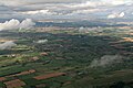
 A circular walk from Leyburn via Wensley village (7) (geograph 7325747).jpg 2,894 × 2,894; 1.43 MB
-
 A terrace of stone cottages - geograph.org.uk - 5574746.jpg 2,000 × 1,333; 2.85 MB
-
 A.R.Calvert, Harmby Road, Leyburn (2) - geograph.org.uk - 5857918.jpg 1,024 × 768; 156 KB
-
 A6108 at Park View bungalows - geograph.org.uk - 3152807.jpg 1,024 × 683; 208 KB
-
 A684 between Leyburn and Wensley - geograph.org.uk - 5031106.jpg 1,600 × 1,067; 320 KB
-
 A684 into Leyburn - geograph.org.uk - 5414293.jpg 640 × 480; 57 KB
-
 A684 Road Bridge - geograph.org.uk - 2536857.jpg 800 × 531; 121 KB
-
 A684 towards Leyburn - geograph.org.uk - 5414277.jpg 640 × 480; 68 KB
-
 A684 towards Leyburn - geograph.org.uk - 5414283.jpg 640 × 480; 55 KB
-
 Access Lane to Park Grange Farm - geograph.org.uk - 5031388.jpg 1,600 × 1,067; 532 KB
-
 Access Lane to Yarker Bank Farm - geograph.org.uk - 5031115.jpg 1,600 × 1,067; 334 KB
-
 Access to Craken House - geograph.org.uk - 4672528.jpg 2,128 × 1,416; 664 KB
-
-
 Across the fields - geograph.org.uk - 4671196.jpg 2,128 × 1,416; 550 KB
-

-
 Arable field next to woodland - geograph.org.uk - 6372834.jpg 1,600 × 1,050; 350 KB
-
 Armby Road, Leyburn - geograph.org.uk - 2008587.jpg 640 × 480; 132 KB
-
 Army Limit at Wimp Hill - geograph.org.uk - 2860201.jpg 1,024 × 768; 168 KB
-
 Barn adjacent to Low Wood Lane - geograph.org.uk - 806528.jpg 640 × 480; 123 KB
-
 Barn beside footpath from A6108 - geograph.org.uk - 3152775.jpg 1,024 × 683; 245 KB
-
 Bench Mark, Leyburn - geograph.org.uk - 2134684.jpg 481 × 640; 75 KB
-

-
 Benchmark on 'Prospect Villa' - geograph.org.uk - 3155389.jpg 732 × 1,024; 271 KB
-

-

-
 Benchmark on building at Moor Farm - geograph.org.uk - 2653165.jpg 683 × 1,024; 316 KB
-
 Benchmark on buttress of Middleham Bridge - geograph.org.uk - 3153402.jpg 683 × 1,024; 272 KB
-
 Benchmark on gatepost near Bellerby Camp - geograph.org.uk - 2654526.jpg 683 × 1,024; 295 KB
-

-
 Benchmark on gatepost, Yarker Bank Farm - geograph.org.uk - 2649164.jpg 683 × 1,024; 268 KB
-
 Benchmark on Howe Hills Barn - geograph.org.uk - 3152816.jpg 1,024 × 683; 328 KB
-
 Benchmark on left side of gatepost beside A6108 - geograph.org.uk - 2654850.jpg 683 × 1,024; 244 KB
-
 Benchmark on old gatepost in hedge of Low Lane - geograph.org.uk - 3153101.jpg 683 × 1,024; 230 KB
-
 Benchmark on ^6 Manor Court - geograph.org.uk - 3552552.jpg 683 × 1,024; 227 KB
-
 Benchmarked stone stile beside A684 - geograph.org.uk - 2771843.jpg 1,024 × 683; 248 KB
-

-
 Boundary stone beside A684 east of Leyburn - geograph.org.uk - 2656141.jpg 1,024 × 683; 199 KB
-
 Bricked up windows, Leyburn - geograph.org.uk - 2546590.jpg 1,024 × 768; 266 KB
-
 Bridge over Mill Beck - geograph.org.uk - 4670108.jpg 2,128 × 1,416; 954 KB
-

-
 Building opposite Walk Mill - geograph.org.uk - 5857945.jpg 1,024 × 768; 224 KB
-
 C Milner & Sons - Shop Front.jpg 2,197 × 1,972; 1.15 MB
-
 Caravan site, Mill Lane, Leyburn - geograph.org.uk - 5857931.jpg 1,024 × 768; 198 KB
-
 Cattle Grid, Craken House - geograph.org.uk - 5857949.jpg 1,024 × 768; 211 KB
-
 Christmas Trees - geograph.org.uk - 4671140.jpg 2,128 × 1,416; 874 KB
-
 Convenience food - geograph.org.uk - 890791.jpg 640 × 480; 114 KB
-

-
 Country Lane leading towards Bellerby - geograph.org.uk - 5031394.jpg 1,600 × 1,067; 625 KB
-
 Covey of Red-legged Partridges - geograph.org.uk - 6372836.jpg 1,600 × 1,271; 535 KB
-
 Crossroad on Whipperdale Bank - geograph.org.uk - 1726684.jpg 518 × 389; 152 KB
-
 Crossroads at Bellerby Camp - geograph.org.uk - 5796351.jpg 3,072 × 2,302; 1.61 MB
-
 Crossroads at Howe Hills - geograph.org.uk - 3085687.jpg 640 × 389; 62 KB
-
 Dads Army - geograph.org.uk - 2537071.jpg 531 × 800; 162 KB
-

-

-
 DANGER Quarry Workings - geograph.org.uk - 6373049.jpg 1,600 × 1,200; 351 KB
-
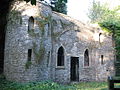
 Deserted ruin - geograph.org.uk - 3575813.jpg 4,000 × 3,000; 3.74 MB
-
 Disused quarry - geograph.org.uk - 6372135.jpg 1,600 × 1,200; 440 KB
-

-
 Enlarged field, north bank of the River Ure - geograph.org.uk - 5137919.jpg 1,024 × 768; 289 KB
-

-
 Entrance to High Side Farm - geograph.org.uk - 405681.jpg 640 × 480; 130 KB
-

-
 Entrance to small wood, Whipperdale Bank - geograph.org.uk - 1726699.jpg 518 × 389; 179 KB
-
 Eye Eye (8628624449).jpg 4,608 × 3,072; 9.42 MB
-
 Farm buildings on south side of A684 - geograph.org.uk - 5279800.jpg 1,024 × 683; 155 KB
-
 Farmland on the north bank of the River Ure - geograph.org.uk - 5137900.jpg 1,024 × 768; 235 KB
-

-
 Field access - geograph.org.uk - 4666729.jpg 2,128 × 1,416; 779 KB
-
 Field and stile - geograph.org.uk - 4671215.jpg 2,128 × 1,416; 701 KB
-
 Field barn - geograph.org.uk - 4666976.jpg 2,128 × 1,416; 800 KB
-
 Field barn below Leyburn - geograph.org.uk - 5242734.jpg 4,320 × 3,240; 3.26 MB
-
 Field Barn, Low Wood lane, Leyburn - geograph.org.uk - 2658853.jpg 1,921 × 1,441; 1.55 MB
-
 Field boundary below (south-west of) Howe Hills - geograph.org.uk - 5137941.jpg 1,024 × 768; 206 KB
-
 Field of trees - geograph.org.uk - 4671155.jpg 2,128 × 1,416; 887 KB
-
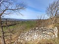
 Fields and dry stone walls - geograph.org.uk - 5574741.jpg 2,000 × 1,333; 1.73 MB
-
 Fields at Washfold Farm - geograph.org.uk - 2653135.jpg 1,024 × 683; 287 KB
-
 Flat roofed building, Leyburn - geograph.org.uk - 2546584.jpg 1,024 × 660; 184 KB
-
 Flooded lay-by, Low Lane - geograph.org.uk - 6350778.jpg 4,288 × 2,848; 2.41 MB
-
 Flooding of the River Ure below Middleham - geograph.org.uk - 2259836.jpg 1,600 × 1,200; 290 KB
-
 Flowers on the Shawl - geograph.org.uk - 891293.jpg 480 × 640; 137 KB
-
 Footpath across to The Cottage - geograph.org.uk - 4672523.jpg 2,128 × 1,416; 788 KB
-
 Footpath beside the River Ure - geograph.org.uk - 4479135.jpg 5,184 × 3,456; 7.08 MB
-
 Footpath heading North towards Bellerby - geograph.org.uk - 5032182.jpg 1,600 × 1,067; 696 KB
-
 Footpath over railway track - geograph.org.uk - 1931591.jpg 2,048 × 1,536; 1.27 MB
-
 Footpath over the Line - geograph.org.uk - 2536847.jpg 800 × 531; 118 KB
-
 Footpath through a field off Harmby Road - geograph.org.uk - 5857924.jpg 1,024 × 768; 186 KB
-
 Former Leyburn Market Hall - geograph.org.uk - 1229269.jpg 480 × 640; 67 KB
-
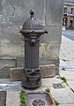 Fountain in town centre, Leyburn.jpg 2,100 × 3,000; 4.6 MB
-
 Friends Meeting House, Leyburn - geograph.org.uk - 2546606.jpg 1,535 × 2,048; 715 KB
-
 Gate and stile - geograph.org.uk - 5857975.jpg 1,024 × 768; 252 KB
-
 Gateway of field, Yarker Bank Farm - geograph.org.uk - 2649130.jpg 1,024 × 683; 213 KB
-
 Gateway on SE side of the A684 - geograph.org.uk - 5279804.jpg 1,024 × 683; 159 KB
-
 George V postbox on Harmby Road, Leyburn - geograph.org.uk - 5526256.jpg 1,015 × 1,847; 319 KB
-
 Ginnel off Shawl Terrace - geograph.org.uk - 2008595.jpg 480 × 640; 104 KB
-
 Grass Fields - geograph.org.uk - 4672516.jpg 2,128 × 1,416; 770 KB
-
 Grassland escarpment - geograph.org.uk - 4666986.jpg 2,128 × 1,416; 804 KB
-
 Grassy hillside at Howe Hills - geograph.org.uk - 5137938.jpg 1,024 × 768; 206 KB
-

-
 Grazing, Leyburn - geograph.org.uk - 5414515.jpg 640 × 480; 57 KB
-
 Grove Square, Leyburn - geograph.org.uk - 2008581.jpg 640 × 480; 115 KB
-
 GWR 0-6-2T 5643 at Leyburn - geograph.org.uk - 2536841.jpg 800 × 531; 130 KB
-
 Harmby Road (A684) - geograph.org.uk - 5414516.jpg 640 × 480; 59 KB
-
 Harmby Road Leyburn looking east - geograph.org.uk - 2960774.jpg 640 × 478; 70 KB
-
 Hedge junction on south side of Low Lane - geograph.org.uk - 3153120.jpg 1,024 × 683; 219 KB
-
 Hedge-laying, Yorkshire style - geograph.org.uk - 1840065.jpg 1,024 × 768; 207 KB
-
 Heritage Locomotive Departing Leyburn - geograph.org.uk - 5874177.jpg 1,024 × 683; 236 KB
-
 Herontree Allotment - geograph.org.uk - 5572432.jpg 5,184 × 3,456; 6.13 MB
-
 High Side farm - geograph.org.uk - 6375891.jpg 1,600 × 977; 256 KB
-
 Horse entrance to the vet's - geograph.org.uk - 5857963.jpg 1,024 × 768; 234 KB
-
 House off Mill Lane, Leyburn - geograph.org.uk - 5857934.jpg 1,024 × 768; 264 KB
-
 House on Richmond Road, Leyburn - geograph.org.uk - 2007147.jpg 480 × 640; 72 KB
-
 Houses along Shawl Terrace - geograph.org.uk - 5243218.jpg 1,500 × 1,075; 1.44 MB
-
 Houses on Richmond Road, Leyburn - geograph.org.uk - 2208554.jpg 1,600 × 1,200; 372 KB
-
 Howe Hills - geograph.org.uk - 5137934.jpg 1,024 × 768; 169 KB
-
 Howe Hills Barn beside A6108 at Mightens' Bank - geograph.org.uk - 3152820.jpg 1,024 × 683; 188 KB
-
 Howe Hills Farm - geograph.org.uk - 4671207.jpg 2,128 × 1,416; 585 KB
-
 HSBC Bank, Leyburn - geograph.org.uk - 1229295.jpg 640 × 480; 72 KB
-
 HSBC Bank, Leyburn - geograph.org.uk - 2180238.jpg 1,024 × 768; 171 KB
-
 HSBC, High Street - geograph.org.uk - 2007106.jpg 640 × 480; 117 KB
-
 Image taken from page 5 of 'Wensleydale and Swaledale Guide ... Illustrated' (11234482436).jpg 1,252 × 2,300; 1,007 KB
-
 In Leyburn - geograph.org.uk - 1841477.jpg 640 × 480; 90 KB
-
 Jacob sheep - geograph.org.uk - 1840058.jpg 1,024 × 768; 161 KB
-
 Junction of Low Lane and A6108 - geograph.org.uk - 3153204.jpg 1,024 × 683; 164 KB
-

-
 Kirkwood Hall, Harmby Road, Leyburn (1) - geograph.org.uk - 5857911.jpg 1,024 × 768; 203 KB
-
 Kirkwood Hall, Harmby Road, Leyburn (2) - geograph.org.uk - 5857913.jpg 1,024 × 768; 167 KB
-
 Lane near High Side farm - geograph.org.uk - 5306708.jpg 3,240 × 4,319; 4.99 MB
-
 Leyburn - geograph.org.uk - 5574745.jpg 2,000 × 1,333; 1.56 MB
-
 Leyburn - stile on the Dale Grove estate - geograph.org.uk - 2227389.jpg 1,600 × 1,200; 624 KB
-

-

-
 Leyburn buildings (3) (geograph 7330877).jpg 4,306 × 2,422; 2.37 MB
-
 Leyburn buildings (4) (geograph 7330878).jpg 4,320 × 3,240; 2.83 MB
-
 Leyburn buildings (5) (geograph 7330879).jpg 4,320 × 3,240; 4.82 MB
-
 Leyburn buildings (6) (geograph 7330880).jpg 2,626 × 3,501; 1.36 MB
-
 Leyburn buildings (7) (geograph 7330883).jpg 2,545 × 3,393; 1.38 MB
-
 Leyburn buildings (8) (geograph 7330888).jpg 2,599 × 3,466; 1.56 MB
-
 Leyburn buildings (9) (geograph 7330889).jpg 3,997 × 2,248; 1.42 MB
-
 Leyburn Cemetery - geograph.org.uk - 6372868.jpg 1,600 × 1,200; 329 KB
-
 Leyburn Christmas Trees - geograph.org.uk - 4671148.jpg 2,128 × 1,416; 990 KB
-
 Leyburn Co-op and Post office - geograph.org.uk - 5414502.jpg 640 × 480; 78 KB
-
 Leyburn Craft Centre - geograph.org.uk - 1961520.jpg 640 × 426; 55 KB
-

-
 Leyburn graveyard from the Shawl - geograph.org.uk - 2211410.jpg 1,600 × 1,200; 647 KB
-
 Leyburn High Street - geograph.org.uk - 3585776.jpg 640 × 481; 65 KB
-
 Leyburn market place - geograph.org.uk - 6161499.jpg 2,048 × 1,536; 1,010 KB
-
 Leyburn Methodist Church - geograph.org.uk - 5414511.jpg 640 × 480; 80 KB
-
 Leyburn Methodist Church - geograph.org.uk - 5857997.jpg 1,024 × 768; 198 KB
-
 Leyburn Moor, from Whipperdale Bank - geograph.org.uk - 1726691.jpg 518 × 389; 171 KB
-
 Leyburn old fire station - geograph.org.uk - 2023340.jpg 640 × 427; 253 KB
-
 Leyburn Old Glebe Nature Reserve - geograph.org.uk - 4413828.jpg 640 × 360; 117 KB
-
 Leyburn Police Station - geograph.org.uk - 2008580.jpg 640 × 480; 122 KB
-
 Leyburn Police Station - geograph.org.uk - 2309568.jpg 1,152 × 864; 589 KB
-
 Leyburn Police Station - geograph.org.uk - 4623532.jpg 1,024 × 710; 609 KB
-
 Leyburn Police Station - geograph.org.uk - 567132.jpg 640 × 480; 93 KB
-
 Leyburn Police Station - geograph.org.uk - 5950454.jpg 800 × 607; 152 KB
-
 Leyburn Railway Station - geograph.org.uk - 5533762.jpg 640 × 427; 68 KB
-
 Leyburn Railway Station - geograph.org.uk - 5533769.jpg 640 × 427; 90 KB
-
 Leyburn Railway Station - geograph.org.uk - 5629951.jpg 640 × 427; 78 KB
-
 Leyburn railway station - NER map - geograph.org.uk - 5858020.jpg 1,024 × 961; 186 KB
-
 Leyburn railway station, Yorkshire - geograph.org.uk - 3268141.jpg 1,024 × 768; 256 KB
-
 Leyburn road junction - geograph.org.uk - 1962321.jpg 640 × 476; 69 KB
-
 Leyburn Sewerage Works - geograph.org.uk - 4670134.jpg 2,128 × 1,416; 885 KB
-
 Leyburn Sham Castle - geograph.org.uk - 1525613.jpg 640 × 480; 128 KB
-
 Leyburn Shawl - geograph.org.uk - 1872417.jpg 1,280 × 853; 280 KB
-
 Leyburn Shawl - geograph.org.uk - 4413799.jpg 640 × 480; 178 KB
-
 Leyburn Shawl - geograph.org.uk - 4413819.jpg 640 × 480; 150 KB
-
 Leyburn Shawl - geograph.org.uk - 4413841.jpg 640 × 480; 138 KB
-
 Leyburn Shawl - geograph.org.uk - 6161492.jpg 2,048 × 1,536; 1,018 KB
-
 Leyburn Shawl - geograph.org.uk - 890789.jpg 640 × 480; 136 KB
-
 Leyburn Shawl - geograph.org.uk - 891199.jpg 640 × 480; 127 KB
-
 Leyburn Shawl footpath - geograph.org.uk - 890787.jpg 640 × 480; 152 KB
-
 Leyburn Shawl view - geograph.org.uk - 6161496.jpg 2,048 × 1,536; 1.26 MB
-
 Leyburn Station - geograph.org.uk - 6375689.jpg 1,600 × 1,050; 255 KB
-
 Leyburn Station building - geograph.org.uk - 5857895.jpg 1,024 × 768; 143 KB
-
 Leyburn the road nr the station - geograph.org.uk - 2389463.jpg 640 × 427; 95 KB
-
 Leyburn Town Centre - geograph.org.uk - 5950456.jpg 800 × 596; 127 KB
-
 Leyburn war memorial - geograph.org.uk - 4623538.jpg 1,024 × 863; 697 KB
-
 Leyburn Water Pump - geograph.org.uk - 2008978.jpg 2,640 × 3,804; 3.06 MB
-
 Leyburn. - geograph.org.uk - 5317659.jpg 640 × 480; 57 KB
-
 Leyburn.jpg 2,000 × 1,500; 668 KB
-
 Lichen- encrusted squeeze stile - geograph.org.uk - 5546356.jpg 2,100 × 2,800; 6.31 MB
-
 Limestone Quarry. nr Leyburn - geograph.org.uk - 2657121.jpg 2,000 × 1,500; 1.55 MB
-
 Limestone Walls near Leyburn - geograph.org.uk - 94335.jpg 640 × 431; 65 KB
-
 Longclose Farm - geograph.org.uk - 6373034.jpg 1,600 × 1,200; 384 KB
-
 Looking north up the A6108 Bellerby Road, Leyburn - geograph.org.uk - 2208538.jpg 1,600 × 1,200; 350 KB
-

-
 Looking south east down Woodside, Leyburn - geograph.org.uk - 2208547.jpg 1,600 × 1,200; 364 KB
-
 Looking south west over Thornborough Crescent. - geograph.org.uk - 2208550.jpg 1,600 × 1,200; 334 KB
-
 Looking towards The Wisings - geograph.org.uk - 4479123.jpg 5,184 × 3,456; 6.17 MB
-
 Looking west from Leyburn Shawl - geograph.org.uk - 6372130.jpg 1,600 × 1,200; 268 KB
-
 Looking west from the Shawl - geograph.org.uk - 5242438.jpg 3,240 × 4,320; 3.39 MB
-
 Low Lane - geograph.org.uk - 3131830.jpg 1,024 × 682; 216 KB
-
 Low Lane - geograph.org.uk - 4479106.jpg 5,184 × 3,456; 5.86 MB
-
 Low Lane - geograph.org.uk - 6350765.jpg 4,280 × 2,519; 1.52 MB
-

-
 Low Lane near Howe Hills plantation - geograph.org.uk - 3085709.jpg 640 × 429; 52 KB
-
 Low Wood Lane - geograph.org.uk - 807030.jpg 480 × 640; 158 KB
-
 Lower Wensleydale Caravan Site - geograph.org.uk - 405662.jpg 640 × 480; 113 KB
_(geograph_7325747).jpg)

_-_geograph.org.uk_-_5857918.jpg)


.jpg)


_Howe_Hills_-_geograph.org.uk_-_5137941.jpg)


_-_geograph.org.uk_-_5414516.jpg)


.jpg)


_-_geograph.org.uk_-_5857911.jpg)
_-_geograph.org.uk_-_5857913.jpg)


_(geograph_7330877).jpg)
_(geograph_7330878).jpg)
_(geograph_7330879).jpg)
_(geograph_7330880).jpg)
_(geograph_7330883).jpg)
_(geograph_7330888).jpg)
_(geograph_7330889).jpg)


