English: Leverstock Green is a
village adjacent to
Hemel Hempstead, in the
English county of
Hertfordshire. It is located on the eastern edge of the town.
<nowiki>Leverstock Green; Leverstock Green; Leverstock Green; Leverstock Green; Leverstock Green; Leverstock Green; Leverstock Green; Leverstock Green; Leverstock Green; Leverstock Green; Leverstock Green; Leverstock Green; Leverstock Green; Leverstock Green; Leverstock Green; Leverstock Green; Leverstock Green; Leverstock Green; Leverstock Green; Leverstock Green; Leverstock Green; Leverstock Green; Leverstock Green; Leverstock Green; Leverstock Green; Leverstock Green; Leverstock Green; Leverstock Green; Leverstock Green; Leverstock Green; Leverstock Green; Leverstock Green; Leverstock Green; Leverstock Green; Leverstock Green; Leverstock Green; Leverstock Green; Leverstock Green; Leverstock Green; Leverstock Green; Leverstock Green; Leverstock Green; Leverstock Green; Leverstock Green; Leverstock Green; Leverstock Green; Leverstock Green; Leverstock Green; Leverstock Green; Leverstock Green; Leverstock Green; Leverstock Green; Leverstock Green; Leverstock Green; Leverstock Green; Leverstock Green; Leverstock Green; Leverstock Green; Leverstock Green; Leverstock Green; Leverstock Green; Leverstock Green; Leverstock Green; Leverstock Green; Leverstock Green; Leverstock Green; Leverstock Green; Leverstock Green; Leverstock Green; Leverstock Green; Leverstock Green; Leverstock Green; Leverstock Green; Leverstock Green; Leverstock Green; Leverstock Green; Leverstock Green; Leverstock Green; Leverstock Green; Leverstock Green; Leverstock Green; Leverstock Green; Leverstock Green; Leverstock Green; Leverstock Green; Leverstock Green; Leverstock Green; Leverstock Green; Leverstock Green; Leverstock Green; Leverstock Green; Leverstock Green; Leverstock Green; Leverstock Green; Leverstock Green; Leverstock Green; Leverstock Green; Leverstock Green; Leverstock Green; Leverstock Green; Leverstock Green; Leverstock Green; Leverstock Green; Leverstock Green; Leverstock Green; Leverstock Green; Leverstock Green; Leverstock Green; Leverstock Green; Leverstock Green; Leverstock Green; Leverstock Green; Leverstock Green; Leverstock Green; Leverstock Green; Leverstock Green; Leverstock Green; Leverstock Green; Leverstock Green; Leverstock Green; Leverstock Green; Leverstock Green; Leverstock Green; Leverstock Green; Leverstock Green; Leverstock Green; Leverstock Green; Leverstock Green; Leverstock Green; Leverstock Green; Leverstock Green; Leverstock Green; Leverstock Green; Leverstock Green; Leverstock Green; Leverstock Green; Leverstock Green; Leverstock Green; Leverstock Green; Leverstock Green; Leverstock Green; Leverstock Green; Leverstock Green; Leverstock Green; Leverstock Green; Leverstock Green; Leverstock Green; Leverstock Green; Leverstock Green; Leverstock Green; Leverstock Green; Leverstock Green; Leverstock Green; Leverstock Green; Leverstock Green; Leverstock Green; Leverstock Green; Leverstock Green; Leverstock Green; Leverstock Green; Leverstock Green; Leverstock Green; Leverstock Green; Leverstock Green; Leverstock Green; Leverstock Green; Leverstock Green; Leverstock Green; Leverstock Green; Leverstock Green; Leverstock Green; Leverstock Green; Leverstock Green; Leverstock Green; Leverstock Green; Leverstock Green; Leverstock Green; Leverstock Green; Leverstock Green; Leverstock Green; Leverstock Green; Leverstock Green; Leverstock Green; Leverstock Green; Leverstock Green; Leverstock Green; Leverstock Green; Leverstock Green; Leverstock Green; Leverstock Green; Leverstock Green; Leverstock Green; Leverstock Green; Leverstock Green; Leverstock Green; Leverstock Green; Leverstock Green; Leverstock Green; población de Inglaterra; যুক্তরাজ্যের একটি গ্রাম; village britannique; dorp in Hertfordshire, Verenigd Koninkrijk; Vorort von Hemel Hempstead; suburb of Hemel Hempstead, Hertfordshire, England, UK; قرية في المملكة المتحدة; селище в Обединено кралство Великобритания и Северна Ирландия; οικισμός του Ηνωμένου Βασιλείου; Leverstock Green, Hertfordshire</nowiki>
Subcategories
This category has the following 2 subcategories, out of 2 total.


 Breakspears House or Farm ^^^ - geograph.org.uk - 41244.jpg 640 × 480; 36 KB
 Emergency Water supply point - geograph.org.uk - 41166.jpg 640 × 480; 26 KB
 Junior School Leverstock Green - geograph.org.uk - 41207.jpg 640 × 480; 25 KB
 Leverstock Green Primary School - geograph.org.uk - 41205.jpg 640 × 480; 24 KB
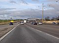 M1 at Junction 7, on a quiet day - geograph.org.uk - 336589.jpg 640 × 473; 68 KB
 M1 at junction 8 - geograph.org.uk - 176766.jpg 640 × 480; 74 KB
 M1 Junction 8 - geograph.org.uk - 176759.jpg 640 × 480; 66 KB
 M1 junction 8 southbound - geograph.org.uk - 176761.jpg 640 × 480; 70 KB
 Pancake Lane, Leverstock Green - geograph.org.uk - 4245143.jpg 2,560 × 1,920; 1.99 MB
 Pancake Lane, Leverstock Green - geograph.org.uk - 4648829.jpg 640 × 480; 147 KB
 Petrol Station at Leverstock Green - geograph.org.uk - 41209.jpg 640 × 480; 23 KB
 Post House Hotel - geograph.org.uk - 260733.jpg 439 × 640; 51 KB
 Shops at Leverstock Green - geograph.org.uk - 41212.jpg 640 × 480; 22 KB
 The A4147, Leverstock Green - geograph.org.uk - 3638317.jpg 1,976 × 1,436; 934 KB
 Entrance to Cherry Tree Farm - geograph.org.uk - 41162.jpg 640 × 480; 33 KB
 M1 crossing B road near junction 8 - geograph.org.uk - 176780.jpg 640 × 480; 84 KB
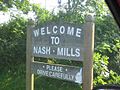 Village welcome sign to Nash Mills - geograph.org.uk - 26791.jpg 640 × 480; 76 KB
 Woodend FarmCherry Tree Lane - geograph.org.uk - 41344.jpg 640 × 480; 14 KB


