Category:Leslie, Fife
Jump to navigation
Jump to search
English: Leslie is a large village on the northern tip of the River Leven Valley, to the west of Glenrothes in Fife. According to the population estimates (2006), the village has a population of 3,092. The village was granted burgh of barony status by James II in 1458 for George Leslie who became the first Earl of Rothes. Later, this was upgraded to a police burgh in 1865.
village in Fife, Scotland, UK  | |||||
| Upload media | |||||
| Instance of |
| ||||
|---|---|---|---|---|---|
| Location |
| ||||
| Population |
| ||||
| Elevation above sea level |
| ||||
 | |||||
Subcategories
This category has the following 4 subcategories, out of 4 total.
C
- Cabbagehall viaduct (3 F)
F
- Fettykil paper mill (6 F)
H
- Holl Reservoir (15 F)
L
- Leslie House (8 F)
Media in category "Leslie, Fife"
The following 50 files are in this category, out of 50 total.
-
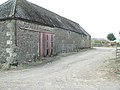 Abandoned byre - geograph.org.uk - 224090.jpg 640 × 480; 119 KB
-
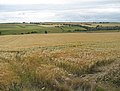 Barley, Strathendry - geograph.org.uk - 1623431.jpg 640 × 488; 97 KB
-
 Car park and pavilion, Hawk Hill - geograph.org.uk - 1623391.jpg 640 × 480; 74 KB
-
 Christ's Kirk on the Green, Leslie - geograph.org.uk - 127308.jpg 640 × 480; 116 KB
-
 Community Woodland - geograph.org.uk - 343627.jpg 640 × 480; 55 KB
-
 Duchess Lodge, Leslie, Fife - c. 1960.jpg 2,735 × 1,786; 1.02 MB
-
 Enterance to Patterson Park and Other Streets, Leslie, Fife.jpg 4,608 × 3,456; 3.85 MB
-
 Entrance - geograph.org.uk - 486969.jpg 640 × 424; 75 KB
-
 Farm track - geograph.org.uk - 480438.jpg 640 × 424; 63 KB
-
 Farmland - geograph.org.uk - 224080.jpg 640 × 480; 66 KB
-
 Farmland - geograph.org.uk - 486381.jpg 640 × 424; 41 KB
-
 Farmlands - geograph.org.uk - 163928.jpg 640 × 480; 58 KB
-
 Former cinema, Leslie - geograph.org.uk - 1864995.jpg 640 × 480; 94 KB
-
 Goatmilk Hills - geograph.org.uk - 277137.jpg 640 × 480; 108 KB
-
 Green War Memorial 3.jpg 448 × 319; 46 KB
-
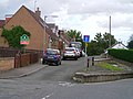
 High Street, Leslie - geograph.org.uk - 1623249.jpg 640 × 480; 70 KB
-
 Holl Reservoir, Fife, Scotland (1).jpg 4,128 × 2,322; 2.06 MB
-
 Holl Reservoir, Fife, Scotland (2).jpg 4,128 × 2,322; 2.83 MB
-
 Holl Reservoir, Fife, Scotland (3).jpg 4,128 × 2,322; 2.86 MB
-
 Holl Reservoir, Fife, Scotland.jpg 4,128 × 2,322; 1.19 MB
-
 Ingrie Farm - geograph.org.uk - 224086.jpg 640 × 480; 82 KB
-
 Leslie - geograph.org.uk - 480871.jpg 640 × 424; 71 KB
-
 Leslie Parish Church - geograph.org.uk - 3987599.jpg 1,439 × 1,707; 647 KB
-
 Leslie, Fife - geograph.org.uk - 127296.jpg 640 × 480; 86 KB
-
 Lothrie burn - geograph.org.uk - 480905.jpg 640 × 424; 79 KB
-
 Main Street, Leslie - geograph.org.uk - 1577596.jpg 640 × 480; 56 KB
-
 Old Greenside Inn; Leslie, Fife, Scotland c. 1875.jpg 3,264 × 1,836; 1.08 MB
-
 On the road to Meikle Balquhomrie - geograph.org.uk - 224067.jpg 640 × 480; 110 KB
-
 Pitkevy Farm - geograph.org.uk - 224104.jpg 640 × 480; 124 KB
-
 Plantation - geograph.org.uk - 481737.jpg 640 × 424; 68 KB
-
 Pylons - geograph.org.uk - 480440.jpg 640 × 424; 48 KB
-
 Regal Cinema, Leslie - geograph.org.uk - 1623378.jpg 640 × 480; 79 KB
-
 Rennies - bx 06 nzv (8074377551).jpg 2,592 × 1,728; 625 KB
-
 Road between reservoirs. - geograph.org.uk - 224060.jpg 640 × 480; 115 KB
-
 Road to Ryelaw - geograph.org.uk - 224063.jpg 640 × 480; 71 KB
-
 Road to West Feal - geograph.org.uk - 1582454.jpg 640 × 359; 64 KB
-
 Ruins of East Feal - geograph.org.uk - 224229.jpg 640 × 480; 107 KB
-
 Sand quarry - geograph.org.uk - 224101.jpg 640 × 480; 79 KB
-
 Shepherd and sheep - geograph.org.uk - 481802.jpg 640 × 424; 51 KB
-
 Silver of World Union.jpg 332 × 617; 109 KB
-
 South Lodge - geograph.org.uk - 163927.jpg 640 × 480; 113 KB
-
 Stagecoach fife-11093 (9251715112).jpg 2,592 × 1,728; 740 KB
-
 Strathenry House driveway - geograph.org.uk - 163925.jpg 480 × 640; 110 KB
-
 The Bull Stone - geograph.org.uk - 486284.jpg 640 × 506; 70 KB
-
 Track alongside Holl Burn - geograph.org.uk - 116568.jpg 640 × 480; 150 KB
-
 Track towards Knockmore - geograph.org.uk - 224070.jpg 640 × 442; 67 KB
-
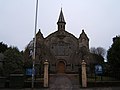 Trinity Parish Church - geograph.org.uk - 1577609.jpg 640 × 480; 46 KB
-
 Two optares - 47003 & 47224 (8154695837).jpg 2,592 × 1,728; 861 KB
-
 West Conland Farm - geograph.org.uk - 433572.jpg 640 × 480; 65 KB
-
 Winter fodder - geograph.org.uk - 1582440.jpg 480 × 640; 153 KB


.jpg)
.jpg)
.jpg)


.jpg)


.jpg)


.jpg)

