Category:Leintwardine
Jump to navigation
Jump to search
village and civil parish in Herefordshire, UK  | |||||
| Upload media | |||||
| Instance of | |||||
|---|---|---|---|---|---|
| Location | Herefordshire, West Midlands, England | ||||
 | |||||
English: Leintwardine is a large village and civil parish in north Herefordshire, England, close to the border with Shropshire.

Subcategories
This category has the following 11 subcategories, out of 11 total.
F
- Forge Bridge, Downton (5 F)
G
- Graham's Cottage Bridge (5 F)
L
- Leintwardine Bridge (34 F)
- Leintwardine Fire Station (3 F)
M
- Marlow, Herefordshire (6 F)
N
S
- Seedley House, Leintwardine (5 F)
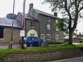
- Sun Inn, Leintwardine (14 F)
T
- The Lion Hotel, Leintwardine (21 F)
Media in category "Leintwardine"
The following 200 files are in this category, out of 382 total.
(previous page) (next page)-
 " Sunset on the river" Leintwardine (1295072).jpg 1,000 × 714; 87 KB
-
 " Wheatstone" L'dine (1293602).jpg 1,000 × 715; 97 KB
-
 " Wheatstone" L'dine (1294360).jpg 1,000 × 710; 114 KB
-
 " Whitton" Leintwardine (1294044).jpg 1,000 × 698; 122 KB
-
 "The Plough" Leintwardine (1294762).jpg 1,000 × 707; 111 KB
-
 ' Leintwardine' from Church Hill (1294986).jpg 1,000 × 740; 74 KB
-

-
 A cold welcome to Herefordshire - geograph.org.uk - 3149700.jpg 640 × 360; 162 KB
-
 A screen of trees - geograph.org.uk - 2340559.jpg 640 × 430; 64 KB
-
 A sharp bend on Broome Road - geograph.org.uk - 2747178.jpg 640 × 428; 53 KB
-
 A wet Teme Valley at Leintwardine - geograph.org.uk - 4781803.jpg 3,920 × 1,615; 2.65 MB
-
 A young woodland near Woodhead - geograph.org.uk - 3148655.jpg 640 × 360; 275 KB
-
 A4110 at the A4113 junction - geograph.org.uk - 2559209.jpg 640 × 480; 57 KB
-
 A4110 in the Teme valley - geograph.org.uk - 2559206.jpg 640 × 480; 51 KB
-
 A4110 towards Leintwardine - geograph.org.uk - 5680820.jpg 1,600 × 901; 684 KB
-

-

-
 A4113 at Billings Wood - geograph.org.uk - 2559322.jpg 640 × 480; 75 KB
-
 A4113 at Hillpike - geograph.org.uk - 2559339.jpg 640 × 480; 70 KB
-
 A4113 at Leintwardine Manor - geograph.org.uk - 2559278.jpg 640 × 480; 84 KB
-

-
 A4113 at track to Hollows Farm - geograph.org.uk - 3280880.jpg 640 × 391; 72 KB
-
 A4113 at Wassell - geograph.org.uk - 2559315.jpg 640 × 480; 66 KB
-
 A4113 at Wassell - geograph.org.uk - 3280891.jpg 640 × 454; 88 KB
-
 A4113 bear Old Lodge - geograph.org.uk - 2559374.jpg 640 × 480; 82 KB
-
 A4113 east of Fiddler's Elbow - geograph.org.uk - 2559333.jpg 640 × 480; 80 KB
-
 A4113 east of the Jolly Frog pub - geograph.org.uk - 2559285.jpg 640 × 480; 62 KB
-
 A4113 entering Herefordshire - geograph.org.uk - 3280861.jpg 640 × 377; 55 KB
-
 A4113 entering Leintwardine - geograph.org.uk - 3280899.jpg 640 × 402; 45 KB
-
 A4113 west of Fiddlers Elbow - geograph.org.uk - 3280896.jpg 640 × 459; 67 KB
-
 A4117 leaves Leintwardine - geograph.org.uk - 3149684.jpg 640 × 360; 171 KB
-
 Abandoned cottage - geograph.org.uk - 3119196.jpg 640 × 480; 97 KB
-
 Abandoned cottage near Clungunford - geograph.org.uk - 3119188.jpg 640 × 480; 79 KB
-
 Above Ferneyhall Dingle - geograph.org.uk - 4956537.jpg 1,024 × 683; 288 KB
-
 Adleymoor Common - geograph.org.uk - 867063.jpg 640 × 480; 107 KB
-

-
 An old course of the River Teme - geograph.org.uk - 2336470.jpg 640 × 430; 74 KB
-
 Angry River Teme - geograph.org.uk - 2921927.jpg 5,056 × 1,296; 2.35 MB
-
 Approaching Trippleton - geograph.org.uk - 2336437.jpg 640 × 430; 103 KB
-

-

-
 B4368 junction near Leintwardine Manor - geograph.org.uk - 3280909.jpg 640 × 472; 111 KB
-
 B4385, Heath - geograph.org.uk - 3149696.jpg 640 × 360; 191 KB
-
 Barns on Church Hill - geograph.org.uk - 2265322.jpg 640 × 480; 108 KB
-
 Beef cattle in summer meadow - geograph.org.uk - 869517.jpg 640 × 305; 68 KB
-

-
 Bird's eye view of the Sun Inn, Leintwardine - geograph.org.uk - 4246712.jpg 3,585 × 2,000; 3.17 MB
-
 Blue remembered hills - geograph.org.uk - 1888626.jpg 1,280 × 960; 504 KB
-
 Bridge House, Leintwardine - geograph.org.uk - 2375402.jpg 1,600 × 899; 612 KB
-
 Broadward Hall - geograph.org.uk - 2747185.jpg 640 × 480; 77 KB
-
 Broadward Hall and castle motte - geograph.org.uk - 3896023.jpg 2,700 × 2,030; 2.55 MB
-
 Broadward Hall and River Clun flood plain - geograph.org.uk - 3896171.jpg 4,048 × 1,404; 2.07 MB
-
 Broadward Hall Harvest Moon set - geograph.org.uk - 4158247.jpg 2,245 × 1,203; 1.32 MB
-
 Brockley Meadow - Leintwardine - geograph.org.uk - 3307848.jpg 2,582 × 1,210; 1.22 MB
-
 Brockley Meadow along the River Teme - geograph.org.uk - 1246843.jpg 640 × 480; 93 KB
-
 Brockley Meadow along the River Teme - geograph.org.uk - 1260415.jpg 640 × 480; 145 KB
-

-
 Brockley meadow mists - Leintwardine - geograph.org.uk - 3307782.jpg 2,585 × 1,334; 1.56 MB
-
 Brockley meadow mists - Leintwardine - geograph.org.uk - 3307796.jpg 2,562 × 1,416; 1.39 MB
-
 Brockley Meadow, Leintwardine - geograph.org.uk - 3307833.jpg 2,400 × 1,928; 1.77 MB
-
 Brook by Jay Lane - geograph.org.uk - 655054.jpg 640 × 480; 102 KB
-
 Cereals, Hillpike - geograph.org.uk - 3148617.jpg 640 × 360; 211 KB
-
 Church Hill sledging - geograph.org.uk - 2104037.jpg 2,848 × 2,136; 1.52 MB
-
 Church Street (Leintwardine) - geograph.org.uk - 6332724.jpg 3,648 × 2,736; 4.77 MB
-
 Church Street - geograph.org.uk - 4909875.jpg 2,048 × 1,536; 609 KB
-
 Church Street - geograph.org.uk - 992098.jpg 640 × 480; 80 KB
-
 Church Street, Leintwardine - geograph.org.uk - 5729445.jpg 1,280 × 851; 403 KB
-

-
 Clun River footbridge, Leintwardine - geograph.org.uk - 5455759.jpg 4,048 × 3,040; 4.41 MB
-
 Clun River footbridge, Leintwardine - geograph.org.uk - 5455761.jpg 4,034 × 2,029; 4.16 MB
-

-

-
 Confluence of Teme and Clun. - geograph.org.uk - 2208032.jpg 2,016 × 1,512; 779 KB
-
 Congregational chapel Leintwardine (1293784).jpg 1,000 × 743; 88 KB
-
 Converted barn, Trippleton - geograph.org.uk - 2336450.jpg 640 × 430; 69 KB
-
 Converted farm building at Woodhead - geograph.org.uk - 6367347.jpg 800 × 533; 149 KB
-
 Converted farm buildings at Gravel Farm - geograph.org.uk - 6367327.jpg 800 × 533; 130 KB
-
 Cottage in Leintwardine village - geograph.org.uk - 2456210.jpg 640 × 480; 85 KB
-
 Criftin Ford Bridge - geograph.org.uk - 2553715.jpg 1,024 × 768; 172 KB
-
 Criftin Ford Bridge - geograph.org.uk - 2876392.jpg 3,757 × 2,774; 5.79 MB
-
 Derelict lodge building at the junction - geograph.org.uk - 6367802.jpg 640 × 480; 144 KB
-
 Ditch by the River Clun - geograph.org.uk - 2343747.jpg 640 × 430; 69 KB
-
 Early morning Autumn mist and sun rise near Paytoe - geograph.org.uk - 4684629.jpg 2,702 × 2,029; 1.68 MB
-
 Edge of the marsh - geograph.org.uk - 5680812.jpg 1,600 × 901; 674 KB
-
 Elan Aqueduct near Leintwardine - geograph.org.uk - 3888081.jpg 4,048 × 2,282; 4.59 MB
-
 Elan Aqueduct works near Leintwardine - geograph.org.uk - 3888103.jpg 3,980 × 1,968; 3.13 MB
-

-

-
 Entrance into wheat field - geograph.org.uk - 2553735.jpg 1,024 × 768; 182 KB
-
 Entrance to Heath Farm - geograph.org.uk - 4979183.jpg 3,957 × 2,006; 1.09 MB
-
 Farm track near Far Barn - geograph.org.uk - 2265356.jpg 640 × 480; 97 KB
-
 Farm track on Shelderton Hill - geograph.org.uk - 2265337.jpg 640 × 480; 126 KB
-
 Farm track to Pool House - geograph.org.uk - 6367337.jpg 800 × 533; 138 KB
-
 Farmland at Paytoe - geograph.org.uk - 2876399.jpg 3,996 × 2,500; 3.66 MB
-
 Felled woodland at Burrington Hays - geograph.org.uk - 1292990.jpg 640 × 480; 63 KB
-
 Fiddler's Elbow, A4113 - geograph.org.uk - 2559327.jpg 640 × 480; 87 KB
-
 Fiddlers Elbow - geograph.org.uk - 907761.jpg 639 × 424; 158 KB
-

-
 Field gate above the Teme valley - geograph.org.uk - 2222087.jpg 640 × 480; 64 KB
-
 Field margin, Shelderton Hill - geograph.org.uk - 4956480.jpg 1,024 × 683; 288 KB
-
 Field off Watling Street - geograph.org.uk - 3156207.jpg 640 × 360; 191 KB
-
 Field off Watling Street - geograph.org.uk - 3156215.jpg 640 × 360; 173 KB
-
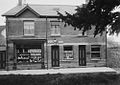
 Filling station and post office, Leintwardine - geograph.org.uk - 4274276.jpg 1,024 × 767; 150 KB
-
 Filling station, Leintwardine - geograph.org.uk - 2342540.jpg 640 × 430; 51 KB
-
 Flood road closures at Leintwardine - geograph.org.uk - 3841680.jpg 4,008 × 2,986; 5.01 MB
-
 Footbridge and ford in fields - geograph.org.uk - 3600126.jpg 640 × 480; 115 KB
-
-
 Footpath off Rosemary Lane - geograph.org.uk - 2341831.jpg 640 × 375; 54 KB
-
 Footpath south of Leintwardine - geograph.org.uk - 2340587.jpg 640 × 430; 59 KB
-
 Footpath to Leintwardine - geograph.org.uk - 2335275.jpg 640 × 430; 83 KB
-
 Ford - geograph.org.uk - 5038259.jpg 640 × 480; 94 KB
-
 Forge Cottage - geograph.org.uk - 1307148.jpg 640 × 480; 113 KB
-
 Former village shop, Leintwardine - geograph.org.uk - 3819000.jpg 3,456 × 2,592; 2.22 MB
-
 Freezing Brockley Meadow - geograph.org.uk - 3307818.jpg 2,518 × 1,840; 2.11 MB
-
 Good advice . Brockley Meadow stile, Leintwardine - geograph.org.uk - 3841671.jpg 3,567 × 2,728; 4.41 MB
-
 Graham's Cottage - geograph.org.uk - 2334470.jpg 640 × 430; 70 KB
-
 Graham's Cottage - geograph.org.uk - 992115.jpg 640 × 480; 86 KB
-
 Griffiths MOT Centre - geograph.org.uk - 2342544.jpg 640 × 430; 62 KB
-
 Harvest Moon set over Broadward Hall - geograph.org.uk - 4158238.jpg 2,592 × 1,944; 2.02 MB
-
 Heading to Leintwardine - geograph.org.uk - 2332582.jpg 640 × 430; 122 KB
-
 Heading to Leintwardine - geograph.org.uk - 2334478.jpg 640 × 430; 70 KB
-
 Heath Lodge (Hopton Heath) - geograph.org.uk - 5796546.jpg 4,096 × 3,072; 3.89 MB
-
 Herefordshire Way crosses Pember's Ditch - geograph.org.uk - 2343760.jpg 640 × 430; 107 KB
-
 Hillside on a misty afternoon - geograph.org.uk - 2265314.jpg 640 × 480; 115 KB
-
 Hilltop field, Mocktree - geograph.org.uk - 3148671.jpg 640 × 360; 178 KB
-
 Horse in a field near Criftin Ford Bridge - geograph.org.uk - 992160.jpg 640 × 480; 121 KB
-
 House on Rosemary Lane - geograph.org.uk - 2340562.jpg 640 × 447; 69 KB
-
 House on the edge of Leintwardine - geograph.org.uk - 2343729.jpg 640 × 323; 34 KB
-
 Is the Abbey near here^ - geograph.org.uk - 2737954.jpg 480 × 640; 144 KB
-
 Jay Bridge - geograph.org.uk - 1252621.jpg 640 × 480; 148 KB
-
 Jay Bridge - geograph.org.uk - 1252627.jpg 640 × 480; 132 KB
-
 Jay Bridge near Leintwardine - geograph.org.uk - 4901127.jpg 3,288 × 2,030; 3.51 MB
-
 Jay Farm, near Leintwardine - geograph.org.uk - 4901132.jpg 4,048 × 1,454; 2.16 MB
-
 Jolly Frog - geograph.org.uk - 907751.jpg 639 × 425; 110 KB
-

-
 Lane from Burrington to Leintwardine - geograph.org.uk - 2334474.jpg 640 × 430; 74 KB
-
 Lane from Burrington to Leintwardine - geograph.org.uk - 2336431.jpg 640 × 430; 109 KB
-
 Lane from Paytoe to Leintwardine - geograph.org.uk - 992170.jpg 640 × 480; 59 KB
-
 Lane intersection near Jay - geograph.org.uk - 5038222.jpg 640 × 480; 65 KB
-
 Lane junction east of Leintwardine - geograph.org.uk - 2340569.jpg 640 × 430; 78 KB
-
 Lane past Trippleton - geograph.org.uk - 992109.jpg 640 × 480; 75 KB
-
 Lane to Leintwardine - geograph.org.uk - 2333859.jpg 640 × 430; 75 KB
-
 Lane to Leintwardine - geograph.org.uk - 2335277.jpg 640 × 430; 94 KB
-
 Lane to Leintwardine - geograph.org.uk - 2336473.jpg 640 × 430; 122 KB
-
 Lane to Leintwardine - geograph.org.uk - 2340550.jpg 640 × 430; 114 KB
-
 Lane to Leintwardine - geograph.org.uk - 5680813.jpg 1,600 × 901; 712 KB
-
 Lane to Lodge Farm - geograph.org.uk - 2737962.jpg 640 × 480; 105 KB
-
 Lane towards Nacklestone - geograph.org.uk - 5096283.jpg 1,000 × 662; 836 KB
-
 Lane, Whitton - geograph.org.uk - 4956473.jpg 683 × 1,024; 464 KB
-
 Lane, Whitton - geograph.org.uk - 4956474.jpg 1,024 × 683; 451 KB
-
 Lanes in the mist - geograph.org.uk - 2265347.jpg 640 × 480; 67 KB
-
-
 Large roadside tree - geograph.org.uk - 2553711.jpg 1,024 × 768; 184 KB
-
 Lawnwell - geograph.org.uk - 4956488.jpg 1,024 × 683; 231 KB
-
 Lawnwell - geograph.org.uk - 4956490.jpg 1,024 × 683; 258 KB
-
 Lawnwell - geograph.org.uk - 4956495.jpg 1,024 × 683; 272 KB
-
 Leintwardine "ancient and modern" (1293642).jpg 1,000 × 717; 126 KB
-
 Leintwardine (1294678).jpg 1,000 × 701; 64 KB
-
 Leintwardine - River Teme East of the bridge weir - geograph.org.uk - 2375362.jpg 4,000 × 2,246; 4.16 MB
-
 Leintwardine - village green - geograph.org.uk - 3208030.jpg 1,345 × 1,008; 1.08 MB
-
 Leintwardine Bier - geograph.org.uk - 6333240.jpg 3,648 × 2,736; 2.62 MB
-
 Leintwardine bridge over River Clun - geograph.org.uk - 4274280.jpg 1,600 × 1,200; 264 KB
-
 Leintwardine buildings (6) (geograph 6987740).jpg 4,035 × 3,025; 4.23 MB
-
 Leintwardine church and football pitch - geograph.org.uk - 3208053.jpg 1,994 × 855; 865 KB
-
 Leintwardine Fisheries (River Teme) - geograph.org.uk - 2336422.jpg 640 × 430; 74 KB
-
 Leintwardine floods, July 2007 - geograph.org.uk - 2379351.jpg 1,280 × 960; 470 KB
-
 Leintwardine football pitch - geograph.org.uk - 3208051.jpg 2,016 × 1,512; 1.67 MB
-
 Leintwardine from "The Green" (1294982).jpg 1,000 × 720; 96 KB
-
 Leintwardine from Brockley Meadow (1293740).jpg 1,000 × 714; 95 KB
-

-
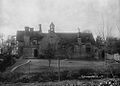
 Leintwardine House (1293711).jpg 1,000 × 712; 114 KB
-
 Leintwardine houses (10) (geograph 6986653).jpg 4,119 × 3,089; 3.54 MB
-
 Leintwardine houses (14) (geograph 6987738).jpg 4,101 × 3,077; 2.97 MB
-
 Leintwardine houses (15) (geograph 6987739).jpg 3,129 × 4,171; 2.64 MB
-
 Leintwardine houses (8) (geograph 6986536).jpg 4,003 × 3,001; 3.47 MB
-
 Leintwardine in the snow (1294356).jpg 1,000 × 717; 179 KB
-
 Leintwardine lime-kilns - geograph.org.uk - 1329425.jpg 640 × 480; 164 KB
-
 Leintwardine Post Office - geograph.org.uk - 2342537.jpg 640 × 430; 51 KB
-
 Leintwardine post office and veterinary surgery (1294630).jpg 1,000 × 710; 120 KB
-
 Leintwardine Recycling Site - geograph.org.uk - 2340592.jpg 640 × 430; 93 KB
-
 Leintwardine school (1294244).jpg 1,000 × 717; 114 KB
-
 Leintwardine vicarage (1294065).jpg 1,000 × 715; 105 KB
-
 Leintwardine village green - geograph.org.uk - 2375355.jpg 4,000 × 2,248; 2.25 MB
-
 Leintwardine Wardens Lane - geograph.org.uk - 4781796.jpg 2,204 × 3,920; 2.55 MB
-
 Leintwardine Weir. Christmas Day 2010. - geograph.org.uk - 2208340.jpg 1,600 × 1,200; 627 KB
-
 Leintwardine, River Teme - geograph.org.uk - 5262997.jpg 1,024 × 768; 219 KB
-
 Liars or just thick^ - geograph.org.uk - 3929787.jpg 640 × 480; 316 KB
-
 Lime-kilns above Leintwardine - geograph.org.uk - 3447829.jpg 2,252 × 1,725; 4.28 MB
-
 Limestone scarp slope - geograph.org.uk - 3149691.jpg 640 × 360; 219 KB
-
 Lone tree - geograph.org.uk - 5679905.jpg 1,600 × 901; 621 KB
-

-
 Marlow Farm, Leintwardine - geograph.org.uk - 3384459.jpg 2,592 × 1,944; 1.13 MB
-
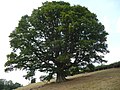 Mature Oak tree in the Teme valley - geograph.org.uk - 2569128.jpg 640 × 480; 103 KB
-
 Meadow near Jay - geograph.org.uk - 5038200.jpg 640 × 480; 71 KB
-
 Meadows near Leintwardine - geograph.org.uk - 3600029.jpg 640 × 480; 64 KB
-
 Meander, River Teme - geograph.org.uk - 2335270.jpg 640 × 430; 123 KB
-
 Methodist Chapel at Church Street Leintwardine - geograph.org.uk - 4345128.jpg 797 × 1,170; 829 KB
-
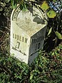 Mile Post - Knighton 10 - geograph.org.uk - 4760120.jpg 480 × 640; 126 KB
-
 Mocktree - geograph.org.uk - 3149680.jpg 640 × 360; 259 KB
-
 Mocktree Cottage - geograph.org.uk - 2265332.jpg 640 × 480; 114 KB
.jpg)
.jpg)
.jpg)
.jpg)
.jpg)
.jpg)


_-_geograph.org.uk_-_6332724.jpg)


.jpg)


_-_geograph.org.uk_-_2559211.jpg)


_-_geograph.org.uk_-_5796546.jpg)


.jpg)
.jpg)


_(geograph_6987740).jpg)

_-_geograph.org.uk_-_2336422.jpg)


.jpg)
.jpg)

.jpg)
_(geograph_6986653).jpg)
_(geograph_6987738).jpg)
_(geograph_6987739).jpg)
_(geograph_6986536).jpg)
.jpg)


.jpg)

.jpg)
.jpg)


