Category:Lee-over-Sands
Jump to navigation
Jump to search
hamlet in Essex, England | |||||
| Upload media | |||||
| Instance of | |||||
|---|---|---|---|---|---|
| Location | St Osyth, Tendring, Essex, East of England, England | ||||
 | |||||
Media in category "Lee-over-Sands"
The following 17 files are in this category, out of 17 total.
-
 A view of Gunfleet Sands - geograph.org.uk - 2181555.jpg 1,024 × 682; 127 KB
-
 Barge Race - geograph.org.uk - 595188.jpg 640 × 392; 70 KB
-
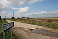
 Beach Road (Creek) - geograph.org.uk - 604903.jpg 640 × 427; 103 KB
-
 Essex Wildlife Trust Hut Colne Point - geograph.org.uk - 595905.jpg 640 × 432; 96 KB
-
 Footpath Path to Seawick - geograph.org.uk - 537545.jpg 640 × 426; 128 KB
-
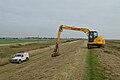 Grass cutting on sea wall west of Seawick.jpg 6,016 × 4,000; 9.32 MB
-
 Lee-over-Sands - geograph.org.uk - 218975.jpg 640 × 432; 98 KB
-
 Lee-over-Sands, 101 Beach Road.JPG 6,016 × 4,000; 10.42 MB
-
 Lee-over-Sands, from sea wall.JPG 6,016 × 4,000; 3.91 MB
-
 Lee-over-Sands, seaward side of Beach Road houses.JPG 6,016 × 4,000; 4.26 MB
-
 Pillbox and Anti Tank Traps - geograph.org.uk - 595752.jpg 640 × 427; 98 KB
-
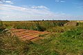
 Ruin in the Marsh - geograph.org.uk - 538590.jpg 640 × 426; 112 KB
-
 Sea Holly - geograph.org.uk - 750639.jpg 504 × 640; 437 KB
-
 Sewage Farm - geograph.org.uk - 218978.jpg 640 × 426; 117 KB
-
 St Osyth Marsh - geograph.org.uk - 537559.jpg 640 × 426; 122 KB
-
 St Osyth Saltmarsh - geograph.org.uk - 538580.jpg 640 × 426; 104 KB
-
 Wall Street - geograph.org.uk - 756550.jpg 640 × 427; 291 KB


_-_geograph.org.uk_-_604903.jpg)


