Category:Leake, North Yorkshire
Jump to navigation
Jump to search
village and civil parish in North Yorkshire, UK  | |||||
| Upload media | |||||
| Instance of | |||||
|---|---|---|---|---|---|
| Location | Hambleton, North Yorkshire, Yorkshire and the Humber, England | ||||
 | |||||
English: Leake is a hamlet and civil parish in the Hambleton district of North Yorkshire, England, about six miles north of Thirsk.
Subcategories
This category has the following 2 subcategories, out of 2 total.
L
- Leake War Memorial (1 F)
S
Media in category "Leake, North Yorkshire"
The following 31 files are in this category, out of 31 total.
-
 A19 - reduce speed now - geograph.org.uk - 2647376.jpg 640 × 428; 69 KB
-
 A19 heading north - geograph.org.uk - 4824671.jpg 640 × 428; 87 KB
-
 A19 heading north - geograph.org.uk - 4824679.jpg 640 × 428; 100 KB
-
 A19 near Leake - geograph.org.uk - 5902390.jpg 3,893 × 1,956; 1.08 MB
-
 A19 northbound - geograph.org.uk - 2647364.jpg 640 × 428; 78 KB
-
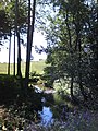 Cod Beck - geograph.org.uk - 536697.jpg 480 × 640; 145 KB
-
 Cows at Leake - geograph.org.uk - 3645264.jpg 3,872 × 2,592; 3.86 MB
-
 Farmland by Stell Bank Bridge - geograph.org.uk - 3645110.jpg 3,872 × 2,592; 4.56 MB
-
 Field beside the A19 at Leake - geograph.org.uk - 6323431.jpg 5,184 × 3,456; 7.59 MB
-
 Footbridge and balsam. - geograph.org.uk - 536710.jpg 480 × 640; 182 KB
-
 High Lane - geograph.org.uk - 6323426.jpg 5,184 × 3,456; 5.19 MB
-
 In a country churchyard - geograph.org.uk - 5198885.jpg 4,320 × 3,240; 4.27 MB
-
 Leake churchyard - geograph.org.uk - 5198881.jpg 4,320 × 3,240; 3.47 MB
-
 Leake Hall - geograph.org.uk - 201990.jpg 640 × 427; 73 KB
-
 Leake Hall - geograph.org.uk - 6325059.jpg 5,184 × 3,456; 7.18 MB
-
 Lime Kilns - geograph.org.uk - 734365.jpg 640 × 480; 118 KB
-
 Ordnance Survey Cut Mark with Bolt - geograph.org.uk - 4212150.jpg 4,000 × 3,000; 3.08 MB
-
 St Mary's, Leake - geograph.org.uk - 5198877.jpg 3,129 × 4,171; 3.06 MB
-
 St. Mary the Virgin Church, Leake (1) - geograph.org.uk - 6324491.jpg 5,184 × 3,456; 5.77 MB
-
 St. Mary the Virgin Church, Leake (2) - geograph.org.uk - 6324496.jpg 5,184 × 3,456; 7.35 MB
-
 Stell Bank Bridge - geograph.org.uk - 5408403.jpg 4,000 × 3,000; 4.26 MB
-
 The A19 - geograph.org.uk - 3500132.jpg 640 × 427; 276 KB
-
 View North East from Stell Bank Bridge - geograph.org.uk - 89951.jpg 640 × 480; 68 KB
-
 Wrapped and Unwrapped Bales - geograph.org.uk - 785806.jpg 640 × 427; 199 KB
-
 Bridge Over Leake Stell - geograph.org.uk - 475861.jpg 640 × 480; 86 KB
-
 Furlands - geograph.org.uk - 476168.jpg 640 × 480; 31 KB
-
 Leake DMV - geograph.org.uk - 734322.jpg 640 × 480; 76 KB
-
 Leake house Farm - geograph.org.uk - 124159.jpg 640 × 480; 57 KB
-
 Limekiln Lane - geograph.org.uk - 734348.jpg 640 × 480; 139 KB
-
 Long Lane - geograph.org.uk - 124155.jpg 640 × 480; 71 KB
-
 Paddock, Stone Lodge - geograph.org.uk - 124283.jpg 640 × 480; 53 KB


_-_geograph.org.uk_-_6324491.jpg)
_-_geograph.org.uk_-_6324496.jpg)


