Category:Laxton, Nottinghamshire
Jump to navigation
Jump to search
English: Laxton is a small village in the civil parish of Laxton and Moorhouse in the English county of Nottinghamshire, situated ca. 25 miles northeasternly of Nottingham city centre.
village in Nottinghamshire, UK  | |||||
| Upload media | |||||
| Instance of | |||||
|---|---|---|---|---|---|
| Location | Laxton and Moorhouse, Newark and Sherwood, Nottinghamshire, East Midlands, England | ||||
 | |||||
Subcategories
This category has the following 3 subcategories, out of 3 total.
Media in category "Laxton, Nottinghamshire"
The following 69 files are in this category, out of 69 total.
-
 Another pylon near to Laxton, Notts. - geograph.org.uk - 1202199.jpg 640 × 457; 69 KB
-
 Barns at Crosshill Farm, Laxton (2) - geograph.org.uk - 2232277.jpg 1,024 × 768; 131 KB
-
 Barns at Crosshill Farm, Laxton - geograph.org.uk - 2232274.jpg 1,024 × 768; 119 KB
-
 Beth Shalom memorial Garden 02.jpg 1,728 × 2,304; 1.07 MB
-
 Converted Chapel, Laxton - geograph.org.uk - 2232251.jpg 1,024 × 768; 162 KB
-
 Covered sewage works, Laxton - geograph.org.uk - 463329.jpg 640 × 480; 130 KB
-
 Cows grazing near Laxton - geograph.org.uk - 1537019.jpg 640 × 449; 75 KB
-
 Derelict brick built building on airfield - geograph.org.uk - 508068.jpg 640 × 480; 159 KB
-
 Entering Laxton on Toad Lane - geograph.org.uk - 2233294.jpg 1,024 × 768; 172 KB
-
 Farm track (footpath) near Laxton - geograph.org.uk - 2692881.jpg 640 × 480; 92 KB
-
 Farm track near Laxton - geograph.org.uk - 3074771.jpg 1,024 × 768; 120 KB
-
 Farmland near Laxton - geograph.org.uk - 2692889.jpg 640 × 480; 60 KB
-
 Footpath and Gate - geograph.org.uk - 172359.jpg 640 × 480; 90 KB
-
 Footpath to Kneesall - geograph.org.uk - 172358.jpg 640 × 480; 96 KB
-
 Footpath to Kneesall - geograph.org.uk - 175146.jpg 640 × 480; 123 KB
-
 Footpath to Laxton - geograph.org.uk - 175148.jpg 640 × 480; 98 KB
-
 Gate on Moorhouse Road - geograph.org.uk - 1202174.jpg 640 × 400; 49 KB
-
 Hedging in progress near Laxton - geograph.org.uk - 1202219.jpg 640 × 480; 42 KB
-
 High Street, Laxton (2) - geograph.org.uk - 2232675.jpg 1,024 × 768; 125 KB
-
 High Street, Laxton - geograph.org.uk - 2232674.jpg 1,024 × 768; 106 KB
-
 High Street, Laxton - geograph.org.uk - 2693113.jpg 640 × 480; 46 KB
-
 House in Laxton - geograph.org.uk - 2693114.jpg 640 × 480; 71 KB
-
 Ivy House Farm, Laxton - geograph.org.uk - 2232677.jpg 1,024 × 768; 125 KB
-
 Kersall Road south of Laxton - geograph.org.uk - 3031869.jpg 3,648 × 2,736; 2.83 MB
-
 Laxton church, c.1912.jpg 2,073 × 1,704; 1.05 MB
-
 Laxton High Street, Nottinghamshire - geograph.org.uk - 1421786.jpg 640 × 480; 69 KB
-
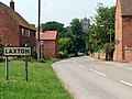 Laxton Nottinghamshire.jpg 640 × 480; 124 KB
-
 Laxton view - geograph.org.uk - 2483298.jpg 640 × 427; 94 KB
-
 Laxton village looking west - geograph.org.uk - 166628.jpg 640 × 480; 130 KB
-
 Laxton village.png 400 × 300; 231 KB
-
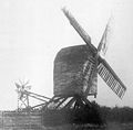 Laxton windmill.jpg 2,094 × 2,065; 4.11 MB
-

-
 Main Street at Laxton - geograph.org.uk - 3031840.jpg 3,648 × 2,736; 2.46 MB
-
 Main Street Laxton - geograph.org.uk - 724524.jpg 640 × 437; 83 KB
-
 Main Street, Laxton - geograph.org.uk - 2092411.jpg 900 × 450; 233 KB
-
 Main Street, Laxton - geograph.org.uk - 3334393.jpg 2,161 × 1,416; 2.13 MB
-
 Monkey Puzzle Tree, Main Street, Laxton - geograph.org.uk - 3334391.jpg 1,504 × 2,256; 2.22 MB
-
 Notts Pylons near Laxton - geograph.org.uk - 3074774.jpg 1,024 × 768; 127 KB
-
 Open gate - geograph.org.uk - 724523.jpg 640 × 480; 70 KB
-
 Part of Laxton village - geograph.org.uk - 2091690.jpg 900 × 527; 327 KB
-
 South Field, Laxton- aerial 2016 - geograph 5009880.jpg 640 × 427; 60 KB
-
 Stone walls, Laxton - geograph.org.uk - 2232258.jpg 1,024 × 768; 253 KB
-
 Telephone Kiosk, Laxton.jpg 4,737 × 3,602; 4.46 MB
-
 The former Post Office, Laxton - geograph.org.uk - 2232681.jpg 1,024 × 768; 133 KB
-
 The Lane to Laxton - geograph.org.uk - 2232244.jpg 1,024 × 768; 129 KB
-
 Toad Lane leaving Laxton - geograph.org.uk - 2092413.jpg 900 × 596; 301 KB
-
 Toad Lane, Laxton - geograph.org.uk - 2693116.jpg 640 × 480; 65 KB
-

-
 Track east of Laxton - geograph.org.uk - 2091660.jpg 900 × 629; 380 KB
-
 Track into the field nr Laxton - geograph.org.uk - 1926350.jpg 640 × 419; 76 KB
-
 Tree by a footpath east of Laxton - geograph.org.uk - 2091674.jpg 673 × 900; 417 KB
-
 View towards High Street, Laxton - geograph.org.uk - 2232671.jpg 1,024 × 768; 194 KB
-
 View towards Laxton from beneath the power lines - geograph.org.uk - 2232243.jpg 1,024 × 768; 103 KB
-
 Village view of Laxton - geograph.org.uk - 2091696.jpg 900 × 653; 378 KB
-
 Access path to field - geograph.org.uk - 508059.jpg 640 × 480; 178 KB
-
 Bottom Farm - geograph.org.uk - 172362.jpg 640 × 480; 87 KB
-
 Busy Crossroads - geograph.org.uk - 175149.jpg 640 × 480; 122 KB
-

-
 Eel Road Laxton - geograph.org.uk - 724526.jpg 640 × 480; 82 KB
-
 Empty road near Kneesall Wood - geograph.org.uk - 724531.jpg 640 × 461; 44 KB
-
 Found one decent jacket - geograph.org.uk - 724528.jpg 640 × 480; 80 KB
-
 It's the end of the road - geograph.org.uk - 460545.jpg 640 × 480; 158 KB
-
 Laxton - Dovecote Inn - geograph.org.uk - 166640.jpg 640 × 480; 106 KB
-

-
 Power lines - geograph.org.uk - 237831.jpg 640 × 427; 64 KB
-
 Road to Kersall - geograph.org.uk - 508049.jpg 640 × 480; 126 KB
-
 The ubiquitous pylon - geograph.org.uk - 237843.jpg 640 × 427; 42 KB
-
 Track to Knapeney - geograph.org.uk - 175154.jpg 640 × 480; 110 KB
-


_-_geograph.org.uk_-_2232277.jpg)


_near_Laxton_-_geograph.org.uk_-_2692881.jpg)


_-_geograph.org.uk_-_2232675.jpg)


