Category:Launton
Jump to navigation
Jump to search
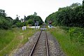
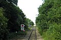
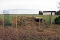
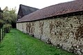
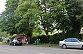
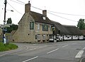
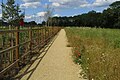
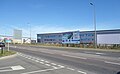
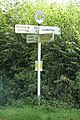
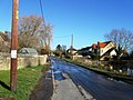
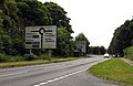
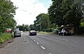
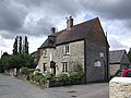
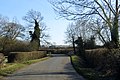
English: Launton is a village and civil parish on the eastern outskirts of Bicester, Oxfordshire, England. Launton is twinned with the village of Gavray in France.
village and civil parish in Cherwell district, Oxfordshire, England, UK  | |||||
| Upload media | |||||
| Instance of | |||||
|---|---|---|---|---|---|
| Location | Cherwell, Oxfordshire, South East England, England | ||||
| Population |
| ||||
| Area |
| ||||
| official website | |||||
 | |||||
Subcategories
This category has the following 2 subcategories, out of 2 total.
L
- Launton railway station (5 F)
Media in category "Launton"
The following 156 files are in this category, out of 156 total.
-
 1987 Citroen 2CV Bamboo.jpg 4,080 × 3,072; 2.98 MB
-
 A footpath crosses the line to Bicester - geograph.org.uk - 4200270.jpg 1,500 × 977; 186 KB
-
 A41 looking west - geograph.org.uk - 63769.jpg 640 × 480; 134 KB
-
 A4421, Bicester bypass - geograph.org.uk - 3368787.jpg 640 × 320; 31 KB
-
 Allotments by Charbridge Lane - geograph.org.uk - 4695637.jpg 1,600 × 1,066; 482 KB
-
 Approaching Launton level crossing - geograph.org.uk - 4200266.jpg 1,500 × 999; 162 KB
-
 Approaching the Bicester Perimeter Road Crossing - geograph.org.uk - 4203414.jpg 1,500 × 990; 185 KB
-
 Bakels on Skimmingdish Lane, Bicester - geograph.org.uk - 6186547.jpg 1,848 × 1,160; 1.27 MB
-

-
 Bicester Gliding Club - geograph.org.uk - 1993682.jpg 3,256 × 2,408; 1.94 MB
-
 Bicester Heritage former RAF Bicester - geograph.org.uk - 4041331.jpg 15,027 × 2,333; 7.09 MB
-
 Bicester Heritage former RAF Bicester - geograph.org.uk - 4041344.jpg 7,859 × 2,564; 5.96 MB
-
 Bicester Road crosses the East - West Line - geograph.org.uk - 4319797.jpg 1,500 × 749; 97 KB
-
 Bicester Road crosses the railway line - geograph.org.uk - 4203408.jpg 1,500 × 996; 182 KB
-
 Bicester Road in Launton - geograph.org.uk - 4319799.jpg 1,500 × 999; 181 KB
-
 Bicester Road, Caversfield - geograph.org.uk - 6176434.jpg 1,870 × 1,200; 1.48 MB
-
 Bicester Road, Launton - geograph.org.uk - 4871624.jpg 2,048 × 1,536; 1.5 MB
-
 Bicester Road, Launton - geograph.org.uk - 6271276.jpg 5,175 × 3,331; 2.06 MB
-
 Blackthorn Road at the junction of West End - geograph.org.uk - 4877073.jpg 1,938 × 1,376; 882 KB
-
 Blackthorn Road, Launton - geograph.org.uk - 4872432.jpg 2,048 × 1,536; 1.46 MB
-
 Blenheim Drive - geograph.org.uk - 4351572.jpg 640 × 480; 75 KB
-
 Bridge carrying disused Varsity Line - geograph.org.uk - 4246140.jpg 4,320 × 3,240; 4.07 MB
-
 Bridleway towards Marsh Gibbon - geograph.org.uk - 6204891.jpg 1,600 × 1,066; 585 KB
-
 Buildings on Bicester Airfield - geograph.org.uk - 3503178.jpg 1,024 × 768; 149 KB
-
 Chair with lights.jpeg 3,024 × 4,032; 1.92 MB
-
 Charbridge Lane crosses the railway line - geograph.org.uk - 4208081.jpg 1,500 × 999; 229 KB
-
 Cross Bucks Way - geograph.org.uk - 2181172.jpg 640 × 480; 109 KB
-
 Cross Bucks Way - geograph.org.uk - 6210873.jpg 1,600 × 1,066; 482 KB
-
 Crumbling structure on the edge of Bicester Airfield - geograph.org.uk - 4902354.jpg 1,600 × 1,066; 528 KB
-
 Cycle path onto Launton Road - geograph.org.uk - 4695686.jpg 1,600 × 1,066; 454 KB
-
 Cycleway and Fence - geograph.org.uk - 6281856.jpg 4,368 × 3,428; 1.91 MB
-
 Farm crossing on the line to Bicester - geograph.org.uk - 4203405.jpg 1,500 × 990; 250 KB
-
 Field Barn - geograph.org.uk - 6205014.jpg 1,600 × 1,066; 400 KB
-
 Field Barn - geograph.org.uk - 716223.jpg 640 × 425; 62 KB
-
 Field by Station Road - geograph.org.uk - 6205029.jpg 1,600 × 1,066; 521 KB
-
 Field by the Chiltern Main Line - geograph.org.uk - 4521012.jpg 640 × 426; 55 KB
-
 Field by the railway in Launton - geograph.org.uk - 4871617.jpg 2,048 × 1,536; 909 KB
-
 Flooded farmland - geograph.org.uk - 3372449.jpg 640 × 430; 40 KB
-
 Footpath by the church - geograph.org.uk - 4695671.jpg 1,600 × 1,066; 639 KB
-
 Footpath by the new care home - geograph.org.uk - 4695655.jpg 1,600 × 1,066; 724 KB
-
 Footpath from Bicester - geograph.org.uk - 6204887.jpg 1,600 × 1,066; 675 KB
-
 Footpath meets the road - geograph.org.uk - 6205076.jpg 1,600 × 1,066; 503 KB
-
 Footpath off Station Road - geograph.org.uk - 6271342.jpg 5,264 × 3,464; 3.15 MB
-
 Footpath through the stubble - geograph.org.uk - 6271360.jpg 5,472 × 3,648; 3.03 MB
-
 Footpath to estbury Court - geograph.org.uk - 6204895.jpg 1,600 × 1,066; 451 KB
-
 Footpath to Poodle Farm - geograph.org.uk - 6205071.jpg 1,600 × 1,066; 395 KB
-
 Footpath towards Field Farm - geograph.org.uk - 4695642.jpg 1,066 × 1,600; 870 KB
-
 Footpath towards Field Farm - geograph.org.uk - 4695643.jpg 1,600 × 1,066; 725 KB
-
 Footpath towards Field Farm - geograph.org.uk - 6204900.jpg 1,600 × 1,066; 368 KB
-
 Footpath towards Field Farm - geograph.org.uk - 6204902.jpg 1,600 × 1,066; 425 KB
-
 Footpath towards the road - geograph.org.uk - 6205018.jpg 1,600 × 1,066; 722 KB
-
 Gliders at Bicester Airfield - geograph.org.uk - 3503278.jpg 1,024 × 565; 113 KB
-
 Hare Leys Farm - geograph.org.uk - 1033898.jpg 640 × 473; 92 KB
-
 Houses on Blackthorn Road, Launton - geograph.org.uk - 4872427.jpg 2,048 × 1,536; 1.49 MB
-
 Kebab van on The A4421, Bicester - geograph.org.uk - 6176437.jpg 1,876 × 1,212; 1.84 MB
-
 Disused railway looking south-east - geograph.org.uk - 65570.jpg 640 × 480; 208 KB
-
 Village Pump - geograph.org.uk - 1638173.jpg 640 × 467; 130 KB
-
 Launton Church Tower - geograph.org.uk - 6271357.jpg 5,072 × 3,648; 2.4 MB
-
 Launton Crossroad - geograph.org.uk - 2177598.jpg 640 × 480; 66 KB
-
 Launton Crossroads - geograph.org.uk - 5941420.jpg 640 × 327; 56 KB
-
 Launton House from West End - geograph.org.uk - 5941459.jpg 640 × 480; 115 KB
-
 Launton House in West End - geograph.org.uk - 5941456.jpg 640 × 480; 82 KB
-
 Launton Level Crossing - geograph.org.uk - 1033879.jpg 640 × 475; 115 KB
-
 Launton level crossing - geograph.org.uk - 4200267.jpg 1,500 × 999; 177 KB
-

-
 Launton, Level crossing - geograph.org.uk - 3522012.jpg 640 × 480; 77 KB
-
 Launton, Pond on Station Road - geograph.org.uk - 3521764.jpg 640 × 480; 94 KB
-

-

-
 Launton, The Bull Inn - geograph.org.uk - 3521741.jpg 640 × 470; 63 KB
-
 Level crossing on A4421 - geograph.org.uk - 5528895.jpg 1,600 × 1,067; 634 KB
-
 Level crossing on Charbridge Road - geograph.org.uk - 4363408.jpg 1,500 × 903; 164 KB
-
 Looking across the grass to Bicester airfield - geograph.org.uk - 6204889.jpg 1,600 × 1,066; 465 KB
-
 Mist - panoramio (5).jpg 4,000 × 3,000; 3.74 MB
-
 New footpath - geograph.org.uk - 6204885.jpg 1,600 × 1,066; 503 KB
-
 New Units on Skimmingdish Lane - geograph.org.uk - 6281835.jpg 5,297 × 3,275; 1.71 MB
-
-
 Old Hangar - geograph.org.uk - 6343254.jpg 800 × 489; 85 KB
-
 Old Rail Track - geograph.org.uk - 6343208.jpg 800 × 450; 120 KB
-
 Old Road Sign - panoramio.jpg 4,000 × 3,000; 3.22 MB
-
 Old Skimmingdish Lane - geograph.org.uk - 6281880.jpg 4,916 × 3,160; 2.62 MB
-
 Paddocks by the path - geograph.org.uk - 6205073.jpg 1,600 × 1,066; 486 KB
-

-
 Path heading to Launton - geograph.org.uk - 6343200.jpg 800 × 450; 92 KB
-
 Path towards the field barn - geograph.org.uk - 6205011.jpg 1,600 × 1,066; 470 KB
-
 Pond by Station Road - geograph.org.uk - 6204892.jpg 1,600 × 1,066; 444 KB
-
 Pond in Launton - geograph.org.uk - 64245.jpg 640 × 480; 100 KB
-
 Railway bridge over A4421 (Gavray Drive) - geograph.org.uk - 5528888.jpg 1,600 × 1,200; 704 KB
-
 Railway bridge over Bicester Road - geograph.org.uk - 5215844.jpg 640 × 480; 246 KB
-
 Railway bridge over the road to Stratton Audley - geograph.org.uk - 4363402.jpg 999 × 1,500; 250 KB
-
 Railway line going towards Bicester - geograph.org.uk - 4695680.jpg 1,066 × 1,600; 520 KB
-
 Railway line to Bicester - geograph.org.uk - 6204904.jpg 1,600 × 1,066; 546 KB
-
 Reflection in the Pond - geograph.org.uk - 6271334.jpg 5,472 × 3,648; 3.28 MB
-
 Road to Marsh Gibbon - geograph.org.uk - 4319805.jpg 1,500 × 999; 221 KB
-
 Road to Stratton Audley - geograph.org.uk - 2177614.jpg 640 × 480; 103 KB
-
 Road to Stratton Audley - geograph.org.uk - 2177620.jpg 640 × 480; 105 KB
-
 Road to Stratton Audley - geograph.org.uk - 5215874.jpg 640 × 480; 239 KB
-
 Roundabout on Charbridge Lane, Bicester - geograph.org.uk - 4871549.jpg 2,048 × 1,536; 1.49 MB
-
 Rural road to Poundon - geograph.org.uk - 4319804.jpg 1,500 × 999; 154 KB
-
 Sherwood Close, Launton - geograph.org.uk - 6271273.jpg 5,472 × 3,194; 2.5 MB
-
 Single lane railway bridge on Bicester Road, Launton - geograph.org.uk - 4871579.jpg 2,048 × 1,536; 1.47 MB
-
 Skimmingdish Lane, Bicester - geograph.org.uk - 6176441.jpg 1,920 × 1,280; 912 KB
-
 Skimmingdish Lane, Bicester - geograph.org.uk - 6176446.jpg 1,920 × 1,280; 1.3 MB
-
 St Mary's Church, Launton - geograph.org.uk - 4695664.jpg 1,600 × 1,066; 578 KB
-
 St Mary, Launton - geograph.org.uk - 5941389.jpg 640 × 480; 79 KB
-
 St Mary, Launton - geograph.org.uk - 5941400.jpg 640 × 480; 83 KB
-
 Station Road - geograph.org.uk - 2177611.jpg 640 × 480; 68 KB
-
 Station Road - geograph.org.uk - 4351604.jpg 640 × 480; 79 KB
-
 Station Road - geograph.org.uk - 4351613.jpg 640 × 480; 63 KB
-
 Station Road in Launton - geograph.org.uk - 4363404.jpg 1,500 × 999; 172 KB
-
 Station Road out of Launton - geograph.org.uk - 4319802.jpg 1,500 × 999; 177 KB
-
 Station Road to Poundon - geograph.org.uk - 4319803.jpg 1,500 × 999; 215 KB
-
 Station Road, Launton - geograph.org.uk - 5941440.jpg 640 × 480; 81 KB
-
 Station Road, Launton - geograph.org.uk - 6271339.jpg 5,172 × 3,236; 2.54 MB
-

-
 Telephone mast by Skimmingdish Lane - geograph.org.uk - 4695689.jpg 1,600 × 1,066; 359 KB
-
 The A4421 into Bicester - geograph.org.uk - 4318866.jpg 1,500 × 981; 166 KB
-
 The A4421, Bicester - geograph.org.uk - 6176372.jpg 1,872 × 1,204; 1.65 MB
-
 The Black Bull in Launton - geograph.org.uk - 4363405.jpg 1,500 × 999; 197 KB
-
 The Black Bull, Launton - geograph.org.uk - 218851.jpg 640 × 480; 85 KB
-
 The Black Bull, Launton - geograph.org.uk - 6271351.jpg 5,199 × 3,369; 2.5 MB
-
 The Blue Texel, Launton - geograph.org.uk - 6269545.jpg 4,939 × 3,047; 1.6 MB
-
 The Bull Inn - geograph.org.uk - 4351636.jpg 640 × 480; 64 KB
-
 The Bull Inn on Bicester Road - geograph.org.uk - 4097040.jpg 1,500 × 999; 154 KB
-
 The Bull Inn, Launton - geograph.org.uk - 4872425.jpg 2,048 × 1,536; 1.48 MB
-
 The Bull Inn, Launton - geograph.org.uk - 64247.jpg 640 × 480; 81 KB
-
 The Chiltern Line crosses Charbridge Lane - geograph.org.uk - 4363410.jpg 1,500 × 999; 136 KB
-

-
 The Glades, Launton - geograph.org.uk - 4871633.jpg 2,048 × 1,536; 1.49 MB
-
 The line to Bicester - geograph.org.uk - 4200255.jpg 1,500 × 988; 185 KB
-
 The line to Bicester - geograph.org.uk - 4200264.jpg 1,500 × 999; 235 KB
-
 The line to Bicester - geograph.org.uk - 4200272.jpg 1,500 × 964; 198 KB
-
 The line to Bicester crosses a bridge - geograph.org.uk - 4200259.jpg 1,500 × 999; 222 KB
-
 The new back entrance to RAF Bicester airfield - geograph.org.uk - 6176435.jpg 1,920 × 1,280; 1.59 MB
-
 The pond in Launton - geograph.org.uk - 4363403.jpg 1,500 × 999; 267 KB
-
 The railway line crosses a farm track - geograph.org.uk - 4200268.jpg 1,500 × 999; 220 KB
-
 The road to Marsh Gibbon - geograph.org.uk - 4426763.jpg 1,500 × 999; 266 KB
-
 The road to Marsh Gibbon - geograph.org.uk - 4426764.jpg 1,500 × 999; 411 KB
-
 The road to Marsh Gibbon - geograph.org.uk - 4426765.jpg 1,500 × 999; 250 KB
-
 The road to Poundon - geograph.org.uk - 4325948.jpg 1,500 × 926; 130 KB
-
 The road to Poundon passes Hare Leys Farm - geograph.org.uk - 4325954.jpg 1,500 × 982; 143 KB
-
 The road up Poundon Hill - geograph.org.uk - 4325961.jpg 1,500 × 999; 129 KB
-
 View to the edge of Launton - geograph.org.uk - 3372445.jpg 640 × 430; 42 KB
-
 Vulcan View, Bicester - geograph.org.uk - 6281886.jpg 5,463 × 2,748; 1.83 MB
-

-

-
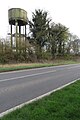 Water tower on Bicester Airfield - geograph.org.uk - 4902352.jpg 1,066 × 1,600; 474 KB
-
 Wayside oak - geograph.org.uk - 5215856.jpg 640 × 480; 170 KB
-
 West End, Launton - geograph.org.uk - 5941451.jpg 640 × 480; 79 KB
-

-
 Bridleway South East of Launton - geograph.org.uk - 717479.jpg 640 × 425; 57 KB
-
 Gavray Roundabout - geograph.org.uk - 97031.jpg 640 × 480; 51 KB
-
 Graven Hill inside DSDC Bicester - geograph.org.uk - 63772.jpg 640 × 480; 123 KB
-
 Mallards Way looking north - geograph.org.uk - 58073.jpg 640 × 480; 107 KB
-
 Peregrine Way looking north east - geograph.org.uk - 58266.jpg 640 × 480; 103 KB
-
 Pond between old and new Langford Village - geograph.org.uk - 58269.jpg 640 × 480; 137 KB


.jpg)


_-_geograph.org.uk_-_5528888.jpg)


