Category:Laughton, Leicestershire
Jump to navigation
Jump to search
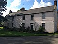
English: Laughton is a small village and parish situated in Leicestershire, approximately 5 miles west of Market Harborough. Old buildings dominate Laughton with currently only two modern buildings situated in the village. There is a row of cottages opposite the church that has parts dating back to medieval times. The church itself dates back to the C13th and had a major renovation in 1879.
village and civil parish in Leicestershire, UK  | |||||
| Upload media | |||||
| Instance of | |||||
|---|---|---|---|---|---|
| Location | Harborough, Leicestershire, East Midlands, England | ||||
 | |||||
Subcategories
This category has only the following subcategory.
Media in category "Laughton, Leicestershire"
The following 70 files are in this category, out of 70 total.
-
 Approaching Laughton - geograph.org.uk - 545148.jpg 640 × 480; 137 KB
-
 Approaching Laughton - geograph.org.uk - 545189.jpg 640 × 570; 120 KB
-
 Bridleway to Laughton Road - geograph.org.uk - 5008529.jpg 640 × 480; 64 KB
-
 Bridleway to Laughton Road - geograph.org.uk - 5008531.jpg 640 × 480; 65 KB
-
 Bridleway to Laughton Road - geograph.org.uk - 5008533.jpg 640 × 480; 70 KB
-
 Bridleway to Laughton Road - geograph.org.uk - 5008537.jpg 640 × 480; 66 KB
-
 Bridleway to Laughton Road - geograph.org.uk - 5008538.jpg 640 × 480; 67 KB
-
 Bridleway view - geograph.org.uk - 5008536.jpg 640 × 480; 71 KB
-
 Down the track from Laughton - geograph.org.uk - 5924381.jpg 1,024 × 768; 235 KB
-
 Edge of a field south of Laughton Lane - geograph.org.uk - 5018322.jpg 640 × 442; 122 KB
-
 Field south of Main Street Laughton - geograph.org.uk - 5018327.jpg 640 × 443; 78 KB
-
 Fields near to Laughton - geograph.org.uk - 5023237.jpg 640 × 454; 119 KB
-
 Gateway to a field with a stable in it - geograph.org.uk - 5023241.jpg 640 × 456; 122 KB
-

-

-
 Laughton centre - geograph.org.uk - 5008556.jpg 480 × 640; 81 KB
-
 Laughton junction - geograph.org.uk - 5008472.jpg 640 × 480; 106 KB
-
 Laughton Lane towards Laughton - geograph.org.uk - 5018324.jpg 640 × 509; 63 KB
-
 Laughton Lane towards Mowsley - geograph.org.uk - 5018325.jpg 640 × 473; 123 KB
-
 Laughton Phone Box - geograph.org.uk - 5008463.jpg 480 × 640; 73 KB
-
 Laughton residence - geograph.org.uk - 5008462.jpg 640 × 480; 63 KB
-
 Laughton Village - geograph.org.uk - 3927667.jpg 1,024 × 768; 193 KB
-
 Laughton Village Hall - geograph.org.uk - 5008467.jpg 640 × 480; 89 KB
-
 Laughton, Leicestershire - geograph.org.uk - 545167.jpg 640 × 423; 88 KB
-
 Laughton, Leicestershire - geograph.org.uk - 545201.jpg 640 × 404; 96 KB
-
 Laughton-Leicestershire.jpg 640 × 519; 148 KB
-
 Layby on the way to Laughton - geograph.org.uk - 5549435.jpg 480 × 640; 51 KB
-
 Main Street Laughton - geograph.org.uk - 5018328.jpg 640 × 442; 122 KB
-
 Path near Laughton - geograph.org.uk - 5008478.jpg 640 × 480; 62 KB
-
 Path to Laughton - geograph.org.uk - 5008477.jpg 640 × 480; 104 KB
-
 Path to Laughton - geograph.org.uk - 5008540.jpg 640 × 480; 59 KB
-
 Path to Laughton - geograph.org.uk - 5008541.jpg 640 × 480; 59 KB
-
 Path to Laughton - geograph.org.uk - 5008542.jpg 640 × 480; 61 KB
-
 Path to Laughton - geograph.org.uk - 5008544.jpg 640 × 480; 75 KB
-
 Path to Laughton - geograph.org.uk - 5008545.jpg 640 × 480; 58 KB
-
 Path to Laughton - geograph.org.uk - 5008546.jpg 640 × 480; 72 KB
-
 Path to Laughton - geograph.org.uk - 5008549.jpg 640 × 480; 76 KB
-
 Path to Laughton - geograph.org.uk - 5008550.jpg 640 × 480; 59 KB
-
 Path to Laughton - geograph.org.uk - 5008553.jpg 640 × 480; 55 KB
-
 Path to Laughton - geograph.org.uk - 5008555.jpg 640 × 480; 69 KB
-
 Road to Laughton - geograph.org.uk - 3295134.jpg 640 × 480; 55 KB
-
 Road to Lubenham - geograph.org.uk - 5008473.jpg 640 × 480; 97 KB
-
 Road to Lubenham - geograph.org.uk - 5008475.jpg 640 × 480; 89 KB
-
 Spinney - geograph.org.uk - 2719496.jpg 640 × 611; 76 KB
-
 Stables in a field - geograph.org.uk - 5023243.jpg 640 × 466; 93 KB
-
 Towards Gumley Lodge - geograph.org.uk - 5008480.jpg 640 × 480; 58 KB
-
 Towards Gumley Lodge - geograph.org.uk - 5008482.jpg 640 × 480; 69 KB
-
 Towards Gumley Lodge - geograph.org.uk - 5008483.jpg 640 × 480; 74 KB
-
 Towards Gumley Lodge - geograph.org.uk - 5008485.jpg 640 × 480; 79 KB
-
 Towards Gumley Lodge - geograph.org.uk - 5008486.jpg 640 × 480; 95 KB
-
 Towards Laughton - geograph.org.uk - 5023239.jpg 640 × 398; 55 KB
-
 Towards Lubbenham - geograph.org.uk - 5023244.jpg 640 × 445; 135 KB
-
 Towards Lubenham - geograph.org.uk - 5023240.jpg 640 × 438; 73 KB
-
 Towards the Laughton Road - geograph.org.uk - 5008539.jpg 640 × 480; 84 KB
-
 View towards Laughton - geograph.org.uk - 545401.jpg 640 × 409; 91 KB
-
 View towards Saddington - geograph.org.uk - 545186.jpg 640 × 421; 93 KB
-
 Welcome to Laughton - geograph.org.uk - 545212.jpg 640 × 480; 109 KB
-
 A view of Laughton - geograph.org.uk - 545368.jpg 640 × 357; 100 KB
-
 Cattle near Laughton - geograph.org.uk - 202649.jpg 640 × 480; 113 KB
-
 Country road - geograph.org.uk - 545419.jpg 572 × 640; 119 KB
-
 Country Road near Laughton - geograph.org.uk - 545420.jpg 640 × 517; 135 KB
-
 Farmland near Laughton - geograph.org.uk - 202638.jpg 480 × 640; 126 KB
-
 Gumley Road, Laughton - geograph.org.uk - 545385.jpg 640 × 435; 120 KB
-
 House at Laughton - geograph.org.uk - 224721.jpg 640 × 480; 93 KB
-
 Lane close to Laughton, Leicestershire - geograph.org.uk - 545393.jpg 640 × 424; 123 KB
-
 Laughton - geograph.org.uk - 202645.jpg 640 × 480; 130 KB
-
 Laughton Lane, Laughton - geograph.org.uk - 545208.jpg 640 × 461; 127 KB
-
 Morton's Bridge - geograph.org.uk - 545441.jpg 640 × 461; 127 KB
-
 Next to Gumley Road, Laughton - geograph.org.uk - 545381.jpg 640 × 469; 135 KB
-
 Track north of Laughton, Leicestershire - geograph.org.uk - 545181.jpg 640 × 501; 137 KB


