Category:Lastingham
Jump to navigation
Jump to search
village in the United Kingdom   | |||||
| Upload media | |||||
| Instance of | |||||
|---|---|---|---|---|---|
| Located in protected area | |||||
| Location | Ryedale, North Yorkshire, Yorkshire and the Humber, England | ||||
 | |||||
Subcategories
This category has the following 3 subcategories, out of 3 total.
B
M
S
Media in category "Lastingham"
The following 200 files are in this category, out of 220 total.
(previous page) (next page)-
 A gradual invasion of birch - geograph.org.uk - 6168191.jpg 4,273 × 2,640; 2.37 MB
-
 A look at life in Lastingham 2011 - geograph.org.uk - 2365864.jpg 2,048 × 1,704; 791 KB
-
 A view of Lastingham - geograph.org.uk - 5306670.jpg 4,320 × 3,240; 3.43 MB
-
 A village that's well off for wells - geograph.org.uk - 2365880.jpg 2,048 × 1,536; 1.32 MB
-
 Access bridge over small stream - geograph.org.uk - 2365120.jpg 2,048 × 1,536; 1.07 MB
-
 Advisory notice at footpath junction - geograph.org.uk - 6168176.jpg 4,320 × 3,240; 2.66 MB
-
 Advisory notice at path junction - geograph.org.uk - 6168156.jpg 4,320 × 3,240; 2.64 MB
-
 Ana Cross - geograph.org.uk - 6108767.jpg 640 × 427; 80 KB
-
 Ana Cross - geograph.org.uk - 6167755.jpg 3,167 × 4,223; 1.82 MB
-
 Anserdale Lane, Lastingham, Yorkshire - geograph.org.uk - 3259537.jpg 1,600 × 1,200; 559 KB
-
 Anserdale Lane, Lastingham, Yorkshire - geograph.org.uk - 4776462.jpg 1,600 × 1,200; 945 KB
-
 Anserdale Lane, Lastingham, Yorkshire - geograph.org.uk - 4776493.jpg 1,600 × 1,200; 951 KB
-
 Anserdale Lane, Lastingham, Yorkshire - geograph.org.uk - 4776502.jpg 1,600 × 1,200; 1.08 MB
-
 Bank Foot cottages in Summer - geograph.org.uk - 868994.jpg 640 × 479; 104 KB
-
 Bank Foot near Lastingham - geograph.org.uk - 868996.jpg 640 × 479; 112 KB
-
 Barn, Lower Askew Farm - geograph.org.uk - 2171251.jpg 640 × 568; 80 KB
-

-
 Bench Mark, Lower Askew Farm - geograph.org.uk - 2171275.jpg 480 × 640; 101 KB
-
 Bench with a view over Rosedale - geograph.org.uk - 5074623.jpg 4,320 × 3,240; 3.2 MB
-
 Bridleway in lower Rosedale - geograph.org.uk - 6168163.jpg 4,320 × 3,240; 2.38 MB
-
 Bridleway to Askew - geograph.org.uk - 3483689.jpg 4,320 × 3,240; 6.24 MB
-
 Brook Farm Cottage, Lastingham - geograph.org.uk - 1038291.jpg 419 × 640; 190 KB
-
 Camomile Farm - geograph.org.uk - 5306663.jpg 4,320 × 2,834; 3.26 MB
-
 Cattle and conifers - geograph.org.uk - 6168209.jpg 4,205 × 3,082; 2.15 MB
-
 Cottage garden at Lastingham - geograph.org.uk - 2666935.jpg 1,000 × 750; 322 KB
-
 Cycling through Lastingham - geograph.org.uk - 2365267.jpg 2,048 × 1,536; 755 KB
-
 Dam, Ings Beck - geograph.org.uk - 2171235.jpg 640 × 480; 106 KB
-
 Down the hill to Lastingham - geograph.org.uk - 3483801.jpg 4,320 × 3,240; 2.15 MB
-
 Dry stone wall, Lastingham - geograph.org.uk - 2365178.jpg 2,048 × 1,536; 875 KB
-
 Ellers Beck - geograph.org.uk - 2365263.jpg 1,536 × 2,048; 1.34 MB
-
 End of the road - geograph.org.uk - 2367197.jpg 2,048 × 1,536; 915 KB
-
 Entering the Spaunton Estate - geograph.org.uk - 2365314.jpg 2,048 × 1,536; 868 KB
-
 Farm, Lastingham, Yorkshire - geograph.org.uk - 3259541.jpg 1,600 × 1,200; 400 KB
-
 Farmland ahead - geograph.org.uk - 6168196.jpg 4,320 × 3,240; 2.65 MB
-
 Farmland, Lastingham - geograph.org.uk - 3124920.jpg 640 × 480; 106 KB
-
 Field entrance and hagg Wood - geograph.org.uk - 3124893.jpg 640 × 480; 114 KB
-
 Floral verge by the Grange Hotel - geograph.org.uk - 2365842.jpg 2,048 × 1,507; 1.16 MB
-
 Footpath along the edge of Hagg Wood - geograph.org.uk - 6168220.jpg 4,300 × 2,562; 2.02 MB
-
 Footpath to Lastingham - geograph.org.uk - 2168517.jpg 640 × 480; 99 KB
-
 Footpath Tranmire Bank - geograph.org.uk - 3939963.jpg 2,634 × 1,882; 884 KB
-
 Footpath Tranmire Bank across Tranmire Beck - geograph.org.uk - 3939967.jpg 2,640 × 1,886; 920 KB
-
 Footpath, Lower Askew - geograph.org.uk - 2168590.jpg 640 × 522; 89 KB
-
 Ford at Tranmire Beck - geograph.org.uk - 1608444.jpg 640 × 480; 107 KB
-
 Former Wesleyan Chapel, Lastingham - geograph.org.uk - 2365890.jpg 2,048 × 1,536; 952 KB
-
 Front Street Lastingham - geograph.org.uk - 1031835.jpg 640 × 427; 232 KB
-
 Front Street, Lastingham - geograph.org.uk - 1038313.jpg 640 × 427; 249 KB
-
 Front Street, Lastingham, Yorkshire - geograph.org.uk - 3259521.jpg 1,174 × 1,324; 691 KB
-
 Front Street, Lastingham, Yorkshire - geograph.org.uk - 4776511.jpg 1,190 × 1,592; 1.09 MB
-
 George VI postbox, Lastingham - geograph.org.uk - 2365872.jpg 1,536 × 2,048; 1.05 MB
-
 Get your fish and chips here - geograph.org.uk - 2365276.jpg 2,048 × 1,351; 985 KB
-
 Happy walkers approaching Lastingham - geograph.org.uk - 1607079.jpg 640 × 480; 89 KB
-
 Hartoft Bridge Farm - geograph.org.uk - 6168170.jpg 3,240 × 4,320; 3.47 MB
-
 Heather and trees - geograph.org.uk - 6168185.jpg 4,242 × 2,523; 1.76 MB
-
 Heather dying back - geograph.org.uk - 3630498.jpg 1,024 × 768; 1.04 MB
-
 High Askew access road - geograph.org.uk - 3825087.jpg 1,600 × 1,200; 390 KB
-
 High Askew farmhouse - geograph.org.uk - 6168202.jpg 4,320 × 3,240; 2.25 MB
-
 High Cross remains - geograph.org.uk - 125059.jpg 640 × 479; 87 KB
-
 High Street, Lastingham - geograph.org.uk - 2365283.jpg 1,024 × 733; 332 KB
-
 Hillside grazing, Birk Head - geograph.org.uk - 3124888.jpg 640 × 480; 89 KB
-
 House near Bank Foot - geograph.org.uk - 869003.jpg 640 × 479; 163 KB
-
 Howdale Lane - geograph.org.uk - 3124891.jpg 640 × 480; 123 KB
-
 Incline Rosedale West - geograph.org.uk - 3939951.jpg 2,708 × 1,935; 867 KB
-
 Incline Rosedale West 2 - geograph.org.uk - 3939953.jpg 2,814 × 2,010; 1,016 KB
-
 Inclined Plane, Hollins Mine - geograph.org.uk - 2708665.jpg 1,424 × 2,136; 914 KB
-
 Ings Beck, a downstream view - geograph.org.uk - 2366130.jpg 1,447 × 2,048; 1.15 MB
-
 Ings Beck, an upstream view - geograph.org.uk - 2365924.jpg 1,485 × 2,048; 1.18 MB
-
 Ings Beck, an upstream view - geograph.org.uk - 2366118.jpg 1,024 × 714; 380 KB
-
 Ings Beck, Lastingham - geograph.org.uk - 4120232.jpg 1,600 × 1,600; 885 KB
-
 Ings Lane - geograph.org.uk - 3124921.jpg 640 × 480; 88 KB
-
 Jackson Bridge, Lastingham - geograph.org.uk - 4788367.jpg 640 × 425; 211 KB
-
 Juniper exclosure - geograph.org.uk - 2964114.jpg 1,024 × 768; 429 KB
-
 Juniper Exclosure on Birk Head - geograph.org.uk - 5703860.jpg 2,500 × 1,667; 1.1 MB
-
 Just follow the wall - geograph.org.uk - 3483757.jpg 4,320 × 3,240; 2.17 MB
-
 K6 phonebox and Geo VI postbox, Lastingham - geograph.org.uk - 2365853.jpg 2,048 × 1,536; 625 KB
-
 Approaching Lastingham ... - geograph.org.uk - 495868.jpg 427 × 640; 83 KB
-
 Lastingham - centre of village - geograph.org.uk - 4203641.jpg 1,024 × 605; 274 KB
-
 Lastingham - geograph.org.uk - 3483768.jpg 3,240 × 4,320; 2.09 MB
-
 Lastingham - village - geograph.org.uk - 1982068.jpg 640 × 480; 109 KB
-
 Lastingham Beck - geograph.org.uk - 2360843.jpg 1,536 × 2,048; 1.28 MB
-
 Lastingham Church - geograph.org.uk - 5802965.jpg 1,024 × 683; 179 KB
-
 Lastingham duck woman (70846500).jpg 800 × 519; 154 KB
-
 Lastingham from above - geograph.org.uk - 4202769.jpg 1,500 × 1,000; 1.07 MB
-
 Lastingham from near Victoria Cross - geograph.org.uk - 5480794.jpg 1,500 × 911; 280 KB
-
 Lastingham from the churchyard - geograph.org.uk - 3614372.jpg 1,024 × 768; 223 KB
-
 Lastingham Methodist Church - geograph.org.uk - 5802961.jpg 1,024 × 683; 162 KB
-
 Lastingham Village.jpg 640 × 436; 75 KB
-
 Lastingham, St. Mary's Church - geograph.org.uk - 5937329.jpg 5,980 × 3,986; 6.1 MB
-
 Lastingham, St. Mary's Church, Churchyard entrance - geograph.org.uk - 5937319.jpg 6,210 × 4,139; 7.17 MB
-
 Lastingham, St. Mary's Church, Churchyard entrance gates - geograph.org.uk - 5937324.jpg 6,046 × 4,030; 6.14 MB
-
 Lastingham, St. Mary's Church, Northern aspect - geograph.org.uk - 5937352.jpg 5,119 × 3,412; 4.23 MB
-
-
 Lastingham, St. Mary's Church, The altar in the crypt - geograph.org.uk - 5937335.jpg 7,257 × 4,838; 6.33 MB
-

-

-

-

-
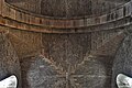
 Lastingham, St. Mary's Church, The Norman apse - geograph.org.uk - 5937346.jpg 6,830 × 4,553; 5.87 MB
-
 Lastingham, St. Mary's Church, Western aspect - geograph.org.uk - 5937349.jpg 5,911 × 3,941; 4.52 MB
-

-
 Looking down on Hollins Farm - geograph.org.uk - 6168138.jpg 4,320 × 3,240; 2.97 MB
-

-
 Low Street - geograph.org.uk - 2365945.jpg 2,048 × 1,536; 987 KB
-
 Low Street, Lastingham - geograph.org.uk - 1038280.jpg 640 × 427; 200 KB
-
 Low Street, Lastingham - geograph.org.uk - 2365906.jpg 2,048 × 1,536; 728 KB
-
 Low Street, Lastingham - geograph.org.uk - 2367199.jpg 2,048 × 1,536; 553 KB
-
 Low Street, Lastingham - geograph.org.uk - 4120230.jpg 1,600 × 1,200; 508 KB
-
 Low Street, Lastingham - geograph.org.uk - 4764219.jpg 640 × 545; 251 KB
-
 Marston, Freda; Lastingham.jpg 1,200 × 435; 90 KB
-
 Meadows by Ings Beck - geograph.org.uk - 6168227.jpg 3,215 × 3,762; 3.27 MB
-

-
 Memorial seat by track junction - geograph.org.uk - 226863.jpg 640 × 480; 112 KB
-
 Moor Farm - geograph.org.uk - 2365305.jpg 2,048 × 1,536; 765 KB
-
 Moorland edge path - geograph.org.uk - 3483746.jpg 4,320 × 3,240; 1.98 MB
-
 Moorland footpath - geograph.org.uk - 2365827.jpg 2,048 × 1,536; 953 KB
-
 Moorland seat - geograph.org.uk - 2365331.jpg 2,048 × 1,536; 738 KB
-
 Moorland track from Ana Cross - geograph.org.uk - 3630464.jpg 1,024 × 768; 954 KB
-
 Near Hollins Farm - geograph.org.uk - 5266880.jpg 2,592 × 1,936; 1.03 MB
-
 New Road, Lastingham, Yorkshire - geograph.org.uk - 3259531.jpg 1,600 × 1,200; 408 KB
-
 New Road, Lastingham, Yorkshire - geograph.org.uk - 4776514.jpg 1,600 × 1,200; 792 KB
-
 New Road, Lastingham, Yorkshire - geograph.org.uk - 4776516.jpg 1,600 × 1,200; 754 KB
-
 New Road, Lastingham, Yorkshire - geograph.org.uk - 4776525.jpg 1,600 × 1,200; 626 KB
-
 Old mine workings, Rosedale - geograph.org.uk - 1108785.jpg 640 × 427; 111 KB
-
 Old School, Lastingham - geograph.org.uk - 2365247.jpg 2,048 × 1,536; 542 KB
-
 Old Schoolhouse, Lastingham - geograph.org.uk - 3124952.jpg 640 × 480; 85 KB
-
 Old shed East of Lastingham - geograph.org.uk - 149350.jpg 640 × 427; 62 KB
-
 Old tramway incline, Rosedale - geograph.org.uk - 5074618.jpg 3,240 × 4,320; 3.77 MB
-
 On Spaunton Moor - geograph.org.uk - 3825071.jpg 1,600 × 1,200; 428 KB
-
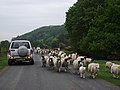 Oncoming Traffic - geograph.org.uk - 1901259.jpg 1,600 × 1,200; 417 KB
-
 Ordnance Survey Sheet SE 79 Rosedale Abbey, Published 1954.jpg 7,335 × 7,468; 15.07 MB
-
 Pastures below Hagg Wood - geograph.org.uk - 2393930.jpg 800 × 600; 202 KB
-
 Pastures south of the Lastingham to Cropton Road - geograph.org.uk - 2367212.jpg 2,048 × 1,536; 551 KB
-
 Path into Rosedale - geograph.org.uk - 6167828.jpg 4,284 × 2,569; 1.92 MB
-
 Path on the north side of Lastingham - geograph.org.uk - 5306666.jpg 3,240 × 4,320; 4.95 MB
-
 Path to Ana Cross - geograph.org.uk - 6167756.jpg 4,320 × 3,240; 2.39 MB
-
 Permissive bridleway on Spaunton Moor - geograph.org.uk - 3630487.jpg 1,024 × 768; 964 KB
-
 Planted up - geograph.org.uk - 2367205.jpg 2,048 × 1,536; 708 KB
-
 Plaque on the bridge over Ings Beck - geograph.org.uk - 2365914.jpg 2,048 × 1,536; 1.22 MB
-
 Power line markers - geograph.org.uk - 4512356.jpg 1,024 × 768; 348 KB
-
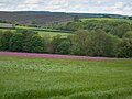 Purple flowering game cover crop - geograph.org.uk - 4512359.jpg 1,024 × 768; 547 KB
-
 Rebuilding of Scugdale - geograph.org.uk - 5563356.jpg 3,898 × 2,922; 3.16 MB
-
 Recently renovated old barn - geograph.org.uk - 2765060.jpg 1,024 × 683; 447 KB
-
 Redman Cross - geograph.org.uk - 3825081.jpg 1,600 × 1,200; 990 KB
-
 Redman Cross - geograph.org.uk - 6167758.jpg 4,320 × 3,240; 2.49 MB
-
 River Seven - upstream - geograph.org.uk - 2360932.jpg 1,536 × 2,048; 1.08 MB
-
 River Seven Stepping Stones - geograph.org.uk - 5353849.jpg 640 × 426; 552 KB
-
 Road junction at Bank Foot, Lastingham - geograph.org.uk - 1099399.jpg 640 × 468; 134 KB
-
 Road to Camomile Farm - geograph.org.uk - 2365126.jpg 2,048 × 1,536; 708 KB
-
 Road to Cropton from Lastingham - geograph.org.uk - 2360847.jpg 1,024 × 768; 331 KB
-
 Rosedale - geograph.org.uk - 4519137.jpg 1,024 × 768; 212 KB
-
 Rosedale bridleway - geograph.org.uk - 6168148.jpg 4,320 × 3,240; 3.29 MB
-
 Semi-ruined barn - geograph.org.uk - 149370.jpg 640 × 427; 71 KB
-
 Seven Bridge - geograph.org.uk - 2360928.jpg 1,024 × 768; 358 KB
-
 Seven Bridge - geograph.org.uk - 3483672.jpg 3,240 × 4,320; 6.22 MB
-
 Sheep in the Heather - geograph.org.uk - 1753788.jpg 2,048 × 1,360; 665 KB
-
 Simple clapper bridge - geograph.org.uk - 2366151.jpg 2,048 × 1,302; 835 KB
-
 Simple stone arch bridge over Ings Beck - geograph.org.uk - 2366113.jpg 2,048 × 1,468; 1.18 MB
-
 Spaunton Moor - geograph.org.uk - 4155181.jpg 1,600 × 1,200; 479 KB
-
 Spaunton Quarry - geograph.org.uk - 125110.jpg 640 × 479; 88 KB
-
 Spaunton Quarry - geograph.org.uk - 226852.jpg 640 × 480; 138 KB
-
 Spiers Bank House - geograph.org.uk - 1498673.jpg 640 × 427; 114 KB
-
 St Chad's Well,Lastingham - geograph.org.uk - 2365295.jpg 2,048 × 2,356; 1.41 MB
-
 St.Cedd's well, Lastingham - geograph.org.uk - 1099397.jpg 640 × 482; 131 KB
-
 Stepping Stones at Hartoft - geograph.org.uk - 2712189.jpg 768 × 1,024; 297 KB
-
 Stone footbridge, Lastingham - geograph.org.uk - 6168233.jpg 3,240 × 4,320; 4.75 MB
-
 Temptation lies within - geograph.org.uk - 3483776.jpg 4,236 × 2,609; 1.84 MB
-
 Terrace Houses Lastingham - geograph.org.uk - 640829.jpg 640 × 480; 141 KB
-
 The choice is yours - geograph.org.uk - 2365821.jpg 1,536 × 2,048; 727 KB
-
 The edge of the moor - geograph.org.uk - 3483703.jpg 4,320 × 3,240; 2.71 MB
-
 The Millennium Stone in Lastingham - geograph.org.uk - 1608469.jpg 640 × 480; 100 KB
-
 Track to Hollins Farm - geograph.org.uk - 3630514.jpg 1,024 × 768; 959 KB
-
 Tracked vehicle near Hartoft End - geograph.org.uk - 1608423.jpg 640 × 480; 99 KB
-
 Tranmire Bank - geograph.org.uk - 171969.jpg 480 × 640; 156 KB
-
 Tranmire Beck - geograph.org.uk - 3483724.jpg 3,240 × 4,320; 2.87 MB
-
 Two crosses on the moor - geograph.org.uk - 6167759.jpg 3,240 × 4,320; 1.26 MB
-
 Victoria Cross - geograph.org.uk - 369723.jpg 640 × 479; 91 KB
-
 Victoria Cross and view to the moors - geograph.org.uk - 3468587.jpg 1,024 × 768; 689 KB
-
 Victoria Cross Lastingham - geograph.org.uk - 318973.jpg 640 × 436; 74 KB
-
 View at Hartoft End - geograph.org.uk - 2432465.jpg 1,024 × 768; 178 KB
-
 View east from above Lastingham - geograph.org.uk - 4202764.jpg 1,500 × 1,000; 446 KB
-
 View from Redman Cross - geograph.org.uk - 3825398.jpg 1,600 × 1,200; 578 KB
-
 View north-east from above Lastingham - geograph.org.uk - 4202761.jpg 1,500 × 1,000; 1.16 MB
-
 View to Hagg Wood - geograph.org.uk - 2393914.jpg 1,024 × 768; 233 KB
-
 View towards Lastingham - geograph.org.uk - 2964125.jpg 1,024 × 768; 211 KB
-
 View towards Lastingham Moor - geograph.org.uk - 2432516.jpg 1,024 × 768; 183 KB
-
 View west from above Lastingham - geograph.org.uk - 4202759.jpg 1,500 × 1,000; 1.09 MB
-
 Walking in the rain near Hartoft End - geograph.org.uk - 1607024.jpg 640 × 480; 47 KB
-
 Wellington Bridge - geograph.org.uk - 2360838.jpg 1,024 × 645; 232 KB
-
 Bank Foot Cottages near Spaunton - geograph.org.uk - 125024.jpg 640 × 375; 77 KB
-

-
 Camomile Farm - geograph.org.uk - 496708.jpg 640 × 427; 80 KB
-
 Cattle Grid onto Askew Rig - geograph.org.uk - 149357.jpg 640 × 427; 64 KB
-
 Cattle shed near Lastingham - geograph.org.uk - 149353.jpg 640 × 390; 59 KB
-
 Fairy Call Beck - geograph.org.uk - 640247.jpg 640 × 427; 61 KB
-
 Fence Corner, Tranmire Bank - geograph.org.uk - 495884.jpg 640 × 427; 66 KB
-
 Fields and woods near Fairy Call Beck - geograph.org.uk - 640240.jpg 640 × 427; 59 KB
-
 Footpath to the Victoria Cross - geograph.org.uk - 496706.jpg 640 × 427; 63 KB
-
 Former post office at Spaunton - geograph.org.uk - 544320.jpg 640 × 427; 76 KB
-
 Gate, Ings Lane - geograph.org.uk - 495875.jpg 640 × 427; 83 KB
-
 Hamley - geograph.org.uk - 149386.jpg 640 × 427; 67 KB
-


.jpg)


_-_geograph.org.uk_-_5937345.jpg)


