Category:Lapworth
Jump to navigation
Jump to search
village in United Kingdom | |||||
| Upload media | |||||
| Instance of | |||||
|---|---|---|---|---|---|
| Location | Warwick, Warwickshire, West Midlands, England | ||||
 | |||||
English: Lapworth is a village and civil parish situated in the east of the county of Warwickshire, England. It lies close to the border with the West Midlands and in the 2001 census had a population of 2,100.
Subcategories
This category has the following 9 subcategories, out of 9 total.
K
L
- Lapworth Link (6 F)
- Lapworth railway station (13 F)
- Lapworth War Memorial (3 F)
P
T
- The Boot Inn, Lapworth (4 F)
- The Navigation, Lapworth (9 F)
Media in category "Lapworth"
The following 200 files are in this category, out of 584 total.
(previous page) (next page)-

-
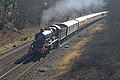 7029 Clun Castle Lapworth 26-02-19 (46681067054).jpg 4,103 × 2,735; 11.02 MB
-
 A bench in the Yew Garden - geograph.org.uk - 5714857.jpg 2,025 × 2,700; 761 KB
-
 A clearly marked path - geograph.org.uk - 1913219.jpg 640 × 480; 464 KB
-

-
 A glimpse of Catesby House - geograph.org.uk - 1912751.jpg 640 × 480; 425 KB
-
 A glimpse of Tapster Mill - geograph.org.uk - 2043770.jpg 640 × 480; 422 KB
-
 A muddy track - geograph.org.uk - 13566.jpg 640 × 426; 119 KB
-
 A paddock above the Tapster valley - geograph.org.uk - 2043790.jpg 640 × 480; 386 KB
-
 Above Church Lane - geograph.org.uk - 2301886.jpg 1,280 × 960; 1.5 MB
-
 Across the Stratford-upon-Avon Canal - geograph.org.uk - 5535417.jpg 2,626 × 1,988; 1.19 MB
-

-
 Approaching the 'Rabbit Ears' junction - geograph.org.uk - 3719703.jpg 4,272 × 2,284; 1.29 MB
-
 At Lock 25, Stratford-upon-Avon Canal - geograph.org.uk - 5536218.jpg 2,819 × 1,907; 1.35 MB
-
 Autumn hedgerow by the footpath - geograph.org.uk - 3231131.jpg 2,000 × 1,500; 525 KB
-
 Aylesbury Road leaves Hockley Heath - geograph.org.uk - 2691264.jpg 640 × 480; 74 KB
-

-
 B4439 Junction - geograph.org.uk - 5413004.jpg 800 × 600; 106 KB
-
 Barley field near Packwood House - geograph.org.uk - 4633213.jpg 800 × 531; 142 KB
-
 Barn at Bushwood Grange - geograph.org.uk - 2403655.jpg 640 × 480; 77 KB
-
 Barns and stock, Brome Hall - geograph.org.uk - 1869279.jpg 640 × 480; 390 KB
-

-
 Bend on Chapel Lane, Chessetts Wood - geograph.org.uk - 3634179.jpg 640 × 480; 381 KB
-
 Black Boy Bridge - geograph.org.uk - 6374881.jpg 640 × 480; 24 KB
-
 Bluebells by Dicks Lane - geograph.org.uk - 1869271.jpg 640 × 480; 671 KB
-
 Boundary wall, Hole House Farm - geograph.org.uk - 2047819.jpg 640 × 480; 519 KB
-
 Brick barn, 'High Chimneys' - geograph.org.uk - 1868978.jpg 640 × 470; 370 KB
-
 Bridge 26 Stratford Canal - geograph.org.uk - 3132334.jpg 2,086 × 1,413; 790 KB
-
 Bridge 30, Stratford-upon-Avon canal - geograph.org.uk - 2052198.jpg 640 × 480; 134 KB
-
 Bridge 31, Stratford-upon-Avon Canal - geograph.org.uk - 3231175.jpg 2,000 × 1,500; 559 KB
-
 Bridge 32, Lapworth Locks - geograph.org.uk - 3812659.jpg 3,120 × 2,314; 2.03 MB
-
 Bridge 33 Lapworth (5710008061).jpg 4,328 × 2,644; 7.97 MB
-
 Bridge No 27 near Lapworth, Warwickshire - geograph.org.uk - 1715206.jpg 640 × 456; 145 KB
-
 Bridge No 27 near Lapworth, Warwickshire - geograph.org.uk - 1715211.jpg 640 × 480; 147 KB
-
 Bridge No 27 near Lapworth, Warwickshire - geograph.org.uk - 1715248.jpg 640 × 430; 142 KB
-

-

-

-

-
 Bridleway south of Brome Hall Farm, 1 - geograph.org.uk - 1913212.jpg 640 × 480; 612 KB
-
 Bridleway south of Brome Hall Farm, 2 - geograph.org.uk - 1913214.jpg 640 × 480; 583 KB
-
 Bridleway to Chessetts Wood - geograph.org.uk - 6008495.jpg 768 × 1,024; 228 KB
-
 Brome Hall (geograph 5535653).jpg 1,795 × 1,360; 570 KB
-
 Brome Hall - geograph.org.uk - 5535668.jpg 3,072 × 2,048; 1.45 MB
-
 Brome Hall Bridge - geograph.org.uk - 5535659.jpg 1,946 × 2,516; 1,011 KB
-
 Brome Hall Farm - geograph.org.uk - 1913172.jpg 640 × 480; 361 KB
-
 Brook below Church Lane - geograph.org.uk - 2301896.jpg 1,280 × 960; 1.71 MB
-
 Brook Meadow Nature Reserve SSSI - geograph.org.uk - 2191463.jpg 640 × 427; 326 KB
-
 Broom Hall Bridge No 38 - geograph.org.uk - 4717097.jpg 605 × 800; 152 KB
-
 Broom Hall Bridge south of Kingswood in Warwickshire - geograph.org.uk - 6197811.jpg 1,280 × 960; 1.51 MB
-
 Broom Hall Bridge south of Kingswood in Warwickshire - geograph.org.uk - 6198780.jpg 1,280 × 960; 1.71 MB
-
 Bushwood Lane - geograph.org.uk - 2043813.jpg 640 × 480; 520 KB
-

-
 Bushwood Lane bridge on Tapster Brook - geograph.org.uk - 2055004.jpg 640 × 480; 153 KB
-
 Buttercups by Lapworth Street - geograph.org.uk - 1912733.jpg 640 × 480; 456 KB
-
 By the motorway bridge, Stratford-upon-Avon Canal - geograph.org.uk - 5535422.jpg 1,935 × 2,600; 1,010 KB
-
 Camp Lane near Irelands Farm - geograph.org.uk - 5137199.jpg 800 × 600; 186 KB
-
 Canal at the bottom of your garden - geograph.org.uk - 2818593.jpg 640 × 458; 78 KB
-
 Canal basin at Kingswood Junction in Warwickshire - geograph.org.uk - 6197588.jpg 1,600 × 900; 1.53 MB
-

-

-

-
 Canal bridge on B4489, Lapworth - geograph.org.uk - 5535959.jpg 3,072 × 2,048; 1.31 MB
-
 Canal junction near Kingswood in Warwickshire - geograph.org.uk - 6175174.jpg 960 × 1,280; 1.73 MB
-
 Canal signpost, Kingswood Junction - geograph.org.uk - 5535836.jpg 3,072 × 2,048; 1.04 MB
-
 Canal Turning Basin - geograph.org.uk - 2818202.jpg 640 × 480; 62 KB
-
 Canal west of Rowington in Warwickshire - geograph.org.uk - 6202513.jpg 1,440 × 960; 1.7 MB
-
 Canal west of Turner's Green in Warwickshire - geograph.org.uk - 6200129.jpg 960 × 1,280; 1.48 MB
-
 Canal west of Turner's Green in Warwickshire - geograph.org.uk - 6202017.jpg 1,440 × 960; 1.83 MB
-
 Canalside, Lapworth - geograph.org.uk - 5536149.jpg 3,072 × 2,048; 1.36 MB
-
 Cattle, oaks, thistles, rushes, stump - geograph.org.uk - 2052353.jpg 640 × 480; 127 KB
-

-
 Chessetts Wood Road in Darley Green - geograph.org.uk - 4639958.jpg 800 × 569; 175 KB
-
 Chestnut Cottage, Lapworth Street - geograph.org.uk - 1912738.jpg 640 × 480; 459 KB
-
 Church Lane meets Old Warwick Road B4439 - geograph.org.uk - 2051933.jpg 640 × 480; 165 KB
-
 Church Lane, Lapworth - geograph.org.uk - 2051928.jpg 640 × 480; 156 KB
-
 Churchyard extension, Lapworth - geograph.org.uk - 2051897.jpg 640 × 480; 118 KB
-
 Churchyard extension, Lapworth - geograph.org.uk - 3230266.jpg 2,000 × 1,500; 525 KB
-
 Clay pigeon shooting ground, 1 - geograph.org.uk - 2047860.jpg 640 × 480; 300 KB
-
 Clay pigeon shooting ground, 2 - geograph.org.uk - 2047868.jpg 640 × 480; 344 KB
-
 Conifer plantation west of Tapster Brook - geograph.org.uk - 2055023.jpg 640 × 480; 135 KB
-

-

-

-

-
 Cottages, Old Warwick Road - geograph.org.uk - 2052163.jpg 640 × 480; 88 KB
-
 Country Lane near Kingswood - geograph.org.uk - 2391039.jpg 640 × 480; 140 KB
-
 Countryside near Lapworth Park - geograph.org.uk - 2403675.jpg 640 × 480; 109 KB
-
 Courtyard Scene - geograph.org.uk - 5412994.jpg 800 × 508; 111 KB
-
 Crossroads near the Punchbowl pub - geograph.org.uk - 4640052.jpg 800 × 498; 105 KB
-
 Crossroads, Copt Green - geograph.org.uk - 2054993.jpg 640 × 480; 107 KB
-
 Curtiss ^ Sons timber yard, 1 - geograph.org.uk - 2052052.jpg 640 × 480; 102 KB
-
 Curtiss ^ Sons timber yard, 2 - geograph.org.uk - 2052069.jpg 640 × 480; 115 KB
-
 Curtiss ^ Sons timber yard, 3 - geograph.org.uk - 2052078.jpg 640 × 480; 122 KB
-
 Curtiss ^ Sons timber yard, 4 - geograph.org.uk - 2052104.jpg 640 × 480; 84 KB
-
 Cycling up Tapster Lane - geograph.org.uk - 2047432.jpg 640 × 480; 552 KB
-
 Cycling uphill, Church Lane - geograph.org.uk - 2301892.jpg 960 × 1,280; 1.96 MB
-

-
 Detached Houses, Rising Lane - geograph.org.uk - 2819216.jpg 640 × 466; 95 KB
-
 Dick's Lane Bridge - geograph.org.uk - 5535493.jpg 3,072 × 2,048; 1.21 MB
-
 Dick's Lane Bridge near Turner's Green, Warwickshire - geograph.org.uk - 6199155.jpg 1,440 × 960; 1.67 MB
-

-
 Dick's Lane Lock near Turner's Green, Warwickshire - geograph.org.uk - 6199953.jpg 1,280 × 960; 1.51 MB
-

-
 Directions to Packwood House - geograph.org.uk - 899644.jpg 640 × 480; 78 KB
-
 Dismantled bridge on Lapworth Street - geograph.org.uk - 2148504.jpg 640 × 427; 352 KB
-
 Dismantled railway bridge over canal - geograph.org.uk - 2977033.jpg 2,000 × 1,501; 448 KB
-
 Dismantled tree below Ireland's Farm - geograph.org.uk - 2053209.jpg 640 × 480; 137 KB
-
 Divided property, Lapworth Street - geograph.org.uk - 1912762.jpg 640 × 480; 514 KB
-

-
 Drawbridge Farm Bridge, Stratford Canal - geograph.org.uk - 4631103.jpg 1,280 × 851; 399 KB
-
 Drive to Gospel Oak Farm - geograph.org.uk - 2818654.jpg 640 × 480; 117 KB
-
 Duck house by Tapster Lane - geograph.org.uk - 2047415.jpg 640 × 480; 415 KB
-
 Ducklings sunning on an old tyre - geograph.org.uk - 3114742.jpg 800 × 800; 269 KB
-
 East of 'High Chimneys', 17-57 BST - geograph.org.uk - 1864193.jpg 640 × 480; 461 KB
-
 Embedded - geograph.org.uk - 4200732.jpg 800 × 533; 115 KB
-

-
 Entrance to link at Kingswood Junction (geograph 5535800).jpg 3,072 × 2,048; 1.01 MB
-
 Entrance to Pound House - geograph.org.uk - 5553917.jpg 3,072 × 2,048; 777 KB
-
 Exit field by hole in hedge, 1 - geograph.org.uk - 2046017.jpg 640 × 480; 622 KB
-
 Exit field by hole in hedge, 2 - geograph.org.uk - 2046025.jpg 640 × 480; 583 KB
-
 Exposed pebbles below Ireland's Farm - geograph.org.uk - 2046433.jpg 512 × 640; 492 KB
-
 Fallow land adjoining the M40 - geograph.org.uk - 2300421.jpg 1,024 × 682; 238 KB
-
 Far Croft - geograph.org.uk - 2049055.jpg 640 × 480; 350 KB
-
 Farm buildings at Packwood Farm - geograph.org.uk - 6357720.jpg 800 × 533; 128 KB
-
 Farm track near Bushwood - geograph.org.uk - 2403658.jpg 640 × 480; 77 KB
-
 Farm track near Ivy House Farm - geograph.org.uk - 6210885.jpg 6,000 × 4,000; 4.8 MB
-
 Farming Today - geograph.org.uk - 1868985.jpg 640 × 480; 364 KB
-
 Farmland at Lapworth - geograph.org.uk - 4632134.jpg 800 × 531; 121 KB
-
 Farmland by the railway line - geograph.org.uk - 4494985.jpg 640 × 426; 48 KB
-
 Farmland near Baker's Lane - geograph.org.uk - 3401642.jpg 968 × 1,024; 154 KB
-
 Farmland near Lapworth Park - geograph.org.uk - 5143736.jpg 800 × 600; 149 KB
-
 Farmland near Nuthurst, Warwickshire - geograph.org.uk - 1715607.jpg 640 × 480; 151 KB
-
 Farmland, Bon Accord Farm - geograph.org.uk - 4494976.jpg 640 × 426; 57 KB
-
 Farmland, Kingswood Brook - geograph.org.uk - 4494992.jpg 640 × 426; 55 KB
-
 Fetherston Grange - geograph.org.uk - 40982.jpg 640 × 480; 108 KB
-

-
 Field east of Far Croft - geograph.org.uk - 2049035.jpg 640 × 480; 390 KB
-
 Field gateway - geograph.org.uk - 5143727.jpg 800 × 600; 133 KB
-
 Field gateway - geograph.org.uk - 5143767.jpg 800 × 600; 170 KB
-

-
 Field of sheep above Tapster Brook - geograph.org.uk - 2047809.jpg 640 × 476; 358 KB
-
 Field of wheat near Ivy House Farm - geograph.org.uk - 6210877.jpg 6,000 × 4,000; 5.84 MB
-
 Fields east of Ireland's Farm - geograph.org.uk - 2046595.jpg 640 × 480; 374 KB
-
 Fields next to Chessetts Wood Road - geograph.org.uk - 4639982.jpg 800 × 562; 117 KB
-
 Fishing west of Brome Hall Farm - geograph.org.uk - 1913181.jpg 640 × 480; 492 KB
-
 Fly tipping by the footpath^ - geograph.org.uk - 3230128.jpg 2,000 × 1,500; 492 KB
-
 Flying boat at Swallow Cruisers - geograph.org.uk - 5194420.jpg 3,734 × 3,046; 4.94 MB
-
 Footbridge 37a and Lapworth Lock No 22 - geograph.org.uk - 4717093.jpg 800 × 603; 200 KB
-
 Footbridge at Lapworth Bottom Lock, Warwickshire - geograph.org.uk - 3723100.jpg 1,024 × 728; 463 KB
-
 Footbridge at Lapworth station - geograph.org.uk - 6374872.jpg 640 × 480; 32 KB
-
 Footbridge Over M40 Motorway - geograph.org.uk - 5638271.jpg 640 × 480; 58 KB
-
 Footbridge over the M40 - geograph.org.uk - 3242921.jpg 640 × 430; 35 KB
-
 Footbridge over the M40 - geograph.org.uk - 4469800.jpg 1,500 × 996; 139 KB
-
 Footbridge, M40 - geograph.org.uk - 2682524.jpg 640 × 430; 49 KB
-
 Footpath by Tapster Brook, 1 - geograph.org.uk - 2049402.jpg 640 × 480; 403 KB
-
 Footpath by Tapster Brook, 2 - geograph.org.uk - 2049407.jpg 640 × 480; 335 KB
-
 Footpath crossing - geograph.org.uk - 559906.jpg 640 × 480; 91 KB
-
 Footpath leaves Spring Lane - geograph.org.uk - 3230137.jpg 2,000 × 1,500; 478 KB
-

-
 Footpath to Kingswood - geograph.org.uk - 3231101.jpg 2,000 × 1,500; 484 KB
-
 Footpath to Packwood Farm - geograph.org.uk - 6008502.jpg 768 × 1,024; 190 KB
-
 Ford at Tapster Valley - geograph.org.uk - 3238661.jpg 3,872 × 2,592; 2.33 MB
-
 Ford flowing well^ - geograph.org.uk - 6031866.jpg 768 × 1,024; 236 KB
-
 Front of Mafeking Cottage - geograph.org.uk - 2052174.jpg 640 × 480; 116 KB
-
 Garden buildings, Kingswood Bridge - geograph.org.uk - 3401629.jpg 640 × 486; 59 KB
-
 Garden wall and gate pillars, Lapworth Grange - geograph.org.uk - 2300415.jpg 1,024 × 768; 284 KB
-
 Gates of Green Acres - geograph.org.uk - 2048975.jpg 640 × 480; 456 KB
-
 Gates to the Old Barn, Church Lane - geograph.org.uk - 2051918.jpg 640 × 480; 156 KB
-
 Gazebo interior - geograph.org.uk - 2628028.jpg 640 × 480; 48 KB
-
 Giant Hogweed by the M40 - geograph.org.uk - 1912651.jpg 512 × 640; 637 KB
-
 Grand Union Canal - panoramio (1).jpg 3,264 × 2,448; 2.52 MB
-
 Grazing near Swallowfield Stud - geograph.org.uk - 3401637.jpg 640 × 492; 47 KB
-

-
 Grounds of Green Acres - geograph.org.uk - 2047429.jpg 640 × 480; 328 KB
-
 Grove Lane, Lapworth - geograph.org.uk - 2052041.jpg 640 × 480; 173 KB
-
 Gypsy caravan near Green Acres - geograph.org.uk - 2048949.jpg 640 × 480; 396 KB
-
 H&S Motors DAF dealer sticker, Lapworth, Warwickshire (24194626932).jpg 3,072 × 2,304; 1.37 MB
-
 Handling grain, Ireland's Farm - geograph.org.uk - 2046437.jpg 640 × 480; 390 KB
-
 Harvested field near Copt Green - geograph.org.uk - 2055014.jpg 640 × 480; 109 KB
-

-
 Hedgerow oaks, Ireland's Lane - geograph.org.uk - 2053786.jpg 640 × 480; 175 KB
-
 Hedgerow parallel to Tapster Brook - geograph.org.uk - 2049389.jpg 640 × 480; 547 KB
-

-
 Heronbrook House and grounds - geograph.org.uk - 2192098.jpg 640 × 480; 371 KB
-
 Hill Park - geograph.org.uk - 1912737.jpg 640 × 480; 356 KB
-
 Hockley Heath - geograph.org.uk - 2547465.jpg 640 × 480; 182 KB
-
 Hockley Heath Drawbridge - geograph.org.uk - 4847488.jpg 1,280 × 851; 335 KB
-
 Hockley Heath Drawbridge - geograph.org.uk - 4847501.jpg 851 × 1,280; 373 KB
-
 Hole House Lane - geograph.org.uk - 2047800.jpg 640 × 480; 542 KB
-
 Hole House Lane bears right - geograph.org.uk - 2043830.jpg 640 × 480; 395 KB
-
 Hole House Lane near Yew Tree Farm - geograph.org.uk - 2054980.jpg 640 × 480; 122 KB
-
 House next to the Grand Union Canal - geograph.org.uk - 4644851.jpg 800 × 672; 162 KB
-
 House on the Old Warwick Road - geograph.org.uk - 2818603.jpg 640 × 466; 54 KB
-
 Houses at Chessetts Wood - geograph.org.uk - 4639967.jpg 800 × 550; 142 KB
-
 Houses on Chapel Lane, Chessetts Wood - geograph.org.uk - 3280946.jpg 640 × 480; 356 KB
-
 Houses on Spring Lane - geograph.org.uk - 4632135.jpg 800 × 531; 184 KB
-
 Ireland's Lane heads north - geograph.org.uk - 2053784.jpg 640 × 480; 161 KB
-
 Ireland's Lane nears Copt Green - geograph.org.uk - 2055018.jpg 640 × 480; 168 KB
-
 Junction Cottage, The Arm off Brome Hall Lane, Lapworth - geograph.org.uk - 6392156.jpg 2,048 × 1,360; 1.8 MB

.jpg)


.jpg)


.jpg)


.jpg)


.jpg)


.jpg)


