Category:Lanlivery
Jump to navigation
Jump to search
hamlet in Cornwall, UK  Eglwys Sant Bryvyth, Lanlivery | |||||
| Upload media | |||||
| Instance of | |||||
|---|---|---|---|---|---|
| Location | Cornwall, South West England, England | ||||
 | |||||
English: Lanlivery is a village and civil parish in Cornwall, United Kingdom. The village, through which the Saints' Way runs, is located approximately 1.5 miles West of Lostwithiel.
Subcategories
This category has the following 8 subcategories, out of 8 total.
C
- Countryside around Lanlivery (14 F)
- Crown Inn, Lanlivery (3 F)
H
- Helman Tor, Cornwall (81 F)
M
- Milltown, Lanlivery (9 F)
- Minerals of Wheal Maudlin (2 F)
P
- Puddle, Cornwall (1 F)
S
T
- Transport in Lanlivery (2 F)
Media in category "Lanlivery"
The following 172 files are in this category, out of 172 total.
-
 A converted barn at Churchtown Farm - geograph.org.uk - 2764927.jpg 640 × 480; 59 KB
-
 A tunnel of greenery south of Trebell Green - geograph.org.uk - 6017652.jpg 1,600 × 1,201; 1.1 MB
-
 Above Treverran Tunnel - geograph.org.uk - 1551265.jpg 640 × 415; 85 KB
-
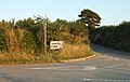
 Approaching Lanlivery - geograph.org.uk - 1760816.jpg 640 × 480; 66 KB
-
 Benchmark on trig point, Helman Tor - geograph.org.uk - 4871599.jpg 768 × 1,024; 382 KB
-
 Breney Common, west of Helman Tor - geograph.org.uk - 6017581.jpg 1,600 × 1,200; 958 KB
-
 Chark - geograph.org.uk - 151703.jpg 640 × 427; 104 KB
-
 Colcerrow - geograph.org.uk - 195959.jpg 640 × 480; 105 KB
-
 Converted barn at Lancrow - geograph.org.uk - 2708712.jpg 640 × 480; 71 KB
-
 Converted chapel near Sweetshouse - geograph.org.uk - 2279162.jpg 640 × 480; 77 KB
-
 Cornish Hillside - geograph.org.uk - 5634678.jpg 640 × 426; 42 KB
-
 Cornish pylon - geograph.org.uk - 6025922.jpg 1,024 × 681; 89 KB
-
 Cottages at Strickstenton - geograph.org.uk - 2118273.jpg 640 × 480; 64 KB
-
 Crift - geograph.org.uk - 195976.jpg 640 × 480; 116 KB
-

-
 Entrance to Sweetshouse - geograph.org.uk - 3413865.jpg 640 × 480; 52 KB
-
 Farmhouse, Trethevey - geograph.org.uk - 1760764.jpg 640 × 456; 98 KB
-
 Field edge near Colcerrow - geograph.org.uk - 2708722.jpg 640 × 480; 85 KB
-
 First quarter moon viewed from Helman Tor - geograph.org.uk - 4871591.jpg 680 × 1,024; 145 KB
-
 Fork in the road on edge of Penpillick - geograph.org.uk - 6000611.jpg 1,600 × 1,561; 942 KB
-
 Helman Tor - geograph.org.uk - 4871550.jpg 1,024 × 680; 350 KB
-
 Helman Tor - geograph.org.uk - 6017595.jpg 1,600 × 1,200; 865 KB
-
 Helman Tor from the Saints' Way - geograph.org.uk - 5371488.jpg 4,608 × 3,456; 3.96 MB
-
 Helman Tor from the south - geograph.org.uk - 6017587.jpg 1,600 × 1,200; 921 KB
-
 Higher Trevilmick (Helman Tor Cottages) from Helman Tor - geograph.org.uk - 6017644.jpg 1,600 × 1,200; 1,010 KB
-
 Higher Trevilmick Farm - geograph.org.uk - 4182344.jpg 1,600 × 1,064; 371 KB
-
 Information board and Helman Tor - geograph.org.uk - 4871582.jpg 800 × 531; 139 KB
-
 Isolated Cross - geograph.org.uk - 195957.jpg 640 × 480; 82 KB
-
 Junction near Sweetshouse - geograph.org.uk - 5293379.jpg 2,245 × 1,235; 681 KB
-
 Junction near Sweetshouse - geograph.org.uk - 5293503.jpg 2,167 × 1,377; 644 KB
-
 Lane at Trethevey - geograph.org.uk - 1760052.jpg 480 × 640; 145 KB
-
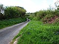 Lane to Lanivery - geograph.org.uk - 3983834.jpg 640 × 480; 113 KB
-
 Lanlivery Board School - geograph.org.uk - 56432.jpg 640 × 447; 75 KB
-
 Lanlivery Community Primary School - geograph.org.uk - 2764917.jpg 640 × 480; 73 KB
-
 Lanlivery Community Primary School - geograph.org.uk - 3107995.jpg 3,264 × 2,448; 1.5 MB
-
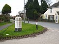
 Lanlivery Millennium Stone - geograph.org.uk - 2764902.jpg 480 × 640; 146 KB
-
 Lanlivery Millennium Stone - geograph.org.uk - 6279290.jpg 4,027 × 6,039; 7.03 MB
-
 Lanlivery War Memorial - geograph.org.uk - 2765001.jpg 640 × 480; 88 KB
-
 Lanlivery, 'War memorial' seat with a ferocious guard - geograph.org.uk - 6279287.jpg 5,829 × 3,886; 6.42 MB
-
 Lanlivery, A small part of an enormous pink rose bush - geograph.org.uk - 6279292.jpg 6,679 × 4,453; 4.91 MB
-
 Lanlivery, approaching Lower Penhale - geograph.org.uk - 2381165.jpg 640 × 427; 522 KB
-
 Lanlivery, Bokiddick - geograph.org.uk - 2381274.jpg 640 × 427; 325 KB
-
 Lanlivery, St Brevita's church - geograph.org.uk - 5373391.jpg 4,608 × 3,456; 5.27 MB
-
 Lanlivery, St. Brevita's Church entrance - geograph.org.uk - 6279286.jpg 6,066 × 4,044; 7.66 MB
-
 Lanlivery, St. Brevita's Church, Grotesques on the tower 1 - geograph.org.uk - 6279275.jpg 6,093 × 4,062; 6.13 MB
-
 Lanlivery, St. Brevita's Church, Grotesques on the tower 2 - geograph.org.uk - 6279278.jpg 5,661 × 3,775; 7.25 MB
-
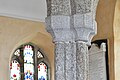 Lanlivery, St. Brevita's Church, Nave capital - geograph.org.uk - 6279652.jpg 6,948 × 4,632; 6.25 MB
-

-

-

-

-

-

-

-

-
 Lanlivery, St. Brevita's Church, South porch roof - geograph.org.uk - 6279648.jpg 7,389 × 4,926; 7.49 MB
-
 Lanlivery, St. Brevita's Church, Southern aspect - geograph.org.uk - 6279270.jpg 6,885 × 4,590; 7.22 MB
-
 Lanlivery, St. Brevita's Church, Stained glass window - geograph.org.uk - 6279313.jpg 5,287 × 3,525; 4.01 MB
-
 Lanlivery, St. Brevita's Church, Stained glass window - geograph.org.uk - 6279643.jpg 5,034 × 3,356; 3.74 MB
-
 Lanlivery, St. Brevita's Church, Stained glass window - geograph.org.uk - 6279644.jpg 7,014 × 4,676; 4.33 MB
-

-
 Lanlivery, St. Brevita's Church, The bell ringers rhyme - geograph.org.uk - 6279300.jpg 3,739 × 5,609; 6.9 MB
-
 Lanlivery, St. Brevita's Church, The bell ringers rhyme - geograph.org.uk - 6279303.jpg 2,638 × 3,957; 3.26 MB
-

-

-

-

-
 Lanlivery, St. Brevita's Church, The Jane Kendall memorial 1 - geograph.org.uk - 6279619.jpg 6,266 × 4,178; 7.72 MB
-

-

-

-

-

-

-

-
 Lanlivery, St. Brevita's Church, The Kendall memorial - geograph.org.uk - 6279638.jpg 5,201 × 3,467; 2.81 MB
-

-
 Lanlivery, St. Brevita's Church, The nave - geograph.org.uk - 6279294.jpg 7,353 × 4,902; 6.97 MB
-
 Lanlivery, St. Brevita's Church, The nave - geograph.org.uk - 6279297.jpg 7,042 × 4,695; 5.75 MB
-
 Lanlivery, St. Brevita's Church, The organ - geograph.org.uk - 6279312.jpg 7,138 × 4,758; 6.01 MB
-

-

-
 Lanlivery, St. Brevita's Church, Walter Kendall memorial - geograph.org.uk - 6279314.jpg 4,715 × 7,072; 7.09 MB
-
 Lanlivery, tree and tor - geograph.org.uk - 2381240.jpg 640 × 427; 394 KB
-
 Lantyan - geograph.org.uk - 5039550.jpg 640 × 426; 72 KB
-
 Lantyan - geograph.org.uk - 5039553.jpg 640 × 426; 65 KB
-
 Lantyan - geograph.org.uk - 5655144.jpg 640 × 426; 64 KB
-
 Lantyan - geograph.org.uk - 5846048.jpg 1,024 × 681; 101 KB
-
 Leat above the Par River - geograph.org.uk - 1968889.jpg 640 × 480; 151 KB
-
 Leat in Carmears Wood - geograph.org.uk - 2713975.jpg 480 × 640; 136 KB
-
 Looking along the Treffry Viaduct - geograph.org.uk - 6016861.jpg 1,600 × 1,200; 1.07 MB
-
 Lower Tregantle - geograph.org.uk - 1226543.jpg 640 × 482; 201 KB
-
 Luxulyan Valley below Treffry Viaduct - geograph.org.uk - 6016862.jpg 1,600 × 1,200; 1 MB
-
 Medieval wayside cross at Trevorry - geograph.org.uk - 2764976.jpg 640 × 480; 66 KB
-
 Milltown in trees - geograph.org.uk - 5631423.jpg 640 × 354; 81 KB
-
 Minor road junction near Maudlin - geograph.org.uk - 3980379.jpg 640 × 480; 81 KB
-
 Mud in the gateway - geograph.org.uk - 1544141.jpg 640 × 427; 97 KB
-
 Newly cut grass field next to A39 - geograph.org.uk - 3982633.jpg 640 × 480; 91 KB
-

-

-
 Old farm building at Roseny Mill - geograph.org.uk - 6016880.jpg 1,600 × 1,200; 1,014 KB
-
 Old milestone at Sweetshouse - geograph.org.uk - 2279215.jpg 640 × 480; 83 KB
-

-

-
 Pasture near Milltown - geograph.org.uk - 5156266.jpg 640 × 426; 52 KB
-
 Path beside the Fowey Consols Leat - geograph.org.uk - 4456131.jpg 4,000 × 3,000; 5.87 MB
-
 Pelyntor Cottage - geograph.org.uk - 1761057.jpg 640 × 399; 55 KB
-
 Perrose - geograph.org.uk - 5039559.jpg 640 × 426; 42 KB
-
 Perrose - geograph.org.uk - 5846049.jpg 1,024 × 681; 88 KB
-
 Perrose - geograph.org.uk - 6025928.jpg 1,024 × 681; 104 KB
-
 Powderham Castle caravan park - geograph.org.uk - 195947.jpg 640 × 480; 121 KB
-
 Pylon by Cornish Main Line - geograph.org.uk - 5871424.jpg 1,024 × 951; 245 KB
-
 Pylon, Milltown - geograph.org.uk - 5631424.jpg 640 × 426; 77 KB
-
 Rail bridge over Milltown Road - geograph.org.uk - 5499367.jpg 640 × 480; 272 KB
-
 Redmoor nature reserve - geograph.org.uk - 169870.jpg 640 × 480; 91 KB
-
 Redundant gate near Lanlivery - geograph.org.uk - 1760842.jpg 640 × 438; 91 KB
-
 Ridge and valley south-east of Helman Tor - geograph.org.uk - 6017640.jpg 1,600 × 1,200; 897 KB
-
 Road junction at Redmoor - geograph.org.uk - 3980410.jpg 640 × 480; 113 KB
-
 Road junction on Cycle Route 3. - geograph.org.uk - 195975.jpg 640 × 480; 114 KB
-
 Road to Helman Tor - geograph.org.uk - 4871657.jpg 1,024 × 768; 412 KB
-
 Rock outcrop on south slope of Helman Tor - geograph.org.uk - 6017584.jpg 1,600 × 1,200; 1.02 MB
-
 Rocks on Helman Tor - geograph.org.uk - 4871554.jpg 800 × 531; 125 KB
-
 Rocks on Helman Tor - geograph.org.uk - 4871561.jpg 531 × 800; 131 KB
-
 Rocks on Helman Tor - geograph.org.uk - 4871602.jpg 800 × 600; 131 KB
-
 Roseny Mill - geograph.org.uk - 195972.jpg 640 × 480; 135 KB
-
 Saints' Way sign at Lanlivery - geograph.org.uk - 2764942.jpg 640 × 480; 127 KB
-
 Saints' Way sign east of Lanlivery - geograph.org.uk - 2764964.jpg 640 × 480; 123 KB
-
 Scrub on the north-east slope of Helman Tor - geograph.org.uk - 6017592.jpg 1,600 × 1,200; 1.06 MB
-

-
 Signpost by the Saints' Way near Lanlivery - geograph.org.uk - 5373386.jpg 3,456 × 4,608; 5.28 MB
-
 Signpost for the Saints' Way near Helman Tor - geograph.org.uk - 5371480.jpg 3,456 × 4,608; 5.9 MB
-
 Stile, Roselath - geograph.org.uk - 1760884.jpg 570 × 640; 128 KB
-

-
 Stream in Carmears Wood - geograph.org.uk - 2708705.jpg 480 × 640; 121 KB
-
 Sweetshouse entrance sign - geograph.org.uk - 2425416.jpg 640 × 435; 56 KB
-
 The Carmears incline - geograph.org.uk - 2708685.jpg 480 × 640; 153 KB
-
 The farmstead at Chark - geograph.org.uk - 6024018.jpg 640 × 480; 85 KB
-
 The lane to Chark Mill - geograph.org.uk - 3980398.jpg 640 × 480; 129 KB
-

-

-
 The road through Boslymon - geograph.org.uk - 3980391.jpg 640 × 480; 98 KB
-
 The road to Redmoor - geograph.org.uk - 6024022.jpg 640 × 480; 124 KB
-
 The Saints' Way approaching Lanlivery - geograph.org.uk - 5373379.jpg 4,608 × 3,456; 3.93 MB
-
 The Saints' Way by Crift Downs - geograph.org.uk - 5373371.jpg 4,608 × 3,456; 3.98 MB
-
 The Saints' Way by Helman Tor - geograph.org.uk - 5371484.jpg 4,608 × 3,456; 4.03 MB
-
 The Saints' Way near Bodwen Farm - geograph.org.uk - 5373365.jpg 4,608 × 3,456; 4.01 MB
-
 The Saints' Way near Trebell Green - geograph.org.uk - 5371471.jpg 4,608 × 3,456; 3.94 MB
-
 The Saints' Way on Pelyn Tor - geograph.org.uk - 5373394.jpg 4,608 × 3,456; 4 MB
-
 The south western approach to Lanlivery - geograph.org.uk - 2764949.jpg 640 × 480; 114 KB
-
 The south-east end of Treffry Viaduct - geograph.org.uk - 6016858.jpg 1,600 × 1,200; 1.09 MB
-
 The southern slope of Helman Tor - geograph.org.uk - 6017647.jpg 1,200 × 1,600; 1.01 MB
-
 The wheel pit at Carmears - geograph.org.uk - 2713777.jpg 640 × 480; 142 KB
-
 Three tracks at Trekinard - geograph.org.uk - 1969108.jpg 640 × 451; 94 KB
-
 Tree, Milltown - geograph.org.uk - 5039555.jpg 640 × 426; 60 KB
-
 Treffry Viaduct - geograph.org.uk - 6016859.jpg 1,600 × 1,200; 1.08 MB
-
 Tributary of the River Fowey - geograph.org.uk - 5039544.jpg 640 × 426; 72 KB
-
 Tributary stream of the River Fowey - geograph.org.uk - 5845978.jpg 1,024 × 681; 223 KB
-
 Trig pillar on Helman Tor - geograph.org.uk - 6017639.jpg 1,600 × 1,200; 979 KB
-
 Trig point and Helman Tor - geograph.org.uk - 4871556.jpg 800 × 531; 132 KB
-
 Trig point on Helman Tor - geograph.org.uk - 4871565.jpg 531 × 800; 96 KB
-
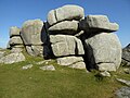
 View towards the Logan Stone from the Saints' Way - geograph.org.uk - 5371487.jpg 4,608 × 3,456; 3.98 MB
-
 Wood anemones - geograph.org.uk - 51207.jpg 640 × 479; 159 KB
-
 Woodland at the south of Corgee Moor - geograph.org.uk - 6016885.jpg 1,600 × 1,333; 1.11 MB
-
 Approaching Lanlivery - geograph.org.uk - 197122.jpg 640 × 480; 112 KB
-
 Entrance Road to a Farm - geograph.org.uk - 143545.jpg 640 × 427; 126 KB
-
 Higher Gready Farm Cottage - geograph.org.uk - 276751.jpg 640 × 480; 94 KB
-
 Houses near Boslymon - geograph.org.uk - 151716.jpg 640 × 396; 104 KB
-
 Pasture Land south of Redmoor - geograph.org.uk - 151709.jpg 640 × 427; 119 KB
-
 Poltip Cottage - geograph.org.uk - 195994.jpg 640 × 480; 111 KB
-
 Sheep Grazing on Marginal Pasture - geograph.org.uk - 151712.jpg 640 × 427; 118 KB
-
 The Road to Tredinnickpits - geograph.org.uk - 151722.jpg 640 × 427; 122 KB
-
 Well dressed horses - geograph.org.uk - 208371.jpg 640 × 480; 102 KB


_from_Helman_Tor_-_geograph.org.uk_-_6017644.jpg)


_-_geograph.org.uk_-_6279621.jpg)
_-_geograph.org.uk_-_6279624.jpg)
_-_geograph.org.uk_-_6279626.jpg)
_Kendall_memorial_(detail)_1_-_geograph.org.uk_-_6279632.jpg)
_Kendall_memorial_(detail)_2_-_geograph.org.uk_-_6279635.jpg)
_Kendall_memorial_-_geograph.org.uk_-_6279629.jpg)


_-_geograph.org.uk_-_6279305.jpg)


