Category:Lange-Diercke Sachsen
Jump to navigation
Jump to search
English: This category contains scans of maps from Lange-Diercke, Sächsischer Schulatlas. These are historic maps (circa 1930), that do not necessarily represent current geography.
Deutsch: Diese Kategorie enthält Scans von Karten aus Lange-Diercke, Sächsischer Schulatlas. Es handelt sich um historische Karten (etwa 1930), welche nicht die aktuelle Situation wiedergeben.
Pages in category "Lange-Diercke Sachsen"
This category contains only the following page.
Media in category "Lange-Diercke Sachsen"
The following 116 files are in this category, out of 116 total.
-
 Karte Plauenscher Platz Dresden um 1930.jpg 930 × 956; 699 KB
-
 Lange diercke sachsen afrika bab el mandeb.jpg 722 × 702; 251 KB
-
 Lange diercke sachsen afrika bodennutzung.jpg 1,256 × 1,366; 726 KB
-
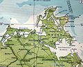
 Lange diercke sachsen afrika ehemalige schutzgebiete kamerun.jpg 1,064 × 824; 518 KB
-
 Lange diercke sachsen afrika ehemalige schutzgebiete ostafrika.jpg 712 × 824; 393 KB
-
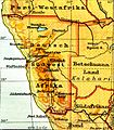 Lange diercke sachsen afrika ehemalige schutzgebiete suedwestafrika.jpg 720 × 826; 394 KB
-
 Lange diercke sachsen afrika nildelta.jpg 1,078 × 702; 381 KB
-
 Lange diercke sachsen afrika oase siwa.jpg 718 × 700; 242 KB
-
 Lange diercke sachsen afrika staatenuebersicht.jpg 1,250 × 1,360; 776 KB
-
 Lange diercke sachsen alte siedlungskerne kaditz.jpg 702 × 508; 194 KB
-
 Lange diercke sachsen alte siedlungskerne mickten.jpg 722 × 502; 157 KB
-
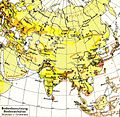 Lange diercke sachsen asien bodennutzung.jpg 1,573 × 1,528; 1.1 MB
-
 Lange diercke sachsen asien hoechstes gebiet des himalaya.jpg 949 × 751; 460 KB
-
 Lange diercke sachsen asien japan.jpg 1,564 × 1,526; 1.22 MB
-
 Lange diercke sachsen asien peking.jpg 950 × 752; 451 KB
-
 Lange diercke sachsen asien tokio.jpg 950 × 752; 449 KB
-
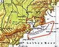 Lange diercke sachsen asien tsingtau.jpg 948 × 752; 449 KB
-
 Lange diercke sachsen deutsche landschaften boddenkueste.jpg 1,227 × 993; 551 KB
-
 Lange diercke sachsen deutsche landschaften bruchlandschaft.jpg 1,254 × 1,019; 811 KB
-
 Lange diercke sachsen deutsche landschaften moorlandschaft.jpg 1,255 × 1,016; 747 KB
-
 Lange diercke sachsen deutsche landschaften seenlandschaft.jpg 1,244 × 997; 767 KB
-
 Lange diercke sachsen deutsche landschaften wattenkueste.jpg 1,235 × 2,057; 1.14 MB
-
 Lange diercke sachsen deutschland bekenntnisse.jpg 1,256 × 1,054; 506 KB
-
 Lange diercke sachsen deutschland bodennutzung.jpg 2,544 × 1,975; 5.53 MB
-
 Lange diercke sachsen deutschland bodenschaetze und industrien.jpg 2,529 × 1,573; 4.24 MB
-
 Lange diercke sachsen deutschland bodenverhaeltnisse 1.jpg 2,512 × 3,472; 7.96 MB
-
 Lange diercke sachsen deutschland bodenverhaeltnisse 2.jpg 2,512 × 3,488; 8.78 MB
-
 Lange diercke sachsen deutschland bodenverhaeltnisse 3.jpg 2,552 × 3,496; 8.69 MB
-
 Lange diercke sachsen deutschland bodenverhaeltnisse.jpg 5,320 × 3,326; 20.46 MB
-
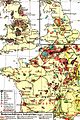
 Lange diercke sachsen deutschland dichte der bevoelkerung.jpg 1,248 × 1,054; 570 KB
-
 Lange diercke sachsen deutschland fischsonderzugverkehr.jpg 1,258 × 1,221; 757 KB
-
 Lange diercke sachsen deutschland fruehlingseinzug.jpg 1,254 × 1,056; 606 KB
-
 Lange diercke sachsen deutschland januar temperatur.jpg 1,250 × 1,052; 635 KB
-
 Lange diercke sachsen deutschland juli temperatur.jpg 1,256 × 1,056; 732 KB
-
 Lange diercke sachsen deutschland landwirtschaftliche und industrielle bevoelkerung.jpg 1,262 × 1,213; 534 KB
-
 Lange diercke sachsen deutschland oberschlesien.jpg 2,528 × 1,004; 1.53 MB
-
 Lange diercke sachsen deutschland regenmenge.jpg 1,252 × 1,054; 733 KB
-
 Lange diercke sachsen deutschland ruhrgebiet 1830.jpg 2,536 × 1,006; 1.4 MB
-
 Lange diercke sachsen deutschland ruhrgebiet 1930.jpg 2,534 × 1,008; 1.49 MB
-
 Lange diercke sachsen deutschland staaten.jpg 5,464 × 3,401; 13.25 MB
-
 Lange diercke sachsen deutschland textil und andere industrien.jpg 2,559 × 1,588; 1.6 MB
-
 Lange diercke sachsen deutschland verkehr.jpg 2,563 × 1,719; 3.59 MB
-
 Lange diercke sachsen deutschtum erde.jpg 2,553 × 1,213; 1.91 MB
-
 Lange diercke sachsen deutschtum mitteleuropa.jpg 2,546 × 2,107; 6.06 MB
-
 Lange diercke sachsen dresden boden.jpg 1,276 × 990; 816 KB
-
 Lange diercke sachsen dresden bodennutzung.jpg 1,277 × 988; 821 KB
-
 Lange diercke sachsen dresden in der gegenwart.jpg 2,418 × 3,081; 5.68 MB
-
 Lange diercke sachsen dresden um 1500.jpg 2,418 × 3,053; 9.87 MB
-
 Lange diercke sachsen dresden und umgegend.jpg 3,844 × 3,054; 11.7 MB
-
 Lange diercke sachsen dresden volksdichte.jpg 1,272 × 988; 754 KB
-
 Lange diercke sachsen dresdens festungswerke um 1800.jpg 1,445 × 2,065; 1.24 MB
-
 Lange diercke sachsen erdkarten deutschlands welthandel.jpg 4,704 × 2,036; 3.28 MB
-
 Lange diercke sachsen erdkarten dichte der bevoelkerung.jpg 2,538 × 996; 792 KB
-
 Lange diercke sachsen erdkarten flaggen.jpg 550 × 3,208; 538 KB
-
 Lange diercke sachsen erdkarten luftdruck und winde im januar.jpg 2,541 × 1,005; 1.27 MB
-
 Lange diercke sachsen erdkarten luftdruck und winde im juli.jpg 2,534 × 994; 1.39 MB
-
 Lange diercke sachsen erdkarten regen und temperatur im januar.jpg 2,545 × 1,002; 847 KB
-
 Lange diercke sachsen erdkarten regen und temperatur im juli.jpg 2,545 × 975; 982 KB
-
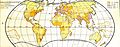
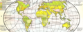
 Lange diercke sachsen erdkarten religionen.jpg 2,546 × 989; 771 KB
-
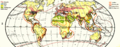
 Lange diercke sachsen erdkarten sprachen und voelker.jpg 2,543 × 992; 857 KB
-
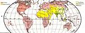
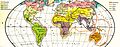
 Lange diercke sachsen erdkarten vegetationsgebiete.jpg 2,531 × 994; 1.01 MB
-
 Lange diercke sachsen erdkarten vegetationsgebiete.PNG 1,276 × 498; 1.43 MB
-
 Lange diercke sachsen erdkarten verbreitung wichtiger nutzpflanzen.jpg 2,541 × 1,003; 912 KB
-
 Lange diercke sachsen erdkarten verbreitung wichtiger nutzpflanzen.png 2,541 × 1,003; 333 KB
-
 Lange diercke sachsen erdkarten verbreitung wichtiger tiere.jpg 2,537 × 998; 891 KB
-
 Lange diercke sachsen europa bodenbenutzung.jpg 1,248 × 1,589; 883 KB
-
 Lange diercke sachsen europa bodenschaetze und industrien.jpg 1,248 × 1,866; 1.21 MB
-
 Lange diercke sachsen europa dichte der bevoelkerung.jpg 1,253 × 1,584; 846 KB
-
 Lange diercke sachsen europa nach deutschland eingefuehrte erzeugnisse.jpg 1,251 × 1,297; 816 KB
-
 Lange diercke sachsen europa religionen.jpg 1,252 × 1,598; 874 KB
-
 Lange diercke sachsen europa sprachen und voelker.jpg 1,253 × 1,603; 954 KB
-
 Lange diercke sachsen europa staaten.jpg 2,638 × 3,042; 4.9 MB
-
 Lange diercke sachsen europaeische landschaften gibraltar.jpg 1,251 × 1,052; 664 KB
-
 Lange diercke sachsen europaeische landschaften london.jpg 1,250 × 932; 658 KB
-
 Lange diercke sachsen europaeische landschaften neapel.jpg 1,258 × 932; 528 KB
-
 Lange diercke sachsen europaeische landschaften paris.jpg 1,258 × 936; 726 KB
-
 Lange diercke sachsen europaeische landschaften schaerenkueste stockholm.jpg 1,260 × 936; 635 KB
-

-

-

-

-
 Lange diercke sachsen europaeische landschaften stor und moldefjord.jpg 1,254 × 1,053; 858 KB
-
 Lange diercke sachsen freistaat sachsen eisenbahnen.jpg 1,234 × 1,600; 1.08 MB
-
 Lange diercke sachsen freistaat sachsen fluglinien.jpg 839 × 588; 231 KB
-
 Lange diercke sachsen freistaat sachsen gesteine.jpg 2,509 × 1,501; 1.86 MB
-
 Lange diercke sachsen freistaat sachsen hauptbodenarten.jpg 1,707 × 996; 667 KB
-
 Lange diercke sachsen freistaat sachsen hauptsiedlungsformen.jpg 1,710 × 998; 540 KB
-
 Lange diercke sachsen freistaat sachsen industrien.jpg 2,508 × 1,519; 1.35 MB
-
 Lange diercke sachsen freistaat sachsen landstrassen fluglinien.jpg 2,503 × 1,470; 1.76 MB
-
 Lange diercke sachsen freistaat sachsen mittlere jahreswaerme.jpg 1,706 × 993; 916 KB
-
 Lange diercke sachsen freistaat sachsen niederschlaege.jpg 1,704 × 996; 813 KB
-
 Lange diercke sachsen freistaat sachsen verwaltung.jpg 1,706 × 996; 737 KB
-
 Lange diercke sachsen freistaat sachsen volksdichte.jpg 1,714 × 988; 660 KB
-
 Lange diercke sachsen freistaat sachsen wasserstrassen.jpg 1,232 × 1,602; 957 KB
-
 Lange diercke sachsen gebiet des windbergs amtliche karte.jpg 1,178 × 586; 496 KB
-
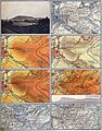
 Lange diercke sachsen gebiet des windbergs farbige höhenschichten.jpg 1,170 × 774; 562 KB
-

-
 Lange diercke sachsen gebiet des windbergs höhenschichten und schraffen.jpg 1,172 × 776; 586 KB
-
 Lange diercke sachsen gebiet des windbergs messtischblattdarstellung.jpg 1,177 × 781; 639 KB
-
 Lange diercke sachsen gebiet des windbergs naturaufnahme.jpg 1,166 × 774; 356 KB
-
 Lange diercke sachsen gebiet des windbergs reichskarte.jpg 1,164 × 592; 482 KB
-
 Lange diercke sachsen gebiet des windbergs schraffen.jpg 1,180 × 774; 612 KB
-
 Lange diercke sachsen gebiet des windbergs.jpg 2,470 × 3,147; 6.86 MB
-
 Lange diercke sachsen mittelamerika panama kanal.jpg 962 × 926; 545 KB
-
 Lange diercke sachsen nördlicher sternhimmel.png 3,427 × 2,614; 2.01 MB
-
 Lange diercke sachsen titelseite picture.jpg 1,068 × 390; 135 KB
-
 Lange diercke sachsen titelseite.jpg 1,408 × 1,963; 332 KB
-
 Lange diercke sachsen titelseite.PNG 540 × 756; 110 KB
-
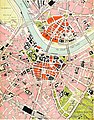
 Lange diercke sachsen uebersichtsplan von dresden.jpg 3,732 × 3,138; 10.56 MB
-
 Lange diercke sachsen vereinigte staaten bodennutzung.jpg 969 × 1,054; 481 KB
-
 Lange diercke sachsen vereinigte staaten bodenschaetze und industrien.jpg 969 × 1,047; 456 KB
-
 Lange diercke sachsen vereinigte staaten new york.jpg 966 × 929; 591 KB
-
 Lange diercke sachsen vereinigte staaten san francisco.jpg 965 × 924; 493 KB
-
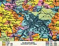
 Sachsen Kreis- u Amts-Einteilung 1900–1932.gif 1,706 × 996; 658 KB
-
 Stadtplan Freital um 1930.jpg 1,043 × 1,053; 960 KB
-
 Tharandter Straße um 1930.jpg 1,189 × 1,001; 891 KB


.jpg)
.jpg)
.jpg)


.jpg)