Category:Langdale Pikes
Jump to navigation
Jump to search
Subcategories
This category has only the following subcategory.
L
- Langdale Pikes from Windermere (14 F)
Media in category "Langdale Pikes"
The following 61 files are in this category, out of 61 total.
-
 A forestry road near Hawkshead - geograph.org.uk - 90443.jpg 640 × 480; 120 KB
-
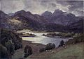
 Blea Tarn and Langdale Pikes - The English Lakes - A. Heaton Cooper.jpg 2,805 × 1,998; 1.86 MB
-
 Blea Tarn Lake District England.jpg 1,070 × 837; 179 KB
-
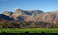
 Bowfell and the Langdale Pikes - geograph.org.uk - 3593106.jpg 4,608 × 3,456; 3.81 MB
-
 Bowfell, the Langdale Pikes and Sergeant Man - geograph.org.uk - 2571052.jpg 3,968 × 2,976; 2.86 MB
-
 Elterwater and Langdale Pikes - The English Lakes - A. Heaton Cooper.jpg 2,795 × 1,990; 1.97 MB
-
 Elterwater and the Langdale Pikes - geograph.org.uk - 3571131.jpg 4,608 × 3,456; 3.66 MB
-
 Langdale again (3274818297).jpg 2,464 × 1,508; 321 KB
-
 Langdale from Rossett Gyhll (3031541553).jpg 3,888 × 2,592; 4.49 MB
-
 Langdale in Winter - geograph.org.uk - 1159642.jpg 640 × 480; 50 KB
-
 Langdale Pikes (11994129463).jpg 1,620 × 1,080; 621 KB
-
 Langdale Pikes (11994645006).jpg 2,569 × 1,712; 1.44 MB
-
 Langdale Pikes - geograph.org.uk - 1040972.jpg 640 × 419; 57 KB
-
 Langdale Pikes - geograph.org.uk - 1040974.jpg 640 × 413; 73 KB
-
 Langdale pikes - geograph.org.uk - 2033845.jpg 800 × 501; 123 KB
-
 Langdale Pikes - geograph.org.uk - 3483678.jpg 640 × 457; 86 KB
-
 Langdale Pikes - geograph.org.uk - 4121091.jpg 3,648 × 2,736; 1.5 MB
-
 Langdale Pikes - panoramio.jpg 1,920 × 1,080; 988 KB
-
 Langdale Pikes from Pike OBlisco.jpg 2,048 × 1,536; 542 KB
-
 Langdale Pikes from Rossett Pike.jpg 1,048 × 1,328; 100 KB
-
 Langdale Pikes from the east - geograph.org.uk - 3684442.jpg 1,000 × 750; 447 KB
-
 Langdale Pikes from the Holbeck Ghyll Hotel, Windermere - geograph.org.uk - 3338472.jpg 4,608 × 3,456; 3.95 MB
-
 Langdale Pikes from the south - geograph.org.uk - 3684324.jpg 1,000 × 750; 517 KB
-
 Langdale Pikes In English LakeDistrict.jpg 3,264 × 2,448; 5.52 MB
-
 Langdale Pikes seen beyond Baysbrown campsite - geograph.org.uk - 4153908.jpg 2,048 × 1,536; 410 KB
-
 Langdale Pikes seen from the hotel - geograph.org.uk - 1283545.jpg 480 × 640; 59 KB
-
 Langdale Pikes ^ cotton grass . - geograph.org.uk - 2514550.jpg 3,072 × 2,304; 1.38 MB
-
 Langdale Pikes, by Joseph Wilkinson.jpg 900 × 640; 542 KB
-

-
 Ordnance Survey One-Inch Sheet 12 Keswick & Ambleside, Published 1925.jpg 13,095 × 10,213; 14.44 MB
-
 Ordnance Survey Sheet NY 20 Langdale, Published 1960.jpg 5,362 × 5,855; 5.1 MB
-
 Scree run on the Langdale pikes - geograph.org.uk - 1241360.jpg 640 × 480; 91 KB
-
 Sun, mist and snow on Langdale Pikes - geograph.org.uk - 687485.jpg 640 × 480; 70 KB
-

-
 The Langdale Pikes - geograph.org.uk - 1252039.jpg 640 × 426; 71 KB
-
 The Langdale Pikes - geograph.org.uk - 2611311.jpg 3,072 × 2,304; 3.32 MB
-
 The Langdale Pikes - geograph.org.uk - 3844928.jpg 1,024 × 768; 412 KB
-
 The Langdale Pikes - geograph.org.uk - 4220788.jpg 3,776 × 2,520; 4.15 MB
-
 The Langdale Pikes - geograph.org.uk - 630557.jpg 600 × 251; 29 KB
-
 The Langdale Pikes - geograph.org.uk - 871662.jpg 640 × 480; 92 KB
-
 The Langdale Pikes - geograph.org.uk - 945434.jpg 640 × 480; 85 KB
-
 The Langdale Pikes - geograph.org.uk - 946889.jpg 640 × 480; 104 KB
-
 The Langdale Pikes - geograph.org.uk - 946912.jpg 640 × 480; 71 KB
-
 The Langdale Pikes - geograph.org.uk - 947005.jpg 640 × 480; 81 KB
-
 The Langdale Pikes and Windermere - geograph.org.uk - 3075752.jpg 800 × 600; 71 KB
-
 The Langdale Pikes From Elterwater - geograph.org.uk - 356345.jpg 640 × 480; 60 KB
-
 The Langdale Pikes from Holme Fell - geograph.org.uk - 2600630.jpg 800 × 433; 80 KB
-
 The Langdale Pikes from Latterbarrow - geograph.org.uk - 2838522.jpg 800 × 518; 87 KB
-

-
 The Langdale Pikes from sea level - geograph.org.uk - 1622971.jpg 640 × 480; 47 KB
-
 The Langdale Pikes from Skelwith Force - geograph.org.uk - 46.jpg 639 × 384; 109 KB
-
 The Langdale Pikes from The Cumbria Way - geograph.org.uk - 4038699.jpg 4,608 × 3,456; 6.38 MB
-
 The Langdale Pikes from the Wrynose Fell direction - geograph.org.uk - 2529690.jpg 4,592 × 2,613; 7.2 MB
-
 The Langdale Pikes from Wise Een Tarn - geograph.org.uk - 2843928.jpg 800 × 531; 116 KB
-
 The Langdale Pikes seen from The Band - geograph.org.uk - 3787472.jpg 1,024 × 768; 405 KB
-
 The Langdale Pikes seen from the Band - geograph.org.uk - 3788452.jpg 1,024 × 768; 421 KB
-

-
 View North From Stake Pass - geograph.org.uk - 917337.jpg 640 × 427; 198 KB
-
 View towards the Langdale Pikes - geograph.org.uk - 839002.jpg 640 × 411; 132 KB
-
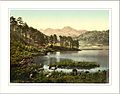
 Windermere Langdale Pikes Lake District England.jpg 1,070 × 835; 160 KB
-
 Zoom shot of the Langdale Pikes - geograph.org.uk - 1040976.jpg 640 × 418; 52 KB


.jpg)
.jpg)

.jpg)
.jpg)


