Category:Lane, West Yorkshire
Jump to navigation
Jump to search
hamlet in West Yorkshire, England, United Kingdom | |||||
| Upload media | |||||
| Instance of | |||||
|---|---|---|---|---|---|
| Location | Holme Valley, Kirklees, West Yorkshire, Yorkshire and the Humber, England | ||||
 | |||||
English: The village consists of farmhouses, some private homes and has long been associated with the Girl Guides Association by the addition of a small training centre, based in some refurbished buildings.
Media in category "Lane, West Yorkshire"
The following 9 files are in this category, out of 9 total.
-
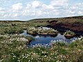 A moorland pool on Holme Moss - geograph.org.uk - 852974.jpg 640 × 480; 102 KB
-
 Bend on Woodhead Road A6024, Holme - geograph.org.uk - 1412940.jpg 640 × 455; 101 KB
-
 Field Barn, Holme - geograph.org.uk - 1412949.jpg 640 × 476; 152 KB
-
 Footpath off Woodhead Road, Holme - geograph.org.uk - 1412946.jpg 640 × 475; 152 KB
-
 Old Gate, off Woodhead Road, Holme - geograph.org.uk - 1412952.jpg 640 × 480; 139 KB
-
 Rake Head Road - geograph.org.uk - 498300.jpg 640 × 428; 113 KB
-
 Towards Lane from Cliff Road - geograph.org.uk - 1561434.jpg 640 × 480; 132 KB
-
 Walls and grass - geograph.org.uk - 55649.jpg 640 × 480; 103 KB
-
 What a diversion - geograph.org.uk - 836332.jpg 640 × 373; 55 KB


