Category:Landzigt, Wissenkerke
Jump to navigation
Jump to search
| Object location | | View all coordinates using: OpenStreetMap |
|---|
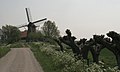
windmill in Wissenkerke, Netherlands  | |||||
| Upload media | |||||
| Instance of |
| ||||
|---|---|---|---|---|---|
| Location | Wissenkerke, Wissenkerke | ||||
| Street address |
| ||||
| Located on street |
| ||||
| Has use | |||||
| Heritage designation |
| ||||
| Source of energy | |||||
 | |||||
|
This is a category about rijksmonument number 39099
|
| Address |
|
Media in category "Landzigt, Wissenkerke"
The following 21 files are in this category, out of 21 total.
-
 Interieur, vochtschade - Wissenkerke - 20375161 - RCE.jpg 1,200 × 1,185; 236 KB
-
 Interieur, vochtschade - Wissenkerke - 20375162 - RCE.jpg 1,200 × 1,175; 268 KB
-
 Interieur, vochtschade - Wissenkerke - 20375163 - RCE.jpg 1,200 × 1,169; 250 KB
-
 Interieur, vochtschade - Wissenkerke - 20375164 - RCE.jpg 1,200 × 1,084; 224 KB
-
 Interieur, vochtschade - Wissenkerke - 20375165 - RCE.jpg 1,200 × 1,178; 199 KB
-
 Korenmolen "Landzicht" - Wissenkerke - 20215609 - RCE.jpg 811 × 1,200; 170 KB
-
 Korenmolen "Landzicht" - Wissenkerke - 20215610 - RCE.jpg 1,200 × 1,114; 158 KB
-
 Korenmolen "Landzicht" - Wissenkerke - 20215611 - RCE.jpg 1,200 × 1,191; 200 KB
-
 Korenmolen "Landzicht", aanrecht in Molen - Wissenkerke - 20215613 - RCE.jpg 1,200 × 1,186; 211 KB
-

-
 Korenmolen "Landzicht", windpeluw - Wissenkerke - 20215612 - RCE.jpg 1,176 × 1,200; 261 KB
-
 Korenmolen Landzicht - Wissenkerke - 20215617 - RCE.jpg 1,200 × 1,186; 171 KB
-
 Korenmolen Landzicht ingericht als woning - Wissenkerke - 20215618 - RCE.jpg 1,200 × 1,186; 201 KB
-
 Korenmolen landzicht vochtplekken nabij raam - Wissenkerke - 20215619 - RCE.jpg 1,200 × 1,186; 235 KB
-
 Korenmolen Landzicht, raakt in verval - Wissenkerke - 20215616 - RCE.jpg 1,200 × 1,176; 160 KB
-
 Molenromp met schade, detail - Wissenkerke - 20375160 - RCE.jpg 1,200 × 1,166; 219 KB
-
 Overzicht - Wissenkerke - 20364679 - RCE.jpg 1,200 × 1,195; 220 KB
-
 Overzicht - Wissenkerke - 20375159 - RCE.jpg 1,200 × 1,173; 215 KB
-

-
 Wissekerke, voormalige korenmolen het Landzigt RM39099 foto2 2014-03-16 13.42.jpg 4,349 × 3,262; 9.18 MB
-
 Wissenkerke molen Landzigt.jpg 2,096 × 1,258; 1.44 MB


