Category:Landslide scars
Jump to navigation
Jump to search
Deutsch: Anrisszonen
Subcategories
This category has the following 3 subcategories, out of 3 total.
Media in category "Landslide scars"
The following 27 files are in this category, out of 27 total.
-
 Bartolome coast, Galapagos.jpg 3,784 × 2,424; 1.11 MB
-
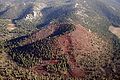
 Bucegi 2009-7 5.jpg 2,100 × 1,400; 2.03 MB
-
 Bundesarchiv Bild 135-GA-1-05-28, Tibetexpedition, Erdrutsch.jpg 800 × 599; 104 KB
-
 Burgas, Bulgaria - panoramio (24).jpg 1,024 × 683; 571 KB
-
 Burgas, Bulgaria - panoramio (25).jpg 1,024 × 683; 633 KB
-
 Cathedral rock skree.png 1,000 × 750; 1.07 MB
-
 Debris fan Furlo.JPG 1,920 × 2,072; 2 MB
-
 Fuerte de San Garcia (13).JPG 4,752 × 3,168; 6.26 MB
-
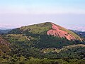
 Groundhog cinder cone.jpg 640 × 425; 75 KB
-
 Hangrutschung bei Reichesdorf.JPG 5,184 × 3,456; 9.92 MB
-
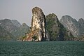 Island in Ha Long (3695255340).jpg 1,600 × 1,067; 378 KB
-
 Khait Rockslide landsat.png 744 × 550; 1.05 MB
-
 Machermo, Kyajo Ri, Nepal.jpg 4,032 × 2,688; 7.36 MB
-
 Mountainous Farming Plots Haiti.jpg 2,623 × 1,470; 943 KB
-
 Nantua (lac, ville, viaduc).JPG 4,288 × 3,216; 5.48 MB
-
 North Salt Lake landslide cliff.jpg 2,592 × 1,552; 747 KB
-
 Puy de Pariou 2001-07-30.jpg 2,048 × 1,536; 717 KB
-
 Shymbulak Valley - CIMG8512.JPG 2,048 × 1,536; 1.11 MB
-
 Slide starts here (7030409427).jpg 640 × 480; 41 KB
-
 Smueia de Badia 2.jpg 7,360 × 4,912; 21.46 MB
-
 Smueia de Badia.jpg 5,462 × 3,154; 10.2 MB
-
 Tafjord ras.JPG 2,440 × 3,052; 1.9 MB
-
 Tori-Shima Island of Izu-Islands Aerial photograph.2001.jpg 3,335 × 3,221; 2.66 MB
-
 Tori-Shima Island of Izu-Islands Aerial photograph.jpg 5,197 × 4,143; 28.36 MB
-
 USGS Khait landslide.jpg 700 × 463; 230 KB
-
 Vargas landslide scars 1999.jpg 528 × 352; 36 KB
-
 Volcán Maipo NASA.jpg 540 × 334; 95 KB


.jpg)
.jpg)


.JPG)


.jpg)


.JPG)


.jpg)


