Category:Lancing, West Sussex
Jump to navigation
Jump to search
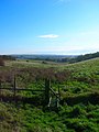
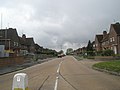
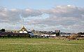
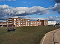
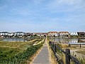
English: Lancing is a village and civil parish in the Adur district of West Sussex, England, on the western edge of the Adur Valley. It is on the coastal plain between Sompting to the west, Shoreham-by-Sea to the east and the parish of Coombes to the north. It is sometimes credited as being the largest village in England, covering an area of 3.65 miles² (946.4 hectares).
Norsk bokmål: Lancing er en landsby og et verdslig sogn i West Sussex i England. Den ligger i distriktet Adur, med Sompting mot vest, Shoreham-by-Sea mot øst og Coombes mot nord. Stedet er en av landsbyene som hevder å være den største i England, med omkring 19 000 innbyggere i 2002.
Simple English: Lancing is a town in West Sussex, England, UK. It is south-east of Sompting and south-west of Shoreham-by-Sea. There is a private school called Lancing College here.
village and civil parish in West Sussex, England  | |||||
| Upload media | |||||
| Instance of | |||||
|---|---|---|---|---|---|
| Location | Adur, West Sussex, South East England, England | ||||
| Area |
| ||||
| Said to be the same as | Lancing (Wikimedia duplicated page, civil parish) | ||||
| official website | |||||
 | |||||
Subcategories
This category has the following 12 subcategories, out of 12 total.
1
- 1966 in Lancing, West Sussex (2 F)
A
- Adur Railway Bridge (28 F)
C
L
- Lancing Beach, West Sussex (39 F)
P
S
- Shops in Lancing, West Sussex (33 F)
- Sussex Pad (2 F)
Media in category "Lancing, West Sussex"
The following 200 files are in this category, out of 579 total.
(previous page) (next page)-
 011 Lancing August 1971 (51491042097).jpg 2,361 × 1,504; 464 KB
-
 A rainy morning in Sompting Road - geograph.org.uk - 1837958.jpg 640 × 480; 66 KB
-

-
-
 A wet morning in Hurstfield - geograph.org.uk - 1838046.jpg 640 × 480; 44 KB
-
 A27 bridge over the River Adur - geograph.org.uk - 2503487.jpg 640 × 430; 49 KB
-
 A27 crosses the River Adur - geograph.org.uk - 2501510.jpg 640 × 430; 43 KB
-
 A27 crossing the River Adur - geograph.org.uk - 2868403.jpg 640 × 430; 36 KB
-
 A27 crossing the River Adur - geograph.org.uk - 3689046.jpg 640 × 430; 36 KB
-
 A27 eastbound - geograph.org.uk - 4127540.jpg 640 × 480; 60 KB
-
 A27 over the River Adur - geograph.org.uk - 2501527.jpg 640 × 430; 62 KB
-
 A27, eastbound - geograph.org.uk - 3688981.jpg 640 × 430; 43 KB
-
 A27, eastbound - geograph.org.uk - 3688983.jpg 640 × 430; 31 KB
-
 A27, eastbound - geograph.org.uk - 3689045.jpg 640 × 412; 31 KB
-
 Across Widewater Lagoon - geograph.org.uk - 641506.jpg 640 × 426; 84 KB
-
 Adur Recreation Ground - geograph.org.uk - 2496126.jpg 640 × 404; 46 KB
-
 Air Ambulance near Norfolk Bridge Shoreham - geograph.org.uk - 2500301.jpg 1,600 × 1,397; 395 KB
-
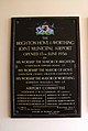 Airport opening plaque, Shoreham-by-Sea - geograph.org.uk - 3360126.jpg 1,075 × 1,600; 293 KB
-
 Alley in South Street - geograph.org.uk - 1837605.jpg 480 × 640; 65 KB
-
 Alma Street, Lancing - geograph.org.uk - 2485195.jpg 640 × 480; 64 KB
-
 Almond Avenue - geograph.org.uk - 1012476.jpg 479 × 640; 83 KB
-
 An empty station car park at Lancing - geograph.org.uk - 1837809.jpg 640 × 480; 54 KB
-
 Approaching a bus stop in Hurstfield - geograph.org.uk - 1838029.jpg 640 × 480; 54 KB
-
-
-
-

-

-
-
-

-

-
-

-
-
 Asda supermarket, Lancing - geograph.org.uk - 2746746.jpg 4,320 × 3,240; 4.22 MB
-
 Barn at 53 Manor Road, North Lancing (July 2020) (2).jpg 3,000 × 1,800; 2.2 MB
-
 Beach and Rocks at Lancing - geograph.org.uk - 5728003.jpg 1,600 × 1,102; 548 KB
-
 Beach Green - geograph.org.uk - 3792870.jpg 800 × 530; 402 KB
-
 Beach Green - geograph.org.uk - 3792880.jpg 800 × 530; 463 KB
-
 Beach Green - geograph.org.uk - 3792885.jpg 800 × 530; 459 KB
-
 Beach Green Cafe - Lancing - geograph.org.uk - 2500267.jpg 1,600 × 1,200; 301 KB
-
 Beach Green car park - geograph.org.uk - 3792890.jpg 800 × 530; 419 KB
-
 Beach Green sculpture - geograph.org.uk - 3792866.jpg 530 × 800; 524 KB
-
 Beach Green sculpture - geograph.org.uk - 3792882.jpg 800 × 530; 500 KB
-
 Beach Green sign, Lancing - geograph.org.uk - 5023446.jpg 3,672 × 4,896; 5.45 MB
-
 Beach Green, Lancing - geograph.org.uk - 2811579.jpg 1,600 × 1,200; 517 KB
-
 Beach hut - geograph.org.uk - 3792853.jpg 800 × 530; 419 KB
-
 Beach huts - geograph.org.uk - 3792856.jpg 800 × 530; 481 KB
-
 Beach Huts - geograph.org.uk - 5727977.jpg 1,600 × 1,066; 431 KB
-

-

-
 Beach huts, Lancing Beach - geograph.org.uk - 3156915.jpg 640 × 480; 112 KB
-
 Beach Park Holiday Homes - geograph.org.uk - 2524159.jpg 1,600 × 1,200; 700 KB
-
 Beachville Court Brighton Road South Lancing - geograph.org.uk - 3250373.jpg 3,264 × 2,448; 3.01 MB
-
 Bend on Mash Barn Lane - geograph.org.uk - 5109845.jpg 800 × 600; 165 KB
-
 Bend on Old Salts Farm Road - geograph.org.uk - 5113321.jpg 800 × 600; 130 KB
-
 Bent road name sign in Sompting Road - geograph.org.uk - 1837967.jpg 640 × 480; 68 KB
-
 Birch Close, Lancing - geograph.org.uk - 2746759.jpg 4,320 × 3,240; 4.22 MB
-
 BMX Racing - geograph.org.uk - 4376742.jpg 575 × 383; 67 KB
-
 BMX Racing - geograph.org.uk - 4376748.jpg 575 × 383; 67 KB
-
 BMX Racing - geograph.org.uk - 4376752.jpg 575 × 383; 74 KB
-
 Boundstone Lane Lancing - geograph.org.uk - 3250393.jpg 3,264 × 2,448; 4.02 MB
-
 Bowness Avenue Post Office - geograph.org.uk - 18761.jpg 640 × 480; 162 KB
-
 Bridleway 2065 to Lancing Ring - geograph.org.uk - 2269578.jpg 4,000 × 3,000; 3.35 MB
-

-
 Bridleway to Lancing Ring - geograph.org.uk - 2269689.jpg 4,000 × 3,000; 3.44 MB
-
-
 Brighton Road passing South Lancing, West Sussex - geograph.org.uk - 3280484.jpg 1,024 × 645; 426 KB
-
 Brighton Road South Lancing - geograph.org.uk - 3243908.jpg 3,264 × 2,448; 2.55 MB
-
 Brighton Road through South Lancing - geograph.org.uk - 4997026.jpg 640 × 427; 52 KB
-
 Brighton Road with roundabout sign - geograph.org.uk - 5113428.jpg 800 × 600; 125 KB
-
 Brighton Road, Lancing - geograph.org.uk - 2740641.jpg 4,320 × 3,240; 3.65 MB
-
 Brighton Road, Lancing - geograph.org.uk - 2740644.jpg 4,320 × 3,240; 3.59 MB
-
 Brighton Road, Lancing - geograph.org.uk - 2746760.jpg 4,320 × 3,240; 3.72 MB
-
 Brighton Road, Lancing - geograph.org.uk - 3077384.jpg 1,600 × 1,020; 272 KB
-
 Brighton Road, Shoreham - geograph.org.uk - 2740635.jpg 4,320 × 3,240; 3.31 MB
-

-
 Brightonandhovealbionwomen2012.jpg 1,944 × 1,296; 438 KB
-
 Brookland Cars, Lancing - geograph.org.uk - 2746711.jpg 4,320 × 3,240; 4.22 MB
-
 Brooklands Leisure Park, Lancing - geograph.org.uk - 4404.jpg 640 × 480; 57 KB
-

-
 Bungalows in Upper Boundstone Lane - geograph.org.uk - 1870335.jpg 640 × 480; 67 KB
-
 Bus in Brighton Road - geograph.org.uk - 1983985.jpg 640 × 480; 54 KB
-
 Bus stop in Station Approach - geograph.org.uk - 1837790.jpg 480 × 640; 55 KB
-
 Bus stop in Tower Road - geograph.org.uk - 1837982.jpg 640 × 480; 53 KB
-
 Bus stop, Brighton Road, Lancing - geograph.org.uk - 3077378.jpg 1,600 × 973; 296 KB
-
 Business premises in Manor Road - geograph.org.uk - 1870432.jpg 480 × 640; 93 KB
-
 By Lancing Manor Park, West Sussex - geograph.org.uk - 3806662.jpg 768 × 1,024; 699 KB
-
 Car care on Brighton Road - geograph.org.uk - 5113393.jpg 800 × 600; 105 KB
-
 Car wash - geograph.org.uk - 1736260.jpg 640 × 428; 102 KB
-
-
 Causeway across Widewater Lagoon (1) - geograph.org.uk - 5311027.jpg 800 × 600; 147 KB
-
 Causeway across Widewater Lagoon (2) - geograph.org.uk - 5311039.jpg 800 × 600; 138 KB
-
 Cecil Road BN15 8HP - geograph.org.uk - 4781654.jpg 4,608 × 3,456; 4.37 MB
-
 Cecil Road BN15 8HP - geograph.org.uk - 4782066.jpg 4,608 × 3,456; 4.4 MB
-
 Cedar Close. Lancing - geograph.org.uk - 2746754.jpg 4,320 × 3,240; 4.8 MB
-
 Cherry Tree Lodge in Boundstone Lane - geograph.org.uk - 1870087.jpg 640 × 480; 67 KB
-

-
 Chester Avenue, Lancing - geograph.org.uk - 2746757.jpg 4,320 × 3,240; 3.52 MB
-
 Children's playground - geograph.org.uk - 1111519.jpg 640 × 480; 94 KB
-
 Circle Garage, Lancing - geograph.org.uk - 2746731.jpg 4,320 × 3,240; 3.43 MB
-
 Circle Garage, South Street - geograph.org.uk - 1837634.jpg 640 × 480; 49 KB
-
 Coombes Road begins near Shoreham Airport - geograph.org.uk - 3329153.jpg 1,600 × 1,230; 631 KB
-
 Crabtree Parade. Lancing - geograph.org.uk - 4221608.jpg 1,600 × 1,200; 472 KB
-
 Creek, River Adur Estuary - geograph.org.uk - 2496154.jpg 640 × 405; 73 KB
-
 Cuckoo Corner - geograph.org.uk - 2268627.jpg 4,000 × 3,000; 3.52 MB
-
 Culver Road, home of Lancing FC - geograph.org.uk - 2238550.jpg 1,600 × 1,200; 209 KB
-
 Cycle Track - Lancing Seafront - geograph.org.uk - 2500254.jpg 1,600 × 1,200; 287 KB
-
 Dell boys backup - geograph.org.uk - 2269629.jpg 4,000 × 3,000; 3 MB
-
 Digging for Bait - geograph.org.uk - 4757301.jpg 2,399 × 1,599; 675 KB
-
 Disused Chalk Pit near Lancing College - geograph.org.uk - 1012420.jpg 640 × 479; 160 KB
-
 Drainage channel into the River Adur - geograph.org.uk - 2496123.jpg 640 × 430; 78 KB
-
 Dry Valley near Lancing Ring - geograph.org.uk - 1012358.jpg 479 × 640; 93 KB
-
 East Street, Lancing - geograph.org.uk - 2746717.jpg 4,320 × 3,240; 4.11 MB
-
 Eastern end of Tower Road - geograph.org.uk - 1837968.jpg 640 × 480; 49 KB
-
 Eastern Sands Holiday Park - geograph.org.uk - 3792842.jpg 800 × 530; 394 KB
-
 Eastern Sands Holiday Park - geograph.org.uk - 3792845.jpg 800 × 530; 476 KB
-
 Elmstone Close - geograph.org.uk - 1870065.jpg 640 × 480; 63 KB
-
 Emergency Services Rendezvous Point - geograph.org.uk - 1012466.jpg 479 × 640; 91 KB
-
 Entrance to Beach Park Caravan Park, Lancing - geograph.org.uk - 5803563.jpg 2,784 × 1,568; 1.82 MB
-
 Entrance to Shoreham Technical Centre - geograph.org.uk - 5109539.jpg 800 × 554; 138 KB
-
 Far end of Rosecroft Close - geograph.org.uk - 1837801.jpg 640 × 480; 66 KB
-
 Farmland near Shoreham-by-Sea, West Sussex - geograph.org.uk - 3288503.jpg 1,024 × 635; 366 KB
-
 Farmland near Shoreham-by-Sea, West Sussex - geograph.org.uk - 3288508.jpg 1,024 × 583; 362 KB
-

-
 Field beside Hoe Court - geograph.org.uk - 5109870.jpg 800 × 600; 159 KB
-

-
 Fire Station on Elm Grove - geograph.org.uk - 5113438.jpg 800 × 600; 87 KB
-
 Fishermans Walk, Shoreham - geograph.org.uk - 2740633.jpg 4,320 × 3,240; 3.29 MB
-
 Flats by Beach Green - geograph.org.uk - 2811592.jpg 1,600 × 1,174; 418 KB
-
 Flats in Sompting Road - geograph.org.uk - 1837960.jpg 480 × 640; 53 KB
-
 Flats in Station Approach - geograph.org.uk - 1837786.jpg 640 × 480; 60 KB
-
 Flats on Brighton Road, Lancing - geograph.org.uk - 2669176.jpg 1,600 × 1,200; 362 KB
-
 Football Pitch, North Lancing - geograph.org.uk - 4221665.jpg 1,600 × 1,121; 307 KB
-
 Footbridge across Widewater Lagoon - geograph.org.uk - 3566201.jpg 1,600 × 1,200; 424 KB
-
 Footpath 2064-1 on Lancing Hill - geograph.org.uk - 2269715.jpg 3,264 × 2,448; 3.78 MB
-

-
 Footpath between walls, North Lancing - geograph.org.uk - 1138416.jpg 471 × 640; 115 KB
-
 Footpath by the River Adur - geograph.org.uk - 2501482.jpg 640 × 430; 67 KB
-

-

-

-
 Footpath to the beach - geograph.org.uk - 5113408.jpg 800 × 600; 159 KB
-
 Footpath under the railway - geograph.org.uk - 2496131.jpg 640 × 430; 85 KB
-
 Footpath with steps to beach - geograph.org.uk - 5113415.jpg 800 × 600; 123 KB
-
 Footpath with stile on Lancing Hill - geograph.org.uk - 5115459.jpg 800 × 600; 142 KB
-

-
 Former hardcore waste site west of Shoreham Airport - geograph.org.uk - 3027254.jpg 3,264 × 2,448; 3.81 MB
-
 Former Luxor Cinema, Lancing - geograph.org.uk - 2746744.jpg 4,320 × 3,240; 3.55 MB
-
 Freshbrook Road off Old Salts Farm Road South Lancing - geograph.org.uk - 3227719.jpg 3,264 × 2,448; 4.64 MB
-
 Friar's Acre, 61 Manor Road, North Lancing (NHLE Code 1027893) (July 2020).jpg 3,000 × 1,600; 2.12 MB
-
 Friar's Acre.jpg 3,855 × 2,364; 1.85 MB
-

-

-
 Gateway and field corner at Hoe Court - geograph.org.uk - 5115485.jpg 800 × 600; 100 KB
-
 Globe Primary School - geograph.org.uk - 4221770.jpg 1,600 × 1,145; 270 KB
-
 Grace Cottages, East Street, Lancing - geograph.org.uk - 2485201.jpg 640 × 480; 76 KB
-
 Grants Manor.jpg 3,237 × 2,321; 2.16 MB
-
 Grass and boulders, Shoreham Beach - geograph.org.uk - 2990564.jpg 1,600 × 1,169; 315 KB
-
 Grass verge in Elmstone Close - geograph.org.uk - 1870070.jpg 640 × 480; 70 KB
-
 Grazing land on South Downs - geograph.org.uk - 712685.jpg 640 × 480; 70 KB
-
 Grinstead Lane, North Lancing - geograph.org.uk - 2746763.jpg 4,320 × 3,240; 3.43 MB
-
 Grinstead Lane, North Lancing - geograph.org.uk - 2746764.jpg 4,320 × 3,240; 3.62 MB
-
 Groyne, Lancing Beach - geograph.org.uk - 3156668.jpg 640 × 480; 112 KB
-
 Hawker Hunter at Shoreham Airshow 2015 - geograph.org.uk - 4625909.jpg 2,200 × 1,466; 1.36 MB
-
 Hawthorn Cottage.jpg 3,653 × 3,401; 2.31 MB
-
 Hayley Road - geograph.org.uk - 2521744.jpg 1,024 × 768; 149 KB
-
 Hedborough Gardens, Lancing - geograph.org.uk - 5023442.jpg 4,896 × 3,672; 5.78 MB
-

-
 High Street, (A259) - geograph.org.uk - 711862.jpg 640 × 480; 68 KB
-
 High Tide at Lancing - geograph.org.uk - 4792550.jpg 5,472 × 3,648; 7.32 MB
-
 High tide on the River Adur - geograph.org.uk - 3027228.jpg 3,264 × 2,448; 3.17 MB
-
 Hoe Court - geograph.org.uk - 1012379.jpg 479 × 640; 166 KB
-
 Hotel overlooking Lancing Beach - geograph.org.uk - 1460632.jpg 640 × 480; 56 KB
-
 Houses along the Brighton Road - geograph.org.uk - 2524164.jpg 1,600 × 1,200; 533 KB
-
 Houses along Widewater Lagoon - geograph.org.uk - 1191320.jpg 640 × 390; 88 KB
-
 Houses backing onto Widewater Lagoon - geograph.org.uk - 5644797.jpg 640 × 427; 81 KB
-
 Houses beside Widewater Lagoon - geograph.org.uk - 2811634.jpg 1,600 × 916; 449 KB
-
 Houses in Cokeham Lane - geograph.org.uk - 1845087.jpg 640 × 421; 47 KB
-
 Houses in East Street, Lancing - geograph.org.uk - 5023458.jpg 4,896 × 3,672; 5.65 MB
-
 Houses in Elmstone Close - geograph.org.uk - 1870067.jpg 640 × 480; 76 KB
-
 Houses in Tower Road - geograph.org.uk - 1837972.jpg 640 × 480; 51 KB
-
 Houses on West Beach Road - geograph.org.uk - 2811892.jpg 1,600 × 1,200; 470 KB
-
 Houses overlooking Widewater Lagoon - geograph.org.uk - 3792824.jpg 800 × 530; 464 KB
-
 Houses, Monks Close - geograph.org.uk - 2611710.jpg 640 × 430; 55 KB
-
 Housing near South Lancing, West Sussex - geograph.org.uk - 3288512.jpg 1,024 × 716; 423 KB
-
 Housing near South Lancing, West Sussex - geograph.org.uk - 3288518.jpg 800 × 498; 306 KB
-
 Hurstfield - geograph.org.uk - 1838049.jpg 640 × 480; 55 KB
-
 In Lancing Manor Park, West Sussex - geograph.org.uk - 3806676.jpg 768 × 1,024; 722 KB
-
 Irene Avenue. North Lancing - geograph.org.uk - 4221695.jpg 1,600 × 1,045; 290 KB
-
-

-

-

-
-
 Keeper saves a penalty, Culver Road, home of Lancing FC - geograph.org.uk - 2237392.jpg 1,600 × 1,200; 381 KB
-
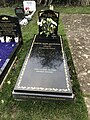 Keith Emerson Grave.jpg 3,024 × 4,032; 4.12 MB
-
 Kings Court Apartments, Lancing - geograph.org.uk - 5803568.jpg 2,784 × 1,568; 2.09 MB
-
 Kingston Bible Trust Building, Wembley Avenue, Lancing (July 2009).jpg 2,000 × 1,400; 1.01 MB
.jpg)


_(2).jpg)


_-_geograph.org.uk_-_5311027.jpg)
_-_geograph.org.uk_-_5311039.jpg)


_(July_2020).jpg)


_-_geograph.org.uk_-_711862.jpg)


.jpg)