Category:Lamesley
Jump to navigation
Jump to search
village and civil parish in Tyne and Wear, United Kingdom  L'église paroissiale de Lamesley. | |||||
| Upload media | |||||
| Instance of | |||||
|---|---|---|---|---|---|
| Location | Gateshead, Tyne and Wear, North East England, England | ||||
| Area |
| ||||
 | |||||
English: Lamesley is a village and civil parish in the Metropolitan Borough of Gateshead, Tyne and Wear, England. The village is on the southern outskirts of Gateshead, near to Birtley. The parish includes Kibblesworth, Lamesley village, Eighton Banks and Northside, Birtley which is predominantly private housing in neighbourhoods named The Hollys, Long Bank, Northdene and Crathie. (→Lamesley)
Español: Lamesley es la única parroquia civil del distrito de Gateshead, en el condado de Tyne y Wear (Inglaterra). Incluye el pueblo homónimo, Kibblesworth, Eighton Banks y el área norte de Birley. (→Lamesley)
Nederlands: Lamesley is een plaats en civil parish in het bestuurlijke gebied Gateshead, in het Engelse graafschap Tyne and Wear met 3.928 inwoners. (→Lamesley)
Polski: Lamesley – wieś w Anglii, w hrabstwie ceremonialnym Tyne and Wear, w dystrykcie (unitary authority) Gateshead. Leży 7 km na południe od centrum Newcastle i 391 km na północ od Londynu. Miejscowość liczy 3928 mieszkańców. (→Lamesley)

Subcategories
This category has the following 4 subcategories, out of 4 total.
Media in category "Lamesley"
The following 200 files are in this category, out of 462 total.
(previous page) (next page)-

-
 A corner of Birkheads Secret Gardens - geograph.org.uk - 6154028.jpg 640 × 480; 468 KB
-
 A glimpse of the Angel of the North - geograph.org.uk - 5782094.jpg 5,202 × 3,465; 2.69 MB
-
 A1 crosses the River Derwent - geograph.org.uk - 715780.jpg 640 × 480; 93 KB
-
 A1 from Smithy Lane bridge - geograph.org.uk - 2593476.jpg 640 × 480; 110 KB
-
 A1 from Smithy Lane bridge - geograph.org.uk - 2593477.jpg 640 × 480; 121 KB
-
 Access control on the Angel Cycleway - geograph.org.uk - 5856216.jpg 640 × 480; 398 KB
-
 Access Lane to Ravensworth Grange - geograph.org.uk - 221643.jpg 640 × 480; 88 KB
-
 Access road for Hill Head Farm - geograph.org.uk - 6340902.jpg 2,000 × 1,333; 3.43 MB
-
 Across Gateshead and Newcastle - geograph.org.uk - 1116549.jpg 640 × 480; 98 KB
-

-
 Allotments off Longshank Lane - geograph.org.uk - 3807511.jpg 640 × 480; 93 KB
-
 Along Birkheads Lane - geograph.org.uk - 2952456.jpg 4,608 × 3,456; 5.67 MB
-
 Angel Cycleway - geograph.org.uk - 3781825.jpg 640 × 480; 283 KB
-
 Angel Cycleway - geograph.org.uk - 3781829.jpg 640 × 480; 306 KB
-
 Angel Cycleway - geograph.org.uk - 5856205.jpg 640 × 480; 297 KB
-
 Angel Cycleway - geograph.org.uk - 5856207.jpg 640 × 480; 343 KB
-
 Angel Cycleway - geograph.org.uk - 5856214.jpg 640 × 480; 342 KB
-
 Angel of the North (plaque) - geograph.org.uk - 2477071.jpg 640 × 480; 389 KB
-
 Angel of the North - geograph.org.uk - 2278137.jpg 1,824 × 1,216; 232 KB
-
 Angel of the North - geograph.org.uk - 2752482.jpg 640 × 530; 32 KB
-
 Angel of the North - geograph.org.uk - 2752485.jpg 640 × 364; 54 KB
-
 Angel of the North - geograph.org.uk - 2943628.jpg 640 × 480; 66 KB
-
 Angel of the North - geograph.org.uk - 306386.jpg 640 × 419; 67 KB
-
 Angel of the North - geograph.org.uk - 349540.jpg 427 × 640; 77 KB
-
 Angel of the North - geograph.org.uk - 3547352.jpg 640 × 480; 289 KB
-
 Angel of the North - geograph.org.uk - 3547363.jpg 481 × 640; 76 KB
-
 Angel of the North - geograph.org.uk - 3547366.jpg 482 × 640; 240 KB
-
 Angel of the North - geograph.org.uk - 3632829.jpg 2,000 × 1,383; 1.49 MB
-
 Angel of the North - geograph.org.uk - 3639260.jpg 4,000 × 3,000; 2.23 MB
-
 Angel of the North - geograph.org.uk - 3788418.jpg 1,005 × 524; 65 KB
-
 Angel of the North - geograph.org.uk - 3885979.jpg 1,024 × 768; 489 KB
-
 Angel of The North - geograph.org.uk - 3978518.jpg 2,445 × 4,113; 864 KB
-
 Angel of the North - geograph.org.uk - 4130085.jpg 640 × 360; 31 KB
-
 Angel of the North - geograph.org.uk - 4130108.jpg 640 × 360; 35 KB
-
 Angel of the North - geograph.org.uk - 4364678.jpg 3,333 × 2,222; 3.55 MB
-
 Angel of the North - geograph.org.uk - 4587679.jpg 918 × 1,632; 288 KB
-
 Angel of the North - geograph.org.uk - 4707649.jpg 1,600 × 1,200; 195 KB
-
 Angel of the North - panoramio.jpg 1,024 × 680; 322 KB
-
 Angel of the North and worshippers - geograph.org.uk - 2679157.jpg 640 × 426; 93 KB
-
 Angel of the North on a wet day - geograph.org.uk - 4130071.jpg 640 × 360; 22 KB
-
 Angel of the North, Gateshead - geograph.org.uk - 4420821.jpg 640 × 480; 49 KB
-
 Angel of the North, Gateshead - geograph.org.uk - 5721821.jpg 1,024 × 682; 65 KB
-
 Angel of the North, Gateshead - geograph.org.uk - 5723057.jpg 1,024 × 682; 104 KB
-
 Angel of the North, Gateshead, Tyne ^ Wear - geograph.org.uk - 2003482.jpg 1,024 × 768; 115 KB
-
 Angel of the North, near Lamesley - geograph.org.uk - 3707714.jpg 480 × 640; 46 KB
-
 Angel of the North, near Lamesley - geograph.org.uk - 3707836.jpg 480 × 640; 66 KB
-
 Angel of the North, near Lamesley - geograph.org.uk - 3707838.jpg 480 × 640; 42 KB
-
 Angel of the North, near Lamesley - geograph.org.uk - 3707839.jpg 640 × 480; 93 KB
-
 Angel of the North, near Lamesley - geograph.org.uk - 3707841.jpg 640 × 480; 104 KB
-
 Angel of the North, near Lamesley - geograph.org.uk - 3708674.jpg 480 × 640; 43 KB
-
 Angel of the North, near Lamesley - geograph.org.uk - 3708694.jpg 640 × 640; 111 KB
-
 Angel of the North, near Lamesley - geograph.org.uk - 3708712.jpg 480 × 640; 91 KB
-
 Angel of the North, near Lamesley - geograph.org.uk - 3708716.jpg 480 × 640; 120 KB
-

-
 Arbour at Birkheads Secret Gardens - geograph.org.uk - 6154042.jpg 640 × 480; 375 KB
-

-
 At the top of Coppy Lane - geograph.org.uk - 3052665.jpg 4,608 × 3,456; 5.7 MB
-
 Autumn tree colours behind Lady Park Farm - geograph.org.uk - 5196216.jpg 4,478 × 3,276; 6.94 MB
-
 Banesley Lane - geograph.org.uk - 3441298.jpg 640 × 480; 141 KB
-
 Barley field near Ravensworth Grange - geograph.org.uk - 2458961.jpg 1,500 × 838; 913 KB
-
 Barn at Kibblesworth West Farm - geograph.org.uk - 2816321.jpg 1,500 × 988; 1.21 MB
-
 Bee and butterfly Circle - geograph.org.uk - 6153997.jpg 640 × 480; 413 KB
-
 Belted Galloways at Burdon Moor - geograph.org.uk - 2952494.jpg 4,608 × 3,456; 5.8 MB
-
 Bench beside the Bowes Railway Path - geograph.org.uk - 3807240.jpg 640 × 480; 176 KB
-
 Bend in the road, Urpeth Forge - geograph.org.uk - 3441245.jpg 640 × 480; 118 KB
-
 Birkhead Cottages - geograph.org.uk - 3807215.jpg 640 × 480; 91 KB
-
 Birkheads Lane - geograph.org.uk - 4228509.jpg 640 × 480; 127 KB
-
 Birkheads Secret Gardens - geograph.org.uk - 6154033.jpg 640 × 480; 379 KB
-
 Birkland Lane - geograph.org.uk - 4228508.jpg 640 × 480; 180 KB
-
 Birkland Lane heading north - geograph.org.uk - 3441269.jpg 640 × 480; 98 KB
-
 Birkland Lane heading north - geograph.org.uk - 3441277.jpg 640 × 480; 134 KB
-
 Birkland Lane heading north - geograph.org.uk - 4742797.jpg 640 × 480; 33 KB
-

-

-
 Birtley Brickworks Pond - geograph.org.uk - 3409220.jpg 4,608 × 3,456; 4.91 MB
-
 Birtley Cemetery - geograph.org.uk - 2816283.jpg 1,500 × 1,125; 1.54 MB
-
 Bottom of Banesley Lane - geograph.org.uk - 5197027.jpg 4,025 × 2,792; 6.54 MB
-
 Boundary Stone Kibblesworth Common - geograph.org.uk - 6077011.jpg 1,200 × 1,600; 470 KB
-
 Bowes Railway - geograph.org.uk - 3781801.jpg 640 × 480; 321 KB
-
 Bowes Railway access - geograph.org.uk - 3781789.jpg 640 × 480; 351 KB
-
 Bowes Railway Garden - geograph.org.uk - 6154023.jpg 640 × 480; 364 KB
-
 Bowes Railway Path - geograph.org.uk - 3407957.jpg 4,608 × 3,456; 5.13 MB
-
 Bowes Railway Path - geograph.org.uk - 4107703.jpg 640 × 480; 117 KB
-
 Bowes Railway Path - geograph.org.uk - 4107704.jpg 640 × 480; 113 KB
-
 Bowes Railway Path - geograph.org.uk - 5040123.jpg 640 × 480; 92 KB
-

-
 Bowes Railway Path at Birkland Lane - geograph.org.uk - 3807233.jpg 640 × 480; 90 KB
-
 Bowes Railway Path at Birtley - geograph.org.uk - 3807526.jpg 640 × 480; 153 KB
-
 Bowes Railway Path at Kibblesworth - geograph.org.uk - 3807402.jpg 640 × 480; 121 KB
-
 Bowes Railway Path at Kibblesworth - geograph.org.uk - 3807410.jpg 640 × 480; 142 KB
-
 Bowes Railway Path at Kibblesworth - geograph.org.uk - 3807415.jpg 480 × 640; 108 KB
-
 Bowes Railway Path at Kibblesworth Bank - geograph.org.uk - 3807250.jpg 640 × 480; 136 KB
-
 Bowes Railway Path at Kibblewsorth - geograph.org.uk - 3807449.jpg 640 × 480; 104 KB
-

-

-
 Bowes Railway Path near Birkland Lane - geograph.org.uk - 3807238.jpg 640 × 480; 149 KB
-
 Bowes Railway Walk - geograph.org.uk - 2952383.jpg 4,608 × 3,456; 5.69 MB
-
 Brandling Street - geograph.org.uk - 659291.jpg 640 × 485; 82 KB
-
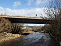
 Bridge Over The River Team - geograph.org.uk - 70760.jpg 640 × 480; 98 KB
-
 Bridleway to Ousborough Wood - geograph.org.uk - 4229564.jpg 640 × 480; 256 KB
-
 Bulrush Lake - geograph.org.uk - 3807175.jpg 640 × 480; 92 KB
-
 Bus stop and shelter on Chowdene Bank - geograph.org.uk - 5881928.jpg 3,648 × 2,736; 1.58 MB
-
 Car park for Angel of the North - geograph.org.uk - 3632840.jpg 2,000 × 1,500; 772 KB
-
 Car park for the Angel of the North - geograph.org.uk - 5855960.jpg 640 × 480; 339 KB
-

-

-
 Causey Arch Inn - geograph.org.uk - 1985649.jpg 1,024 × 768; 131 KB
-
 CEF (City Electrical Factors) - geograph.org.uk - 5881582.jpg 640 × 410; 49 KB
-
 Close up to the Angel of the North - geograph.org.uk - 5819093.jpg 1,308 × 1,600; 234 KB
-

-
 Coach Road - geograph.org.uk - 109130.jpg 640 × 480; 174 KB
-
 Coach Road heading north - geograph.org.uk - 4922851.jpg 1,500 × 1,000; 2.02 MB
-
 Colourful Foliage in Long Acre Wood - geograph.org.uk - 971942.jpg 480 × 640; 152 KB
-
 Colourful houses on Woodford - geograph.org.uk - 5856210.jpg 640 × 480; 271 KB
-
 Control Tower - geograph.org.uk - 2277068.jpg 1,824 × 1,216; 725 KB
-
 Copse trees - geograph.org.uk - 3409197.jpg 4,608 × 3,456; 5.38 MB
-
 Cottages at Riding Farm - geograph.org.uk - 3639422.jpg 3,648 × 2,736; 2.88 MB
-
 Crossing the Bridge - geograph.org.uk - 971946.jpg 480 × 640; 133 KB
-
 Crossroads near Silverhills - geograph.org.uk - 2952481.jpg 4,608 × 3,456; 5.82 MB
-
 Cycleway under the A1 - geograph.org.uk - 1562775.jpg 640 × 480; 136 KB
-

-
 Daffodil and Bluebell Copse - geograph.org.uk - 6153988.jpg 640 × 480; 378 KB
-
 Durham Road near Lamesley - geograph.org.uk - 3707713.jpg 640 × 480; 72 KB
-
 Durham Road near Lamesley - geograph.org.uk - 3708656.jpg 640 × 480; 100 KB
-
 East end of the main street in Kibblesworth - geograph.org.uk - 2874531.jpg 3,264 × 2,448; 1.51 MB
-
 End of the Old Road - geograph.org.uk - 971922.jpg 640 × 480; 92 KB
-
 Entering Long Acre Wood - geograph.org.uk - 971937.jpg 640 × 480; 138 KB
-
 Exit from car park to Eleventh Avenue - geograph.org.uk - 3131527.jpg 1,500 × 1,125; 1.81 MB
-
 Exmoor ponies on Burdon Moor - geograph.org.uk - 3409312.jpg 4,608 × 3,456; 5.4 MB
-
 Farm vehicles in a muddy field - geograph.org.uk - 3052697.jpg 4,608 × 3,456; 4.72 MB
-

-
 Farmland near Birtley - geograph.org.uk - 2879535.jpg 640 × 444; 43 KB
-
 Farmland near Kibblesworth - geograph.org.uk - 3441287.jpg 640 × 480; 73 KB
-
 Farmland near Long Acre Farm, Birtley - geograph.org.uk - 3557382.jpg 4,608 × 3,456; 5.76 MB
-
 Farmland off Birkland Lane - geograph.org.uk - 3441264.jpg 640 × 480; 68 KB
-
 Farmland to the northwest of Birtley - geograph.org.uk - 3557392.jpg 4,492 × 3,296; 4.45 MB
-
 Farmland, Beamish East Moor - geograph.org.uk - 3441256.jpg 640 × 480; 106 KB
-
 Farmland, Briar Dene - geograph.org.uk - 3441294.jpg 640 × 480; 68 KB
-
 Farmland, Old Ravensworth - geograph.org.uk - 3441301.jpg 640 × 480; 87 KB
-
 Fewster Square, Leam Lane Est. - geograph.org.uk - 513249.jpg 640 × 480; 83 KB
-
 Field and sheep, beside Birkland Lane - geograph.org.uk - 118502.jpg 640 × 434; 73 KB
-
 Field at Birkhead Cottages - geograph.org.uk - 2068351.jpg 2,000 × 1,123; 1.89 MB
-
 Field at Ravensworth Park Farm - geograph.org.uk - 604630.jpg 640 × 480; 74 KB
-
 Field near Lamesley - geograph.org.uk - 2808325.jpg 1,500 × 918; 1.02 MB
-
 Field north of Lamesey Road - geograph.org.uk - 6303807.jpg 1,024 × 684; 211 KB
-
 Field north of Longshank Lane - geograph.org.uk - 6303803.jpg 1,024 × 684; 196 KB
-

-
 Field with long grass - geograph.org.uk - 4064135.jpg 1,500 × 1,125; 1.44 MB
-
 Field with sheep off Birkland Lane - geograph.org.uk - 4229580.jpg 640 × 480; 122 KB
-
 Field, Lamesley - geograph.org.uk - 3259914.jpg 1,964 × 1,423; 1.8 MB
-

-
 Fields beside Birkland Lane - geograph.org.uk - 4228505.jpg 640 × 480; 118 KB
-
 Fields south of the Team Valley - geograph.org.uk - 3058471.jpg 4,608 × 3,456; 5.24 MB
-
 Five geese not a-laying - geograph.org.uk - 4416539.jpg 640 × 478; 87 KB
-
 Footbridge in Ousbrough Wood - geograph.org.uk - 3329266.jpg 4,608 × 3,456; 5.65 MB
-

-
 Forestry track into High Park Wood - geograph.org.uk - 3441307.jpg 640 × 480; 124 KB
-
 Former brickworks site at Birtley - geograph.org.uk - 2952372.jpg 4,608 × 3,456; 5.55 MB
-
 Former bus station on the Team Valley - geograph.org.uk - 3410803.jpg 4,608 × 3,456; 4.56 MB
-
 Former mineral railway, Team Colliery - geograph.org.uk - 3781849.jpg 640 × 480; 298 KB
-
 Garden of remembrance - geograph.org.uk - 3259891.jpg 3,348 × 2,231; 6.2 MB
-
 Gate and farm track, Kibblesworth Common - geograph.org.uk - 4229587.jpg 640 × 480; 211 KB
-
 Gate and view, Old Ravensworth - geograph.org.uk - 604564.jpg 640 × 480; 77 KB
-
 Gateway into Ravensworth Golf Club - geograph.org.uk - 5856219.jpg 640 × 480; 358 KB
-
 GNER train, Bensham Junction - geograph.org.uk - 445429.jpg 640 × 480; 72 KB
-

-

-
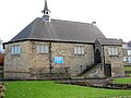
 Graves in the churchyard of St. Andrew, Lamesley - geograph.org.uk - 2808339.jpg 1,500 × 1,125; 1.5 MB
-
 Grazing near High Park Wood - geograph.org.uk - 3441310.jpg 640 × 480; 57 KB
-
 Great North Forest from Hedley Fell - geograph.org.uk - 2068348.jpg 2,000 × 1,123; 1.4 MB
-
 Great North Forest Trail - geograph.org.uk - 135635.jpg 640 × 451; 63 KB
-
 Great North Forest Trail - geograph.org.uk - 2619422.jpg 1,500 × 1,125; 1.64 MB
-
 Haggs Lane, Lamesley - geograph.org.uk - 2593621.jpg 640 × 480; 125 KB
-
 Haggs Lane, Lamesley - geograph.org.uk - 2593633.jpg 640 × 480; 112 KB
-
 Haggs Lane, Lamesley - geograph.org.uk - 2593639.jpg 640 × 480; 135 KB
-
 Harlow Green - geograph.org.uk - 2179003.jpg 3,888 × 2,396; 1.04 MB
-
 Hedge alongside farm road - geograph.org.uk - 6124119.jpg 1,600 × 973; 634 KB
-
 Hedley Hall Wood - geograph.org.uk - 2355114.jpg 640 × 480; 143 KB
-
 Hedley Lane - geograph.org.uk - 3807173.jpg 640 × 480; 98 KB
-
 High Park Wood - geograph.org.uk - 2179010.jpg 3,888 × 2,592; 1.66 MB
-
 High Park Wood - geograph.org.uk - 2268825.jpg 1,824 × 1,216; 770 KB
-
 High Park Wood from Angel of the North - geograph.org.uk - 2596951.jpg 3,000 × 2,000; 3.32 MB
-
 Holy Trinity Church, Swalwell - geograph.org.uk - 613649.jpg 640 × 480; 64 KB
-
 Horses at Lamesley - geograph.org.uk - 5196972.jpg 4,608 × 3,456; 5.6 MB
-
 House Garden and topiary - geograph.org.uk - 6154043.jpg 640 × 480; 304 KB
-
 Houses beside A167 - geograph.org.uk - 2154841.jpg 2,000 × 1,213; 2.31 MB
-
 Housing, Kibblesworth - geograph.org.uk - 3779219.jpg 3,648 × 2,056; 3.89 MB
-
 Iconic Sculpture - geograph.org.uk - 5819088.jpg 3,264 × 2,136; 1.43 MB
-
 Ikea fire escape - geograph.org.uk - 715793.jpg 480 × 640; 80 KB
-
 Junction, Low Eighton - geograph.org.uk - 3781806.jpg 640 × 480; 243 KB
-
 Kibblesworth Back - geograph.org.uk - 4742794.jpg 640 × 480; 32 KB
-

-

-
 Kibblesworth Bank - geograph.org.uk - 3441292.jpg 640 × 480; 89 KB
-
 Kibblesworth Bank, looking down - geograph.org.uk - 4742792.jpg 640 × 480; 69 KB
-
 Kibblesworth Grange - geograph.org.uk - 3441282.jpg 640 × 480; 58 KB
-
 Kibblesworth Workmen's Club - geograph.org.uk - 2290188.jpg 1,824 × 1,216; 739 KB
-
 Lambton Arms - geograph.org.uk - 2456931.jpg 3,269 × 2,165; 1.05 MB
-
 Lamesley Meadows - geograph.org.uk - 2874546.jpg 3,264 × 2,448; 1.15 MB


_-_geograph.org.uk_-_2477071.jpg)


_-_geograph.org.uk_-_5881582.jpg)


