Category:Lakes of the East Riding of Yorkshire
Jump to navigation
Jump to search
Ceremonial counties of England: Bedfordshire · Berkshire · Buckinghamshire · Cambridgeshire · Cheshire · Cornwall · Cumbria · Derbyshire · Devon · Dorset · Durham · East Riding of Yorkshire · East Sussex · Essex · Gloucestershire · Greater London · Greater Manchester · Hampshire · Herefordshire · Hertfordshire · Kent · Lancashire · Leicestershire · Lincolnshire · Merseyside · Norfolk · North Yorkshire · Northamptonshire · Northumberland · Nottinghamshire · Oxfordshire · Rutland · Shropshire · Somerset · South Yorkshire · Staffordshire · Suffolk · Surrey · Tyne and Wear · Warwickshire · West Midlands · West Sussex · West Yorkshire · Wiltshire · Worcestershire
City-counties: Bristol ·
Former historic counties:
Other former counties:
City-counties: Bristol ·
Former historic counties:
Other former counties:
Wikimedia category | |||||
| Upload media | |||||
| Instance of | |||||
|---|---|---|---|---|---|
| |||||
Subcategories
This category has the following 7 subcategories, out of 7 total.
Media in category "Lakes of the East Riding of Yorkshire"
The following 64 files are in this category, out of 64 total.
-
 A Burstwick Gravel Pond - geograph.org.uk - 1426183.jpg 640 × 480; 120 KB
-
 A Burstwick Pond - geograph.org.uk - 1426867.jpg 640 × 480; 127 KB
-
 A Burstwick Pond at Sunset - geograph.org.uk - 1426188.jpg 528 × 640; 74 KB
-
 Allerthorpe Lakeland Park - geograph.org.uk - 744287.jpg 640 × 381; 58 KB
-
 Barrf Hill - geograph.org.uk - 1141915.jpg 640 × 457; 167 KB
-
 Barrf Hill Hempholme.jpg 640 × 480; 71 KB
-
 Brandesburton Pits - geograph.org.uk - 785179.jpg 464 × 640; 67 KB
-
 Brandesburton Pits Frodingham Hill.jpg 480 × 640; 153 KB
-
 Brandesburton Pits, Frodingham Hill - geograph.org.uk - 785249.jpg 455 × 640; 127 KB
-
 Bridlington Boating Lake - geograph.org.uk - 1244036.jpg 640 × 480; 74 KB
-
 Burshill fishing lake.jpg 459 × 622; 173 KB
-
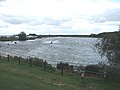
 Burstwick (Ski) Pond - geograph.org.uk - 1344601.jpg 640 × 480; 126 KB
-
 Burstwick Pond's Headquarters - geograph.org.uk - 1426857.jpg 640 × 406; 124 KB
-
 Drewton Dale - geograph.org.uk - 737025.jpg 640 × 470; 193 KB
-
 East of Hempholme - geograph.org.uk - 114725.jpg 640 × 480; 119 KB
-
East Park.ogv 1 min 42 s, 320 × 240; 8.65 MB
-
 Eight Acre Lake - geograph.org.uk - 732900.jpg 640 × 437; 194 KB
-
 Far Grange Country Park - geograph.org.uk - 73569.jpg 640 × 480; 77 KB
-
 Far Grange Lake - geograph.org.uk - 1291601.jpg 640 × 480; 42 KB
-
 Far Grange Lake - geograph.org.uk - 1291615.jpg 640 × 480; 47 KB
-
 Fishing lake at Welton Ings (geograph 4383808).jpg 800 × 533; 90 KB
-
 Fishing pond off Common Lane, Welton (geograph 4956768).jpg 1,600 × 1,065; 670 KB
-
 Footbridge on the Wolds Way - geograph.org.uk - 1564279.jpg 480 × 640; 126 KB
-
 Fosse Hill Jetksi Centre, near Catwick - geograph.org.uk - 1497557.jpg 640 × 426; 222 KB
-
 Fosse Hill jetski lake - geograph.org.uk - 80194.jpg 600 × 400; 57 KB
-
 Fosse Hill Pond - geograph.org.uk - 1463860.jpg 640 × 480; 60 KB
-
 Gravel Extraction at South Ings Lane - geograph.org.uk - 185614.jpg 640 × 480; 95 KB
-
 Houghton Hall Lake - geograph.org.uk - 181795.jpg 640 × 480; 88 KB
-
 Humber Lock Farm - geograph.org.uk - 629588.jpg 640 × 480; 124 KB
-
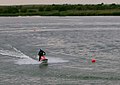 Jetski at Fosse Hill - geograph.org.uk - 1497549.jpg 640 × 453; 183 KB
-
 Kelk Lake.jpg 640 × 480; 94 KB
-
 Kelsey Hill Gravel Pit, Burstwick - geograph.org.uk - 216050.jpg 640 × 480; 105 KB
-
 Kelsey Hill Gravel Pit, Burstwick - geograph.org.uk - 216073.jpg 640 × 479; 116 KB
-
 Kelsey Hill Gravel Pit, Burstwick - geograph.org.uk - 746426.jpg 468 × 640; 96 KB
-
 Lagoon and Pump - geograph.org.uk - 234550.jpg 640 × 426; 145 KB
-
 Lake at Bleach House Farm (geograph 4459679).jpg 1,280 × 960; 1.04 MB
-
 Lake at Lake Minster Park, Beverley (geograph 5099797).jpg 1,600 × 1,065; 675 KB
-
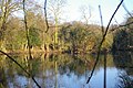 Lake near Tranby - geograph.org.uk - 708880.jpg 640 × 426; 109 KB
-
 Lake, South Cave - geograph.org.uk - 1601878.jpg 640 × 480; 81 KB
-
 Londesborough Park - geograph.org.uk - 1229103.jpg 640 × 468; 207 KB
-
 Londesborough Park - geograph.org.uk - 589107.jpg 640 × 501; 95 KB
-
 Mere near Sigglesthorne Yorkshire.jpg 3,264 × 2,448; 1.56 MB
-
 North Cave Lake - geograph.org.uk - 31175.jpg 640 × 432; 87 KB
-
 North Cave Lake.jpg 640 × 480; 112 KB
-
 River Hull and Lake - geograph.org.uk - 143418.jpg 640 × 480; 79 KB
-
 Rush Lyvars Fishing Lake Hedon.jpg 480 × 640; 83 KB
-
 Serendipity Lake - geograph.org.uk - 202850.jpg 640 × 480; 119 KB
-
 Skidby Lakes Golf Club - geograph.org.uk - 879706.jpg 640 × 422; 110 KB
-
 Small lake - geograph.org.uk - 706557.jpg 600 × 400; 89 KB
-
 Small Lake north west of Welton Water (geograph 5404731).jpg 4,032 × 3,024; 4.13 MB
-
 Summer fun at Bridlington, East Riding - geograph.org.uk - 1412953.jpg 640 × 480; 134 KB
-
 The former Burstwick Ski Pond - geograph.org.uk - 634714.jpg 640 × 480; 94 KB
-
 The Lake at the end of The Park North Cave.jpg 640 × 480; 100 KB
-
 The Lake in Londesborough Park - geograph.org.uk - 529685.jpg 480 × 640; 91 KB
-
 The Lake North of Hedon - geograph.org.uk - 674132.jpg 640 × 427; 129 KB
-
 The Ski Pond, Burtwick - geograph.org.uk - 674247.jpg 640 × 427; 73 KB
-
 Thornwick Fishing Lake - geograph.org.uk - 1420783.jpg 640 × 416; 64 KB
-
 Trawlams Lake - geograph.org.uk - 1477210.jpg 640 × 480; 75 KB
-
 Trees in Londesborough Park - geograph.org.uk - 529694.jpg 640 × 480; 68 KB
-
 Upper Lake, Londesborough Hall Park - geograph.org.uk - 1564269.jpg 480 × 640; 83 KB
-
 View towards Londesborough Park - geograph.org.uk - 1564284.jpg 480 × 640; 92 KB
-
 Water Sports Centre - geograph.org.uk - 1351998.jpg 640 × 480; 56 KB
-
 Water Sports centre, Brandesburton.jpg 640 × 480; 93 KB
-
 Watton Carr Nature Reserve - geograph.org.uk - 8884.jpg 640 × 480; 137 KB


_Pond_-_geograph.org.uk_-_1344601.jpg)


.jpg)
.jpg)


.jpg)
.jpg)


.jpg)


