Category:Lakes of Wisconsin
Jump to navigation
Jump to search
States of the United States: Alabama · Alaska · Arizona · Arkansas · California · Colorado · Connecticut · Delaware · Florida · Georgia · Hawaii · Idaho · Illinois · Indiana · Iowa · Kansas · Kentucky · Louisiana · Maine · Maryland · Massachusetts · Michigan · Minnesota · Mississippi · Missouri · Montana · Nebraska · Nevada · New Hampshire · New Jersey · New Mexico · New York · North Carolina · North Dakota · Ohio · Oklahoma · Oregon · Pennsylvania · Rhode Island · South Carolina · South Dakota · Tennessee · Texas · Utah · Vermont · Virginia · Washington · West Virginia · Wisconsin · Wyoming – Washington, D.C.
Guam · Northern Mariana Islands · Puerto Rico
Guam · Northern Mariana Islands · Puerto Rico
Wikimedia category | |||||
| Upload media | |||||
| Instance of | |||||
|---|---|---|---|---|---|
| Category combines topics | |||||
| Category contains | |||||
| Wisconsin | |||||
state of the United States of America      | |||||
| Pronunciation audio | |||||
| Instance of | |||||
| Part of | |||||
| Named after | |||||
| Location |
| ||||
| Located in or next to body of water | |||||
| Capital | |||||
| Legislative body | |||||
| Executive body | |||||
| Highest judicial authority | |||||
| Anthem |
| ||||
| Head of government |
| ||||
| Inception |
| ||||
| Highest point | |||||
| Population |
| ||||
| Area |
| ||||
| Elevation above sea level |
| ||||
| Maximum temperature record |
| ||||
| Minimum temperature record |
| ||||
| official website | |||||
 | |||||
Subcategories
This category has the following 46 subcategories, out of 46 total.
*
- Maps of lakes of Wisconsin (6 F)
B
- Brandenburg Lake (1 F)
C
- Cox Hollow Lake (9 F)
D
- Devil's Lake (38 F)
F
- Flambeau Lake (2 F)
G
- Geneva Lake (25 F)
H
L
- Lake Butte des Morts (5 F)
- Lake Wingra (18 F)
- Lauterman Lake (11 F)
- Loon Lake (Wisconsin) (2 F)
M
- Mamie Lake (Wisconsin) (4 F)
- Lake Menomin (24 F)
N
- Lake Namekagon (3 F)
- North Twin Lake (8 F)
O
- Otter Lake (Wisconsin) (3 F)
P
- Pelican Lake (Wisconsin) (9 F)
- Pewaukee Lake (9 F)
R
- Rice Lake (Wisconsin) (6 F)
- Rock Lake (Wisconsin) (7 F)
S
- Siskiwit Lake (Wisconsin) (2 F)
T
W
- Lake Waubesa (4 F)
- Wazee Lake (3 F)
Media in category "Lakes of Wisconsin"
The following 200 files are in this category, out of 244 total.
(previous page) (next page)-
 (Cropped) Trumpeter Swans on the Vista Flowage by Michele Woodford.png 884 × 663; 953 KB
-
 A Relaxing View III.jpg 2,688 × 1,520; 1.13 MB
-
 Aerial view of Egg Harbor and Lost Lake in Door County, Wisconsin 2020.png 9,180 × 12,692; 221.2 MB
-
-
-
 Aerial view of White Birch, Ballard and Irving Lakes.jpg 4,000 × 3,000; 5.31 MB
-
 Alma Lake 1.jpg 3,264 × 2,448; 3.66 MB
-
 Alma Lake 2.jpg 3,264 × 1,504; 1.93 MB
-
 Altoona Lake and dam.jpg 3,967 × 2,901; 9.3 MB
-
 Anvil Lake Boat Landing in Vilas County..jpg 1,024 × 768; 145 KB
-
 Aunt Polly’s Wash Tub 1.jpg 2,048 × 1,536; 879 KB
-
 Aunt Polly’s Wash Tub from Joyce’s lookout.jpg 2,048 × 1,536; 673 KB
-
 Aunt Polly’s Wash Tub Panorama 1.jpg 10,570 × 3,840; 12.08 MB
-
 Aunt Polly’s Wash Tub Panorama 2.jpg 11,304 × 3,706; 10.23 MB
-
 Autumn at Crescent Lake, Wisconsin (49113407061).jpg 9,343 × 6,229; 31.31 MB
-
 Bark Lake.jpg 4,032 × 3,024; 3.47 MB
-
 Bastille Lake.jpg 4,904 × 1,958; 9.68 MB
-

-
 Big Donahue Lake - panoramio.jpg 3,456 × 5,184; 3.83 MB
-
 BigFootBeachStatePark.jpg 800 × 600; 86 KB
-
 Black Lake in the Chequamegon National Forest.jpg 1,760 × 1,320; 520 KB
-
 Bladder Lake in Bayfield County.jpg 1,760 × 1,320; 472 KB
-
 Boglake.jpg 1,024 × 685; 709 KB
-
 Boundry Lake.jpg 2,048 × 1,276; 231 KB
-
 Bridge Section Opens 160819-A-PS134-763.jpg 2,121 × 1,414; 2.17 MB
-
 Bugle Lake.jpg 6,798 × 3,358; 13.4 MB
-
 Cadizsprings.jpg 2,419 × 1,613; 378 KB
-
 Camplakeautumn2014.jpg 960 × 717; 150 KB
-
 Castle rock lake photo.jpg 768 × 1,024; 196 KB
-
 Castlerockdock.jpg 720 × 960; 59 KB
-
 Cazenovia, Wisconsin dam.jpg 3,980 × 3,820; 8.42 MB
-
 Chelsea Lake in north-central Wisconsin.jpg 3,235 × 2,580; 2.39 MB
-
 Chippewamorainelakes1.jpg 1,024 × 319; 567 KB
-
 Church on the Lake.jpg 3,264 × 2,448; 2.86 MB
-
 Clark Lake Door County Wisconsin.jpg 3,846 × 2,575; 7.06 MB
-
 Clark Lake in Jacksonport Wisconsin postcard.jpg 1,143 × 667; 146 KB
-
 Cornell Lake.jpg 4,032 × 3,024; 3.35 MB
-
 Crystal Lake (2).jpg 4,032 × 3,024; 2.36 MB
-
 Crystal Lake, Wis LCCN2007663044.tif 2,625 × 700; 5.26 MB
-
 Day Downtown Eau Claire.jpg 4,032 × 3,024; 4.04 MB
-
 Day Lake in Vilas County 1.jpg 1,760 × 1,320; 475 KB
-
 Day Lake in Vilas County 2.jpg 1,760 × 1,320; 412 KB
-
 Delavan Lake from WIS50.jpg 1,936 × 1,288; 828 KB
-
 East Horsehead Lake at Sunset - panoramio.jpg 4,896 × 3,672; 4.81 MB
-
 Eastern Clark Lake, Door County, Wisconsin 2020.png 9,180 × 12,679; 230.37 MB
-
 Echo Lake 284.jpg 3,264 × 2,448; 3.27 MB
-
 Emily Lake near Lac du Flambeau in the Chequamegon national Forest..jpg 1,760 × 1,320; 453 KB
-
 Evening, Big Green Lake, WI. Shot with a DJI Phantom 3se (48373809496).jpg 2,879 × 2,086; 1.38 MB
-
 Evening, Big Green Lake, WI. Shot with a DJI Phantom 3se (48373940972).jpg 3,200 × 2,004; 1.4 MB
-
 Fallison Lake.jpg 2,048 × 1,536; 608 KB
-
 Fanny Lake in the Chequamegon National Forest..jpg 1,760 × 1,320; 550 KB
-
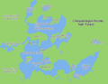
 FMIB 42308 Sketch map of Wisconsin, showing lake districts.jpeg 1,151 × 1,158; 134 KB
-
 Forest lake from the south, Nashotah County Park 01.jpg 4,032 × 3,024; 3.08 MB
-
 Forest lake from the south, Nashotah County Park 02.jpg 4,032 × 3,024; 5.72 MB
-
 Foss Lake with snapper.jpg 2,736 × 3,648; 5.07 MB
-
 Galesville dam at Lake Marinuka and Beaver Creek.jpg 6,146 × 2,777; 10.89 MB
-
Galesville dam.webm 11 s, 1,920 × 1,080; 18.83 MB
-
 Geese - panoramio - Corey Coyle (2).jpg 4,580 × 3,281; 3.31 MB
-
 Geese - panoramio - Corey Coyle (3).jpg 4,896 × 3,672; 6.09 MB
-
 Geese in Lake Montesion - panoramio.jpg 4,896 × 3,672; 6.39 MB
-
 Goose Lake - panoramio.jpg 4,896 × 3,672; 6.37 MB
-
 GovernorThompsonStateParkWoodsLakeBench.jpg 2,304 × 1,728; 851 KB
-
 Grass Lake in Nashotah Park.jpg 14,494 × 3,628; 22.31 MB
-
 Green Lake, Wisconsin 2.jpg 6,148 × 2,768; 12.15 MB
-
 Green Lake, Wisconsin.jpg 5,646 × 2,928; 13.33 MB
-
 GreenLakeWisconsinPanarama.jpg 3,888 × 2,592; 2.89 MB
-
 GrindstoneLake Wisconsin USA.jpg 2,048 × 1,536; 1.03 MB
-
 Gull Lake.jpg 5,472 × 3,648; 6.13 MB
-
 Hasmer Lake.jpg 16,252 × 3,784; 10.07 MB
-
 Henrietta Lake bench, Waterville, WI.jpg 4,032 × 3,024; 2.83 MB
-
 Henrietta Lake panorama, Waterville, WI.jpg 16,382 × 3,850; 25.64 MB
-
 Horseshoe Lake County Park boat launch.jpg 800 × 600; 141 KB
-
 Hunters Lake (1).jpg 13,022 × 3,628; 14.76 MB
-
 Hydrographic Map of Green Lake Wisconsin.pdf 4,204 × 2,883; 2.43 MB
-
 Ice Age Trail Picnic Lake.jpg 3,648 × 2,736; 5.13 MB
-
 Incoming Severe Weather - panoramio.jpg 4,896 × 3,672; 4.97 MB
-
 Indian Lake, Sugar Camp.png 263 × 189; 95 KB
-
 Kangaroo Lake Aerial.JPG 186 × 312; 12 KB
-
 Kangaroo Lake Door County Wisconsin.jpg 3,872 × 2,592; 3.52 MB
-
 Kentuck Lake Boat Landing.jpg 1,760 × 1,320; 354 KB
-
 KeshenaLake.jpg 2,976 × 1,984; 1.57 MB
-
 Lac La Belle (1).jpg 11,382 × 3,844; 8.18 MB
-
 Lac Vieux Desert - Source of the Wisconsin River.jpg 1,760 × 1,320; 376 KB
-
 Lake - Flickr - wackybadger (11).jpg 8,549 × 3,151; 21.45 MB
-
 Lake - Flickr - wackybadger (17).jpg 3,724 × 3,083; 9.33 MB
-
 Lake - Flickr - wackybadger (18).jpg 3,872 × 2,592; 7.11 MB
-
 Lake - Flickr - wackybadger (20).jpg 4,928 × 3,264; 12.87 MB
-
 Lake Beulah WI.jpg 1,600 × 1,200; 397 KB
-
 Lake Cravath.jpg 922 × 691; 143 KB
-
 Lake Henry in Blair, Wisconsin.jpg 4,000 × 3,000; 7.95 MB
-
 Lake Henry-2.jpg 4,000 × 3,000; 8.24 MB
-
 Lake Joy - panoramio.jpg 4,608 × 3,456; 7 MB
-
 Lake Kegonsa State Park.JPG 1,024 × 675; 197 KB
-
 Lake Killian South Shore.jpg 6,734 × 2,936; 5.92 MB
-
 Lake Lorraine Wisconsin.jpg 1,200 × 900; 716 KB
-
 Lake Menomin and dam.jpg 6,662 × 2,761; 10.57 MB
-
 Lake minocqua trestle.jpg 3,008 × 2,000; 1.64 MB
-
 Lake Namekagon in Bayfield County.jpg 1,760 × 1,320; 877 KB
-
 Lake Noquebay Loon Lake Realty.jpg 2,192 × 1,565; 593 KB
-
 Lake O the Dalles Interstate Park Wisconsin.jpg 2,736 × 1,824; 2.31 MB
-
 Lake of the Falls from the Campground.jpg 2,048 × 1,536; 906 KB
-
 Lake of the Falls near Mercer in Iron County.jpg 2,048 × 1,536; 937 KB
-
 Lake Onalaska 3.jpg 8,189 × 2,252; 11.2 MB
-
 Lake Onalaska, WI.jpg 537 × 518; 55 KB
-
 Lake Redstone.jpg 4,928 × 1,136; 860 KB
-
 Lake Sinissippi - panoramio - NaturesFan1226.jpg 3,888 × 2,592; 1.15 MB
-
 Lake Sinissippi - panoramio.jpg 3,888 × 2,592; 1.19 MB
-
 Lake Tomah.jpg 7,967 × 6,648; 21.2 MB
-
 Lake Winneshiek from WIS35.jpg 3,648 × 2,432; 2.23 MB
-
 Lake Wissota Fishing Pier.jpg 800 × 600; 79 KB
-
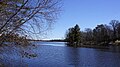
 Lake Wissota State Park 01.jpg 8,192 × 1,856; 5.21 MB
-
 Lake Wissota State Park 02.jpg 1,920 × 1,080; 1.29 MB
-
 Lake Wissota State Park 03.jpg 1,816 × 1,080; 1.7 MB
-
 Lake Wissota State Park 04.jpg 1,920 × 1,080; 1.3 MB
-
 Lake Wissota State Park 05.jpg 1,920 × 1,080; 1.07 MB
-
 Lake Wissota State Park 06.jpg 1,920 × 1,080; 1.34 MB
-
 Lake Wissota State Park 07.jpg 1,920 × 1,080; 1.72 MB
-
 Lake Wissota State Park 08.jpg 1,920 × 1,080; 1.57 MB
-
 Lake Wissota State Park 09.jpg 1,920 × 1,080; 1.84 MB
-
 Lake Wissota State Park 10.jpg 1,799 × 1,012; 1.3 MB
-
 Lake Wissota State Park 11.jpg 1,812 × 1,019; 1.31 MB
-
 Lake Wissota State Park 12.jpg 1,799 × 1,012; 1.68 MB
-
 Lake Wissota State Park 13.jpg 1,920 × 1,080; 1.74 MB
-
 Lake Wissota State Park 14.jpg 1,920 × 1,080; 943 KB
-
 Lake Wissota State Park 15.jpg 1,920 × 1,080; 1.35 MB
-
 Lake Wissota State Park 16.jpg 1,920 × 1,080; 1.64 MB
-
 Lake Wissota State Park 17.jpg 1,492 × 1,059; 1.02 MB
-
 Lake Wissota State Park 18.jpg 1,080 × 1,920; 1.45 MB
-
 Lake Wissota State Park 19.jpg 1,080 × 1,920; 1.23 MB
-
 Lake Wissota State Park 20.jpg 1,920 × 1,080; 1.09 MB
-
 Lake Wissota State Park 21.jpg 1,920 × 1,080; 1.29 MB
-
 Lake Wissota State Park 23.jpg 1,835 × 1,032; 1.2 MB
-
 Lake Wissota State Park 24.jpg 1,765 × 993; 1.24 MB
-
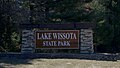 Lake Wissota State Park Entrance Sign.jpg 1,205 × 678; 677 KB
-
 LakeLucerneWisconsinLookingSouth.jpg 2,304 × 1,728; 887 KB
-
 LakePoyganWisconsinIceRoad.jpg 1,936 × 1,288; 969 KB
-
 LakeWissotaStatePark1.jpg 800 × 500; 128 KB
-
 Large Panorama.jpg 640 × 480; 66 KB
-
 Lily Lake Boat Launch.jpg 1,280 × 960; 398 KB
-
 Little Donahue Lake - panoramio.jpg 3,456 × 5,184; 4.98 MB
-
 Little Elkhart Lake Boat launch.jpg 1,280 × 960; 286 KB
-
 Little Lake (Wisconsin).jpg 1,280 × 960; 287 KB
-
 Little Presque Isle Lake - panoramio.jpg 2,816 × 2,112; 2.38 MB
-
 Logan Creek and northern Clark Lake, Door County, Wisconsin 2020 (cropped).png 4,815 × 4,319; 36.13 MB
-
 Logan Creek and northern Clark Lake, Door County, Wisconsin 2020.png 9,312 × 12,502; 217.5 MB
-
 LongLakeStateParkWisconsin.jpg 2,200 × 1,588; 476 KB
-
 Lost Lake in Vilas County.jpg 2,048 × 1,536; 616 KB
-
 Lower Genesee Lake.jpg 16,358 × 3,628; 19.05 MB
-
 Lower Nashotah Lake.jpg 13,510 × 3,628; 10.62 MB
-
 Lulu Lake.jpg 3,872 × 2,592; 1.16 MB
-
 Mamie Lake in Land O' Lakes, Wisconsin looking North from Bent's Camp.jpg 4,032 × 3,024; 2.78 MB
-
 Mamie Lake region.png 2,506 × 1,814; 3.31 MB
-
 Marinuka Lake Galesville.jpg 6,907 × 6,066; 20.95 MB
-
 Marinuka Lake.jpg 4,000 × 3,000; 7.36 MB
-
 Mauthe Lake viewed from the Tamarack Trail.jpg 2,048 × 1,536; 665 KB
-
 Mccarty park - milwaukee.jpg 8,661 × 2,249; 18.13 MB
-
 Meyers b17 s0754a.jpg 3,093 × 2,536; 3.37 MB
-
 Mill pound 4 - panoramio.jpg 7,718 × 2,314; 2.32 MB
-
 Milwaukee breakwater winter.jpg 1,712 × 1,184; 473 KB
-

-

-

-
-
 Monadnock (Baraboo Range) - panoramio.jpg 4,000 × 3,000; 5.17 MB
-
 Moose Lake in the Chequamegon, viewed from behind campsite 2.jpg 1,760 × 1,320; 667 KB
-
 Moose Lake viewed from behind Campsite 2.jpg 800 × 600; 113 KB
-
 Moose Lake Wisconsin 01.jpg 15,952 × 3,628; 16.13 MB
-
 Moose Lake Wisconsin 02.jpg 4,032 × 3,024; 2.05 MB
-
 Muir Park State Natural Area.jpg 3,872 × 2,592; 8.15 MB
-
 Nagawicka Lake.jpg 11,450 × 3,810; 9.06 MB
-
 Lake Namakagon.png 668 × 518; 18 KB
-
 Nelson Lake.jpg 4,032 × 3,024; 1.13 MB
-
 Neosho Millpond.jpg 11,689 × 3,574; 11.74 MB
-
 Night time boat launch.jpg 3,264 × 2,448; 1.86 MB
-
 North Lake (1).jpg 16,382 × 3,834; 14.43 MB
-

-
 Oconomowoc Lake.jpg 8,786 × 2,972; 4.23 MB
-
 Okauchee Lake.jpg 12,806 × 3,678; 9.21 MB
-
 Onalaska Wisconsin Lake Onalaska.jpg 3,024 × 4,032; 4.01 MB
-
 Onalaska, from Lake Onalaska 10-20-16.jpg 5,184 × 2,912; 4.05 MB
-
 On the lakes of southeastern Wisconsin (IA onlakesofsouthea00fennrich).pdf 835 × 1,325, 272 pages; 35.39 MB
-
 PECATONICA BATTLEFIELD (picture taken in 2020).jpg 4,608 × 3,456; 6.8 MB
-
 Pelican Lake Oneida County Wisconsin.jpg 3,888 × 2,592; 4.66 MB
-
 Perch Lake near Drummond, WI and the Rainbow Lake Wilderness.jpg 1,760 × 1,320; 659 KB
-
 Petenwell Lake and dam.jpg 7,855 × 2,531; 11.68 MB
-

-
 Pike Lake Hartford WI.jpg 3,008 × 2,008; 2.49 MB
-
 Pike Lake Unit Kettle Moraine State Forest panorama.jpg 11,515 × 2,544; 2.42 MB
-
 Pikelakepicnicandlake.JPG 2,400 × 1,600; 730 KB
-
 Pine Lake.jpg 13,535 × 3,628; 15.9 MB
-
 PleasantLakeParkAniwaWisconsin.jpg 2,976 × 1,984; 3.26 MB
-
 Powers Lake WI.jpg 4,608 × 1,302; 1.03 MB
-
 Powers Lake WI2.jpg 8,608 × 1,302; 1.12 MB
-
 Pretty Lake time.jpg 612 × 612; 92 KB
-
 PuckawayLakeWinterFeb2018.jpg 2,736 × 1,824; 2.08 MB
-

-
 Runge Hollow Lake 9 pano.jpg 7,998 × 7,201; 35.25 MB
-
 Runge Hollow Lake from ground-2.jpg 4,032 × 3,024; 11.72 MB
-
 Runge Hollow Lake from ground.jpg 4,032 × 2,895; 10.23 MB
-
 Runge Hollow Lake.jpg 4,000 × 3,000; 7.99 MB
_Trumpeter_Swans_on_the_Vista_Flowage_by_Michele_Woodford.png)


.png)


.jpg)


.jpg)


.jpg)
.jpg)


.jpg)
.jpg)


.jpg)
.jpg)
.jpg)


.jpg)

.png)


_-_panoramio.jpg)


.jpg)


.jpg)
.jpg)
.jpg)
.jpg)