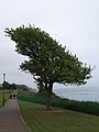
Category:Lake, Isle of Wight
Jump to navigation
Jump to search
village and civil parish on the Isle of Wight, UK _(5).JPG) | |||||
| Upload media | |||||
| Instance of | |||||
|---|---|---|---|---|---|
| Location | Isle of Wight, South East England, England | ||||
| Area |
| ||||
 | |||||
English: Lake is a village on the east of of the Isle of Wight between the towns of Sandown and Shanklin.

Subcategories
This category has the following 6 subcategories, out of 6 total.
G
K
- Kingdom Hall, Lake (7 F)
L
- Lake Green Christian Mission (3 F)
- Lake Methodist Church (5 F)
- Lake railway station (25 F)
Media in category "Lake, Isle of Wight"
The following 200 files are in this category, out of 300 total.
(previous page) (next page)-

-
 A new place to stay - geograph.org.uk - 5560009.jpg 640 × 480; 48 KB
-
 A Spot of Training - geograph.org.uk - 2449515.jpg 2,733 × 1,567; 3.75 MB
-
 Along the Beach to Sandown, Isle of Wight - geograph.org.uk - 2971645.jpg 4,200 × 2,800; 4.4 MB
-
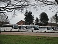 ALS Travel coaches at Lake Spithead coach park.JPG 4,000 × 3,000; 4.93 MB
-
 Araluen Way bench, Lake, Isle of Wight - geograph.org.uk - 4669487.jpg 800 × 532; 166 KB
-

-

-

-
 Araluen Way, Lake - geograph.org.uk - 6368960.jpg 1,024 × 768; 260 KB
-
 Araluen Way, Lake, Isle of Wight - geograph.org.uk - 4653297.jpg 800 × 721; 153 KB
-

-

-

-
 Bay View Court and railway towards Ryde - geograph.org.uk - 5506357.jpg 640 × 480; 146 KB
-
 Bay View Court, Lake - geograph.org.uk - 5505890.jpg 640 × 480; 127 KB
-
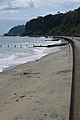
 Beach between Sandown and Shanklin - geograph.org.uk - 1902135.jpg 640 × 427; 150 KB
-
 Beach Café, Sandown, Isle of Wight - geograph.org.uk - 2971627.jpg 4,200 × 2,800; 5.61 MB
-
 Beach huts - geograph.org.uk - 3539174.jpg 640 × 361; 56 KB
-
 Beach huts at Lake - geograph.org.uk - 2052461.jpg 1,600 × 1,200; 394 KB
-
 Beach Huts at Sandown - geograph.org.uk - 3566140.jpg 640 × 481; 236 KB
-
 Beach huts at Sandown - geograph.org.uk - 5619281.jpg 2,848 × 2,144; 1.52 MB
-
 Beach huts below Lake Cliff - geograph.org.uk - 5506173.jpg 640 × 480; 127 KB
-
 Beach huts between Lake and Sandown - geograph.org.uk - 5794961.jpg 3,370 × 2,711; 2.49 MB
-
 Beach huts near Sandown - geograph.org.uk - 1967232.jpg 480 × 640; 98 KB
-
 Beach huts on the sea wall - geograph.org.uk - 5296383.jpg 640 × 427; 185 KB
-
 Beach Huts, Sandown - geograph.org.uk - 3571318.jpg 640 × 481; 269 KB
-
 Beach near Lake - geograph.org.uk - 5296388.jpg 640 × 427; 203 KB
-
 Beach north of Shanklin - geograph.org.uk - 1902139.jpg 640 × 427; 186 KB
-
 Beaches at Lake - geograph.org.uk - 2052473.jpg 1,600 × 1,200; 367 KB
-
 Beech Grove Surgery, Lake, Isle of Wight - geograph.org.uk - 4651740.jpg 800 × 625; 131 KB
-
 Beside Wightwater, Isle of Wight - geograph.org.uk - 2971582.jpg 4,200 × 2,800; 5.54 MB
-

-
 Bridge 38, Island Line - geograph.org.uk - 5505866.jpg 640 × 480; 184 KB
-
 Brinkcliffe Gardens, Lake, Isle of Wight - geograph.org.uk - 4657906.jpg 800 × 615; 141 KB
-
 Bus Stop at Lake - geograph.org.uk - 3758676.jpg 640 × 480; 270 KB
-
 Bus Stop at Lake Hill - geograph.org.uk - 3760122.jpg 640 × 480; 280 KB
-
 Cafe at Hinks Slipway - geograph.org.uk - 5522887.jpg 2,332 × 3,110; 2.1 MB
-
 Cemetery Road, Lake, Isle of Wight - geograph.org.uk - 4656202.jpg 800 × 508; 115 KB
-
 Cliff Lodge Guest House, Lake, Sandown - geograph.org.uk - 4638877.jpg 1,600 × 1,065; 677 KB
-

-
-
 Cliff Path - geograph.org.uk - 3571334.jpg 640 × 481; 282 KB
-
-
 Cliff Path, Lake - geograph.org.uk - 3571338.jpg 640 × 481; 295 KB
-
 Cliff Path, Lake, Isle of Wight - geograph.org.uk - 4669512.jpg 796 × 800; 185 KB
-
 Cliff Way, Lake, Isle of Wight - geograph.org.uk - 4653294.jpg 800 × 580; 131 KB
-

-
 Cliffs between Sandown and Shanklin - geograph.org.uk - 1967219.jpg 640 × 480; 49 KB
-
 Cliffs to the south of Sandown - geograph.org.uk - 2144626.jpg 640 × 480; 230 KB
-
 Clifftop gardens near Lake, IoW - geograph.org.uk - 1967240.jpg 640 × 480; 82 KB
-
 Clifftop stabilisation - geograph.org.uk - 5172139.jpg 640 × 480; 67 KB
-

-
 Close competition - geograph.org.uk - 5561305.jpg 1,024 × 768; 107 KB
-

-
 Cross Road, Lake, Isle of Wight - geograph.org.uk - 4651498.jpg 800 × 594; 116 KB
-
 Cycle Route - geograph.org.uk - 2682920.jpg 3,264 × 2,448; 4.8 MB
-
 Cycle Route, Alverstone, Isle of Wight - geograph.org.uk - 2928208.jpg 3,480 × 2,320; 6.79 MB
-
 Cycle Route, Alverstone, Isle of Wight - geograph.org.uk - 3281505.jpg 4,000 × 2,662; 7.1 MB
-
 Daffodils along Lake Hill 2.JPG 3,000 × 4,000; 4.25 MB
-
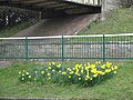 Daffodils along Lake Hill.JPG 4,000 × 3,000; 4.82 MB
-
 Day Lewis Pharmacy, Lake, Isle of Wight - geograph.org.uk - 4651824.jpg 800 × 769; 146 KB
-

-
 Dog on the beach - geograph.org.uk - 5296382.jpg 640 × 427; 163 KB
-
 Downer ^ White, Lake, Isle of Wight - geograph.org.uk - 4651353.jpg 800 × 598; 141 KB
-
 Drifters cafe, Lake, Isle of Wight - geograph.org.uk - 4669504.jpg 800 × 600; 210 KB
-
 Drifters Kiosk - geograph.org.uk - 4638906.jpg 1,600 × 1,065; 638 KB
-

-

-

-
 Entertaining topiary, Cliff Road, Lake - geograph.org.uk - 5492926.jpg 2,074 × 1,675; 1.15 MB
-

-
 Entrance to Bridleway, Near Sandown - geograph.org.uk - 2449521.jpg 3,163 × 2,139; 4.89 MB
-
-

-
 Flats beside railway line, Lake, IoW - geograph.org.uk - 1967251.jpg 640 × 480; 82 KB
-
 Flickr - ronsaunders47 - COASTAL FOOTPATH 2. SANDOWN-SHANKLIN. ISLE OF WIGHT..jpg 2,772 × 2,064; 1.52 MB
-
 Flickr - ronsaunders47 - ISLE OF WIGHT BEACH HUTS. 5.jpg 3,008 × 2,000; 1.32 MB
-
 Flickr - ronsaunders47 - WHAT'S INSIDE YOUR BEACH HUT.jpg 3,008 × 2,000; 1.5 MB
-
 Flitcroft Gardens, Lake, Isle of Wight - geograph.org.uk - 4654928.jpg 800 × 484; 123 KB
-
 Floods Beside the Cycle Route, Alverstone, Isle of Wight - geograph.org.uk - 2928267.jpg 4,200 × 2,800; 5.29 MB
-

-

-
 Footpath at Sandown, Isle of Wight - geograph.org.uk - 2449511.jpg 2,984 × 1,986; 7.21 MB
-

-
 Footpath in the woods of Blackpan Common - geograph.org.uk - 3024471.jpg 600 × 800; 548 KB
-
 Footpath Near Alverstone, Isle of Wight - geograph.org.uk - 2449528.jpg 2,984 × 1,986; 7.22 MB
-
 Footpath to cliff top path, Lake - geograph.org.uk - 6368035.jpg 1,024 × 768; 287 KB
-

-

-

-

-
 Groyne and beach at Lake - geograph.org.uk - 5699474.jpg 3,853 × 2,630; 2.71 MB
-

-
 Groyne near Sandown - geograph.org.uk - 1967228.jpg 480 × 640; 59 KB
-
 Heath Gardens, Lake, Isle of Wight - geograph.org.uk - 4651698.jpg 777 × 800; 131 KB
-
 Heath Road, Lake, Isle of Wight - geograph.org.uk - 4651705.jpg 800 × 652; 138 KB
-
 High tide at Trade Winds Beach Café - geograph.org.uk - 5504557.jpg 640 × 480; 96 KB
-
 Highland cattle in the Isle of Wight - geograph.org.uk - 1967587.jpg 640 × 480; 99 KB
-

-
 Houses in Sandown Road - geograph.org.uk - 5686195.jpg 640 × 427; 90 KB
-
 Houses on Fir Tree Close - geograph.org.uk - 5506368.jpg 640 × 428; 103 KB
-
 Houses on Ranelach Road, Lake, Sandown - geograph.org.uk - 4638959.jpg 1,600 × 1,065; 575 KB
-

-
 Industrial units at Lake - geograph.org.uk - 2142131.jpg 640 × 480; 206 KB
-
 Island Line at 7 1-2 milepost - geograph.org.uk - 5505880.jpg 640 × 480; 199 KB
-
 Island Line from Lake towards Shanklin - geograph.org.uk - 4658214.jpg 800 × 508; 145 KB
-
 Island Line near Shanklin in 1986 - geograph.org.uk - 3303080.jpg 640 × 427; 105 KB
-

-
 Island Line railway at Lake public footpath SS66 2.JPG 4,000 × 3,000; 4.94 MB
-
 Island Line railway at Lake public footpath SS66.JPG 4,000 × 3,000; 4.82 MB
-

-
 Island Line railway, Lake, Isle of Wight - geograph.org.uk - 4656222.jpg 613 × 800; 165 KB
-
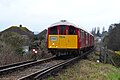 Island Line train arriving at Lake - geograph.org.uk - 5686181.jpg 640 × 427; 70 KB
-
 Island Line train at Lake station - geograph.org.uk - 5686185.jpg 640 × 427; 56 KB
-
 Island Line train passing Lake Cliff Gardens - geograph.org.uk - 6277233.jpg 3,322 × 2,252; 2.71 MB
-

-
 Isle of Wight Coastal Path fencing being built at Lake.JPG 4,000 × 3,000; 4.11 MB
-
 Isle of Wight railway near Lake station - geograph.org.uk - 1967235.jpg 640 × 480; 102 KB
-
 Isle of Wight Tours Ltd office in Lake - geograph.org.uk - 4652601.jpg 800 × 585; 120 KB
-

-
 Ko Sing, Lake, Isle of Wight - geograph.org.uk - 4651802.jpg 800 × 672; 127 KB
-
 Lake , Morrisons Supermarket - geograph.org.uk - 2880614.jpg 2,048 × 1,536; 633 KB
-
 Lake , Morrisons Supermarket - geograph.org.uk - 2882222.jpg 2,526 × 1,874; 2 MB
-
 Lake , Morrisons Supermarket - geograph.org.uk - 2882225.jpg 2,560 × 1,920; 2.39 MB
-
 Lake , Morrisons Supermarket Car Park - geograph.org.uk - 2882221.jpg 2,550 × 1,908; 2.14 MB
-
 Lake Barber Shop, Lake, Isle of Wight - geograph.org.uk - 4651471.jpg 800 × 621; 138 KB
-
 Lake Cliff Garden - geograph.org.uk - 2052670.jpg 1,600 × 1,200; 410 KB
-
 Lake Cliff Gardens - geograph.org.uk - 5505918.jpg 640 × 480; 113 KB
-
 Lake Cliff Gardens, Lake, Isle of Wight - geograph.org.uk - 4656256.jpg 800 × 562; 173 KB
-
 Lake Cliff Path 2.JPG 4,000 × 3,000; 4.5 MB
-
 Lake Cliff Path flower bed.JPG 3,072 × 2,304; 2.19 MB
-
 Lake Cliff Path kiosk.JPG 3,072 × 2,304; 2 MB
-
 Lake Cliff Path old Drifters kiosk.JPG 4,000 × 3,000; 4.89 MB
-
 Lake Cliff Path.JPG 4,000 × 3,000; 4.84 MB
-
 Lake Cliff Road 2.JPG 3,000 × 4,000; 3.64 MB
-
 Lake Cliff Road.JPG 3,000 × 4,000; 4.08 MB
-
 Lake Fairway Athletics Track during Island Games 2011.JPG 3,072 × 2,304; 3.22 MB
-
 Lake Fairway Co-operative FuneralCare.JPG 4,000 × 3,000; 4.3 MB
-
 Lake Fairway old health centre 2.JPG 4,000 × 3,000; 5.01 MB
-
 Lake Fairway old health centre.JPG 4,000 × 3,000; 4.5 MB
-
 Lake Fish Bar, Lake, Isle of Wight - geograph.org.uk - 4651400.jpg 712 × 800; 132 KB
-
 Lake Golf Links Road village sign.JPG 4,000 × 3,000; 4.81 MB
-
 Lake Golf Links Road water treatment plant 2.JPG 4,000 × 3,000; 4.5 MB
-
 Lake Golf Links Road water treatment plant.JPG 4,000 × 3,000; 4.8 MB
-
 Lake Green Lane County Sports Ground 2.JPG 4,000 × 3,000; 4.45 MB
-
 Lake Green Lane County Sports Ground.JPG 4,000 × 3,000; 4.73 MB
-
 Lake Green Road, Lake, Isle of Wight - geograph.org.uk - 4652630.jpg 799 × 800; 158 KB
-
 Lake High Street at dusk.JPG 4,592 × 3,056; 4.73 MB
-
 Lake High Street post office.JPG 3,072 × 2,304; 2.16 MB
-

-
 Lake Hill Railway Bridge - geograph.org.uk - 3758672.jpg 640 × 480; 326 KB
-
 Lake Hill railway bridge.JPG 3,072 × 2,304; 1.96 MB
-
 Lake Memorial to War Horses (and Dogs) - geograph.org.uk - 3571354.jpg 640 × 481; 304 KB
-

-

-
 Lake New Road public toilets.JPG 4,000 × 3,000; 4.78 MB
-
 Lake Old Manor House pub.JPG 4,592 × 3,056; 3.49 MB
-
 Lake public footpath SS60 2.JPG 3,000 × 4,000; 4.17 MB
-
 Lake public footpath SS60 cliff erosion warning sign.JPG 4,000 × 3,000; 4.94 MB
-
 Lake public footpath SS60 erosion.JPG 4,000 × 3,000; 4.9 MB
-
 Lake public footpath SS60.JPG 3,000 × 4,000; 4.2 MB
-
 Lake public footpath SS66 dog walker notice.JPG 4,000 × 3,000; 4.89 MB
-
 Lake public footpath SS66 railway crossing.JPG 4,000 × 3,000; 4.94 MB
-
 Lake public footpath SS66.JPG 4,000 × 3,000; 5.12 MB
-
 Lake Sandown Road house construction.JPG 4,000 × 3,000; 4.79 MB
-
 Lake Skew Bridge public toilets.JPG 4,000 × 3,000; 4.76 MB
-
 Lake, Old Manor House - geograph.org.uk - 3571345.jpg 640 × 481; 295 KB
-
 Leaving Lake Station - geograph.org.uk - 5691672.jpg 4,000 × 3,000; 2.81 MB
-
 Let's go shopping - geograph.org.uk - 5561318.jpg 1,024 × 768; 154 KB
-

-
 Longwood Lane Crossing - geograph.org.uk - 2682916.jpg 3,264 × 2,448; 5.22 MB
-
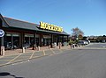
 Morrisons supermarket at Lake - geograph.org.uk - 2142123.jpg 640 × 480; 200 KB
-
 NCN 23, near Sandown, IoW - geograph.org.uk - 1967582.jpg 640 × 480; 70 KB
-
 NCN route 23, near Sandown, IoW - geograph.org.uk - 1967595.jpg 480 × 640; 127 KB
-
 New Road, Lake, Sandown - geograph.org.uk - 2652304.jpg 800 × 600; 237 KB
-

-

-
 Old railway sleepers for cliff falls - geograph.org.uk - 5684344.jpg 3,963 × 2,972; 3.54 MB
-
 On Lake station - geograph.org.uk - 6368038.jpg 1,024 × 768; 351 KB
-
 On Lake station - geograph.org.uk - 6369463.jpg 1,024 × 768; 333 KB
-
 Osterley Lodge, Lake, Isle of Wight - geograph.org.uk - 4654843.jpg 800 × 659; 200 KB
-
-

-

-
 Path leading to Talbot Road, Sandown - geograph.org.uk - 4639095.jpg 1,600 × 1,065; 815 KB
-

-
 Playing boules in Sandown - geograph.org.uk - 2653887.jpg 800 × 600; 322 KB
-
 Playing boules on Lake Beach - geograph.org.uk - 5734979.jpg 3,852 × 2,595; 1.7 MB
-
 Porter Court, Lake, Isle of Wight - geograph.org.uk - 4654953.jpg 800 × 513; 106 KB
-
 Postman on his rounds, Cliff Road, Sandown, IOW - geograph.org.uk - 3289186.jpg 1,024 × 768; 152 KB
-
 Promenade between Sandown ^ Shanklin - geograph.org.uk - 2052444.jpg 1,600 × 1,200; 271 KB
-
 Promenade north of Shanklin - geograph.org.uk - 1902146.jpg 427 × 640; 157 KB
-
 Promenade towards Sandown - geograph.org.uk - 5506346.jpg 640 × 428; 100 KB
-

-
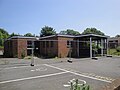
 Public toilets in Lake, Isle of Wight - geograph.org.uk - 4652619.jpg 800 × 800; 162 KB
-
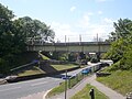
 Railway bridge over A3055 - geograph.org.uk - 5129777.jpg 640 × 428; 114 KB
-
 Railway south of Lake station - geograph.org.uk - 6368041.jpg 1,024 × 768; 334 KB
-

-


_-_geograph.org.uk_-_3571354.jpg)


