Category:Laakmolen
Jump to navigation
Jump to search
| Object location | | View all coordinates using: OpenStreetMap |
|---|
windmill in The Hague, Netherlands  | |||||
| Upload media | |||||
| Instance of |
| ||||
|---|---|---|---|---|---|
| Location | The Hague, South Holland, Netherlands | ||||
| Street address |
| ||||
| Located on street |
| ||||
| Has use |
| ||||
| Heritage designation |
| ||||
| Inception |
| ||||
| Source of energy | |||||
 | |||||
|
This is a category about rijksmonument number 18073
|
| Address |
|
Media in category "Laakmolen"
The following 30 files are in this category, out of 30 total.
-
 A view of The Hague from Rijswijk by P C La Fargue Circa 1765.jpg 4,032 × 3,024; 1.92 MB
-
 Den Haag Laakmolen.jpg 1,296 × 1,944; 1.62 MB
-
 Denhaag laakmolen.jpg 1,338 × 1,800; 310 KB
-
 Exterieur HET STEKEN VAN DE STAART EN DE ROEDEN - 's-Gravenhage - 20299451 - RCE.jpg 1,200 × 1,200; 237 KB
-
 Exterieur HET STEKEN VAN DE STAART EN DE ROEDEN - 's-Gravenhage - 20299452 - RCE.jpg 1,200 × 1,184; 341 KB
-
 Exterieur SCHOEPEN VAN HET SCHEPRAD - 's-Gravenhage - 20299453 - RCE.jpg 1,200 × 1,200; 290 KB
-
 Galgemolen - Den Haag (8575847149).jpg 2,748 × 2,338; 2.65 MB
-
 Grondzeiler na brand - 's-Gravenhage - 20091508 - RCE.jpg 1,200 × 1,197; 349 KB
-
 Grondzeiler na brand - 's-Gravenhage - 20091509 - RCE.jpg 1,192 × 1,200; 346 KB
-
 Grondzeiler na brand - 's-Gravenhage - 20091510 - RCE.jpg 1,192 × 1,200; 333 KB
-
 Grondzeiler na brand - 's-Gravenhage - 20091511 - RCE.jpg 1,188 × 1,200; 337 KB
-
 Grondzeiler na brand - 's-Gravenhage - 20091512 - RCE.jpg 1,190 × 1,200; 261 KB
-

-
 Grondzeiler van achteren gefotografeerd - 's-Gravenhage - 20091506 - RCE.jpg 808 × 1,200; 169 KB
-
 Grondzeiler van opzij gefotografeerd - 's-Gravenhage - 20145215 - RCE.jpg 1,200 × 853; 184 KB
-
 INTERIEUR, INGEROTTE KRUISARMEN - 's-Gravenhage - 20299454 - RCE.jpg 1,200 × 1,200; 312 KB
-
 INTERIEUR, ONDERWIEL - 's-Gravenhage - 20299456 - RCE.jpg 1,200 × 1,184; 258 KB
-
 INTERIEUR, VERROTTE VELLINGSTUKKEN - 's-Gravenhage - 20299455 - RCE.jpg 1,200 × 1,200; 298 KB
-
-
 Laakmolen, gesloopt zomer 1906 - 's-Gravenhage - 20091489 - RCE.jpg 1,200 × 952; 165 KB
-
 Laakmolen, Trekvliet, Den Haag, ca 1912-15 (RHCL, VKG 006).jpg 2,500 × 1,773; 468 KB
-
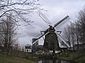 Laakmolen.jpg 1,600 × 1,200; 1.06 MB
-
 Moleninterieur na brand - 's-Gravenhage - 20091513 - RCE.jpg 1,200 × 1,200; 260 KB
-
 Netherlands, The Hague, Laakmolen.JPG 1,316 × 1,988; 971 KB
-

-
 Stam, De stad s Gravenhage vanaf de Delftse vaart.jpg 1,402 × 864; 659 KB
-
 Trekvliet den haag.jpg 1,600 × 1,200; 547 KB
-
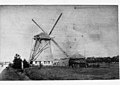
 The "Laakmolen" Near The Hague .jpg 1,899 × 1,263; 1.1 MB
-
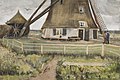
 Vincent van Gogh - The 'Laakmolen' near The Hague (The Windmill) F 884 JH 59.jpg 3,200 × 2,152; 2.8 MB
-


.jpg)


.jpg)


_F_884_JH_59.jpg)
