Category:La Dôle
Jump to navigation
Jump to search
| Object location | | View all coordinates using: OpenStreetMap |
|---|
mountain  | |||||
| Upload media | |||||
| Instance of | |||||
|---|---|---|---|---|---|
| Made from material | |||||
| Location | canton Vaud, Switzerland | ||||
| Mountain range | |||||
| Topographic prominence |
| ||||
| Topographic isolation |
| ||||
| Elevation above sea level |
| ||||
| Parent peak | |||||
 | |||||
Subcategories
This category has the following 9 subcategories, out of 9 total.
A
- Aerial photographs of La Dôle (17 F)
C
- Chalet de La Dôle (17 F)
- Col de Porte (Jura) (14 F)
L
- La Dôle – St-Cergue (14 F)
P
- Pointe de Poêle Chaud (36 F)
R
- Remote views of La Dôle (19 F)
- Rupicapra rupicapra at La Dôle (28 F)
S
V
Media in category "La Dôle"
The following 178 files are in this category, out of 178 total.
-
 1260 Col de la Faucille.jpg 14,000 × 9,600; 117.47 MB
-
 1278 La Rippe, Switzerland - panoramio (1).jpg 3,456 × 5,184; 8.82 MB
-
 1278 La Rippe, Switzerland - panoramio.jpg 5,184 × 3,456; 8.44 MB
-
 Anthocharis cardamines, La Dole - img 22352.jpg 2,496 × 1,664; 1.49 MB
-
 Astrantia major, La Dôle - img 22346.jpg 2,496 × 1,664; 1.52 MB
-
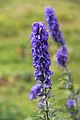
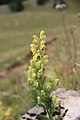
 Campanula thyrsoides, La Dôle - img 22328.jpg 1,664 × 2,496; 2.1 MB
-
 Dole.jpg 2,200 × 1,585; 524 KB
-
 Field gentian - Gentianella campestris - panoramio.jpg 3,456 × 5,184; 5.9 MB
-
 Fir tree at La Dôle - panoramio.jpg 3,456 × 5,184; 8.09 MB
-
 Gentian - panoramio (4).jpg 5,184 × 3,456; 5.48 MB
-
 La Dole.jpg 2,272 × 1,704; 3.07 MB
-
 La Dôle - panoramio (105).jpg 4,272 × 2,848; 10.08 MB
-
 La Dôle - panoramio (116).jpg 2,848 × 4,272; 11.4 MB
-
 La Dôle - panoramio (117).jpg 4,272 × 2,848; 13.6 MB
-
 La Dôle - panoramio (12).jpg 2,848 × 4,272; 11.82 MB
-
 La Dôle - panoramio (120).jpg 4,272 × 2,848; 6.65 MB
-
 La Dôle - panoramio (121).jpg 5,184 × 3,456; 5.74 MB
-
 La Dôle - panoramio (122).jpg 5,184 × 3,456; 5.9 MB
-
 La Dôle - panoramio (13).jpg 2,848 × 4,272; 14.69 MB
-
 La Dôle - panoramio (15).jpg 4,272 × 2,848; 9.65 MB
-
 La Dôle - panoramio (2).jpg 4,272 × 2,848; 9.39 MB
-
 La Dôle - panoramio (20).jpg 4,272 × 2,848; 10.34 MB
-
 La Dôle - panoramio (22).jpg 2,848 × 4,272; 15.31 MB
-
 La Dôle - panoramio (23).jpg 4,272 × 2,848; 11.89 MB
-
 La Dôle - panoramio (24).jpg 2,848 × 4,272; 12.7 MB
-
 La Dôle - panoramio (3).jpg 2,848 × 4,272; 13.8 MB
-
 La Dôle - panoramio (32).jpg 4,272 × 2,848; 10.38 MB
-
 La Dôle - panoramio (33).jpg 2,848 × 4,272; 10.58 MB
-
 La Dôle - panoramio (34).jpg 2,848 × 4,272; 13.44 MB
-
 La Dôle - panoramio (35).jpg 4,272 × 2,848; 6.96 MB
-
 La Dôle - panoramio (36).jpg 4,272 × 2,848; 12.55 MB
-
 La Dôle - panoramio (38).jpg 2,848 × 4,272; 12.35 MB
-
 La Dôle - panoramio (39).jpg 4,272 × 2,848; 12.48 MB
-
 La Dôle - panoramio (42).jpg 4,272 × 2,848; 8.68 MB
-
 La Dôle - panoramio (43).jpg 2,848 × 4,272; 13.12 MB
-
 La Dôle - panoramio (5).jpg 4,272 × 2,848; 10.49 MB
-
 La Dôle - panoramio (67).jpg 2,848 × 4,272; 11.56 MB
-
 La Dôle - panoramio (8).jpg 4,272 × 2,848; 11.54 MB
-
 La Dôle - panoramio (9).jpg 4,272 × 2,848; 10.1 MB
-
 La Dôle - panoramio (90).jpg 4,272 × 2,848; 11.83 MB
-
 La Dôle - panoramio (91).jpg 4,272 × 2,848; 12.7 MB
-
 La Dôle - panoramio (96).jpg 2,848 × 4,272; 11.46 MB
-
 La Dôle and la Barillette.JPG 2,816 × 2,112; 1.16 MB
-
 La Dôle Panorama.jpg 4,096 × 908; 986 KB
-
 La Dôle sommet04 2015-02-07.jpg 3,648 × 2,736; 2.33 MB
-
 La Dôle vue01 2015-02-07.jpg 3,448 × 2,608; 1.89 MB
-
 La Dôle vue03 2015-02-07.jpg 3,648 × 2,432; 1.73 MB
-
La Dôle, October 2016.webm 21 min 26 s, 1,920 × 1,080; 358.71 MB
-
 La Dôle.png 838 × 565; 499 KB
-
 La-Dole-JAN2021-1.jpg 3,648 × 2,056; 5.73 MB
-
 La-Dole-JAN2021-2.jpg 3,648 × 2,056; 6 MB
-
 La-Dole.JPG 5,472 × 3,648; 4.07 MB
-
 La-Dôle-animals.jpg 5,472 × 3,648; 13.04 MB
-
 La-Dôle.jpg 5,472 × 3,648; 11.41 MB
-
 LaDôle.jpeg 2,272 × 1,704; 1.32 MB
-
 Monkshood - Aconitum napellus - panoramio.jpg 3,456 × 5,184; 4.67 MB
-
 Panoramic view on La Dôle - panoramio.jpg 11,521 × 3,409; 21.9 MB
-
 Panoramic view onto the Vallée de la Valserine from La Dôle - panoramio.jpg 10,893 × 2,194; 21.41 MB
-
 Rocks at La Dôle - panoramio (1).jpg 5,184 × 3,456; 10.03 MB
-
 Rocks at La Dôle - panoramio (2).jpg 5,184 × 3,456; 10.02 MB
-
 Rocks at La Dôle - panoramio.jpg 5,184 × 3,456; 12.04 MB
-
 Scenic view from La Barilette - panoramio (1).jpg 5,184 × 3,456; 5.36 MB
-
 Scenic view from La Barilette - panoramio (2).jpg 5,184 × 3,456; 6.02 MB
-
 Scenic view from La Barilette - panoramio.jpg 5,184 × 3,456; 5.08 MB
-
 Scenic view near the Chalet des apprentis - panoramio (1).jpg 5,184 × 3,456; 6.64 MB
-
 Scenic view near the Chalet des apprentis - panoramio (2).jpg 5,184 × 3,456; 6.51 MB
-
 Scenic view near the Chalet des apprentis - panoramio (3).jpg 5,184 × 3,456; 7.02 MB
-
 Scenic view near the Chalet des apprentis - panoramio (4).jpg 5,184 × 3,456; 5.86 MB
-
 Scenic view near the Chalet des apprentis - panoramio (5).jpg 5,184 × 3,456; 5.76 MB
-
 Scenic view near the Chalet des apprentis - panoramio.jpg 5,184 × 3,456; 6.05 MB
-
 Scenic view near the Vieux Château - panoramio (1).jpg 5,184 × 3,456; 9.53 MB
-
 Scenic view near the Vieux Château - panoramio (2).jpg 5,184 × 3,456; 8.34 MB
-
 Scenic view near the Vieux Château - panoramio.jpg 5,184 × 3,456; 8 MB
-
 Scilla bifolia, La Dôle - img 20783.jpg 1,664 × 2,496; 1.95 MB
-
 Sea of Clouds - panoramio (1).jpg 5,184 × 3,456; 3.67 MB
-
 Sea of Clouds - panoramio.jpg 5,184 × 3,456; 3.74 MB
-
 Silver thistle - Carlina acaulis - panoramio (1).jpg 5,184 × 3,456; 5.15 MB
-
 Silver thistle - Carlina acaulis - panoramio (2).jpg 5,184 × 3,456; 9.46 MB
-
 Silver thistle - Carlina acaulis - panoramio (3).jpg 5,184 × 3,456; 5.93 MB
-
 Silver thistle - Carlina acaulis - panoramio (4).jpg 5,184 × 3,456; 6.78 MB
-
 Silver thistle - Carlina acaulis - panoramio.jpg 5,184 × 3,456; 6.44 MB
-
 Snow near the Chalet de la Dôle - panoramio.jpg 3,456 × 5,184; 5.13 MB
-
 Snow-covered trees near La Dôle - panoramio (1).jpg 3,456 × 5,184; 7.06 MB
-
 Snow-covered trees near La Dôle - panoramio.jpg 5,184 × 3,456; 6.5 MB
-
 Soldanella alpina, La Dôle - img 20791.jpg 1,664 × 2,496; 1.75 MB
-
 Stellaria nemorum, La Dôle - img 22354.jpg 1,664 × 2,496; 1.51 MB
-
 Sundawn at La Dole 1677 m with radarstation for plane guiding - panoramio.jpg 4,288 × 2,848; 1.62 MB
-
 Switzerland - La Dôle (8393730736).jpg 3,872 × 2,592; 6.2 MB
-
 View from Col de Porte - panoramio (1).jpg 5,184 × 3,456; 8.29 MB
-
 View from Col de Porte - panoramio (2).jpg 5,184 × 3,456; 8.28 MB
-
 View from Col de Porte - panoramio (3).jpg 5,184 × 3,456; 11.2 MB
-
 View from La Dôle - panoramio (22).jpg 5,184 × 3,456; 5.02 MB
-
 View from La Dôle - panoramio (23).jpg 3,456 × 5,184; 9.44 MB
-
 View from La Dôle - panoramio (24).jpg 3,456 × 5,184; 7.83 MB
-
 View from La Dôle - panoramio (25).jpg 3,456 × 5,184; 8.89 MB
-
 View from La Dôle - panoramio (26).jpg 3,456 × 5,184; 8.44 MB
-
 View from La Dôle - panoramio (27).jpg 3,456 × 5,184; 9.23 MB
-
 View from La Dôle - panoramio (28).jpg 5,184 × 3,456; 9.65 MB
-
 View from the Pointe de Poêle Chaud - panoramio (1).jpg 5,184 × 3,456; 9.02 MB
-
 View from the Pointe de Poêle Chaud - panoramio (2).jpg 5,184 × 3,456; 8.76 MB
-
 View from the Pointe de Poêle Chaud - panoramio (3).jpg 5,184 × 3,456; 8.09 MB
-
 View from the Pointe de Poêle Chaud - panoramio.jpg 5,184 × 3,456; 9.43 MB
-
 View on La Barillette - panoramio (1).jpg 5,184 × 3,456; 7.98 MB
-
 View on La Barillette - panoramio.jpg 5,184 × 3,456; 8.62 MB
-
 View on La Barillette from La Dôle - panoramio.jpg 5,184 × 3,456; 6.18 MB
-
 View on La Dôle (12521308355).jpg 5,184 × 3,456; 10.76 MB
-
 View on La Dôle - panoramio (1).jpg 5,184 × 3,456; 10.7 MB
-
 View on La Dôle - panoramio (10).jpg 5,184 × 3,456; 6.31 MB
-
 View on La Dôle - panoramio (11).jpg 5,184 × 3,456; 7.92 MB
-
 View on La Dôle - panoramio (12).jpg 3,456 × 5,184; 7.66 MB
-
 View on La Dôle - panoramio (13).jpg 5,184 × 3,456; 6.65 MB
-
 View on La Dôle - panoramio (14).jpg 5,184 × 3,456; 8.01 MB
-
 View on La Dôle - panoramio (15).jpg 5,184 × 3,456; 7.89 MB
-
 View on La Dôle - panoramio (16).jpg 5,184 × 3,456; 9.52 MB
-
 View on La Dôle - panoramio (17).jpg 5,184 × 3,456; 6.68 MB
-
 View on La Dôle - panoramio (18).jpg 5,184 × 3,456; 6.95 MB
-
 View on La Dôle - panoramio (19).jpg 5,184 × 3,456; 8.25 MB
-
 View on La Dôle - panoramio (2).jpg 5,184 × 3,456; 8.35 MB
-
 View on La Dôle - panoramio (20).jpg 5,184 × 3,456; 8.81 MB
-
 View on La Dôle - panoramio (21).jpg 5,184 × 3,456; 9.87 MB
-
 View on La Dôle - panoramio (22).jpg 5,184 × 3,456; 8.23 MB
-
 View on La Dôle - panoramio (23).jpg 5,184 × 3,456; 6.74 MB
-
 View on La Dôle - panoramio (24).jpg 5,184 × 3,456; 6.55 MB
-
 View on La Dôle - panoramio (25).jpg 5,184 × 3,456; 8.93 MB
-
 View on La Dôle - panoramio (26).jpg 5,184 × 3,456; 6.4 MB
-
 View on La Dôle - panoramio (27).jpg 5,184 × 3,456; 7.3 MB
-
 View on La Dôle - panoramio (28).jpg 5,184 × 3,456; 7.63 MB
-
 View on La Dôle - panoramio (29).jpg 5,184 × 3,456; 7.13 MB
-
 View on La Dôle - panoramio (3).jpg 5,184 × 3,456; 9.1 MB
-
 View on La Dôle - panoramio (30).jpg 5,184 × 3,456; 5.9 MB
-
 View on La Dôle - panoramio (31).jpg 5,184 × 3,456; 7.58 MB
-
 View on La Dôle - panoramio (39).jpg 10,733 × 2,041; 23.46 MB
-
 View on La Dôle - panoramio (4).jpg 5,184 × 3,456; 8.06 MB
-
 View on La Dôle - panoramio (40).jpg 8,912 × 1,990; 20.54 MB
-
 View on La Dôle - panoramio (41).jpg 9,119 × 2,153; 24.37 MB
-
 View on La Dôle - panoramio (42).jpg 10,333 × 2,201; 21.91 MB
-
 View on La Dôle - panoramio (43).jpg 10,828 × 2,253; 23.76 MB
-
 View on La Dôle - panoramio (44).jpg 3,456 × 5,184; 7.03 MB
-
 View on La Dôle - panoramio (45).jpg 3,456 × 5,184; 8.41 MB
-
 View on La Dôle - panoramio (46).jpg 3,456 × 5,184; 8.84 MB
-
 View on La Dôle - panoramio (47).jpg 3,456 × 5,184; 8.43 MB
-
 View on La Dôle - panoramio (48).jpg 3,456 × 5,184; 8.47 MB
-
 View on La Dôle - panoramio (49).jpg 3,456 × 5,184; 8.26 MB
-
 View on La Dôle - panoramio (50).jpg 3,456 × 5,184; 4.62 MB
-
 View on La Dôle - panoramio (51).jpg 3,456 × 5,184; 7.91 MB
-
 View on La Dôle - panoramio (52).jpg 3,456 × 5,184; 8.15 MB
-
 View on La Dôle - panoramio (53).jpg 3,456 × 5,184; 6.9 MB
-
 View on La Dôle - panoramio (54).jpg 3,456 × 5,184; 7.14 MB
-
 View on La Dôle - panoramio (55).jpg 3,456 × 5,184; 6.2 MB
-
 View on La Dôle - panoramio (56).jpg 5,184 × 3,456; 8.72 MB
-
 View on La Dôle - panoramio (57).jpg 5,184 × 3,456; 9.37 MB
-
 View on La Dôle - panoramio (58).jpg 5,184 × 3,456; 8.61 MB
-
 View on La Dôle - panoramio (59).jpg 5,184 × 3,456; 8.9 MB
-
 View on La Dôle - panoramio (6).jpg 5,184 × 3,456; 6.4 MB
-
 View on La Dôle - panoramio (7).jpg 3,456 × 5,184; 4.91 MB
-
 View on La Dôle - panoramio (8).jpg 5,184 × 3,456; 8.96 MB
-
 View on La Dôle - panoramio (9).jpg 5,184 × 3,456; 9.13 MB
-
 View on La Dôle - panoramio.jpg 3,456 × 5,184; 7.77 MB
-
 View on the Lake of Geneva - panoramio (1).jpg 5,184 × 3,456; 6.31 MB
-
 View on the Lake of Geneva - panoramio (10).jpg 5,184 × 3,456; 10.98 MB
-
 View on the Lake of Geneva - panoramio (12).jpg 5,184 × 3,456; 9.54 MB
-
 View on the Lake of Geneva - panoramio (15).jpg 5,184 × 3,456; 9.51 MB
-
 View on the Lake of Geneva - panoramio (16).jpg 5,184 × 3,456; 8.37 MB
-
 View on the Lake of Geneva - panoramio (17).jpg 5,184 × 3,456; 8.77 MB
-
 View on the Lake of Geneva - panoramio (18).jpg 5,184 × 3,456; 10.06 MB
-
 View on the Lake of Geneva - panoramio (19).jpg 5,278 × 2,175; 14.86 MB
-
 View on the Lake of Geneva - panoramio (20).jpg 6,796 × 2,202; 19.19 MB
-
 View on the Lake of Geneva - panoramio (5).jpg 5,184 × 3,456; 9.53 MB
-
 View on the Lake of Geneva - panoramio (6).jpg 5,184 × 3,456; 10.22 MB
-
 View on the Lake of Geneva - panoramio (7).jpg 5,184 × 3,456; 8.82 MB
-
 View on the Lake of Geneva - panoramio (8).jpg 5,184 × 3,456; 8.97 MB
-
 View on the Lake of Geneva - panoramio (9).jpg 5,184 × 3,456; 9.39 MB
-
 View on the Lake of Geneva - panoramio.jpg 5,184 × 3,456; 7.31 MB
-
 View on the Pointe de Poêle Chaud - panoramio (10).jpg 5,184 × 3,456; 8.87 MB
-
 View on the Pointe de Poêle Chaud - panoramio (11).jpg 5,184 × 3,456; 10.39 MB
-
 View on the Pointe de Poêle Chaud - panoramio (9).jpg 5,184 × 3,456; 8.48 MB
-
 Woolly thistle - Cirsium eriophorum - panoramio.jpg 5,184 × 3,456; 5.89 MB
-
 Yellow Monkshood - Aconitum anthora - panoramio.jpg 3,456 × 5,184; 4.32 MB

.jpg)


.jpg)

.jpg)
.jpg)
.jpg)
.jpg)
.jpg)
.jpg)
.jpg)
.jpg)
.jpg)
.jpg)
.jpg)
.jpg)
.jpg)
.jpg)
.jpg)
.jpg)
.jpg)
.jpg)
.jpg)
.jpg)
.jpg)
.jpg)
.jpg)
.jpg)
.jpg)
.jpg)
.jpg)
.jpg)
.jpg)
.jpg)
.jpg)


.jpg)
.jpg)

.jpg)
.jpg)

.jpg)
.jpg)
.jpg)
.jpg)
.jpg)

.jpg)
.jpg)


.jpg)

.jpg)
.jpg)
.jpg)
.jpg)


.jpg)


.jpg)
.jpg)
.jpg)
.jpg)
.jpg)
.jpg)
.jpg)
.jpg)
.jpg)
.jpg)
.jpg)
.jpg)
.jpg)
.jpg)

.jpg)


.jpg)
.jpg)
.jpg)
.jpg)
.jpg)
.jpg)
.jpg)
.jpg)
.jpg)
.jpg)
.jpg)
.jpg)
.jpg)
.jpg)
.jpg)
.jpg)
.jpg)
.jpg)
.jpg)
.jpg)
.jpg)
.jpg)
.jpg)
.jpg)
.jpg)
.jpg)
.jpg)
.jpg)
.jpg)
.jpg)
.jpg)
.jpg)
.jpg)
.jpg)
.jpg)
.jpg)
.jpg)
.jpg)
.jpg)
.jpg)
.jpg)
.jpg)
.jpg)
.jpg)
.jpg)
.jpg)
.jpg)

.jpg)
.jpg)
.jpg)
.jpg)
.jpg)
.jpg)
.jpg)
.jpg)
.jpg)
.jpg)
.jpg)
.jpg)

.jpg)
.jpg)
.jpg)


.jpg)
.jpg)
.jpg)
.jpg)
.jpg)
.jpg)
.jpg)