Category:Löschgruppe Wengern
Jump to navigation
Jump to search
| Object location | | View all coordinates using: OpenStreetMap |
|---|
Media in category "Löschgruppe Wengern"
The following 6 files are in this category, out of 6 total.
-
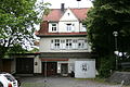 Wetter Wengern - Trienendorfer Straße - Feuerwehr 01 ies.jpg 3,888 × 2,592; 4.41 MB
-
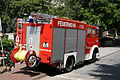
 Wetter Wengern - Trienendorfer Straße - Feuerwehr 02 ies.jpg 3,888 × 2,592; 5.65 MB
-
 Wetter Wengern - Trienendorfer Straße 01 ies.jpg 3,888 × 2,592; 5.01 MB
-
 Wetter Wengern - Trienendorfer Straße 02 ies.jpg 3,888 × 2,592; 5.09 MB
-
 Wetter Wengern - Trienendorfer Straße 03 ies.jpg 3,888 × 2,592; 4.86 MB
-
 Wetter Wengern - Trienendorfer Straße 04 ies.jpg 3,888 × 2,592; 4.37 MB


