Category:Kostolné námestie, Kolárovo
Jump to navigation
Jump to search
*{hu}: Templom-tér
| Object location | | View all coordinates using: OpenStreetMap |
|---|
Subcategories
This category has the following 2 subcategories, out of 2 total.
C
- Catholic church in Kolárovo (8 F)
W
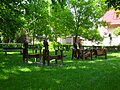
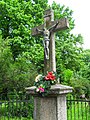
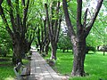
Media in category "Kostolné námestie, Kolárovo"
The following 7 files are in this category, out of 7 total.
-
 Gúta059.JPG 3,648 × 2,736; 2.6 MB
-
 Gúta062.JPG 3,648 × 2,736; 2.58 MB
-
 Gúta071.JPG 3,648 × 2,736; 2.62 MB
-
 Gúta072.JPG 2,736 × 3,648; 2.04 MB
-
 Gúta073.JPG 3,648 × 2,736; 2.42 MB
-
 Gúta080.JPG 3,648 × 2,736; 2.59 MB
-
 Gúta081.JPG 3,648 × 2,736; 2.58 MB


