Category:Knotenpunktsystem radrevier.ruhr
Jump to navigation
Jump to search
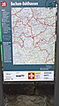
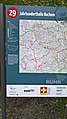
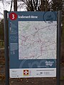
Knotenpunktsystem radrevier.ruhr ist ein Fahrradknotenpunktsystem im Ruhrgebiet.
Media in category "Knotenpunktsystem radrevier.ruhr"
The following 200 files are in this category, out of 507 total.
(previous page) (next page)-
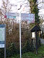
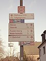
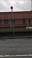 Radrevier.ruhr Knotenpunkt 02 Gasstraße, Wegweiser.jpg 1,456 × 2,592; 855 KB
-
 Radrevier.ruhr Knotenpunkt 1 An der Seseke, Kamen Karte.jpg 3,672 × 4,896; 6.74 MB
-
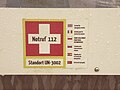
 Radrevier.ruhr Knotenpunkt 1 An der Seseke, Kamen Rettungspunkt.jpg 4,896 × 3,672; 6.1 MB
-
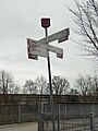
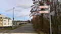
 Radrevier.ruhr Knotenpunkt 1 An der Seseke, Kamen Wegweiser.jpg 3,672 × 4,896; 6.54 MB
-
 Radrevier.ruhr Knotenpunkt 1 Kamen-Ost Karte.jpg 3,672 × 4,896; 6.58 MB
-
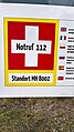
 Radrevier.ruhr Knotenpunkt 1 Kamen-Ost Rettungspunkt.jpg 4,896 × 3,672; 6 MB
-
 Radrevier.ruhr Knotenpunkt 1 Kamen-Ost Wegweiser.jpg 3,672 × 4,896; 6.76 MB
-
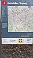 Radrevier.ruhr Knotenpunkt 1 Rheinische Bahn-Grugaweg Karte.jpg 1,456 × 2,592; 1.64 MB
-
 Radrevier.ruhr Knotenpunkt 1 Rheinische Bahn-Grugaweg Rettungspunkt.jpg 1,456 × 2,592; 1.19 MB
-
 Radrevier.ruhr Knotenpunkt 1 Rheinische Bahn-Grugaweg Wegweiser.jpg 2,592 × 1,456; 1.65 MB
-
 Radrevier.ruhr Knotenpunkt 1 Rodenhorst Karte.jpg 2,268 × 4,032; 1.73 MB
-
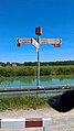
 Radrevier.ruhr Knotenpunkt 1 Uferstraße Wegweiser.jpg 2,592 × 1,456; 1.67 MB
-
 Radrevier.ruhr Knotenpunkt 10 Hamm-Uentrop Karte.jpg 1,456 × 2,592; 2.37 MB
-
 Radrevier.ruhr Knotenpunkt 10 Hamm-Uentrop Wegweiser.jpg 1,456 × 2,592; 1.47 MB
-
 Radrevier.ruhr Knotenpunkt 10 Lindnerstraße Wegweiser.jpg 2,592 × 1,456; 893 KB
-
 Radrevier.ruhr Knotenpunkt 11 Hamm-Werries Karte.jpg 1,456 × 2,592; 2.19 MB
-
 Radrevier.ruhr Knotenpunkt 11 Hamm-Werries Rettungspunkt.jpg 1,456 × 2,592; 1.51 MB
-
 Radrevier.ruhr Knotenpunkt 11 Hamm-Werries Wegweiser.jpg 1,456 × 2,592; 2.38 MB
-
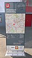
 Radrevier.ruhr Knotenpunkt 12 Bf. Oberhausen-Rheinisches Industriemuseum Wegweiser.jpg 2,592 × 1,456; 636 KB
-
 Radrevier.ruhr Knotenpunkt 12 LVR Industriemuseum Zinkfabrik Altenberg Karte.jpg 1,456 × 2,592; 1.42 MB
-
 Radrevier.ruhr Knotenpunkt 12 LVR Industriemuseum Zinkfabrik Altenberg Rettungspunkt.jpg 1,456 × 2,592; 946 KB
-
 Radrevier.ruhr Knotenpunkt 12 Maximilianpark Karte.jpg 1,456 × 2,592; 2.38 MB
-
 Radrevier.ruhr Knotenpunkt 12 Maximilianpark Wegweiser.jpg 1,456 × 2,592; 1.59 MB
-
 Radrevier.ruhr Knotenpunkt 13 Geitheufer, Hamm Karte.jpg 1,456 × 2,592; 1.49 MB
-
 Radrevier.ruhr Knotenpunkt 13 Geitheufer, Hamm Rettungspunkt.jpg 2,592 × 1,456; 854 KB
-
 Radrevier.ruhr Knotenpunkt 13 Geitheufer, Hamm Wegweiser.jpg 2,592 × 1,456; 1.5 MB
-
 Radrevier.ruhr Knotenpunkt 13 Grüner Pfad, HOAG-Bahn Karte.jpg 1,456 × 2,592; 1.36 MB
-
 Radrevier.ruhr Knotenpunkt 13 Grüner Pfad, HOAG-Bahn Rettungspunkt.jpg 2,592 × 1,456; 853 KB
-
 Radrevier.ruhr Knotenpunkt 13 Grüner Pfad, HOAG-Bahn Wegweiser.jpg 2,592 × 1,456; 1.95 MB
-
 Radrevier.ruhr Knotenpunkt 14 Bahnhof Kamen Karte.jpg 3,672 × 4,896; 6.65 MB
-
 Radrevier.ruhr Knotenpunkt 14 Bahnhof Kamen Rettungspunkt.jpg 4,896 × 3,672; 5.93 MB
-
 Radrevier.ruhr Knotenpunkt 14 Bahnhof Kamen Wegweiser.jpg 3,672 × 4,896; 6.81 MB
-
 Radrevier.ruhr Knotenpunkt 14 Breckerfeld Karte.jpg 1,456 × 2,592; 1.68 MB
-
 Radrevier.ruhr Knotenpunkt 14 Breckerfeld Rettungspunkt.jpg 1,456 × 2,592; 960 KB
-
 Radrevier.ruhr Knotenpunkt 14 Breckerfeld Wegweiser.jpg 2,592 × 1,456; 1.55 MB
-
 Radrevier.ruhr Knotenpunkt 14 Nelskamp Karte.jpg 2,268 × 4,032; 4.11 MB
-
 Radrevier.ruhr Knotenpunkt 14 Schwarze Heide Karte.jpg 1,456 × 2,592; 1.8 MB
-
 Radrevier.ruhr Knotenpunkt 14 Schwarze Heide Rettungspunkt.jpg 2,592 × 1,456; 1.09 MB
-
 Radrevier.ruhr Knotenpunkt 14 Schwarze Heide Wegweiser.jpg 2,592 × 1,456; 1.48 MB
-
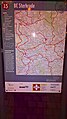 Radrevier.ruhr Knotenpunkt 15 Bf. Sterkrade Karte.jpg 1,456 × 2,592; 1.2 MB
-
 Radrevier.ruhr Knotenpunkt 15 Bf. Sterkrade Rettungspunkt.jpg 2,592 × 1,456; 933 KB
-
 Radrevier.ruhr Knotenpunkt 15 Bf. Sterkrade Wegweiser.jpg 1,456 × 2,592; 1,000 KB
-
 Radrevier.ruhr Knotenpunkt 15 Ennepetal-Voerde Karte.jpg 1,456 × 2,592; 1.79 MB
-
 Radrevier.ruhr Knotenpunkt 15 Ennepetal-Voerde Rettungspunkt.jpg 1,456 × 2,592; 1.27 MB
-
 Radrevier.ruhr Knotenpunkt 15 Ennepetal-Voerde Wegweiser.jpg 1,456 × 2,592; 1.89 MB
-
 Radrevier.ruhr Knotenpunkt 15 Kamen Seseke Karte.jpg 3,672 × 4,896; 6.93 MB
-
 Radrevier.ruhr Knotenpunkt 15 Kamen Seseke Wegweiser.jpg 3,672 × 4,896; 6.56 MB
-
 Radrevier.ruhr Knotenpunkt 15 Schetterstraße Karte.jpg 2,268 × 4,032; 5.08 MB
-
 Radrevier.ruhr Knotenpunkt 16 Bf. Ennepetal Karte.jpg 1,456 × 2,592; 1.04 MB
-
 Radrevier.ruhr Knotenpunkt 16 Bf. Ennepetal Rettungspunkt.jpg 1,456 × 2,592; 940 KB
-
 Radrevier.ruhr Knotenpunkt 16 Bf. Ennepetal Wegweiser.jpg 2,592 × 1,456; 1.08 MB
-
 Radrevier.ruhr Knotenpunkt 16 Halde Haniel Karte.jpg 3,672 × 4,896; 6.85 MB
-
 Radrevier.ruhr Knotenpunkt 16 Halde Haniel Rettungspunkt.jpg 4,896 × 3,672; 6.57 MB
-
 Radrevier.ruhr Knotenpunkt 16 Halde Haniel Wegweiser.jpg 3,672 × 4,896; 6.82 MB
-
 Radrevier.ruhr Knotenpunkt 17 Bahnhof Schwelm Karte.jpg 1,456 × 2,592; 1.53 MB
-
 Radrevier.ruhr Knotenpunkt 17 Bahnhof Schwelm Rettungspunkt.jpg 1,456 × 2,592; 1.32 MB
-
 Radrevier.ruhr Knotenpunkt 17 Bahnhof Schwelm Wegweiser.jpg 2,592 × 1,456; 1.63 MB
-
 Radrevier.ruhr Knotenpunkt 17 Grafenmühle Karte.jpg 3,672 × 4,896; 7.03 MB
-
 Radrevier.ruhr Knotenpunkt 17 Grafenmühle Rettungspunkt.jpg 4,896 × 3,672; 6.65 MB
-
 Radrevier.ruhr Knotenpunkt 17 Grafenmühle Wegweiser.jpg 3,672 × 4,896; 6.59 MB
-
 Radrevier.ruhr Knotenpunkt 17 Halde Rheinpreußen Karte.jpg 3,672 × 4,896; 6.58 MB
-
 Radrevier.ruhr Knotenpunkt 17 Halde Rheinpreußen Rettungspunkt.jpg 4,896 × 3,672; 5.19 MB
-
 Radrevier.ruhr Knotenpunkt 17 Halde Rheinpreußen Wegweiser.jpg 3,672 × 4,896; 6.87 MB
-
 Radrevier.ruhr Knotenpunkt 17 Schloss Schwansbell Karte.jpg 3,672 × 4,896; 6.82 MB
-
 Radrevier.ruhr Knotenpunkt 17 Schloss Schwansbell Rettungspunkt.jpg 4,896 × 3,672; 6.64 MB
-
 Radrevier.ruhr Knotenpunkt 17 Schloss Schwansbell Wegweiser.jpg 3,672 × 4,896; 6.8 MB
-
 Radrevier.ruhr Knotenpunkt 18 Heideseee Karte.jpg 3,672 × 4,896; 6.68 MB
-
 Radrevier.ruhr Knotenpunkt 18 Heideseee Rettungspunkt.jpg 4,896 × 3,672; 6.67 MB
-
 Radrevier.ruhr Knotenpunkt 18 Heideseee Wegweiser.jpg 3,672 × 4,896; 6.73 MB
-
 Radrevier.ruhr Knotenpunkt 18 Lünen-Beckinghausen Karte.jpg 3,672 × 4,896; 7.13 MB
-
 Radrevier.ruhr Knotenpunkt 18 Lünen-Beckinghausen Rettungspunkt.jpg 4,896 × 3,672; 6.68 MB
-
 Radrevier.ruhr Knotenpunkt 18 Lünen-Beckinghausen Wegweiser.jpg 3,672 × 4,896; 7.16 MB
-
 Radrevier.ruhr Knotenpunkt 19 Schermbeck Landwehr Karte.jpg 3,672 × 4,896; 6.43 MB
-
 Radrevier.ruhr Knotenpunkt 19 Schermbeck Landwehr Rettungspunkt.jpg 4,896 × 3,672; 6.35 MB
-
 Radrevier.ruhr Knotenpunkt 19 Schermbeck Landwehr Wegweiser.jpg 3,672 × 4,896; 6.83 MB
-
 Radrevier.ruhr Knotenpunkt 2 Bergkamen-Rünthe Karte.jpg 3,672 × 4,896; 6.65 MB
-
 Radrevier.ruhr Knotenpunkt 2 Bergkamen-Rünthe Rettungspunkt.jpg 4,896 × 3,672; 6.03 MB
-
 Radrevier.ruhr Knotenpunkt 2 Bergkamen-Rünthe Wegweiser.jpg 4,896 × 3,672; 6.42 MB
-
 Radrevier.ruhr Knotenpunkt 2 Hbf. Mülheim an der Ruhr Karte.jpg 1,456 × 2,592; 1.66 MB
-
 Radrevier.ruhr Knotenpunkt 2 Hbf. Mülheim an der Ruhr Rettungspunkt.jpg 1,456 × 2,592; 1.04 MB
-
 Radrevier.ruhr Knotenpunkt 2 Hbf. Mülheim an der Ruhr Wegweiser.jpg 2,592 × 1,456; 1.61 MB
-
 Radrevier.ruhr Knotenpunkt 2 Zum Tollberg Karte.jpg 2,268 × 4,032; 4.49 MB
-
 Radrevier.ruhr Knotenpunkt 20 Preußenhafen Lünen Karte.jpg 3,672 × 4,896; 6.76 MB
-
 Radrevier.ruhr Knotenpunkt 20 Preußenhafen Lünen Wegweiser.jpg 3,672 × 4,896; 6.5 MB
-
 Radrevier.ruhr Knotenpunkt 21 Lünen-Süd Karte.jpg 3,672 × 4,896; 6.35 MB
-
 Radrevier.ruhr Knotenpunkt 21 Lünen-Süd Wegweiser.jpg 3,672 × 4,896; 7.15 MB
-
 Radrevier.ruhr Knotenpunkt 21 Springorum-Radweg Karte.jpg 1,456 × 2,592; 1.71 MB
-
 Radrevier.ruhr Knotenpunkt 21 Springorum-Radweg Rettungspunkt.jpg 1,456 × 2,592; 980 KB
-
 Radrevier.ruhr Knotenpunkt 21 Springorum-Radweg Wegweiser.jpg 2,592 × 1,456; 1.66 MB
-
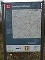 Radrevier.ruhr Knotenpunkt 22 Gewerbepark Lothringen Karte.jpg 3,672 × 4,896; 6.65 MB
-
 Radrevier.ruhr Knotenpunkt 22 Gewerbepark Lothringen Rettungspunkt.jpg 4,896 × 3,672; 6.56 MB
-
 Radrevier.ruhr Knotenpunkt 23 Drevenack Karte.jpg 3,672 × 4,896; 7.17 MB
-
 Radrevier.ruhr Knotenpunkt 23 Drevenack Rettungspunkt.jpg 4,896 × 3,672; 5.5 MB
-
 Radrevier.ruhr Knotenpunkt 23 Drevenack Wegweiser.jpg 3,672 × 4,896; 6.5 MB
-
 Radrevier.ruhr Knotenpunkt 23 Duisburg-Lohmannsheide Karte.jpg 3,672 × 4,896; 7.05 MB
-
 Radrevier.ruhr Knotenpunkt 23 Duisburg-Lohmannsheide Rettungspunkt.jpg 4,896 × 3,672; 5.97 MB
-
 Radrevier.ruhr Knotenpunkt 23 Duisburg-Lohmannsheide Wegweiser.jpg 3,672 × 4,896; 6.67 MB
-
 Radrevier.ruhr Knotenpunkt 24 Bahnhof Lünen Karte.jpg 3,672 × 4,896; 6.77 MB
-
 Radrevier.ruhr Knotenpunkt 24 Bahnhof Lünen Rettungspunkt.jpg 4,896 × 3,672; 6.6 MB
-
 Radrevier.ruhr Knotenpunkt 24 Bahnhof Lünen Wegweiser.jpg 3,672 × 4,896; 7.01 MB
-
 Radrevier.ruhr Knotenpunkt 24 Kemnader See, Karte.jpg 1,456 × 2,592; 1.64 MB
-
 Radrevier.ruhr Knotenpunkt 24 Kemnader See, Rettungspunkt.jpg 1,456 × 2,592; 1.15 MB
-
 Radrevier.ruhr Knotenpunkt 24 Kemnader See, Wegweiser.jpg 1,456 × 2,592; 1.61 MB
-
 Radrevier.ruhr Knotenpunkt 25 Landschaftspark Duisburg-Nord Karte.jpg 1,456 × 2,592; 1.82 MB
-
 Radrevier.ruhr Knotenpunkt 25 Landschaftspark Duisburg-Nord Rettungspunkt.jpg 1,456 × 2,592; 1.04 MB
-
 Radrevier.ruhr Knotenpunkt 25 Schleuse Hattingen Karte.jpg 1,456 × 2,592; 1.68 MB
-
 Radrevier.ruhr Knotenpunkt 25 Schleuse Hattingen Rettungspunkt.jpg 1,456 × 2,592; 1.22 MB
-
 Radrevier.ruhr Knotenpunkt 25 Schleuse Hattingen Wegweiser.jpg 1,456 × 2,592; 2.07 MB
-
 Radrevier.ruhr Knotenpunkt 25 Schlossmühle Buddenburg Karte.jpg 3,672 × 4,896; 6.62 MB
-
 Radrevier.ruhr Knotenpunkt 25 Schlossmühle Buddenburg Rettungspunkt.jpg 4,896 × 3,672; 6.6 MB
-
 Radrevier.ruhr Knotenpunkt 25 Schlossmühle Buddenburg Wegweiser.jpg 3,672 × 4,896; 6.47 MB
-
 Radrevier.ruhr Knotenpunkt 26 Technologiezentrum LÜNTEC Karte.jpg 3,672 × 4,896; 6.82 MB
-
 Radrevier.ruhr Knotenpunkt 26 Technologiezentrum LÜNTEC Rettungspunkt.jpg 4,896 × 3,672; 6.66 MB
-
 Radrevier.ruhr Knotenpunkt 26 Technologiezentrum LÜNTEC Wegweiser.jpg 3,672 × 4,896; 6.35 MB
-
 Radrevier.ruhr Knotenpunkt 27 Bahnhof Bönen Karte.jpg 3,672 × 4,896; 6.85 MB
-
 Radrevier.ruhr Knotenpunkt 27 Bahnhof Bönen Rettungspunkt.jpg 4,896 × 3,672; 5.85 MB
-
 Radrevier.ruhr Knotenpunkt 27 Bahnhof Bönen Wegweiser.jpg 3,672 × 4,896; 6.29 MB
-
 Radrevier.ruhr Knotenpunkt 27 Schwimmbrücke Dahlhausen Karte.jpg 1,456 × 2,592; 1.34 MB
-
 Radrevier.ruhr Knotenpunkt 27 Schwimmbrücke Dahlhausen Rettungspunkt.jpg 1,456 × 2,592; 1.03 MB
-
 Radrevier.ruhr Knotenpunkt 27 Schwimmbrücke Dahlhausen Wegweiser.jpg 1,456 × 2,592; 1.29 MB
-
 Radrevier.ruhr Knotenpunkt 28 Bochum-Dahlhausen Karte.jpg 1,456 × 2,592; 1.66 MB
-
 Radrevier.ruhr Knotenpunkt 28 Bochum-Dahlhausen Rettungspunkt.jpg 1,456 × 2,592; 1.15 MB
-
 Radrevier.ruhr Knotenpunkt 28 Bochum-Dahlhausen Wegweiser.jpg 2,592 × 1,456; 1.66 MB
-
 Radrevier.ruhr Knotenpunkt 28 ehem Zeche Königsborn Karte.jpg 3,672 × 4,896; 6.52 MB
-
 Radrevier.ruhr Knotenpunkt 28 ehem Zeche Königsborn Rettungspunkt.jpg 4,896 × 3,672; 5.95 MB
-
 Radrevier.ruhr Knotenpunkt 28 ehem Zeche Königsborn Wegweiser.jpg 3,672 × 4,896; 7.04 MB
-
 Radrevier.ruhr Knotenpunkt 28 Rheinorange Karte.jpg 1,456 × 2,592; 1.62 MB
-
 Radrevier.ruhr Knotenpunkt 28 Rheinorange Rettungspunkt.jpg 1,456 × 2,592; 1.01 MB
-
 Radrevier.ruhr Knotenpunkt 28 Rheinorange Wegweiser.jpg 2,592 × 1,456; 1.03 MB
-
 Radrevier.ruhr Knotenpunkt 29 Bönen-Flierich Karte.jpg 3,672 × 4,896; 6.83 MB
-
 Radrevier.ruhr Knotenpunkt 29 Bönen-Flierich Rettungspunkt.jpg 4,896 × 3,672; 6.65 MB
-
 Radrevier.ruhr Knotenpunkt 29 Bönen-Flierich Wegweiser.jpg 4,896 × 3,672; 7.01 MB
-
 Radrevier.ruhr Knotenpunkt 29 Dinslakener Landstraße Karte.jpg 3,672 × 4,896; 6.53 MB
-
 Radrevier.ruhr Knotenpunkt 29 Dinslakener Landstraße Rettungspunkt.jpg 4,896 × 3,672; 5.75 MB
-
 Radrevier.ruhr Knotenpunkt 29 Dinslakener Landstraße Wegweiser.jpg 3,672 × 4,896; 6.47 MB
-
 Radrevier.ruhr Knotenpunkt 29 Duisburg-Kaßlerfeld (oben-der-Ruhr) Karte.jpg 1,456 × 2,592; 1.39 MB
-
 Radrevier.ruhr Knotenpunkt 29 Duisburg-Kaßlerfeld (oben-der-Ruhr) Rettungspunkt.jpg 1,456 × 2,592; 1.21 MB
-
 Radrevier.ruhr Knotenpunkt 29 Duisburg-Kaßlerfeld (oben-der-Ruhr) Wegweiser.jpg 2,592 × 1,456; 1.38 MB
-
 Radrevier.ruhr Knotenpunkt 29 Duisburg-Kaßlerfeld (unten-der-Ruhr) Karte.jpg 1,456 × 2,592; 1.76 MB
-
 Radrevier.ruhr Knotenpunkt 29 Duisburg-Kaßlerfeld (unten-der-Ruhr) Rettungspunkt.jpg 1,456 × 2,592; 1.21 MB
-
 Radrevier.ruhr Knotenpunkt 29 Duisburg-Kaßlerfeld (unten-der-Ruhr) Wegweiser.jpg 1,456 × 2,592; 2.14 MB
-
 Radrevier.ruhr Knotenpunkt 29 Jahrhunderthalle Bochum Karte.jpg 1,456 × 2,592; 1.59 MB
-
 Radrevier.ruhr Knotenpunkt 29 Jahrhunderthalle Bochum Rettungspunkt.jpg 2,592 × 1,456; 740 KB
-
 Radrevier.ruhr Knotenpunkt 29 Jahrhunderthalle Bochum Wegweiser.jpg 2,592 × 1,456; 2.11 MB
-
 Radrevier.ruhr Knotenpunkt 3 Gradierwerk Werne Karte.jpg 3,672 × 4,896; 6.39 MB
-
 Radrevier.ruhr Knotenpunkt 3 Gradierwerk Werne Rettungspunkt.jpg 4,896 × 3,672; 6.55 MB
-
 Radrevier.ruhr Knotenpunkt 3 Gradierwerk Werne Wegweiser.jpg 3,672 × 4,896; 7.09 MB
-
 Radrevier.ruhr Knotenpunkt 3 Schloss Broich Karte.jpg 1,456 × 2,592; 1.59 MB
-
 Radrevier.ruhr Knotenpunkt 3 Schloss Broich Rettungspunkt.jpg 1,456 × 2,592; 1.28 MB
-
 Radrevier.ruhr Knotenpunkt 3 Schloss Broich Wegweiser.jpg 2,592 × 1,456; 2.17 MB
-
 Radrevier.ruhr Knotenpunkt 30 Bf Unna Königsborn Karte.jpg 3,672 × 4,896; 6.81 MB
-
 Radrevier.ruhr Knotenpunkt 30 Bf Unna Königsborn Rettungspunkt.jpg 4,896 × 3,672; 6.47 MB
-
 Radrevier.ruhr Knotenpunkt 30 Bf Unna Königsborn Wegweiser.jpg 3,672 × 4,896; 7.03 MB
-
 Radrevier.ruhr Knotenpunkt 30 Bf Wesel Karte.jpg 3,672 × 4,896; 6.86 MB
-
 Radrevier.ruhr Knotenpunkt 30 Bf Wesel Rettungspunkt.jpg 4,896 × 3,672; 6.81 MB
-
 Radrevier.ruhr Knotenpunkt 30 Bf Wesel Wegweiser.jpg 3,672 × 4,896; 6.88 MB
-
 Radrevier.ruhr Knotenpunkt 30 Ickersche Heide Karte.jpg 3,672 × 4,896; 7.03 MB
-
 Radrevier.ruhr Knotenpunkt 30 Ickersche Heide Rettungspunkt.jpg 3,672 × 4,896; 6.49 MB
-
 Radrevier.ruhr Knotenpunkt 30 Ickersche Heide Wegweiser.jpg 3,672 × 4,896; 7.02 MB
-
 Radrevier.ruhr Knotenpunkt 30 Innenhafen DU Wegweiser.jpg 2,592 × 1,456; 1.65 MB
-
 Radrevier.ruhr Knotenpunkt 30 Innenhafen Duisburg Karte.jpg 1,456 × 2,592; 1.46 MB
-
 Radrevier.ruhr Knotenpunkt 30 Innenhafen Duisburg Rettungspunkt.jpg 1,456 × 2,592; 1.05 MB
-
 Radrevier.ruhr Knotenpunkt 30 Innenhafen Duisburg Wegweiser.jpg 2,592 × 1,456; 1.59 MB
-
 Radrevier.ruhr Knotenpunkt 31 Dortmund-Ems-Kanal, Oberwiese Karte.jpg 3,672 × 4,896; 6.44 MB
-
 Radrevier.ruhr Knotenpunkt 31 Dortmund-Ems-Kanal, Oberwiese Rettungspunkt.jpg 3,672 × 4,896; 6.09 MB
-
 Radrevier.ruhr Knotenpunkt 31 Dortmund-Ems-Kanal, Oberwiese Wegweiser.jpg 3,672 × 4,896; 7.18 MB
-
 Radrevier.ruhr Knotenpunkt 31 Duisburg Kuhstraße Karte.jpg 1,456 × 2,592; 1.63 MB
-
 Radrevier.ruhr Knotenpunkt 31 Duisburg Kuhstraße Rettungspunkt.jpg 1,456 × 2,592; 1.23 MB
-
 Radrevier.ruhr Knotenpunkt 31 Duisburg Kuhstraße Wegweiser.jpg 2,592 × 1,456; 1.54 MB
-
 Radrevier.ruhr Knotenpunkt 31 Kurpark Königsborn Karte.jpg 1,456 × 2,592; 2.34 MB
-
 Radrevier.ruhr Knotenpunkt 31 Kurpark Königsborn Rettungspunkt.jpg 1,456 × 2,592; 1.76 MB
-
 Radrevier.ruhr Knotenpunkt 31 Kurpark Königsborn Wegweiser.jpg 3,672 × 4,896; 6.87 MB
-
 Radrevier.ruhr Knotenpunkt 31 Rathaus Wegweiser.jpg 3,672 × 4,896; 6.28 MB
-
 Radrevier.ruhr Knotenpunkt 32 Hbf. Duisburg Karte.jpg 1,456 × 2,592; 1.36 MB
-
 Radrevier.ruhr Knotenpunkt 32 Hbf. Duisburg Rettungspunkt.jpg 1,456 × 2,592; 874 KB
-
 Radrevier.ruhr Knotenpunkt 32 LWL-Industriemuseum Schiffhebewerk Henrichenburg Karte.jpg 3,672 × 4,896; 6.96 MB
-

-
 Radrevier.ruhr Knotenpunkt 32 LWL-Industriemuseum Schiffhebewerk Henrichenburg Wegweiser.jpg 3,672 × 4,896; 6.54 MB
-
 Radrevier.ruhr Knotenpunkt 32 Rathausplatz, Unna Karte.jpg 3,672 × 4,896; 7.01 MB
-
 Radrevier.ruhr Knotenpunkt 32 Rathausplatz, Unna Wegweiser.jpg 3,672 × 4,896; 6.96 MB
-
 Radrevier.ruhr Knotenpunkt 32 Rathausplatze, Unna Rettungspunkt.jpg 4,896 × 3,672; 7.12 MB
-
 Radrevier.ruhr Knotenpunkt 33 Duisburg-Hochfeld Karte.jpg 1,456 × 2,592; 1.69 MB
-
 Radrevier.ruhr Knotenpunkt 33 Duisburg-Hochfeld Rettungspunkt.jpg 1,456 × 2,592; 1.31 MB
-
 Radrevier.ruhr Knotenpunkt 33 Duisburg-Hochfeld Wegweiser.jpg 2,592 × 1,456; 1.46 MB
-
 Radrevier.ruhr Knotenpunkt 33 Morgenstr., Unna Wegweiser.jpg 3,672 × 4,896; 6.73 MB
-
 Radrevier.ruhr Knotenpunkt 33 Schleuse Datteln Karte.jpg 3,672 × 4,896; 7.04 MB
-
 Radrevier.ruhr Knotenpunkt 33 Schleuse Datteln Rettungspunkt.jpg 4,896 × 3,672; 6.6 MB
-
 Radrevier.ruhr Knotenpunkt 33 Schleuse Datteln Wegweiser.jpg 3,672 × 4,896; 7.05 MB
-
 Radrevier.ruhr Knotenpunkt 34 Haltern-Flaesheim Karte.jpg 3,672 × 4,896; 7.13 MB
-
 Radrevier.ruhr Knotenpunkt 34 Haltern-Flaesheim Rettungspunkt.jpg 4,896 × 3,672; 6.77 MB
-
 Radrevier.ruhr Knotenpunkt 34 Haltern-Flaesheim Wegweiser.jpg 3,672 × 4,896; 7.09 MB
-
 Radrevier.ruhr Knotenpunkt 34 Wasserstraße, Unna Karte.jpg 3,672 × 4,896; 6.52 MB
-
 Radrevier.ruhr Knotenpunkt 34 Wasserstraße, Unna Rettungspunkt.jpg 4,896 × 3,672; 6.55 MB
-
 Radrevier.ruhr Knotenpunkt 34 Wasserstraße, Unna Wegweiser.jpg 3,672 × 4,896; 6.66 MB
-
 Radrevier.ruhr Knotenpunkt 35 Oer-Erkenschwick Karte.jpg 1,456 × 2,592; 1.55 MB
-
 Radrevier.ruhr Knotenpunkt 35 Oer-Erkenschwick Rettungspunkt.jpg 2,592 × 1,456; 847 KB
-
 Radrevier.ruhr Knotenpunkt 35 Oer-Erkenschwick Wegweiser.jpg 1,456 × 2,592; 1.54 MB
-
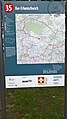
 Radrevier.ruhr Knotenpunkt 35 Tiger&Turtle Magic Mountain Karte.jpg 1,456 × 2,592; 1.57 MB
-
 Radrevier.ruhr Knotenpunkt 35 Tiger&Turtle Magic Mountain Rettungspunkt.jpg 1,456 × 2,592; 989 KB
-
 Radrevier.ruhr Knotenpunkt 35 Tiger&Turtle Magic Mountain Wegweiser.jpg 2,592 × 1,456; 1.44 MB


_Karte.jpg)
_Rettungspunkt.jpg)
_Wegweiser.jpg)
_Karte.jpg)
_Rettungspunkt.jpg)
_Wegweiser.jpg)


