Category:Knook
Jump to navigation
Jump to search
village and civil parish in Wiltshire, United Kingdom  | |||||
| Upload media | |||||
| Instance of | |||||
|---|---|---|---|---|---|
| Location | Wiltshire, South West England, England | ||||
 | |||||
English: Knook is a small village and civil parish in the County of Wiltshire, in the south west of England.
Subcategories
This category has the following 4 subcategories, out of 4 total.
Media in category "Knook"
The following 58 files are in this category, out of 58 total.
-
 2011 , Byway on Knook Down - geograph.org.uk - 2688241.jpg 4,558 × 2,598; 3.68 MB
-
 2011 , Byway on Knook Hill, toward Knook Down House - geograph.org.uk - 2688310.jpg 3,817 × 2,399; 2.83 MB
-
 2011 , Climbing the track from the B390 to Knook Down House - geograph.org.uk - 2690833.jpg 3,816 × 2,850; 4.99 MB
-
 2011 , Field at the foot of Knook Down - geograph.org.uk - 2688402.jpg 4,543 × 2,845; 5 MB
-
 2011 , Field of maize and a dry valley east of Heytesbury - geograph.org.uk - 2553851.jpg 4,727 × 2,974; 5.29 MB
-
 2011 , Fields on Knook Down - geograph.org.uk - 2688331.jpg 4,725 × 2,453; 5.15 MB
-
 2011 , North east from a bridleway on Knook Down - geograph.org.uk - 2656174.jpg 3,265 × 2,499; 3.39 MB
-

-
 2011 , Tree lined bridleway heading home from Knook Hill - geograph.org.uk - 2688348.jpg 3,524 × 2,671; 4.45 MB
-
 2011 , West from a restricted byway on Knook Down - geograph.org.uk - 2656206.jpg 3,896 × 2,485; 3.41 MB
-
 2011 , West of south on Knook Down - geograph.org.uk - 2688288.jpg 4,340 × 2,386; 2.73 MB
-
 B390 - geograph.org.uk - 5179788.jpg 640 × 367; 32 KB
-
 B390 west of Chitterne - geograph.org.uk - 5083938.jpg 640 × 480; 71 KB
-
 Entrance to Knook Camp off the A36 - geograph.org.uk - 3430615.jpg 3,006 × 1,929; 2.26 MB
-
 Footbridge near Knook - geograph.org.uk - 2528026.jpg 640 × 480; 86 KB
-
 Footpath near Knook - geograph.org.uk - 1479525.jpg 640 × 480; 204 KB
-
 Footpath to Corton - geograph.org.uk - 2528032.jpg 640 × 480; 86 KB
-
 Footpath, Knook - geograph.org.uk - 1479243.jpg 640 × 481; 151 KB
-
 Footpath, Knook - geograph.org.uk - 1479266.jpg 640 × 480; 206 KB
-
 Garden ornaments near Knook - geograph.org.uk - 1479123.jpg 640 × 480; 166 KB
-
 Gatepost and ivy near Knook - geograph.org.uk - 1479143.jpg 640 × 482; 198 KB
-
 Knook and Upton Lovell Findings.jpg 800 × 1,218; 172 KB
-
 Knook village - geograph.org.uk - 329845.jpg 640 × 480; 97 KB
-
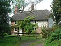 Knook, No. 16 - geograph.org.uk - 537778.jpg 640 × 480; 126 KB
-
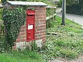 Knook, postbox No. BA 12 27 - geograph.org.uk - 537747.jpg 640 × 480; 129 KB
-
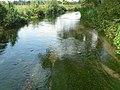 Knook, the river Wylye - geograph.org.uk - 537772.jpg 640 × 480; 102 KB
-
 Maize crop near Knook - geograph.org.uk - 2524774.jpg 640 × 480; 96 KB
-
 Maize with weeds - geograph.org.uk - 1418048.jpg 640 × 465; 139 KB
-
 Paddock in Knook - geograph.org.uk - 1479166.jpg 640 × 480; 112 KB
-
 Poppies in barley - geograph.org.uk - 1416616.jpg 640 × 504; 208 KB
-
 River Wylye, Knook - geograph.org.uk - 1479160.jpg 479 × 640; 212 KB
-
 River Wylye, Knook - geograph.org.uk - 1479227.jpg 640 × 480; 186 KB
-
 River Wylye, Knook - geograph.org.uk - 2528016.jpg 640 × 481; 98 KB
-
 Rose-hips near Corton - geograph.org.uk - 1479516.jpg 640 × 480; 241 KB
-
 Rush hour in Knook - geograph.org.uk - 3658208.jpg 640 × 480; 82 KB
-
 Signs on the B390 - geograph.org.uk - 1159553.jpg 640 × 480; 131 KB
-
 The River Wylye - geograph.org.uk - 6405648.jpg 3,776 × 2,520; 2.96 MB
-
 The River Wylye, Knook - geograph.org.uk - 1479220.jpg 640 × 480; 170 KB
-
 The Wessex Ridgeway path approaching the River Wylye - geograph.org.uk - 6405643.jpg 3,776 × 2,520; 3.97 MB
-
 Victorian postbox, Knook - geograph.org.uk - 1150730.jpg 640 × 480; 158 KB
-
 Water meadows, Knook - geograph.org.uk - 1479237.jpg 640 × 481; 133 KB
-
 Wessex Ridgeway between Corton and Heytesbury - geograph.org.uk - 6397022.jpg 5,184 × 3,456; 4.14 MB
-
 Approaching Knook village - geograph.org.uk - 329848.jpg 640 × 480; 123 KB
-

-

-
 B390 near Knook Camp - geograph.org.uk - 1422949.jpg 640 × 494; 149 KB
-
 B390 on the way to Chitterne - geograph.org.uk - 1423224.jpg 640 × 473; 108 KB
-
 Barley at the top of Ansty Hill - geograph.org.uk - 1423306.jpg 640 × 481; 144 KB
-
 Cut hay and byway, Ansty Hill, Knook - geograph.org.uk - 539941.jpg 480 × 640; 138 KB
-
 Harvested fields - geograph.org.uk - 541169.jpg 640 × 480; 100 KB
-
 Hayfield on Knook Down - geograph.org.uk - 535517.jpg 640 × 480; 200 KB
-
 Knook, main street - geograph.org.uk - 537762.jpg 640 × 480; 84 KB
-
 Maize and pheasant cage above Knook - geograph.org.uk - 541173.jpg 640 × 480; 108 KB
-
 Public footpath to Heytesbury - geograph.org.uk - 329846.jpg 640 × 480; 111 KB
-
 Quebec Barn - geograph.org.uk - 384938.jpg 640 × 480; 64 KB
-
 Quebec Farm - geograph.org.uk - 384933.jpg 640 × 459; 40 KB
-

-
 West Farm - geograph.org.uk - 329841.jpg 640 × 480; 101 KB


