Category:Knapwell
Jump to navigation
Jump to search
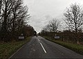
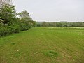
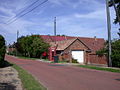
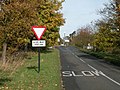
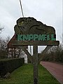
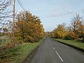
English: Knapwell is a small village in Cambridgeshire situated about west of Cambridge. It is within the diocese of Ely. Its population was estimated at 110 in 2001. The village has no shops or pubs, but is adjacent to the wood known as Overhall Grove (not to be confused with Knapwell Wood), which has a notably large number of surviving elm trees.
village in Cambridgeshire, England, UK  | |||||
| Upload media | |||||
| Instance of | |||||
|---|---|---|---|---|---|
| Location | South Cambridgeshire, Cambridgeshire, East of England, England | ||||
 | |||||
Subcategories
This category has the following 2 subcategories, out of 2 total.
A
- All Saints Church, Knapwell (9 F)
H
- Hope Farm, Cambridgeshire (5 F)
Media in category "Knapwell"
The following 97 files are in this category, out of 97 total.
-
 A428 Cambourne Bypass - geograph.org.uk - 3664936.jpg 2,705 × 2,138; 883 KB
-
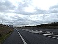 A428 Cambridge Road slip road - geograph.org.uk - 3793449.jpg 3,072 × 2,304; 749 KB
-
 All Saints Church, Knapwell - geograph.org.uk - 5295334.jpg 1,600 × 1,067; 927 KB
-
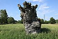 Ancient gnarled tree stump (geograph 3049544).jpg 640 × 427; 208 KB
-
 Approaching Coldharbour Farm - geograph.org.uk - 5524860.jpg 640 × 480; 60 KB
-
 Arable fields - geograph.org.uk - 3097214.jpg 1,600 × 1,200; 794 KB
-
 Barn at Knapwell Wood Farm - geograph.org.uk - 1037026.jpg 640 × 480; 75 KB
-
 Bourn Road (High Street), Knapwell - geograph.org.uk - 3783069.jpg 3,072 × 2,304; 878 KB
-
 Brockley Road - geograph.org.uk - 3248795.jpg 3,072 × 2,304; 1.47 MB
-
 Brockley Road - geograph.org.uk - 3248801.jpg 3,072 × 2,304; 1.41 MB
-
 Byway to St Neots Road - geograph.org.uk - 2663330.jpg 1,600 × 1,200; 933 KB
-
 Cambourne turning, A428 - geograph.org.uk - 5005302.jpg 640 × 426; 53 KB
-
 Cambourne Water Tower - geograph.org.uk - 3795463.jpg 3,072 × 2,304; 1.16 MB
-
 Cold Harbour Farm sign - geograph.org.uk - 3795471.jpg 2,304 × 3,072; 860 KB
-
 Cottages on Brockley Road - geograph.org.uk - 3248790.jpg 3,072 × 2,304; 1.44 MB
-
 Cottages, High Street, Knapwell - geograph.org.uk - 3049264.jpg 640 × 427; 220 KB
-
 Entering Knapwell on High Street - geograph.org.uk - 3782389.jpg 3,072 × 2,186; 1.54 MB
-
 Entrance to Glebe Farm Campus - geograph.org.uk - 1037199.jpg 640 × 480; 131 KB
-
 Entrance to Glebe Farm Campus - geograph.org.uk - 3783073.jpg 3,072 × 2,304; 1.36 MB
-
 Entrance to Knapwell Wood Farm - geograph.org.uk - 1037015.jpg 640 × 480; 118 KB
-

-
 Footpath around a small copse - geograph.org.uk - 3097237.jpg 1,600 × 1,200; 966 KB
-
 Footpath at Knapwell Wood Farm - geograph.org.uk - 1036989.jpg 640 × 480; 104 KB
-
 Footpath to Cambourne - geograph.org.uk - 3097172.jpg 1,600 × 1,200; 608 KB
-
 Footpath to Cambourne - geograph.org.uk - 3097180.jpg 1,600 × 1,200; 828 KB
-
 Footpath to Cambourne - geograph.org.uk - 3097231.jpg 1,600 × 1,200; 727 KB
-
 Footpath to High Street ^ entrance to Cold Harbour Farm - geograph.org.uk - 3795470.jpg 3,072 × 2,304; 1.67 MB
-
 Footpath to Knapwell - geograph.org.uk - 3097171.jpg 1,600 × 1,200; 724 KB
-
 Footpath to New Inn Farm - geograph.org.uk - 3782377.jpg 3,072 × 2,197; 1.19 MB
-
 Footpath towards Knapwell - geograph.org.uk - 3097198.jpg 1,600 × 1,200; 806 KB
-
 Footpath towards Knapwell - geograph.org.uk - 5524863.jpg 640 × 480; 67 KB
-
 Footpath towards Knapwell - geograph.org.uk - 5524864.jpg 640 × 480; 62 KB
-
 Footpath towards Knapwell - geograph.org.uk - 5524865.jpg 480 × 640; 71 KB
-
 Footpath ^ entrance to New Inn Farm - geograph.org.uk - 3783600.jpg 3,072 × 2,304; 1.53 MB
-
 Glebe Farm Campus sign - geograph.org.uk - 3783075.jpg 2,304 × 3,072; 1.15 MB
-
 Hedge removed by St Neots Road - geograph.org.uk - 5410615.jpg 1,600 × 1,200; 343 KB
-
 Hedgerow near Knapwell - geograph.org.uk - 1037207.jpg 640 × 480; 88 KB
-
 High Street - geograph.org.uk - 3782366.jpg 3,072 × 2,304; 1.56 MB
-
 High Street Postbox - geograph.org.uk - 3782627.jpg 2,304 × 3,072; 1.47 MB
-
 High Street sign - geograph.org.uk - 3782392.jpg 3,072 × 2,304; 1.08 MB
-
 High Street ^ footpath - geograph.org.uk - 3782376.jpg 3,072 × 2,304; 921 KB
-
 High Street ^ Knapwell Village sign - geograph.org.uk - 3783042.jpg 3,072 × 2,304; 1.2 MB
-
 High Street ^ Thorofare Lane Byway - geograph.org.uk - 3782610.jpg 3,072 × 2,253; 894 KB
-
 High Street, Knapwell - geograph.org.uk - 3782383.jpg 3,072 × 2,304; 873 KB
-
 High Street, Knapwell - geograph.org.uk - 3783090.jpg 3,072 × 2,304; 1.63 MB
-
 High Street,Telephone Box ^ High Street Postbox - geograph.org.uk - 3782629.jpg 3,072 × 2,304; 1.16 MB
-
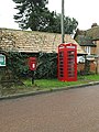
 K6 phone box and Red Well Barn - geograph.org.uk - 904081.jpg 640 × 480; 76 KB
-
 Knapwell village gateway - geograph.org.uk - 1037202.jpg 640 × 480; 109 KB
-
 Knapwell Village Name sign on High Street - geograph.org.uk - 3782390.jpg 2,817 × 2,116; 775 KB
-
 Knapwell Village Notice Board ^ High Street Postbox - geograph.org.uk - 3782990.jpg 1,629 × 3,069; 904 KB
-
 Knapwell Village sign - geograph.org.uk - 3783049.jpg 2,277 × 3,039; 1.33 MB
-
 Knapwell Village sign - geograph.org.uk - 3783051.jpg 2,270 × 3,030; 804 KB
-
 Knapwell Village Sign.jpg 4,000 × 3,000; 3.21 MB
-
 Knapwell Wood Farm sign - geograph.org.uk - 3782384.jpg 2,304 × 3,072; 1.23 MB
-
 Knapwell, footpath across a meadow - geograph.org.uk - 4691948.jpg 1,024 × 732; 1.04 MB
-
 Knapwell, plaster and thatch - geograph.org.uk - 4692133.jpg 1,024 × 1,024; 1.42 MB
-
 Leaving Knapwell - geograph.org.uk - 1036597.jpg 640 × 480; 113 KB
-
 Manor Farm, Knapwell - geograph.org.uk - 904084.jpg 640 × 480; 94 KB
-
 Monks Drive Postbox - geograph.org.uk - 3783107.jpg 3,072 × 2,304; 1.26 MB
-
 Monks Drive Postbox - geograph.org.uk - 3783586.jpg 2,304 × 3,072; 1.11 MB
-
 Monks Drive Postbox - geograph.org.uk - 3783588.jpg 2,304 × 3,072; 1.47 MB
-
 Monks Drive Postbox - geograph.org.uk - 3783591.jpg 2,304 × 3,072; 1.53 MB
-
 New Inn Farm sign - geograph.org.uk - 3783599.jpg 3,029 × 2,276; 839 KB
-
 Overhall Grove - geograph.org.uk - 2664740.jpg 1,600 × 1,200; 1,013 KB
-
 Powertron factory, Glebe Farm Campus - geograph.org.uk - 1037179.jpg 640 × 480; 68 KB
-
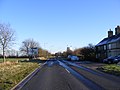
 Road to Knapwell - geograph.org.uk - 5410617.jpg 1,600 × 1,200; 315 KB
-
 Roadsign on Brockley Road - geograph.org.uk - 3248796.jpg 2,304 × 3,072; 1.5 MB
-
 Roadsigns on St.Neots Road - geograph.org.uk - 3783097.jpg 2,304 × 3,072; 1.14 MB
-
 Skylark plots - geograph.org.uk - 3097185.jpg 1,600 × 1,200; 639 KB
-
 Skyline near Cambourne - geograph.org.uk - 5582343.jpg 1,000 × 538; 113 KB
-
 Slepewood House - geograph.org.uk - 1037216.jpg 640 × 480; 116 KB
-
 Small stream near Knapwell - geograph.org.uk - 2663378.jpg 1,600 × 1,200; 833 KB
-
 St.Neots Road ^ Monks Drive Postbox - geograph.org.uk - 3783594.jpg 3,072 × 2,304; 1.56 MB
-
 St.Neots Road, Bourn - geograph.org.uk - 3782363.jpg 3,072 × 2,304; 926 KB
-
 St.Neots Road, Cambourne - geograph.org.uk - 3795476.jpg 3,072 × 2,304; 1.02 MB
-
 St.Neots Road, Knapwell - geograph.org.uk - 3783101.jpg 3,072 × 2,304; 1.23 MB
-
 St.Neots Road, Knapwell - geograph.org.uk - 3783590.jpg 3,072 × 2,304; 1.55 MB
-
 St.Neots Road, Knapwell - geograph.org.uk - 3783606.jpg 3,072 × 2,304; 1.01 MB
-
 Telephone Box ^ High Street Postbox - geograph.org.uk - 3782624.jpg 3,072 × 2,304; 1.03 MB
-
 Telephone Box ^ High Street Postbox - geograph.org.uk - 3782625.jpg 2,304 × 3,072; 1.46 MB
-
 Telephone Box ^ High Street Postbox - geograph.org.uk - 3782974.jpg 2,304 × 3,072; 1.87 MB
-
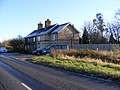
 Terrace houses - geograph.org.uk - 275458.jpg 640 × 427; 139 KB
-
 Thatched cottage, Knapwell - geograph.org.uk - 904096.jpg 640 × 480; 79 KB
-
 The A428 at Cambourne - geograph.org.uk - 3561189.jpg 3,264 × 2,448; 3.09 MB
-
 The approach to Knapwell Church - geograph.org.uk - 4692137.jpg 819 × 1,024; 1.48 MB
-
 The entrance to Glebe Farm Campus - geograph.org.uk - 6190844.jpg 2,000 × 1,330; 2.74 MB
-
 The road through Knapwell - geograph.org.uk - 6190837.jpg 2,000 × 1,330; 2.68 MB
-
 Thorofare Lane Byway to Battle Gate Road - geograph.org.uk - 3782613.jpg 3,072 × 2,304; 1.73 MB
-
 Track off the road to Conington - geograph.org.uk - 1037218.jpg 640 × 480; 116 KB
-
 Track to Cold Harbour Farm - geograph.org.uk - 4119613.jpg 4,000 × 3,000; 4.42 MB
-
 Track to Whale Barn Cottage - geograph.org.uk - 1037138.jpg 640 × 480; 72 KB
-
 Tree-lined road to Knapwell - geograph.org.uk - 1036918.jpg 640 × 480; 82 KB
-
 Tree-lined road to Knapwell - geograph.org.uk - 1037151.jpg 640 × 480; 92 KB
-
 Trees and a field - geograph.org.uk - 1036943.jpg 640 × 480; 74 KB
-
 View to the north of Cambourne - geograph.org.uk - 4119615.jpg 4,000 × 3,000; 4.38 MB
-
 Converted house - geograph.org.uk - 275450.jpg 640 × 427; 159 KB
-
 Knapwell village street - geograph.org.uk - 32806.jpg 640 × 480; 112 KB


.jpg)


,_Knapwell_-_geograph.org.uk_-_3783069.jpg)


