Category:Klintholms Stutthof Memorial
Jump to navigation
Jump to search
| Object location | | View all coordinates using: OpenStreetMap |
|---|
 | |||||
| Upload media | |||||
| Instance of |
| ||||
|---|---|---|---|---|---|
| Location | Klintholm Havn, Møn, Vordingborg Municipality, Region Zealand, Denmark | ||||
| Point in time |
| ||||
 | |||||
Media in category "Klintholms Stutthof Memorial"
The following 4 files are in this category, out of 4 total.
-
 Klintholm memorial 1945.jpg 4,032 × 3,024; 4.6 MB
-
 Klintholm Memorial.JPG 2,592 × 1,944; 3.62 MB
-
 Klintholm Memorial2.JPG 2,592 × 1,944; 3.26 MB
-
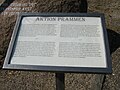 Klinthom memorial board.JPG 2,592 × 1,944; 3.05 MB


